Good Thursday and welcome to December! Wait… What?! Did we blink and miss November? Apparently so. The final month of the year is starting out on a seasonably cold note as we wait for another big wind maker to start the upcoming weekend.
In the longer range, I am still high on the winter weather potential for the middle and end of the month.
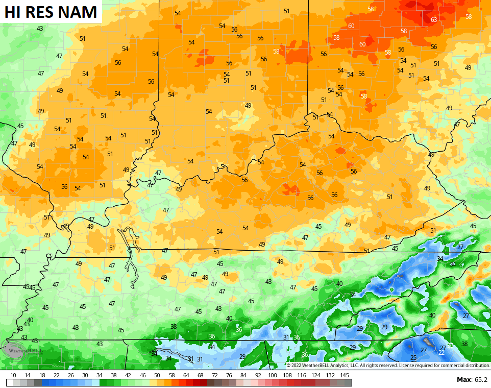
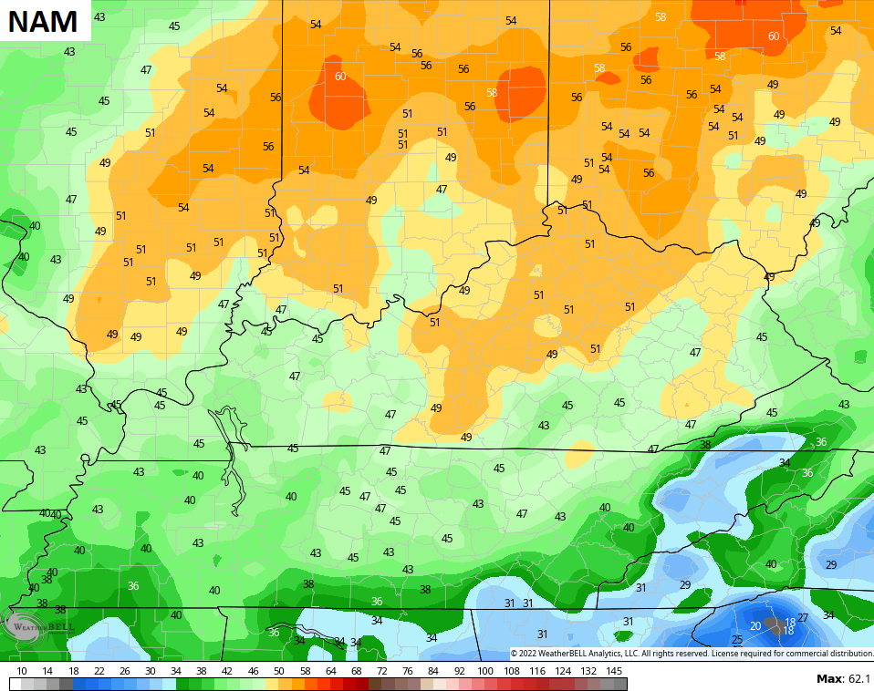
Let’s start with this first day of Meteorological Winter. The day starts with temps in the low and middle 20s for many and ends with upper 30s and low 40s. Some clouds will filter across our sky, but it’s a dry day.
Clouds and winds will increase on Friday as another cold front drops in from the northwest. Wind gusts of 40mph or greater are likely late Friday into Saturday morning…
Check out the showers set to accompany this front…
 That clears out quickly from northwest to southeast on Saturday as temps drop once again.
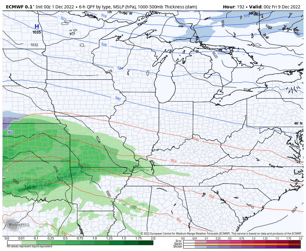
A weak system zips across the Tennessee Valley on Sunday and may brush areas of western and southern Kentucky with some light showers. I can’t rule out a touch of sleet at the onset, but this isn’t a big deal.
The setup for next week and beyond is one featuring winter waking up as a wintry pattern sets up across the eastern half of the country.
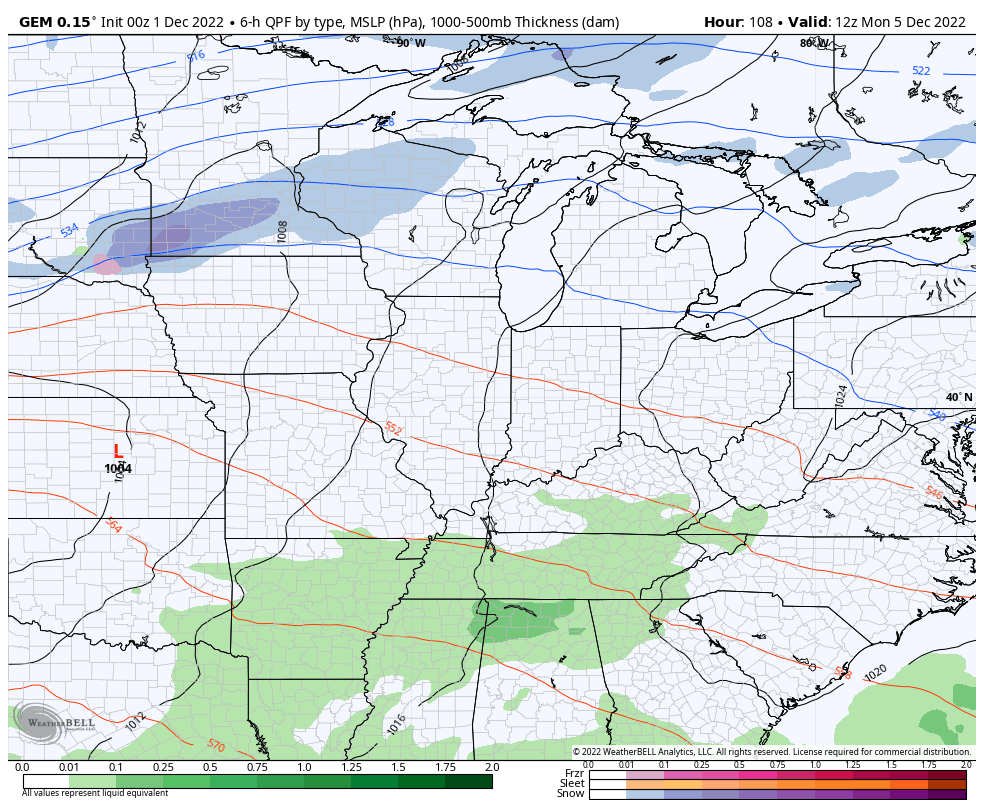
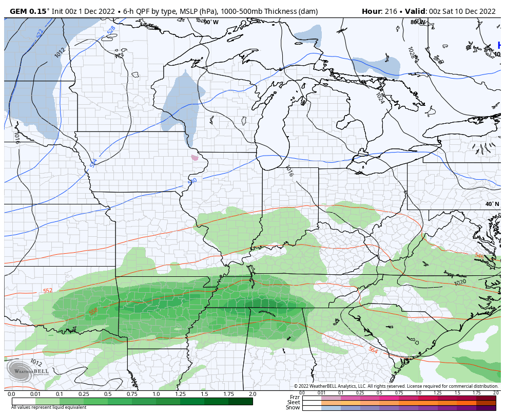
To start things off is the threat for heavy rain early next week as rounds of rain target the region as a boundary slows down near us. This will feature the threat for a few lows to work through here during the course of the week.
The Canadian is showing this potential…
That’s a setup we have to watch for as it can certainly produce too much rain for some areas.
You can see how the colder air continues to press in from the north as the week wears on. That late week setup would have the potential to produce some winter weather if that cold can press far enough south.
I’ve shown you how the various ensembles have been handling the major blocking pattern taking shape late next week into the following week. We are now seeing the operational models slowly coming around to this. The overnight GFS shows the big block and the deepening trough in the east…

Not only is that a cold setup, but it’s one that can feature several winter storm systems in the eastern US. Those systems are impossible to time from this far out, obviously, but you will find the operational models picking up on the potential from time to time.
Individual model runs aren’t to be taken verbatim, but you guys know this already. That said, they can offer up trends and the Canadian is showing something being hinted at on other computer model runs…
The EURO offers up a flatter solution…
Moral of the story is we’re starting to see the winter threats showing up on the medium range models, but you’re going to have some wild swings on individual systems.
I will have updates later today. Have a good one and take care.

Thanks Chris, I don’t feel we could get ” too much rain ” as dry as it has been this previous Autumn in my area. Too bad, being the start of Meteorological Winter that all the rainy days forecast can’t be Snow for all the Snow Lovers out there. Maybe that scenario will happen later this month and bring a White Christmas for some ?
If freezing rain starts I hope it quickly turns to rain before it accumulates on the trees and power lines. A better scenario would be that the freezing rain or sleet turns to Snow before the ice accumulates and causes tons of problems. We hope and wait to see how this Winter unfolds.