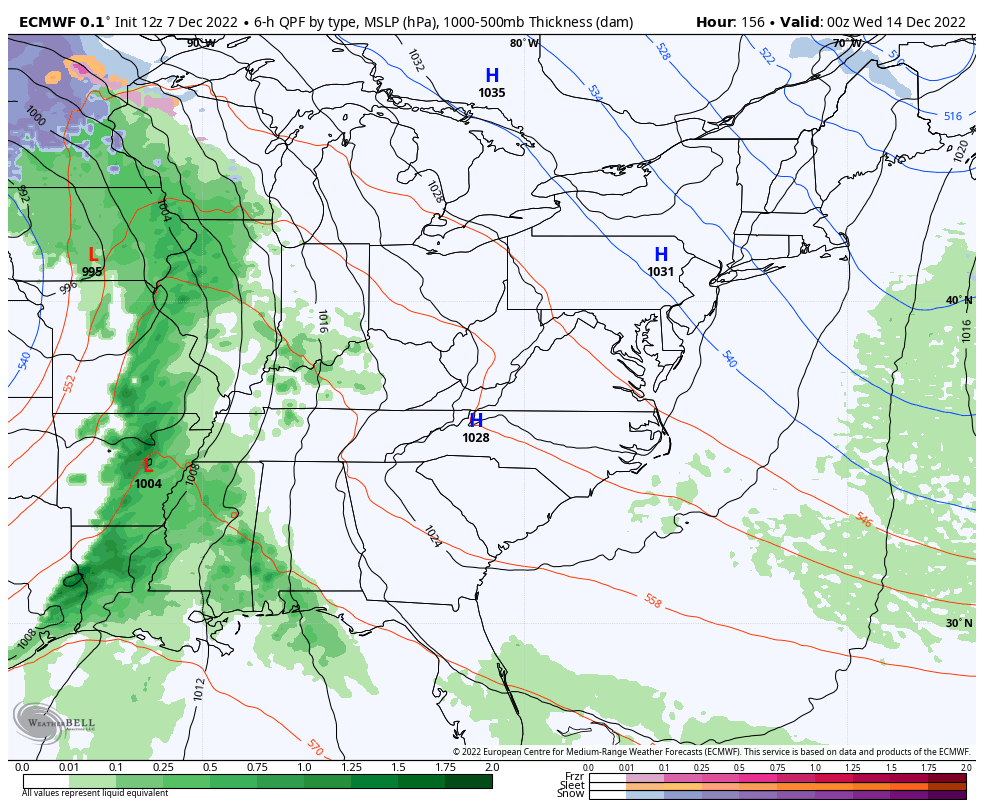
Good evening, folks. Another big rain maker rolls in here for Thursday and part of Friday with a super wet pattern. This setup is ahead of changes arriving next week and those changes bring winter weather into the eastern half of the country.
Let’s start with the evening. Just some showers continue across the far south with some drizzle and fog farther north. Here are your radars…

I have no changes on the heavy rain moving in tomorrow and the next round of rain arriving Saturday. Some folks will see another 1″-3″ of rain, especially across the south.
As we focus on the big storm system rolling out of the Plains into the Great Lakes next week, we find the EURO likely being a little slow with our system, but matching more of the look from the Canadian. That shows rain, storms and wind before cold and some flakes show up a day or two later…
That unleashes the much anticipated colder than normal pattern settling in later next week and continuing through the week leading up to Christmas. The Canadian Ensembles continue to lead the charge…
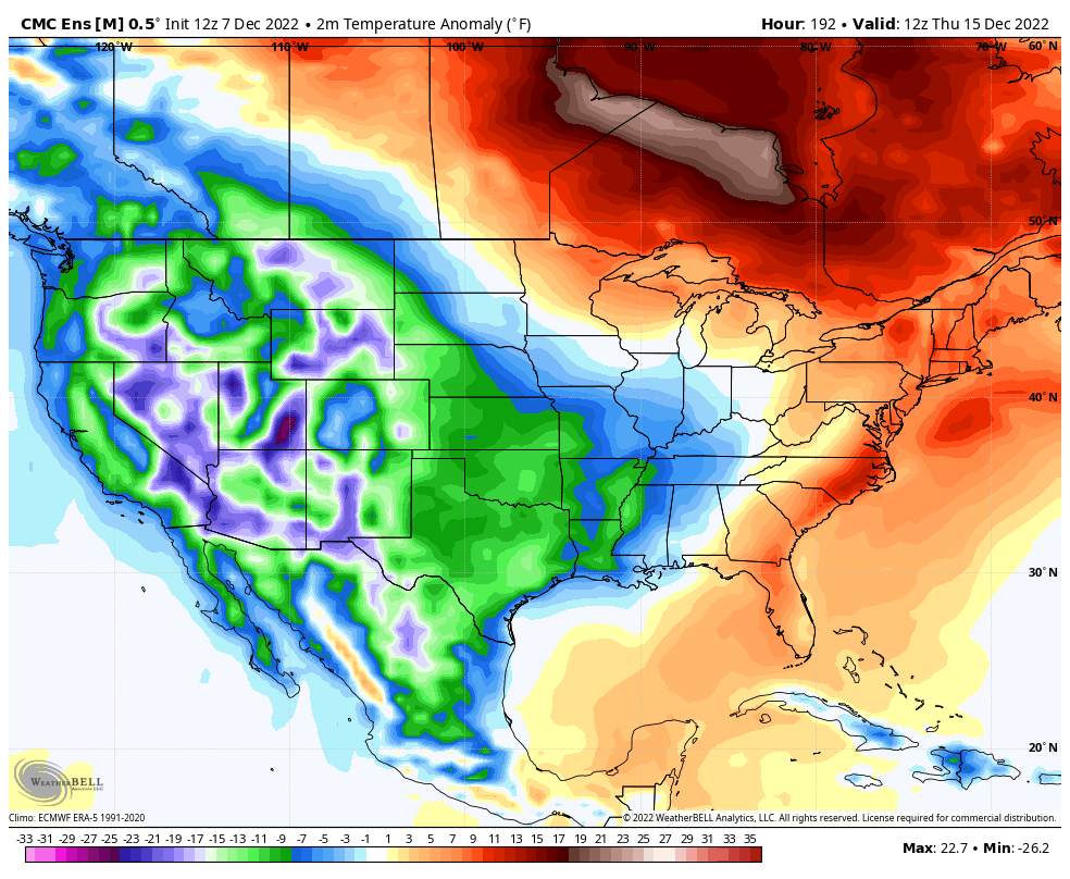
Anything with the name GFS has been dreadful in the medium range and that includes the GFS Ensembles. Still, the Ensembles are finally caving toward the cold look…
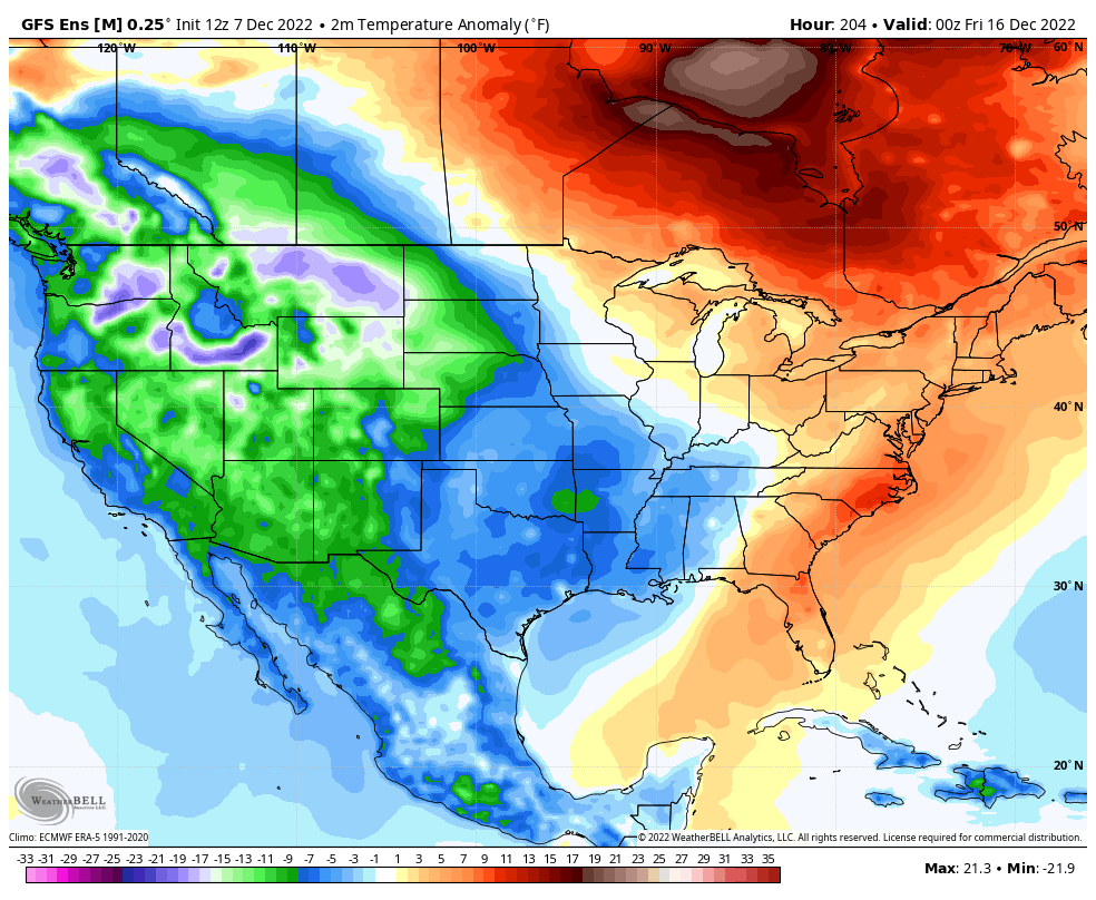
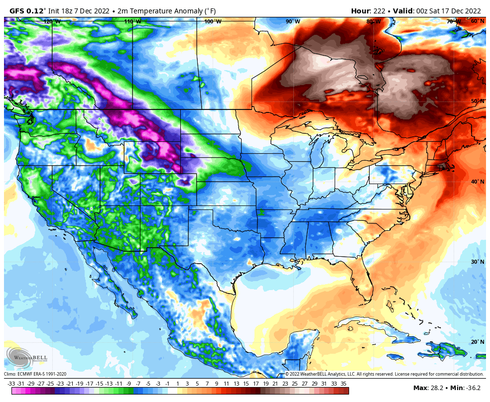
I’ve trashed the GFS for the constant flipping in the medium range, but even this model is catching the cold potential from time to time. The latest run is frigid…
For even more fun, the snow map through December 22…

The model literally goes back and forth between an ice age and a heat wave.
Enjoy the evening and take care.

When you consider that most of lake’s Erie and Ontario, and the southern half of Lake Michigan are relatively ice free, the lake-effect snow resulting from the upcoming pattern change, could be through (or over!) the roof!
https://coastwatch.glerl.noaa.gov/ice.html
I have a friend who lives on the lee side of Lake Michigan. He called me a while back can’t recall the year, but he was really Snowbound with up to 8 feet of Snow in a weeks time ! I told him no thanks, I wouldn’t want that much. I’m more use to 8 inches or less or none.