Good Thursday, folks. Rounds of rain continue to push across the region and this trend carries us into the upcoming weekend. This is ahead of a major pattern change on the way next week. A change likely to lead us into a very cold and wintry setup in the runup to Christmas.
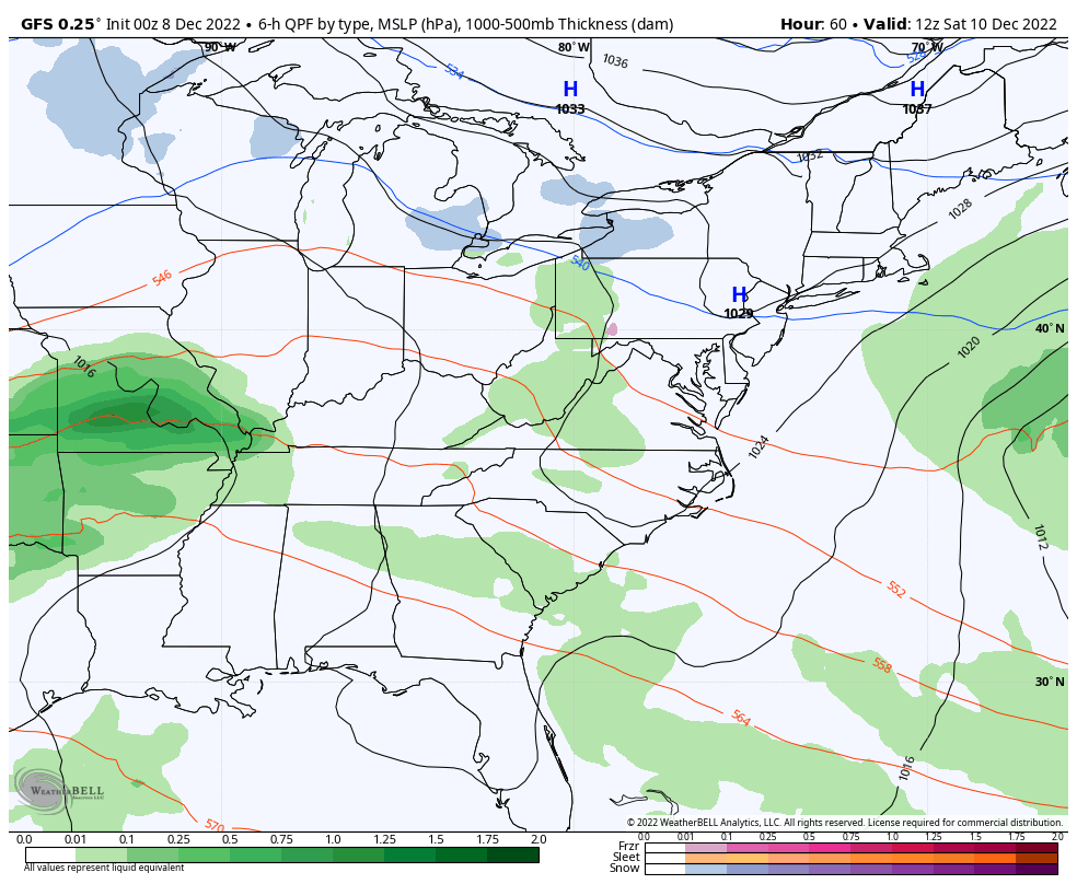
Let us start with what’s going on out there today and roll forward. Waves of rain are rolling from west to east across the state with the heaviest rains showing up across the southern half of the state. This is an area that’s already picked up more than 2″-3″ since Tuesday, so we will have to watch for local high water issues developing.
Here are your radars to track the latest round of wet weather…

This round of rain moves away this evening into tonight, but another wave of showers rolls through here later Friday. That will be followed up by yet another round of rain moving west to east later Saturday into Saturday night. This is the system the Canadian had when no other model was showing much at all. The Canadian still has it…
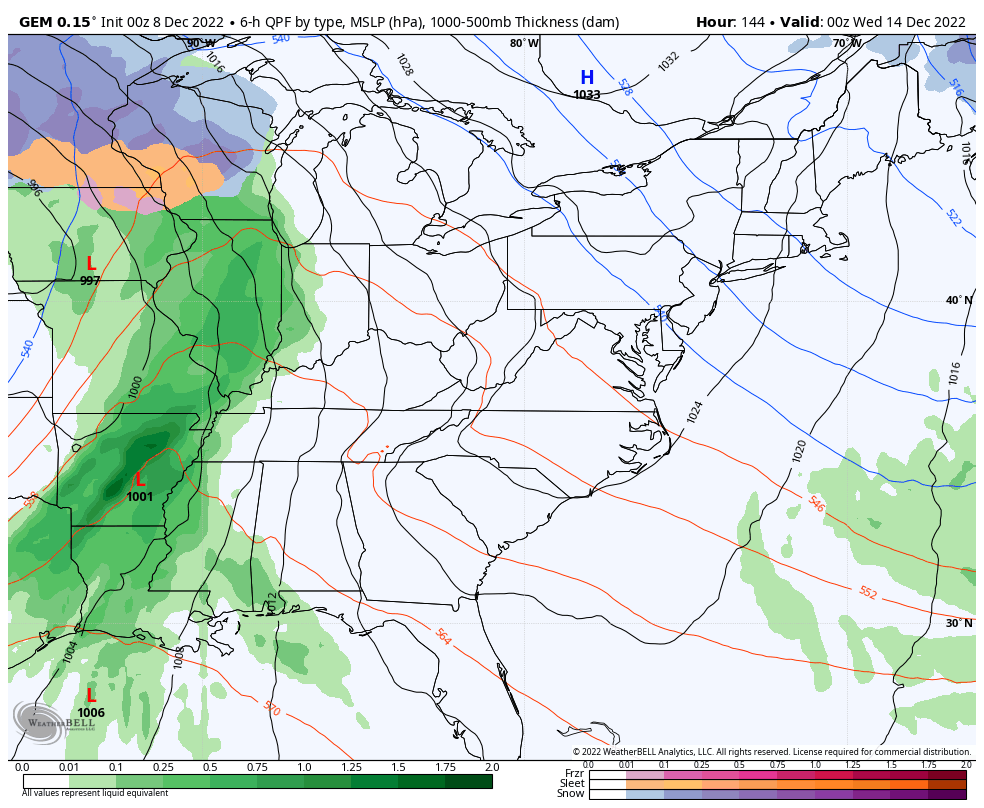
 Look at the snow that brings to the Great Lakes and the northeastern part of the country.
Guess who has now joined the party on all that? The GFS…
Remember this trends, folks.
The next system shows up in the form of a monster plains storm system. Normally, a system like that would lift northeastward into Canada, but that can’t happen because of the mega block showing up. Instead, this system gets pushed east into the Great Lakes and may very well pop another low along the east coast as a powerful front sweeps through the eastern part of the country.
The end result for us would be wind driven rain and thunderstorms starting late Tuesday into Wednesday. That would be followed by a rapid temp crash late Wednesday and Thursday as cold air dumps in. With upper level energy spinning through the region late Thursday and Friday and into the following weekend, it would give us a shot at periods of light snow.
This exact scenario has played out on every run of the Canadian Model for the past several days and continues to do so…
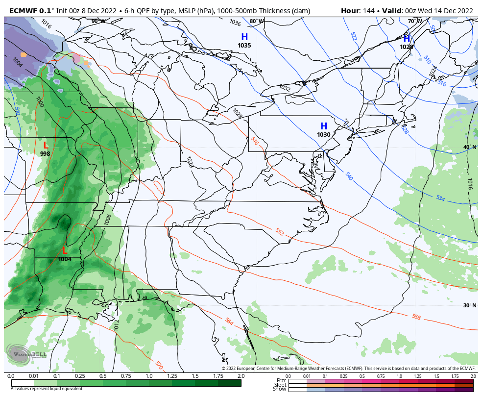
The European Model is also on board with a similar outcome…
I suspect we will see the GFS slowly evolve toward this scenario in the coming days. That’s certainly the trend here, right?
That’s also the trend among the Ensembles as well. The Canadian Ensembles have been spitting out some of the coldest solutions I’ve seen from any Ensembles for as long as I’ve been tracking weather… And that’s a while folks. 👴
This goes from the second half of next week through December 23rd…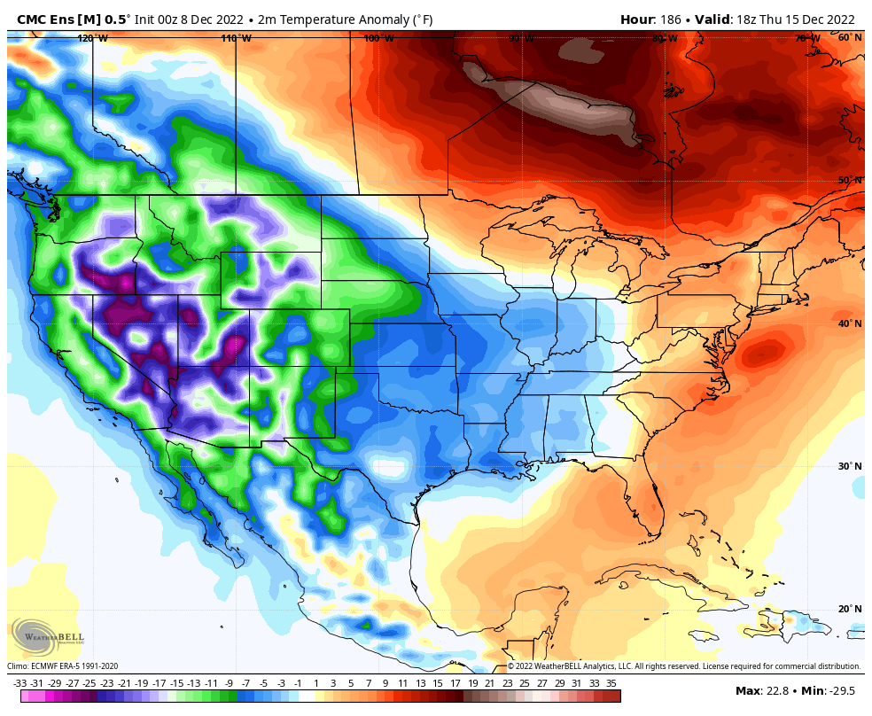
The GFS Ensembles got the memo and are now similar to what the Canadian Ensembles have been showing for a while. This animation goes through the same time period…
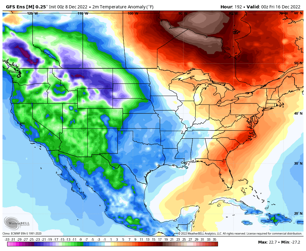
It’s incredibly rare to see Ensembles show that kind of cold on such a broad scale across the country. With the amount of blocking showing up across the northern hemisphere, some extreme events are possible across the good old USA for the second half of December into early January.
It’s way to early to tell exactly how this plays out for Kentucky, but I believe this pattern produces some snowfalls before Christmas. It may also produce some crazy cold shots, too.
Updates will come your way later today. Have a good one and take care.

hey bailey my river showed up yesterday!!!!!!!!!!!!!!
Thanks Chris, Mother Nature doing her best to end the drought in Kentucky. I’ve been watching the weather not tracking since I was 5 years old. One Snowstorm that I will never forget was in March 1960 when up to 3 feet of Snow fell in South Central Indiana in two separate events.
The Christmas Storm of 2004. That was one for the record books. Well-forecast days in advance, just a matter of “what” we’d get. Two feet of snow north of Cincinnati, extreme ice to the south, and thunder sleet in between. Then the bottom dropped out of the thermometer and it all froze solid!
https://www.weather.gov/lmk/22dec2004_winterstorm
The best White Christmas in my lifetime.
During the years I lived in the foothills of the Pocono Mts. in eastern PA, I’ll never forget the Winter of 1977. We had four major storms, two were Nor’easters, and the first of those dumped 37″ of snow. The drifts were unbelievable, with one reaching part way up my second story window!
Never been in a Nor’ Easter but I was in the Blizzard of 1978. Lost one of my Greenhouses. Winds were clocked at 65 mph. with blinding, drifting Snow. The next morning we had a 20′ drift in our driveway.
Look up the phase of ENSO we were in at the time these memorable Snow events took place. I did and found the Snow events were in El Nino years not La Nina years like we have to endure this Winter. However, in 1917-18 a La Nina year, was a very cold and Snowy Winter. One of the worse on record.