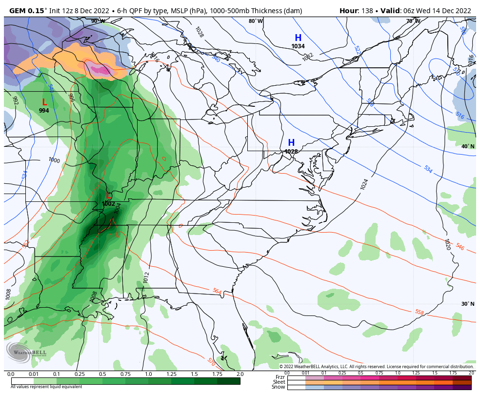
Good afternoon, folks. It’s a washout of a day across Kentucky as another wave of low pressure moves through. We have a few more rainmakers to come through over the next couple of days as we slowly shift our focus to next week’s massive changes.
Today’s rains are putting down totals of 1″-2″ for some areas, especially in the west and south. Much lighter amounts show up in the north with a quarter inch or less for some. The rain will lighten up some from west to east later in the day into the evening. Scattered showers linger into the evening and overnight.
Here are your radars to follow along…

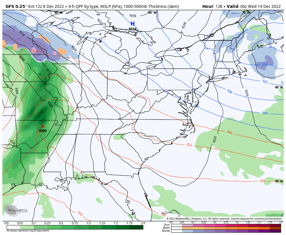
Another shower maker works across our sky later Friday with a second system moving in here late Saturday and Saturday night. This isn’t overly heavy, but it will produce some more ugly weather across our part of the world.
That same system will also turn into a snow maker for the Great Lakes into areas of the northeastern part of the country.
The next system is a massive storm that works from the Plains toward the Great Lakes and pops another low along the eastern seaboard. The end result for us is heavy rain and storms on the front end with a temp crash to cold behind it with periods of light snow and flurries a day or two later.
The Canadian Model is steady as a rock…
As expected, the GFS trend continues to be toward the Canadian…
This kicks off a cold and wintry pattern that threatens to turn severe across much of the country. As hard as it is to believe, the Canadian Ensembles are even colder. This animation starts next Thursday and goes into the start of Christmas Eve…
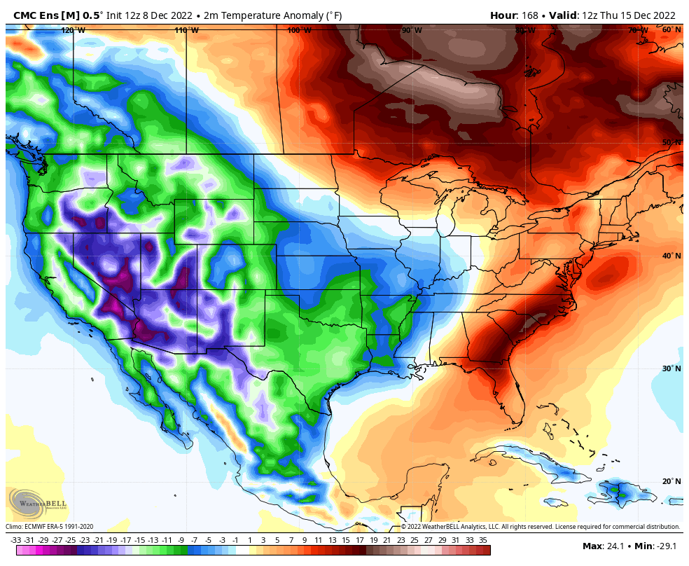
The GFS Ensembles are in the process of running as I post this and they are also even colder.
Buckle up, kiddos.
I’ll be back for another update this evening. Have a good one and take care.

Great soaking rains all afternoon here in Maple.
going be a rough christmas week.
Over the past 48 hours, I’ve recorded 1.30″ of rain at my PWS near Bowling Green.