Good evening, folks. Our super soaker of a weather pattern continues with more showers into the coming weekend. This pattern throws a big storm at us next week as we get set for a major pattern change that flips us into wintertime.
Showers continue out there this evening and your radars are following along…

A few more showers show up for Friday… Then again later Saturday and Saturday night. That comes along with temps that are down closer to normal or even a touch below. Dry weather takes over on Sunday and continues into Monday and part of Tuesday.
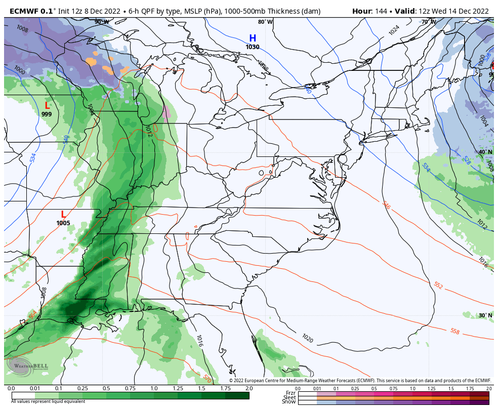
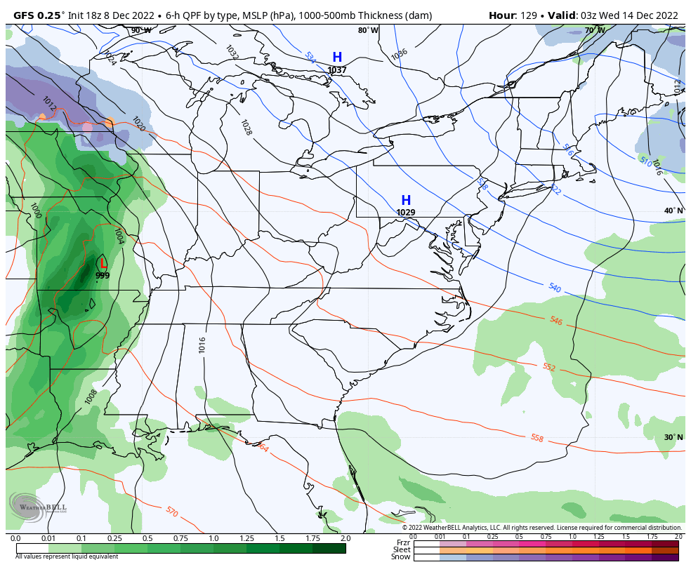
This is a pattern that will spin up a monster of a plains storm on Tuesday. That system is being blocked by the major blocking developing across Canada. That forces our low to roll eastward into the Great Lakes as another low develops in the east.
This continues to look like a rain, wind and thunderstorm maker for us late Tuesday and Wednesday. The cold front slams through Wednesday night with crashing temps from west to east on Thursday. By Friday into next weekend, periods of light snow may develop with upper level action spinning over top of us. There’s also the chance to get moisture from the Great Lakes involved.
The Canadian was the first model to pick up on this and all other models have trended toward it…
EURO
GFS
This is all happening during the week I’ve been targeting for several weeks now… The week of December 12th. Blind squirrel finds the nut? 😏
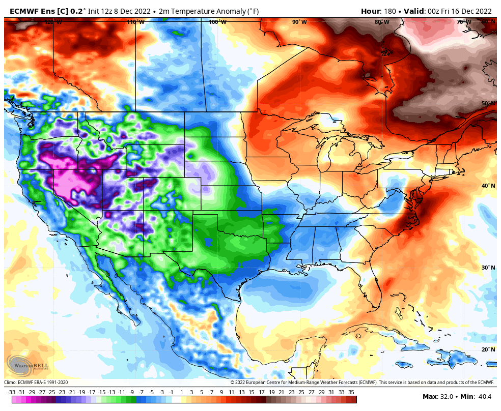
I’ve mentioned how many of the Ensembles have been about as cold as I’ve ever seen from more than a week away. The operational run of the EURO Ensembles is just absurd. Watch this run from later next week through Christmas Eve morning…
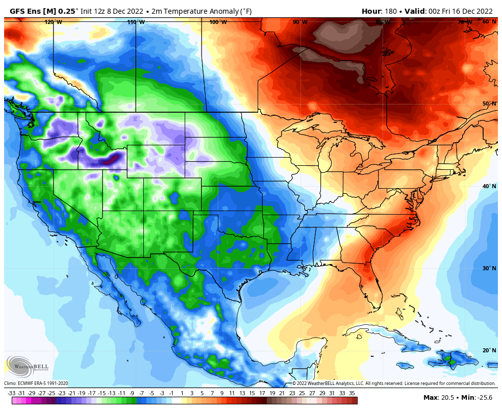
The GFS Ensembles are absolutely frigid over this same time period…
Giddy up!
Enjoy the rest of your evening and take care.
