Good Friday, folks. We are putting the wraps on a super wet week with… Showers. Additional raindrops are out there today and will be again into part of the weekend. As we watch the drops, we are also watching the pattern change toward wintertime on the way for next week.
That’s a pattern cold and snow lovers have to like the looks of. Before we get into all that, let’s focus on the short term forecast.
Showers will continue to be scattered across the state today, but it won’t be nearly as widespread as what we had on Thursday. Here are your radars to track the Kentucky showers…

The system moving in for Saturday has more moisture with it, so some ugly weather is with us once again. Temps will be closer to normal with many areas in the upper 40s.
We slowly dry that sky out on Sunday as showers taper off, but low clouds will be tough to break. Temps are again in the seasonable 40s.
Monday looks dry and seasonable and may wind up being the best day we’ve seen in a while, so make some plans to enjoy the potential sunshine.
The next system coming out of the Rockies into the Plains will be a biggie storm system. This gets trapped under our big block setting up across Canada…
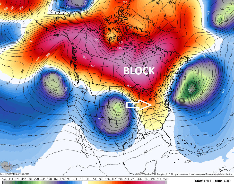
That forces the system to slowly roll eastward through our region for the second half of the week into next weekend. One surface low heads into the Great Lakes and Ohio Valley while another low is likely to develop along the east coast.
The Canadian has been the most consistent model with this whole scenario…
The GFS has been trending toward the Canadian for the past several runs and it took things one step further with a much stronger storm in the east…
The funny thing is… That’s a plausible scenario and something we will need to watch the trends in the coming days.
We’re also seeing a bias of the EURO coming into play. It has a tendency to hold onto energy from the west and southwest just a bit longer than reality, thus impacting the evolution of the setup. Still, it’s in the ballpark…
What does that setup mean for us? Here’s a breakdown of how I see things as of now:
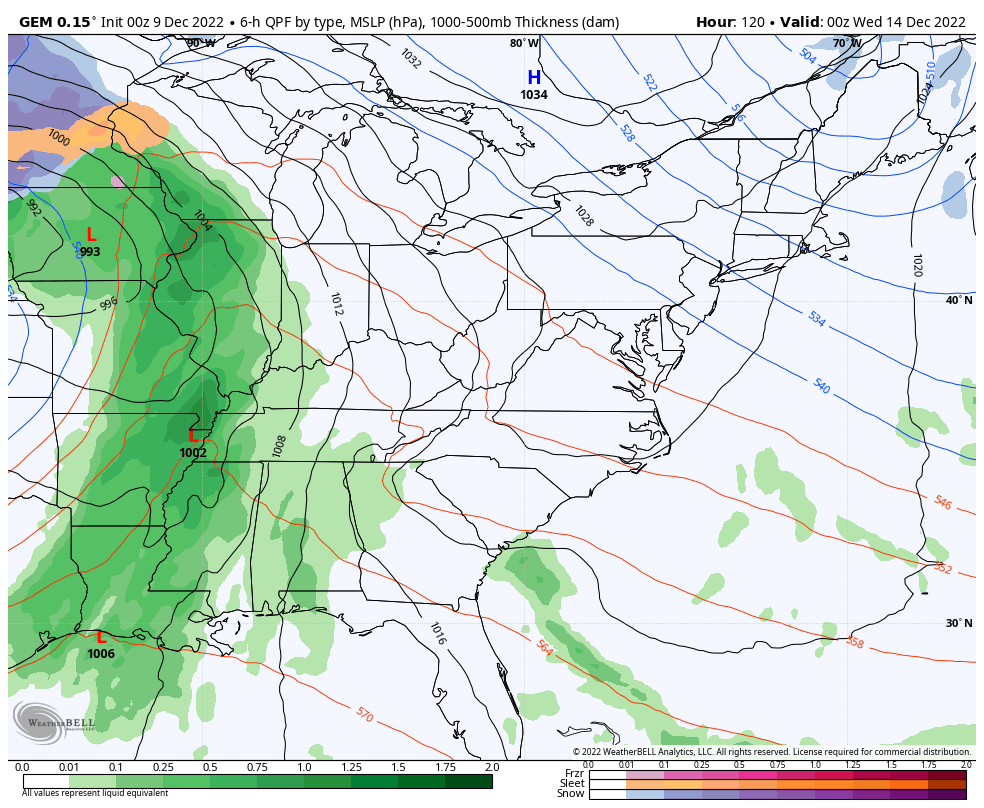
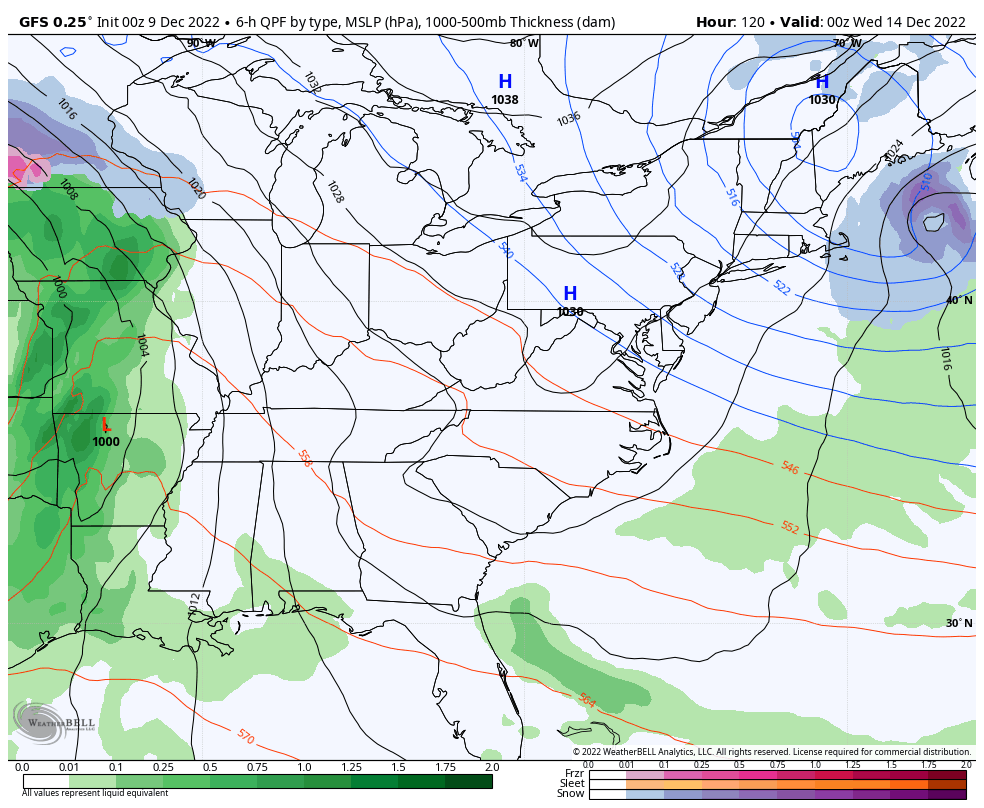
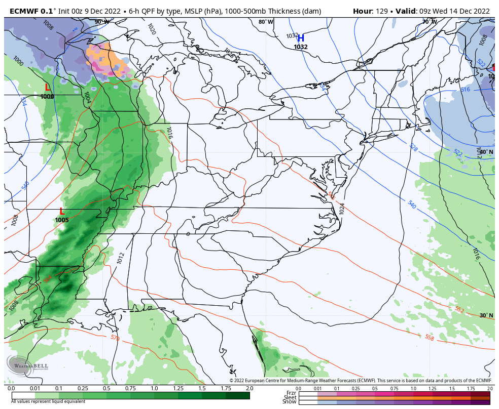
- Temps spike on Tuesday as clouds increase ahead of the storm to the west.
- Rain then sweeps east to west across the state late Tuesday night through Wednesday night.
- The trend with this whole setup is actually trending colder as we get closer.
- Wind gusts of 40mph or greater will also be possible.
- A cold front slams in here late Wednesday or early Thursday with dropping temps behind it.
- With a lot of upper level energy passing through here, and ample low level moisture, periods of light snow may show up by Thursday night and Friday.
- Light snow and snow showers will be possible into next weekend.
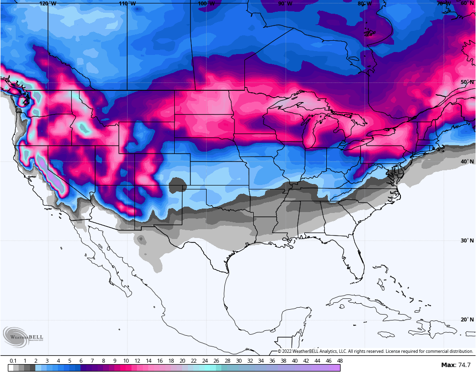
You guys know how much I’ve talked about the prospects of a big time winter pattern taking shape for the second half of December. I’ve harped on this since I first through out my initital winter analogs back in late Summer and early Fall. As we get closer, my thoughts haven’t changed a bit.
The Canadian Ensembles continue to be frigid through the final day of the forecast which is Christmas Eve…
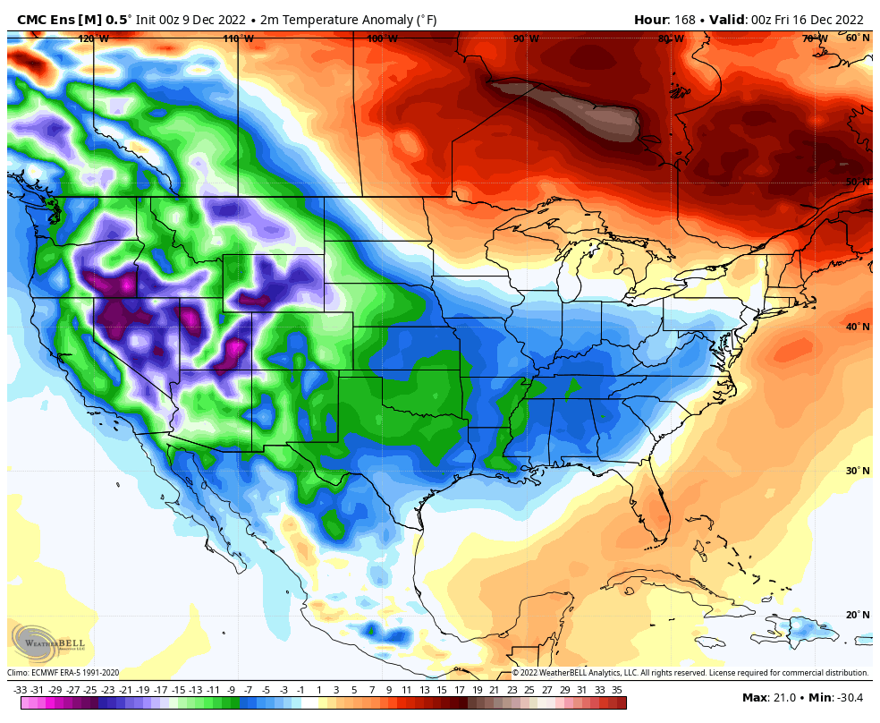
That’s an absurd look, folks!
The snow potential with that kind of setup can actually go pretty far south…
Anyone else doing some dreaming right now?

Updates will come your way later today. Make it a good one and take care.

how much of a snow are we are looking at sir
The next big storm that was tied up with front next week has almost turned into a Miller B on the 6z GFS.
I ran the automatic ( ICON ) on the Ventusky weather site this morning, and there is a prediction for 6.7 inches of Snow here in Maple on the 20th plus temperatures there after down to -2 degrees. Very interesting with this storm coming next week. Never seen the blocking in southeast Canada that strong.