Good Monday to one and all. Our week is starting calm, but it’s not going to end that way. We are ready for a stark flip to winter coming later this week with the increasing threat for much of the country to go into the deep freeze over the next few weeks.
Our week is starting out on a decent note with a mix of sun and clouds out there today. Temps are in the seasonable 40s for highs.
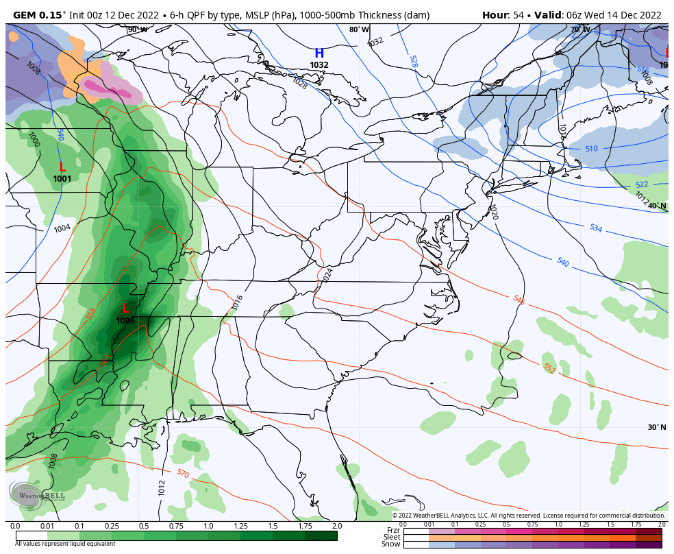
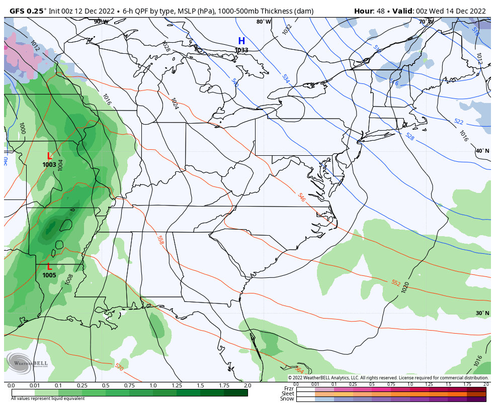
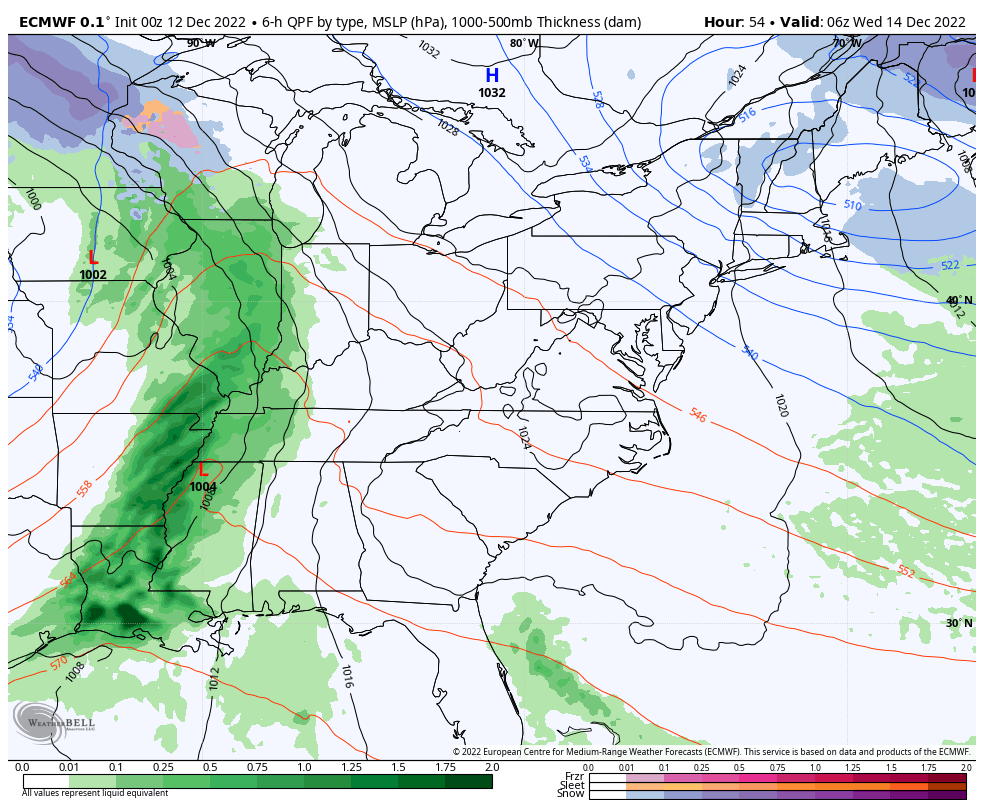
Similar temps will be noted for many on Tuesday as clouds increase ahead of our storm system. This is a monster storm developing across the plains states and this will turn into a blizzard for the plains and upper midwest over the next few days. That low will work toward the Great Lakes and Ohio Valley by Wednesday. As it does so, it drags a strong cold front from west to east across Kentucky Wednesday night and early Thursday.
Another low then pops across the east coast on Thursday and that turns into another biggie snow maker in the northeastern part of the country. At the same time, upper level energy drops into our region by Friday and Saturday, bringing the potential for light snow and flurries.
Here are some fresh thoughts on what this means for Kentucky:
- Heavy rain and gusty winds will move in for Tuesday night and Wednesday. Some thunder may be noted in the far west, but the strong storm threat is south of us.
- A powerful cold front sweeps through here Wednesday night and Thursday. This will initially dry our skies out as temps crash.
- Winds will be gusty and may top 40mph in the west as the front enters the picture.
- Ample low-level moisture under that upper level system will likely create rounds of light snow and flurries Friday and Saturday.
- Some light accumulations will be possible across central and eastern Kentucky. In terms of snowfall, this isn’t a big deal other than it’s a week before Christmas and we get some festive flakes.
The Canadian Model has been the rock of the models with this system and it really hasn’t wavered with the evolution of this whole setup. Here’s the latest run…
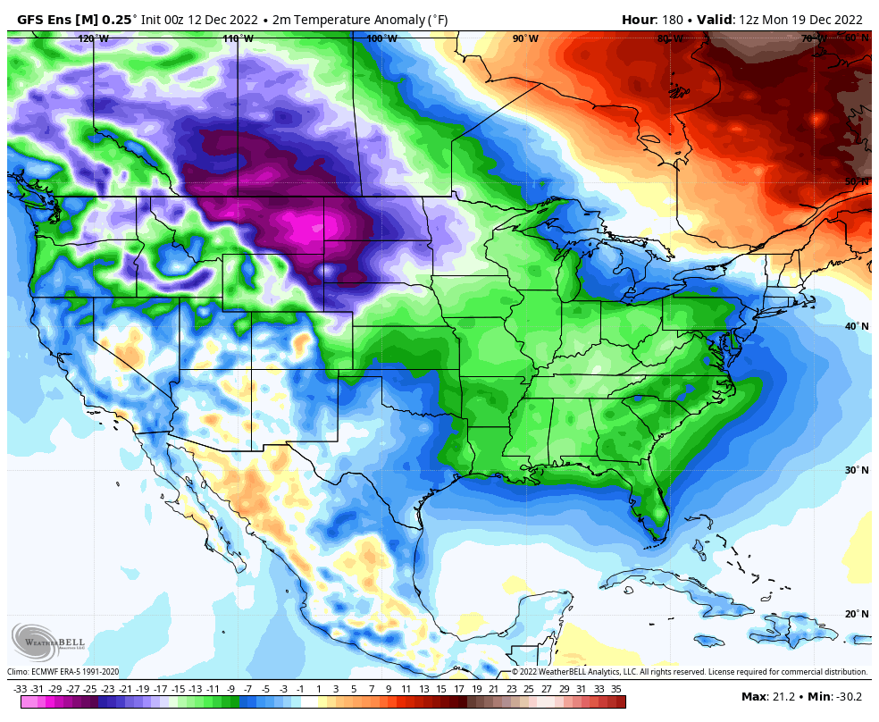
The GFS is finally becoming more consistent, but still has those minor variations with the upper level system…
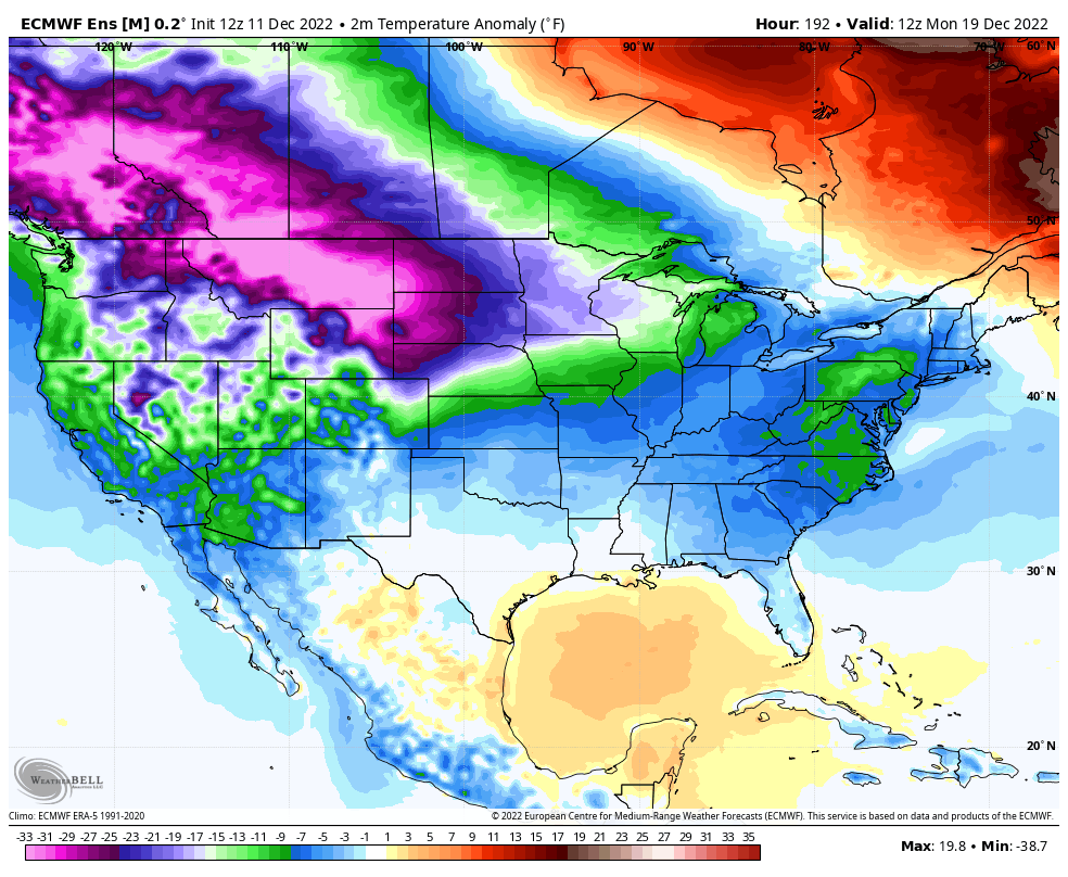
The EURO…
It’s at this point we have to abandon the operational models for a bit. Why? Because there is so much extreme cold entering the country that the models are going to suffer feedback issues that alter storm systems and their tracks. You’re going to see a lot of variability with every model, so you have to be prepared for that. Just know that there is legitimate chance for a storm system or two to threaten our region with winter weather next week and into Christmas weekend.
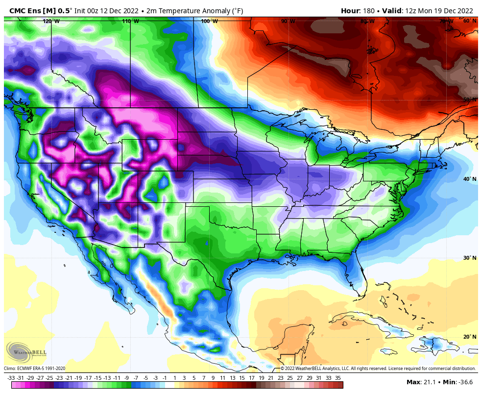
The cold coming for the week leading up to Christmas and beyond looks absolutely brutal for the country.
Canadian Ensembles
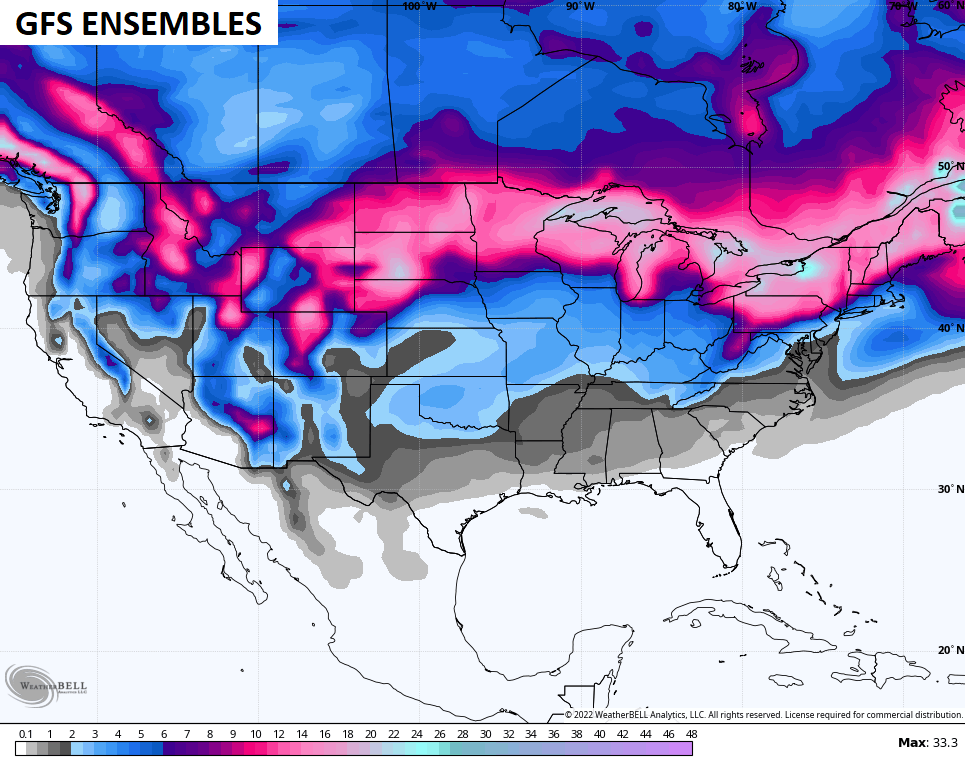
GFS Ensembles
The EURO Ensembles are as cold as I’ve ever seen them, folks. To think this is the average of 51 different members…
Those same ensembles show the chance for flakes to fly in every state in the lower 48 over the next 2 weeks…
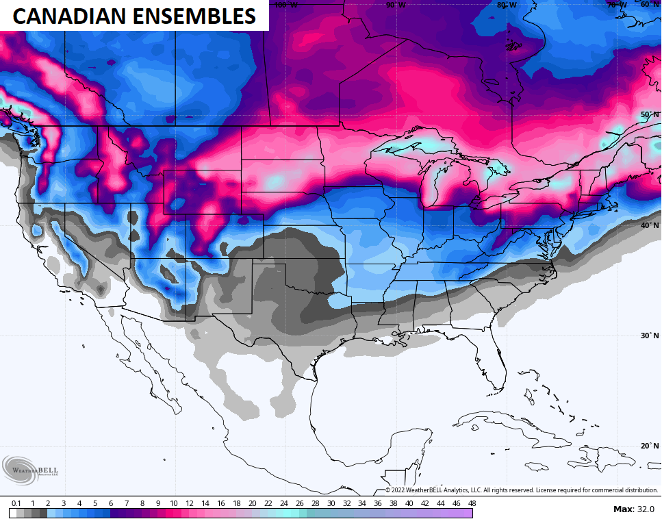
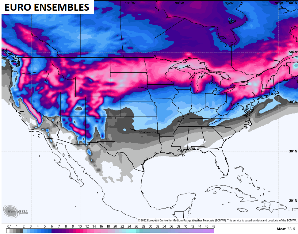
I honestly can’t recall the last time I saw all the Ensembles showing the chance for snow in every state in the lower 48. Kinda cool though, huh? 🥶❄️
I will have your updates later today, so check back. Have a great Monday and take care.

goooooood morning!!!!!!!!!!!!
A good Morning to you too Rolo and everyone else ! My computer won’t load the various maps on your Blog Chris. This has been going on for sometime now so I won’t bore anyone with a comment this Morning. I read your Blog discussion okay and this Arctic Air sounds very dangerous. I’m hoping here in the Ohio Valley we will not get the extreme cold and blizzard as our neighbors to our North, but maybe moderated Arctic Air and a couple of inches of Snow for Christmas would be nice.
If the latest GFS, CMC is any indication. We’ll have plenty to track up to Christmas