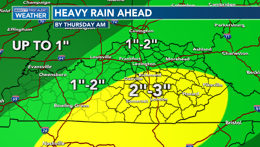
Good evening, friends. Rain is rolling into the west and will soak Kentucky later tonight through Wednesday night. This heavy rain is ahead of a pattern changing storm system that introduces the country to a harsh winter setup over the next few weeks.
Heavy rainfall of 1″-3″ should show up for most of the state, but the south and southeast is likely to see the highest totals. The area I’ve highlighted in yellow has the best chance for local high water issues…
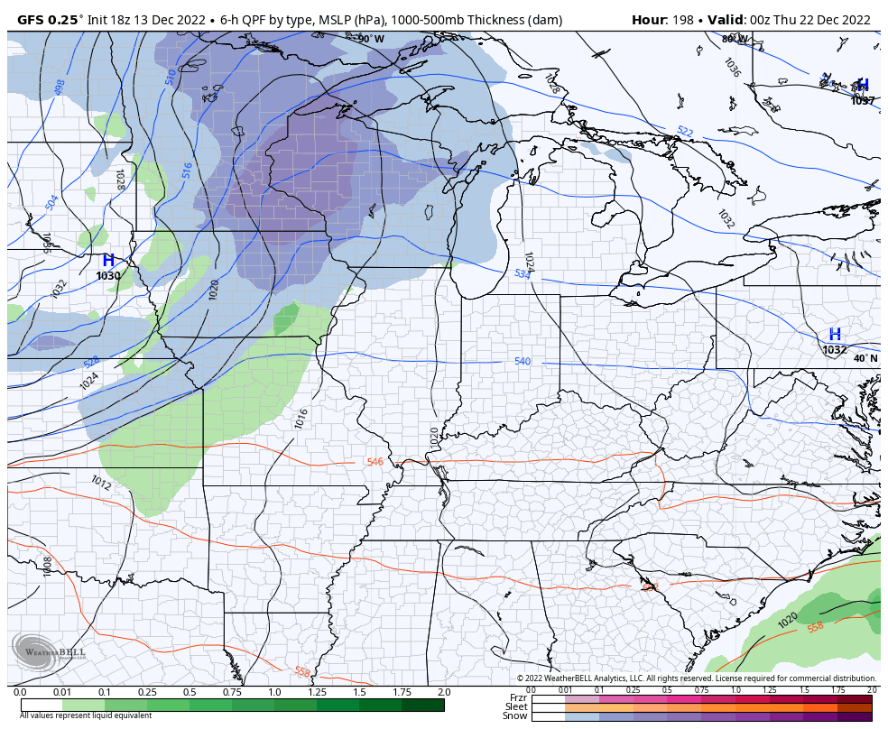
This is part of a massive storm system in the plains. We have a blizzard raging behind it and severe storms and tornadoes ahead of it in the lower Mississippi Valley. Your exclusive interactive radar will take you anywhere you want to go and you can even see live streams from storm chasers…

Cold air surges in behind this later Friday with much colder air settling in for the weekend. A few areas of light snow and flurries will also be possible, especially on Saturday.
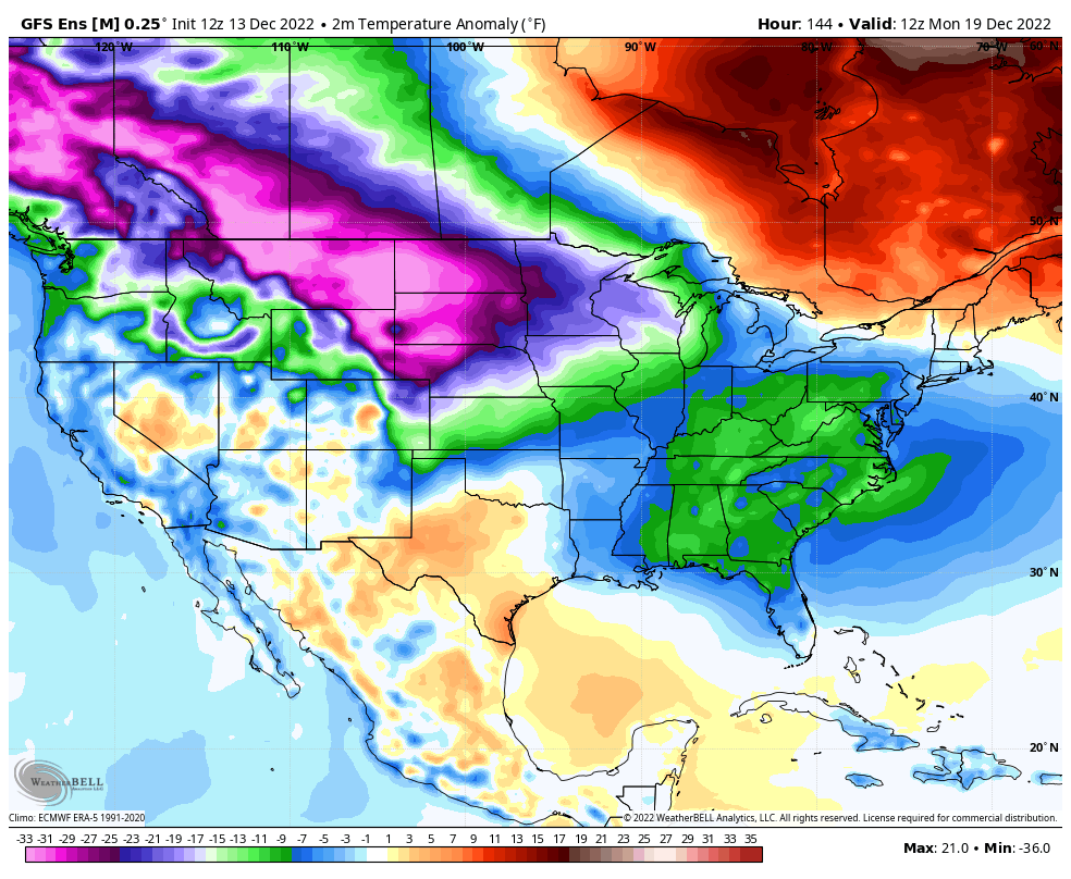
The setup for Christmas week is one that takes the country into the deep freeze which will continue through Christmas weekend and into the final week of the year. I’ve talked about how the operational models will show some wild swings because of the extreme setup. They’re just not built to handle such extremes.
That said… I’m about to say something that may shock you. A few of the recent runs of the GFS are likely getting closer to the reality of the setup and are better than most other models right now. Of course, this doesn’t mean the GFS won’t show some crazy swings… It will. It just means the last few runs of the model are plausible scenarios based on what I’m seeing.
The recent run of the GFS shows a week system dissipating as it moves through here late Monday and Tuesday. It may spit out some light stuff, though.
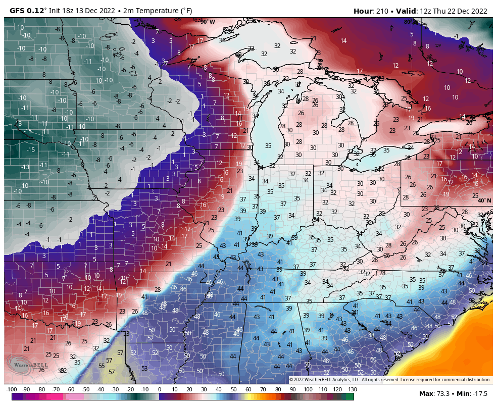
The arctic attack sweeps in after that and we will need to watch for a storm developing along the arctic boundary. The GFS has been showing this potential for a few runs now. Here’s the latest…
The setup has some very interesting potential in the days leading up to Christmas. It’s rather BOLD of Old Man Winter to be showing this kind of potential.
Taken verbatim, that run of the GFS unleashes brutally cold air in here. Watch the dramatic drop…
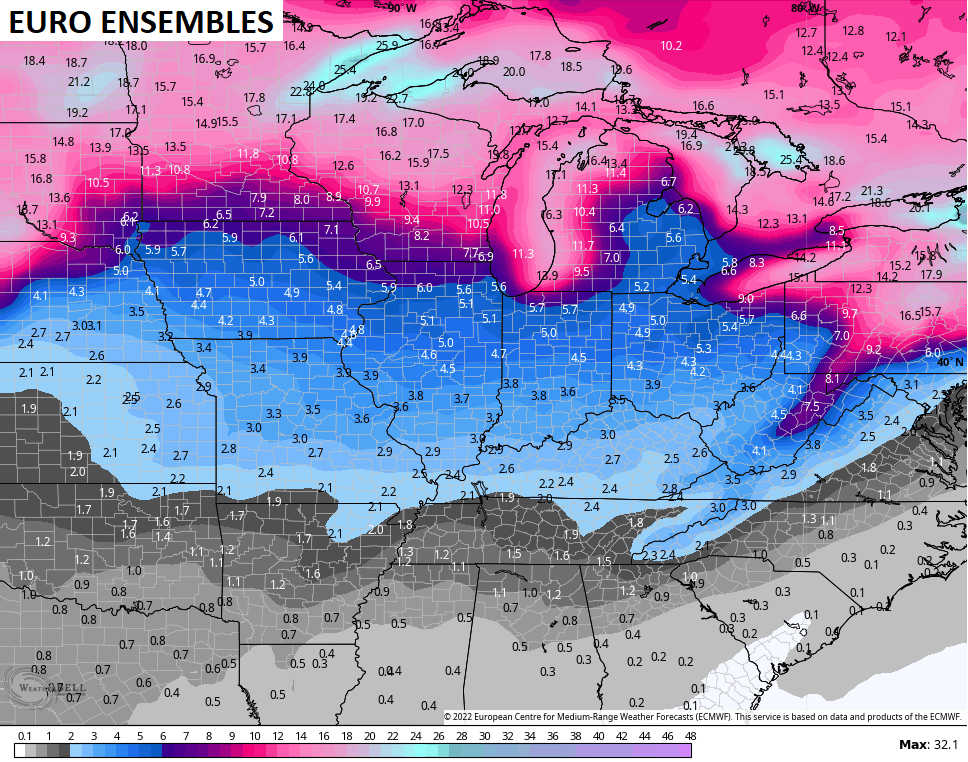
On the flipside, the EURO is having serious feedback issues. The well documented bias of the model is to keep energy in the west way too long and this extreme trough and setup killed this run. Look at how the operational run of the EURO looks nothing like the EURO Ensembles at the same time…
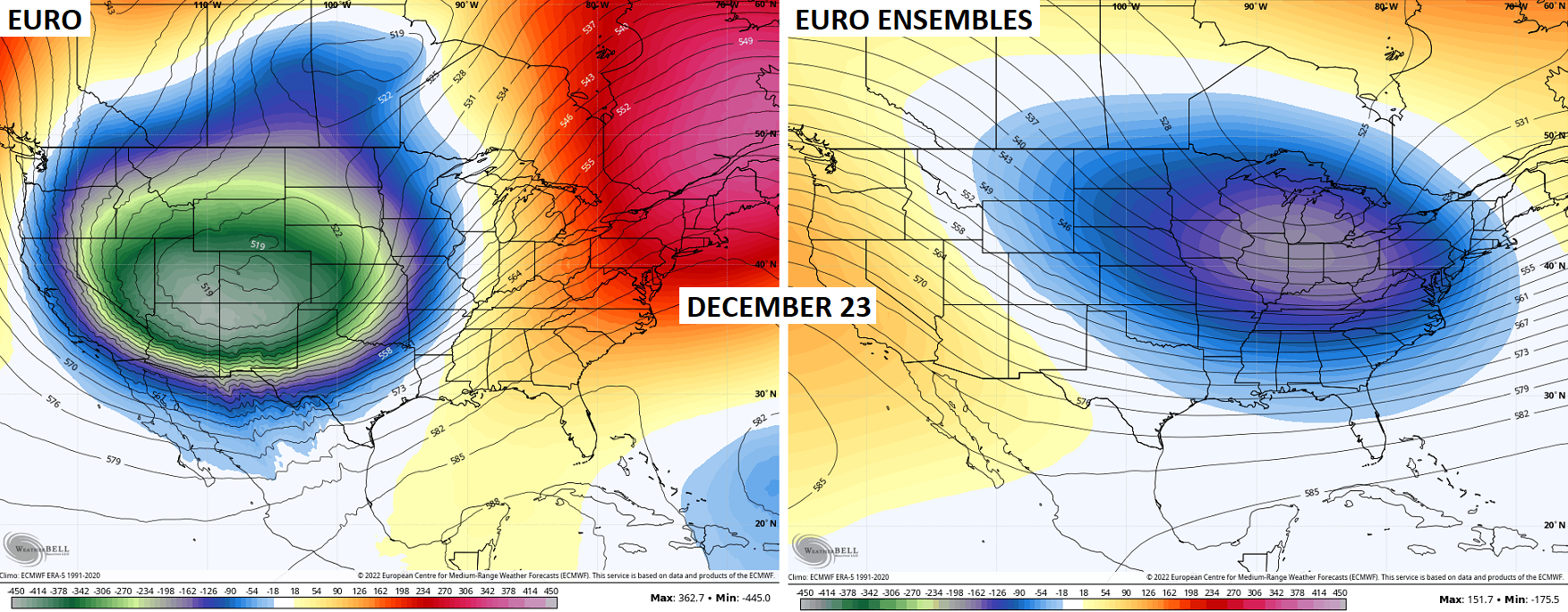
Not even close. Look for the EURO to correct in the next few runs.
The Ensembles continue to show the amount of cold being crazy and engulfing the entire country…
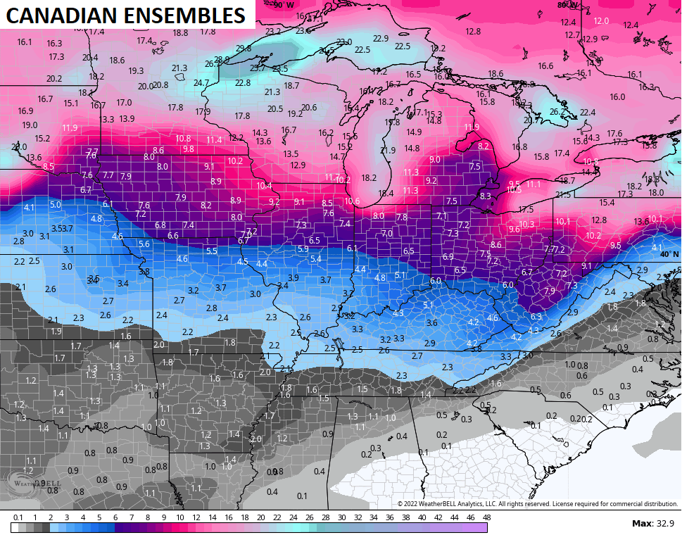
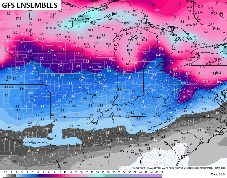
Snow chances over the next two weeks are higher than normal. That’s what the ENSEMBLES are suggesting and I’m not showing these because I think totals are right. I’m showing them as an illustration of how they are locking in on snow threats…
Enjoy your evening and take care.

Thanks Chris, I still don’t understand how the weather will pan out for Christmas ? For now here in Maple, we will be glad for the rains coming to help replenish the soil moisture before Spring Planting Season begins in April.
It will be interesting next week.