Good evening, folks. It’s Christmas Eve Eve and we are dealing with one of the worst winter weather days on record across our region. As we work into the big holiday weekend, we track more bitter cold and snow squalls. Oh, there’s another snowmaker coming Monday.
Before we get started with the forecast, let’s talk a little more about last night’s storm. This qualifies as a blizzard in northern Kentucky. Here’s the NWS definition of a blizzard:
Blizzard means that the following conditions are expected to prevail for a period of 3 hours or longer:
- Sustained wind or frequent gusts to 35 miles an hour or greater; and
- Considerable falling and/or blowing snow (i.e., reducing visibility frequently to less than ¼ mile)
Now, let’s look at this 4 hour window from the official reporting station for Cincy which is actually at the Airport in Covington…
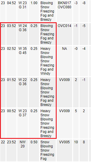
That’s 4 consecutive hours meeting the NWS criteria for a blizzard.
No matter how you slice it, we can officially say this was a blizzard that hit northern Kentucky and the Cincy area. Bold. huh?
Snow showers and squalls will continue through Christmas Eve and may put down up to an inch for some areas. These will also produce whiteout conditions. Most of this won’t show up on radar because of the arctic air in place keeping the flakes from containing much moisture…

Temps continue to be brutal and be well below zero tonight and then again tomorrow night. Wind chills in the -20 degree range continue tonight with some improvement into the -10-15 degree range for Christmas Eve.
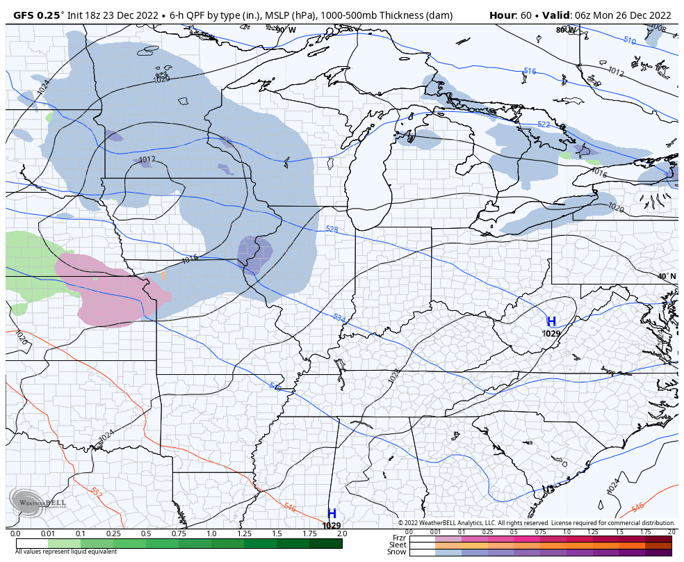
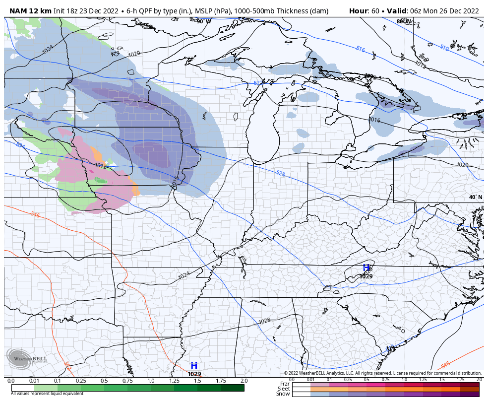
The system moving in for Monday will likely trend stronger on the models…
GFS
NAM
Can we get a WST from this? Maybe.
The pattern breaks for the middle and end of next week as we turn it mild for a bit before winter crashes back in here during the first half of January.
Enjoy the rest of the evening and take care.
