Good Friday, folks. We are rolling into the New Year’s Weekend with rain rolling into Kentucky. This rain is part of a very active setup that may bring us strong storms and snowflakes in the first week of the new year. Crazy weather? Shocking, I say! 😏
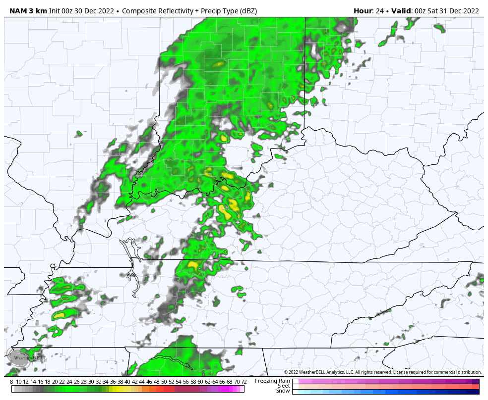
A few showers are being noted out there today, especially in the west. Some of this may get into areas of central and northern Kentucky for a time. Here are your radars…

Temps today reach the low and middle 60s in the east and this will make it feel more than 90 degrees warmer than last Friday. 😲
Showers and a few storms then work in later tonight into Saturday as low pressure swings through here. The future radar shows the rain getting out of here before the clock strikes 2023. Here’s the future radar from the Hi Res NAM that starts at 7pm this evening and goes through the calendar flip…
The next system moves in Monday and Tuesday and brings the chance for strong to severe storms across western Kentucky. The extent of that threat is still to be determined. This happens as a strong storm system blows across the Plains states into the western Great Lakes. That drags a cold front in here on Tuesday with showers and storms areawide. That front will slow down and could allow for another wave of low pressure later in the week. That one may produce some flakes.
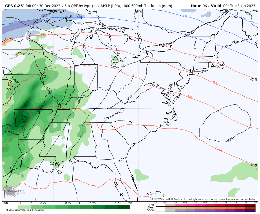
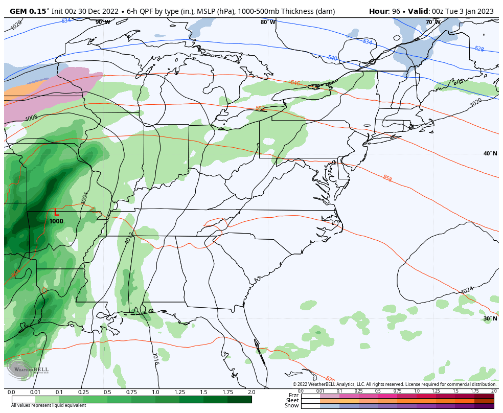
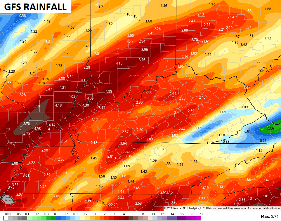
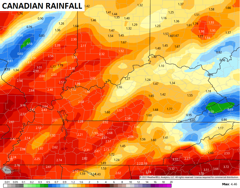
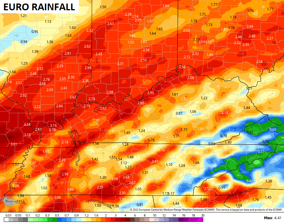
Here’s how the models see this whole scenario next week…
GFS
CANADIAN
EURO
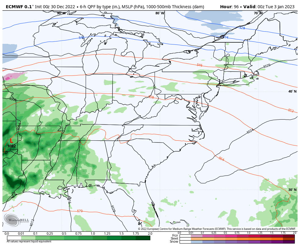
Rainfall totals from today through the middle of next week should average 1″-3″ for many…
Looking down the road toward the second week of January, we find the indices now pointing toward that winter look I’ve been talking about. The GFS Ensembles are showing a negative Arctic Oscillation (-AO), negative North Atlantic Oscillation (-NAO), negative Eastern Pacific Oscillation (-EPO) and +Pacific North American Pattern (+PNA)…
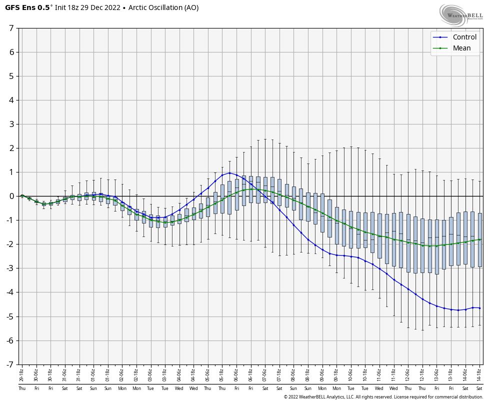
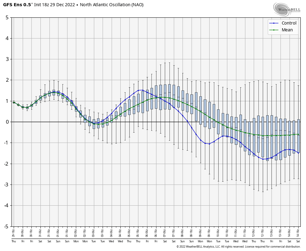
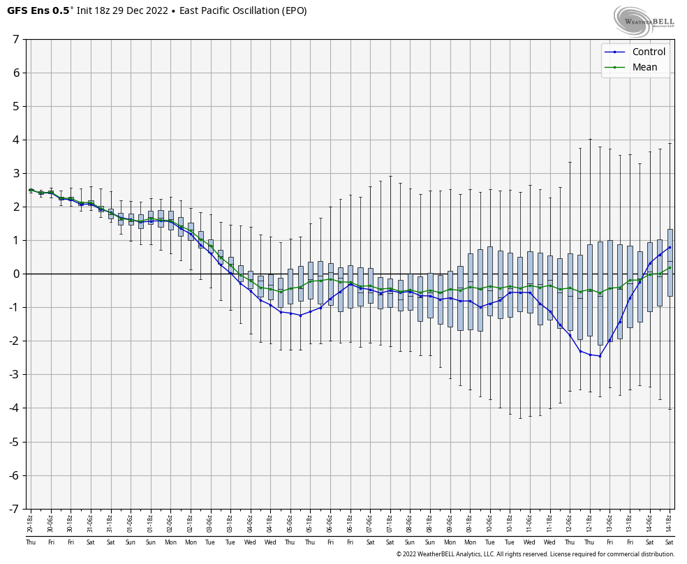
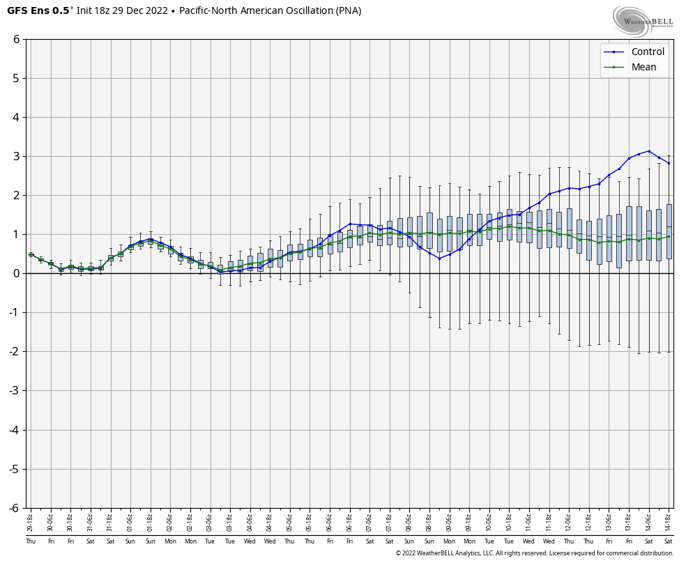
If you’re a cold and snow lover, you like seeing those 4 signals going into their respective phases.
I will update things later today. Make it a great Friday and take care.

Those signals are dipping farther into negative land than they did during the run-up to Christmas. If the blocking sets up across Alaska, Canada and Greenland the way it did in the previous month’s patterns (and there’s every indication that it will), we could be looking at an even more extreme cold outbreak. The second half of January could be one for the books!
Hope your correct Joe, and maybe we’ll have a Spring without damaging freezes. Very concerned of a possible outbreak of severe weather next week. Rains on the radar this morning are arcing around the western edge of the strong Southeast Ridge again. Until there’s a change in the Tropical Pacific to the positive and the Atlantic to the negative we will continue this very erratic weather pattern.
It is funny how the body acclimates to extreme cold weather. After last weekends extreme cold temperatures. I can now walk out with temperatures in the low thirties with only a long sleeve shirt and I find it comfortable.
i walked out barefoot on porch last 2 mornings. we lost KWC BOWL CENTRAL PLAY YESTERDAY.
eddie grant electriq avenue.