Good afternoon, everyone. Low pressure is working into the region for the final day of the year and it’s bringing showers and a few thunderstorms along for the ride. This sets us up for a bigger system early next week and a return to winter that follows.
Temps this afternoon feel more than 90 degrees warmer than this same point last week in several areas. Crazy!
Showers and some thunder will continue to work across the west, while much of the rest of the state stays dry. Here are your radars to follow the afternoon action…

Showers and some thunder will then overspread the rest of the state tonight and early Saturday.
The early week storm system will continue to target the region later Monday and Tuesday and could bring strong to severe storms into the west. The best instability is likely to stay to our southwest and that’s reflected in the Storm Prediction Center’s severe weather outlook for Monday and Monday night…

Damaging wind will be the primary threat there, but that threat decreases as the line moves east. Rain and some storms will be common across the entire region with this into Tuesday.
A wave of low pressure will then develop along the front late Tuesday and Wednesday. That keeps rain going into the middle of the week as colder air comes in from the northwest. That could very well mean some snowflakes by Thursday.
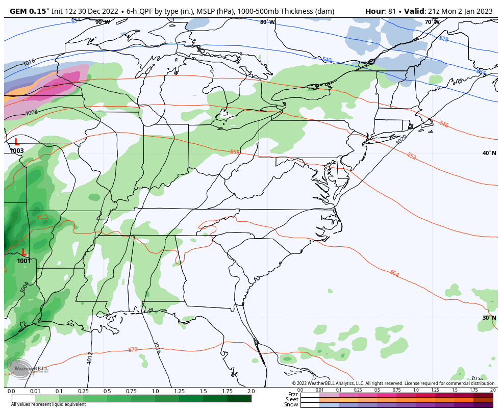
The Canadian seems to have a good handle on this…
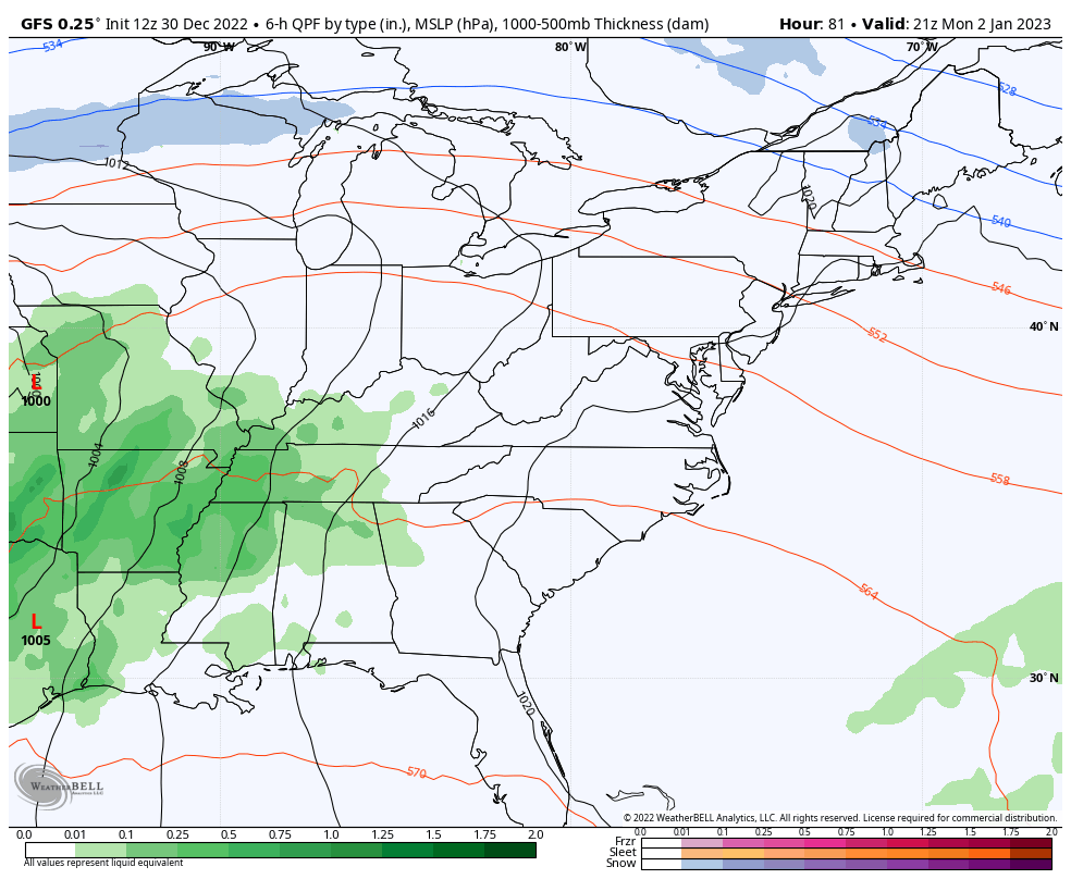
The GFS has the theme right, but it’s too progressive…
Another system follows that by next weekend and could be a rain and/or snow maker around here. It’s at this point we will start to see the overall pattern go stronger toward winter as we hit the second week of the month and the indices start to do some work.
I’ll see you guys later today for the evening update. Make it a good one and take care.

hop[e u r wrong bout winter coming in again.
It’s not even January yet. Long way to go.
Wonder if we are beginning to see La Niña breaking down in the next few weeks..NCEP says 70+% chance neutral by Feb-April..Big changes can lead to big snow..Looks like a lot of systems along the East coast which what I’ve read is more El Niño like..
La Nina does show signs of weakening, but I think next August El Nino will make his presents known in the Tropical Pacific turning the Pacific positive and the Atlantic negative. Winter 2023-24 could be more interesting for Snowstorms in the Ohio Valley ?
Good I hope they are. Looks like we have to get through to some heavy rain before we get back to winter.
What could be seen as a spark of hope is showing up on the latest Sea Surface Temperature Anomaly chart, where the Central and West-Central Pacific waters are still showing up as considerably colder than normal. But the Eastern Pacific waters, which are what directly affect the La Niña/El Niño oscillations, are showing signs of normalizing. In fact, there’s a patch off the coast of Ecuador that is showing up a warmer than normal.
Hope springs eternal!
https://www.ospo.noaa.gov/Products/ocean/sst/anomaly/