Good afternoon, everyone. Winter has returned to Kentucky with rounds of light snow and snow showers. I’ll take a look at the light accumulations from this and look ahead toward a more sustained winter change later next week.
Today’s action is putting down some hit and run light accumulations, but the warm ground and temps just above freezing are keeping a lot from sticking. Once the sun sets, those light accumulations show up much better and we may be talking about slick spots developing as temps go below freezing.
Here are your radars to track the winter weather…

Go to our weathercams page to check out the winter views from across the state…
Next week features another system working in here with rain later Monday into Tuesday. That will be followed up by two more systems later next week into weekend as winter starts to press back in.
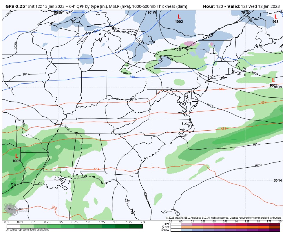
The GFS is trying to trend the storm track farther south…
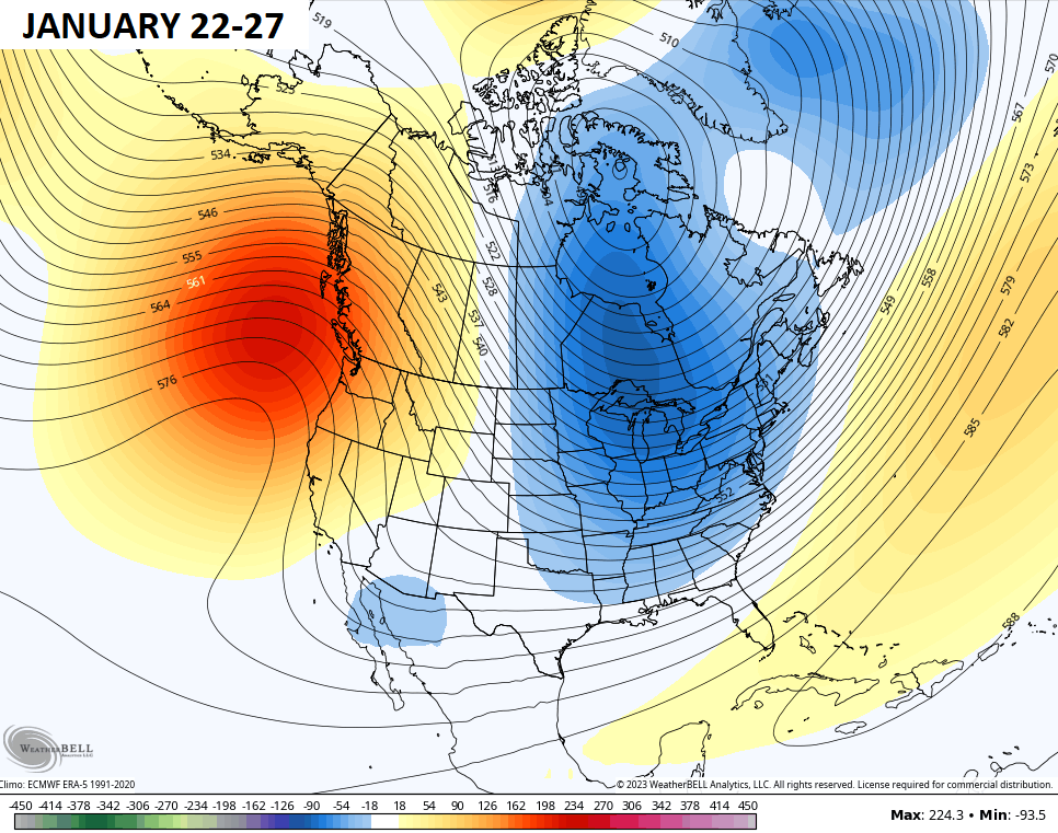
This comes as we watch the overall pattern change across North America. The west is seeing a deep trough and major storms coming through, but that trough is slowly coming out. Check out the 5 day period coming up…
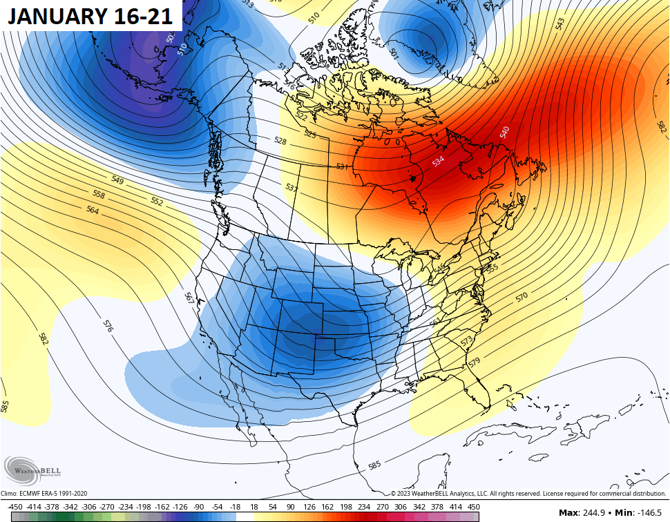
Now watch the following 5 days…
Enjoy the rest of the day and take care.

What is that white stuff falling from the sky oh snow flurries didn’t recognize you lol I am glad to see any flurries. I know we are always pulling in warm air when it comes in from the south but it seems now it’s a struggle when it comes from the north too to get it to change from rain to snow will one of you weather fellows explain that lol ???