Good Friday, folks. Winter has returned to Kentucky as we track rounds of light snow and snow showers. This will bring small accumulations to many, with a better shot at a few inches or more of snow in the southeastern Mountains.
Before we get into today’s winter weather, let’s look back on a mind-boggling occurrence from Thursday. Mercer County has hit by a tornado and an earthquake on the same day…
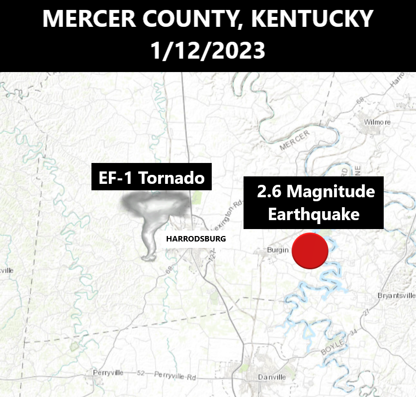
The odds of that happening are astronomical! Feel free to share that graphic if you want… Just give your weatherdude some credit. 😁
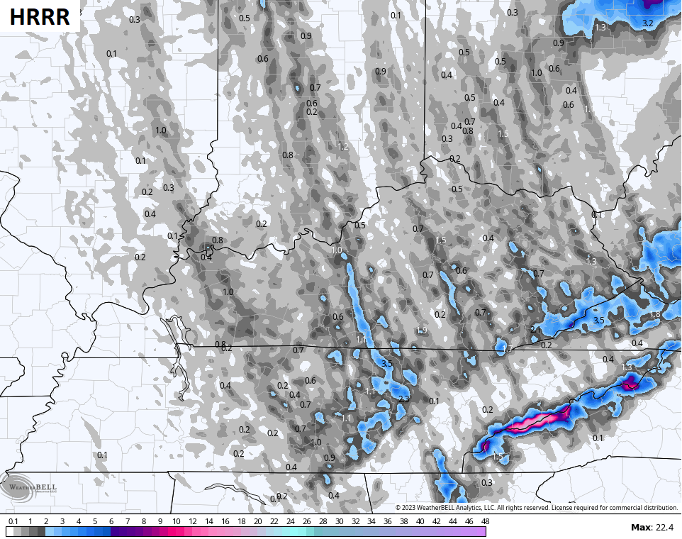
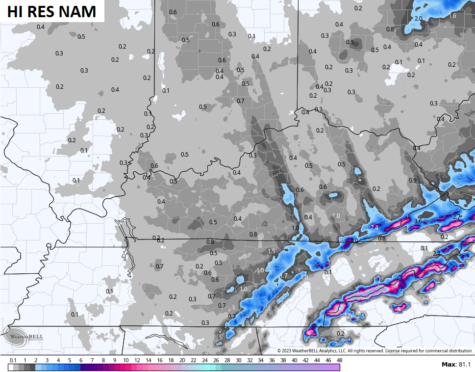
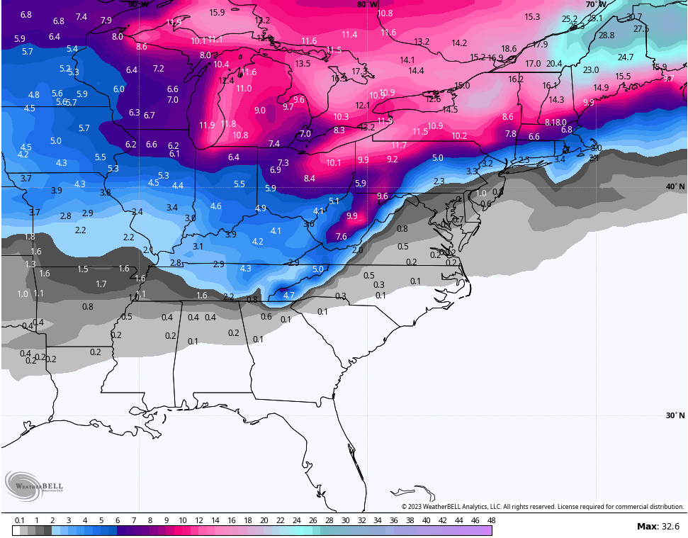
It’s going to be interesting today and tonight to see where these heavier snow streaks set up on this strong northwest flow. Some intense bands of snow may show up in these streaks from northwest to southeast, leading to local accumulations that can overachieve.
At the same time, the mountains in the far southeast are likely to pick up a few to several inches of snow. You can see all this playing out on the snowfall maps from the HRRR and Hi Res NAM…
Don’t sleep on a cold northwest flow with a wide-open Great Lakes!
Here are your radars to track the winter weather…

Go to our weathercams page to check out the winter views from across the state…
This blast of winter doesn’t have staying power past early Saturday as temps jump back up this weekend and early next week. A few weeks ago, I said if this patten doesn’t change soon that we would get ourselves into some trouble with heavy rain and severe weather. That just played out again on Thursday and I’m afraid we can see that again in the week ahead before we do change it up.
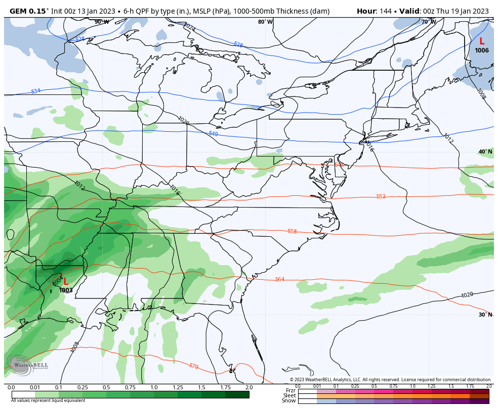
One storm system moves in with rain and some thunder later Monday into Tuesday.
A much stronger system then shows up a few days later with the potential for strong storms and very heavy rain before winter crashes in for a longer stay…
That starts the pattern of Old Man Winter doing some flexing again across the eastern half of the country. Watch this trough develop and just hang tough…
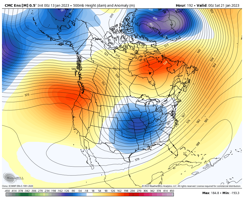
Those same ensembles are showing an increase in potential snowfall during that time as well…
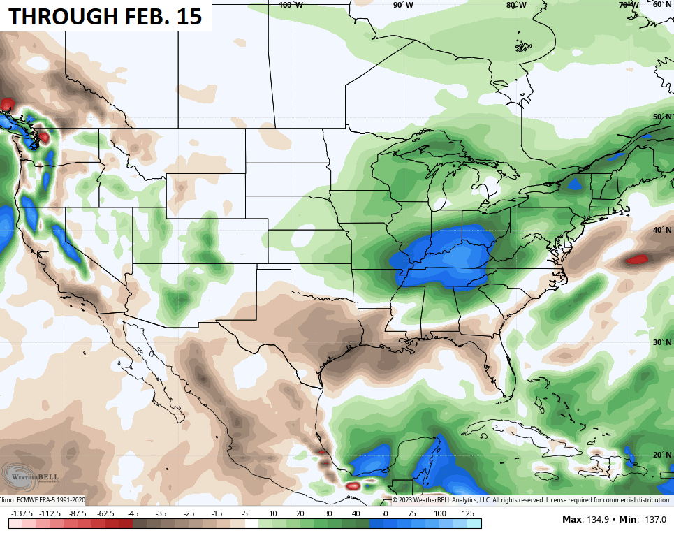
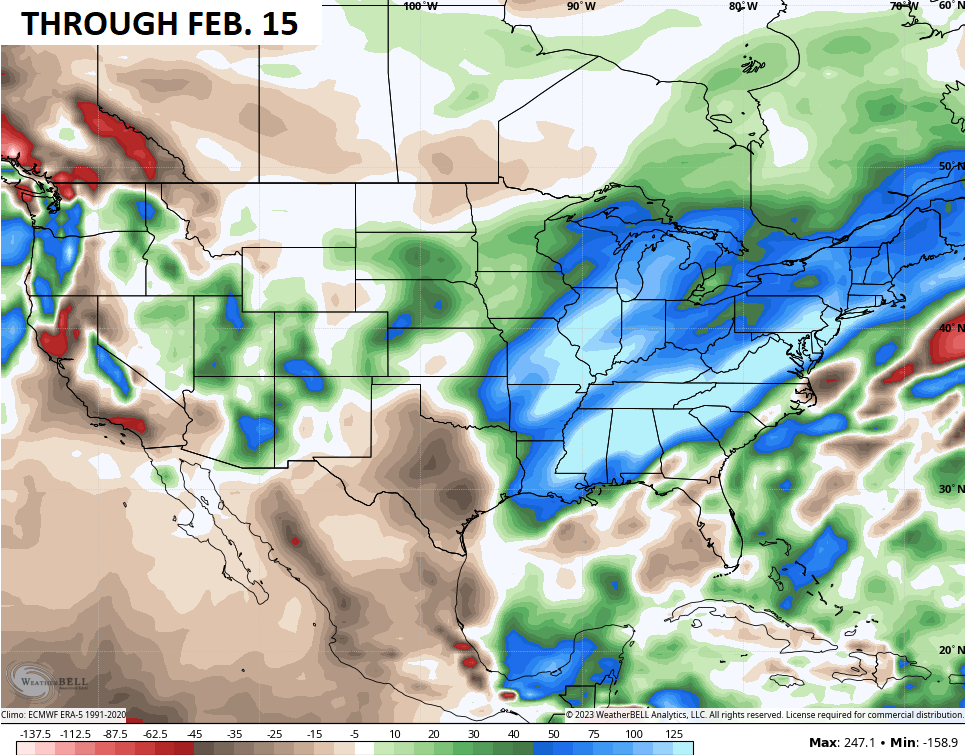
Looking way down the weather road, regardless of temps, we appear to be locked into a very active storm track through our region well into February. The EURO Weeklies go almost to the end of February and show well above normal precipitation here…
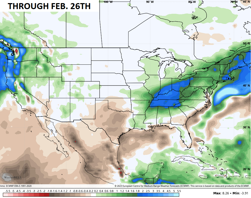
The GFS Extended doesn’t go out as far, but has a similar look…
The operational version of that is kinda crazy looking…
Given the active storm track, it’s safe to assume a few of those storms will threaten us with a lot of snow and ice. It might also be safe to assume we could see additional severe threats.
Extreme is our new normal!
I will have updates later today, so check back. Make it a good one and take care.

colder weather zack b
that earthquake was the big shift of wlex having 3 of thier 5 forcaster taking over the weather wars in our area. wlex had splt screens of meck working the computer and tom on the maps.. all this while jim caldwell having do everything himself. why couldnt bow tie help. ally blake was working twitter from baltimore. its about time WKYT spend some money to keep and or hire you guys some help. wymt had all 3 forcasters killing it as well in eastern ky. one more thing, wtvq had 3 working as well. the winner was bill meck,tom,emily. lex has 5 weather men/women and wkyt has 3.
It takes those other channels 3 to 5 people to do the job that Jim Caldwell can do all by himself. WKYT still rules! 🙂
Bill and Tom (and others at WLEX) have a distinct lack of braggadocio which is refreshing. They are knowledgeable and good-humored. But the guy who is crushing it is Ryan Hall Y’all, right out of Pikeville. Periodic YouTube videos are the main course, but he serves up an informative and entertaining live stream with a storm chaser network when the weather gets rowdy. He has millions of followers – for good reasons.
Bill and Tom are buffoons.
WLEX is garbage.
Go watch another channel if you dislike Chris so much.
You’re right, which is why I don’t watch network TV at all. KWC is the best for the morning weather update. It seems like routinely dissing the other guys isn’t a good look. Chris just needs to do his best and we’ll continue to recognize him as the best. He doesn’t need to pat himself on the back. We’re going to that for him. Ryan Hall isn’t direct competition.