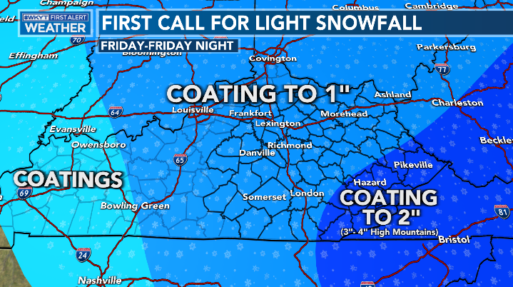
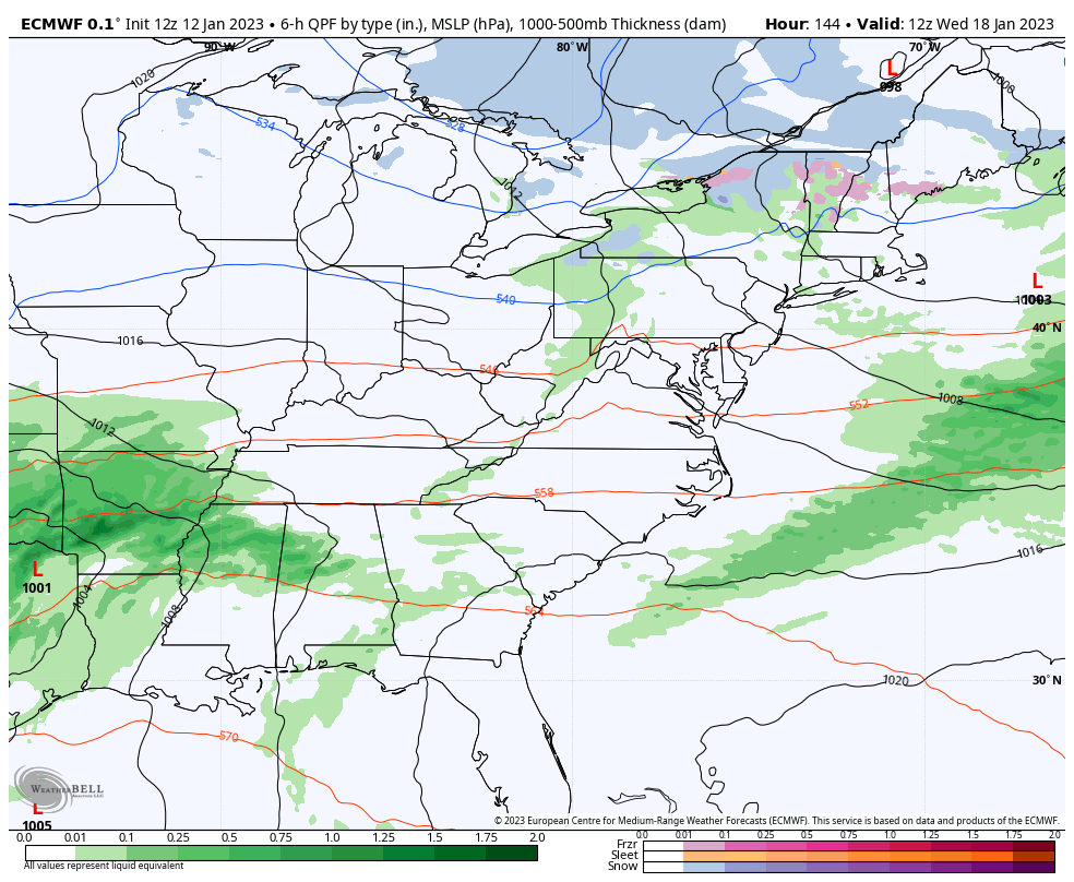
Good evening, folks. Our severe weather day has come to an end and now we focus on light snow and snow showers moving in. Many will see small accumulations, with the greatest concentration across the high ground in the southeast.
I have no changes to my snowfall map…
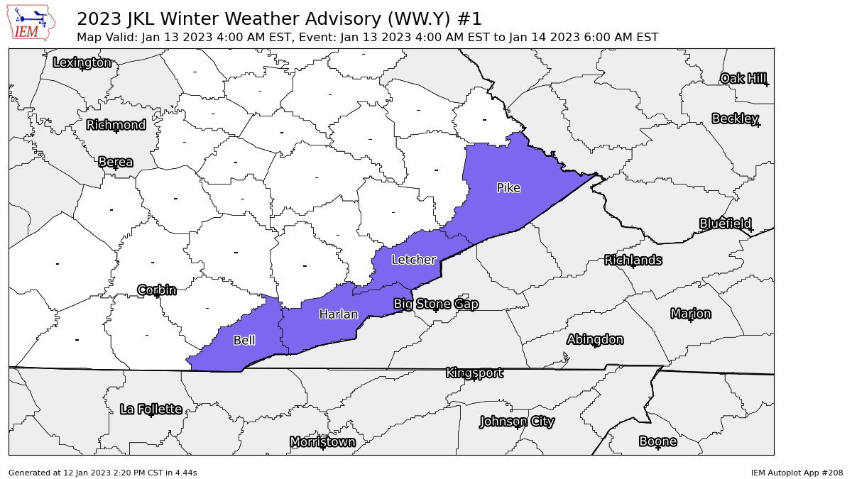
Those counties along the Virginia border are now under a Winter Weather Advisory through Friday night…
There’s still a chance for a few slick spots outside of the WWA , especially in snow showers and a few squalls that go up. The future radar from the Hi Res NAM shows all this well…
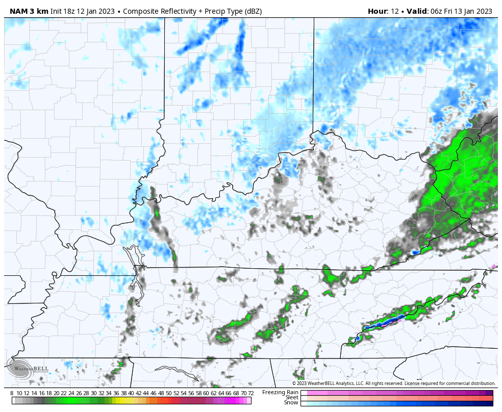
Here are your radars to track the rain and snow mix developing from the northwest…

Temps rebound quickly over the weekend as we track another rain maker in here early next week. A few storms will also be possible with this…
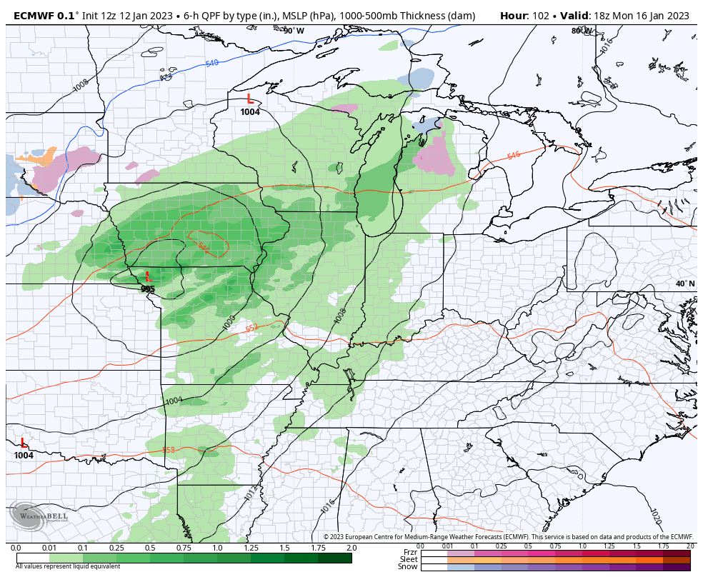
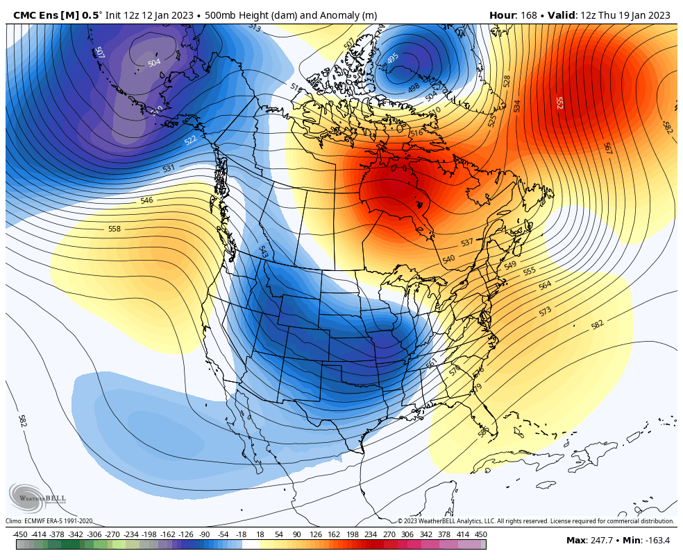
This is part of this super active pattern that will throw 2 more systems at us later next week into next weekend. That’s when the winter pattern begins to flex again. The EURO is showing the potential…
All of this matches up well with the time period the Ensembles have been showing for a winter pattern taking control again. They still do…
I’ll talk much more about this pattern with my overnight update. Make it a good one and take care.

Despite the earlier cold blast, it’s just too doggone warm for January…it was 50 degrees here last night at 3am–that just isnt normal for Janiary 12th! Even if the daytime temps are moderate, it should be cooling off at night. This is not the natural order of things in a temperate climate. This is why are inundated with fleas, ticks, & other pests that should die off seasonally but dont now (not to mention it wreaking havoc on tje rest of the environment)