Good Saturday, everyone. Light snows are slowing down as a seasonably cold day unfolds across Kentucky. As we look ahead, a much more stark change to winter looks to begin later next week, but things remain active ahead of it.
As we start the day, watch for slick spots with temps deep into the 20s. Snow showers and areas of light snows will wind down fairly quickly across the east and southeast. Here are your radars to see the flakes on out of the state…

Sunday’s weather looks pretty good with a mix of sun and clouds and temps in the 40s. Clouds roll in quickly on our MLK Day Monday, with rain and some thunder arriving later in the day and lasting into Tuesday…
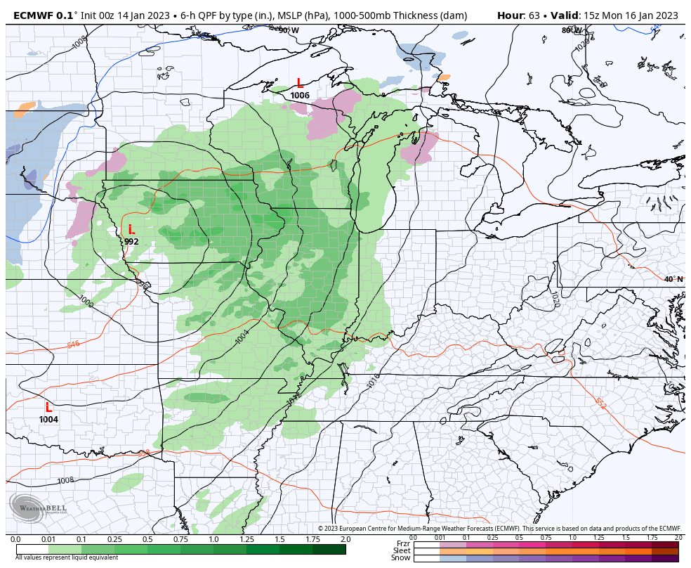
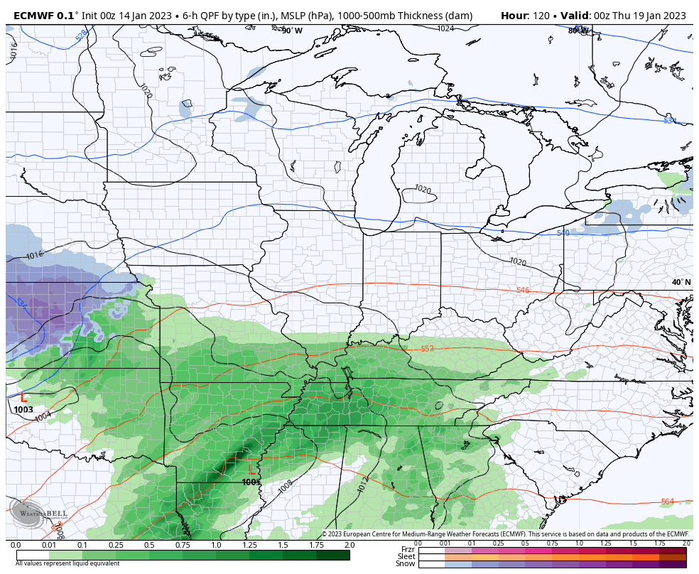
Two more storm systems target the region late next week into the following weekend as winter starts to press back in from the northwest. These initial systems could bring a lot of rain in here, especially the first one…
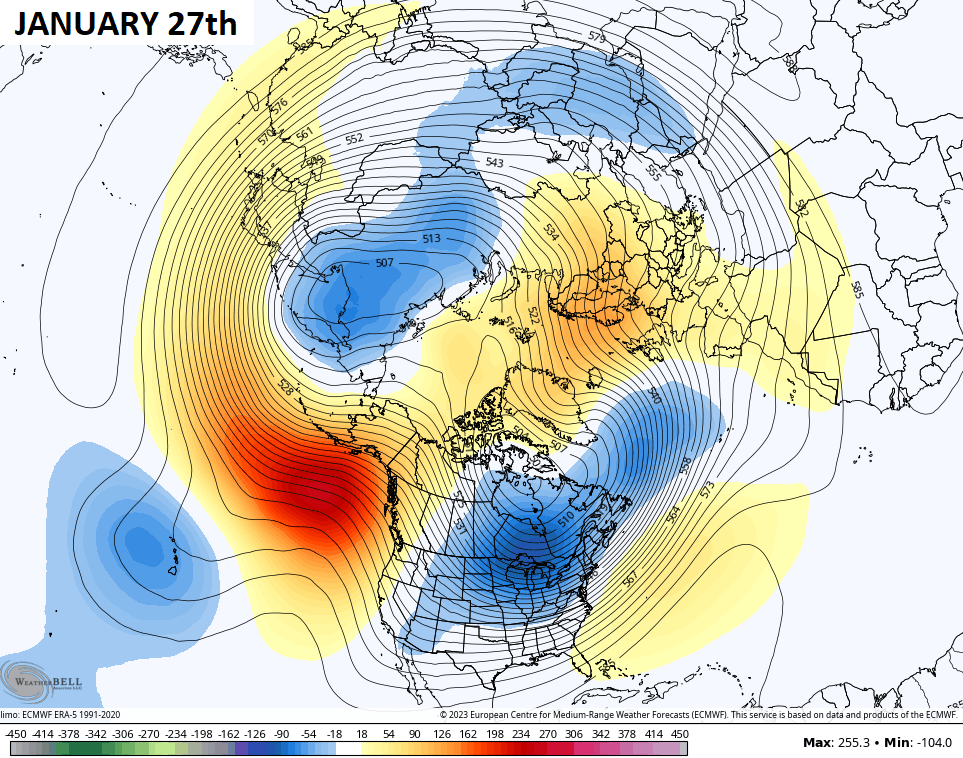
Looking at the upcoming pattern change, it’s pretty clear to see on the EURO Ensembles. Take a look at the northern hemisphere this weekend…
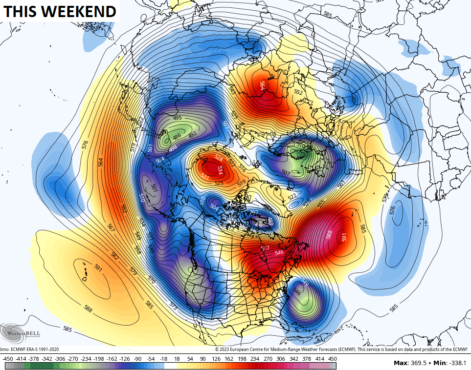
Notice the changes coming by next weekend…
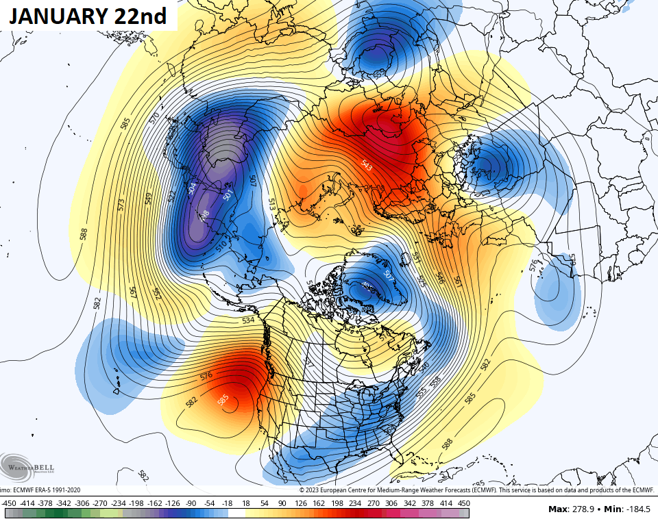
And then that deep trough getting established in the eastern half of the country several days later…
That particular setup brings the coldest air relative to normal in the entire northern hemisphere into the United States…
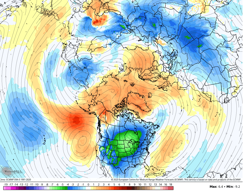
This same pattern has happened every month since September, but it varies in intensity and staying power.
I will have updates later today. Have a great Saturday and take care.

phil collins in the air kentucky gets another slaughter today.
Oops
Mother Nature and Father Winter: you can freeze my cheeks off but please-no ice storm….NO PINK on the weather maps!