Good afternoon, folks. My time is short, but I wanted to drop by for your normal midday update on the winter weather systems on the way. The first one brings a bit of snow with it tonight and Sunday, with the one coming in behind it having a WST look to it.
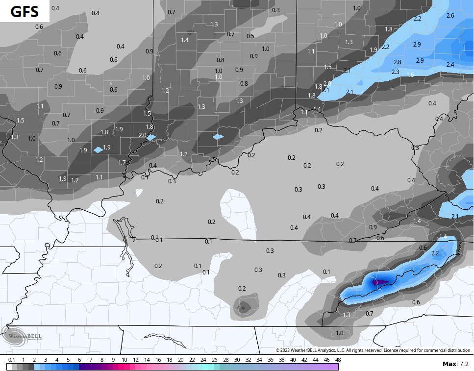
Areas of northern Kentucky continue to have the best chance of seeing light accumulations late tonight and Sunday. This band of light accumulating snow will be oriented from southwest to northeast along and near the Ohio River. The Covington/Cincy area has the best chance of seeing snow on the ground from this.
The rest of us have a much smaller risk until the wraparound light snows kick in Sunday night and Monday morning.
In terms of the models, the HRRR is the snowiest…
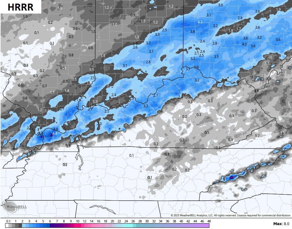
I’m not really feeling that right now.
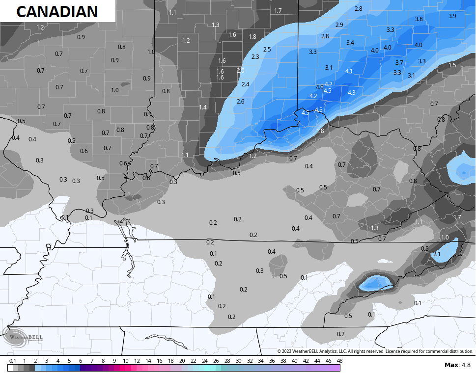
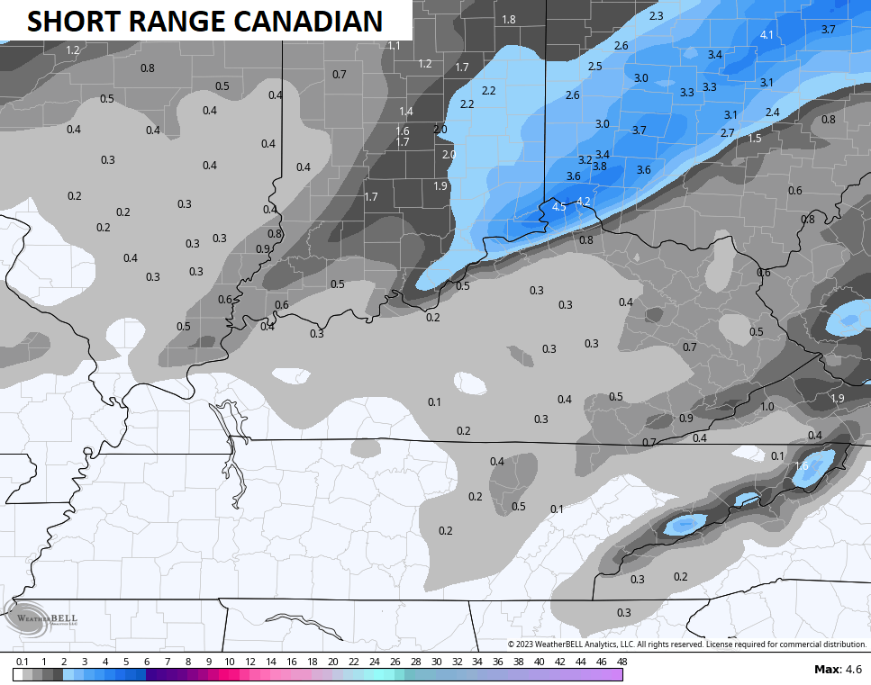
The Canadian twins have the bullseye on northern Kentucky…
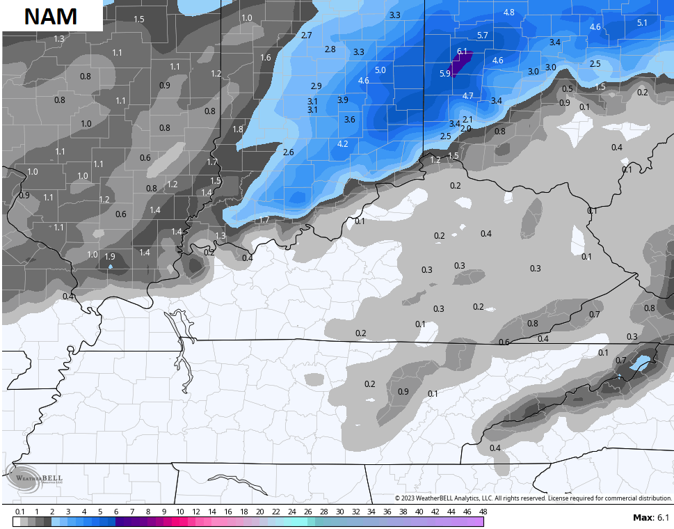
The NAM is a bit northwest of that…
The GFS…
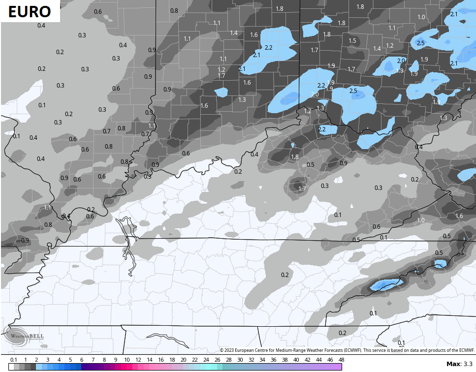
The EURO continues to have a few streaks of snow farther south into north central and northeastern Kentucky…
I’ll get a Last Call For Snowfall map out later today.
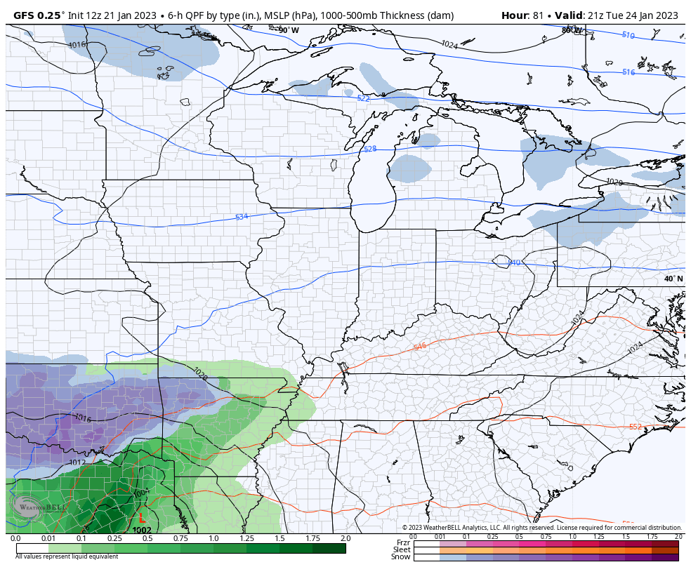
The next storm arriving Tuesday night into Wednesday has the look to it as it impacts areas from Texas to New England. Kentucky is right in the middle and will likely see accumulating snow and some rain. Once again, location will play a big role.
The trend continues to be for the storm track to inch a little farther south and east…
GFS
CANADIAN
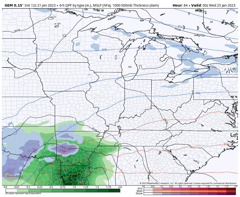
That’s a trend that should continue.
Another light snow maker comes in behind that.
I’ve talked for a while how the pattern for late January into February was giving me a February 2021 vibe and it continues to do so. Of course, that doesn’t mean things play out exactly how they did back then. Not at all. It’s just the pattern evolution has that feel to it.
That’s especially true when you see temperature departures like this showing up on models…
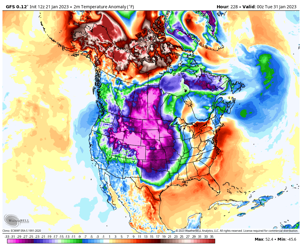
That’s off the charts. 🥶
So much for my short time, huh? 😜
I’ll see you for another update late today. Have a good one and take care.

“Southward Bound” Allman Brothers Band.
Guess that strong push of cold air would explain this..
https://www.pivotalweather.com/model.php?m=gfs&p=zr_acc-imp&rh=2023012112&fh=288&r=us_se&dpdt=&mc=
Of course it’s the GFS so next run could be in Indianapolis..
So true.
48 hrs. out from the storm. (Primary Locked In at least with the track).