Good Saturday, folks. We have made it to the weekend and we have winter weather moving in later tonight. This messy setup looks to bring rain and snow into the Bluegrass state, with some areas getting in on accumulations. Once into next week, a bigger storm will threaten our region.
Our Saturday starts with clouds and a few flurries, but clearing works in from south to north during the day. That means most of us should see some sun before the day is over. That clearing won’t last long as clouds quickly fill back in this evening as our messy system approaches from the southwest.
Rain, snow and a bit of a mix will break out overnight into the first half of Sunday. Areas in the west and north have the best chance of seeing snow, with light accumulations for some. Here’s the current Call for Snowfall that includes the wraparound light snow Sunday night and early Monday…
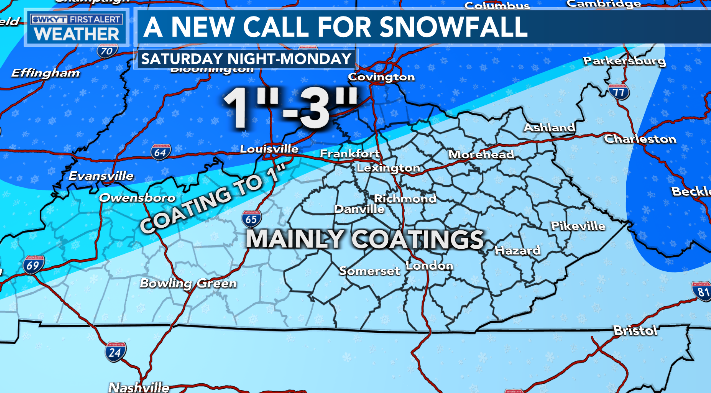
This is a very fine line between rain and wet snow tonight and Sunday. I’ll update that forecast a little later today.
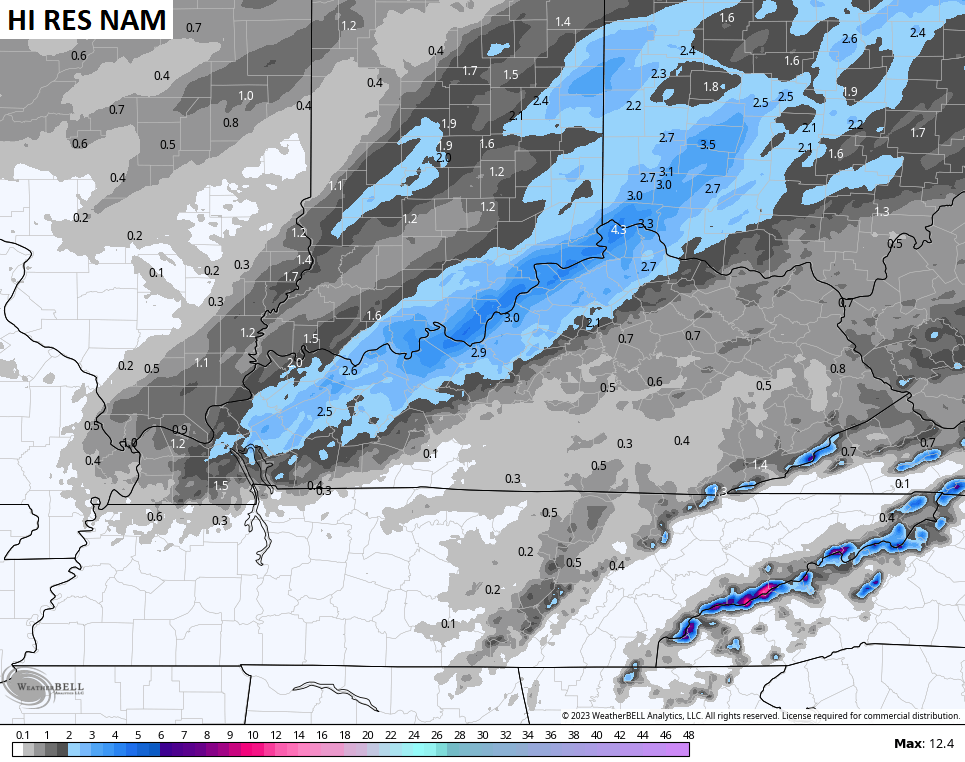
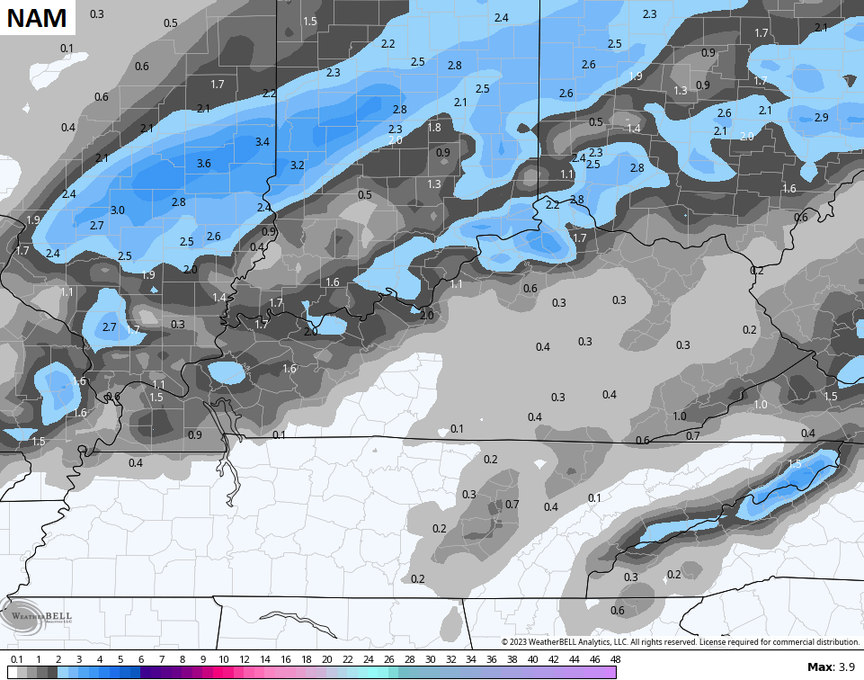
The forecast models continue to have their usual disagreements on that snow line with the NAM fam being most aggressive…
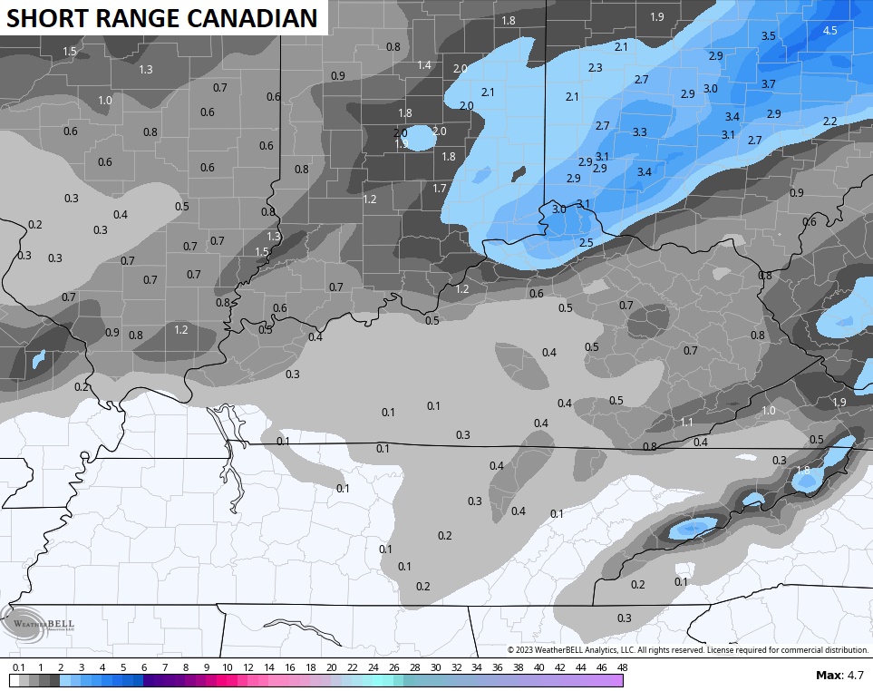
The Canadian is a little more northern Ky oriented…
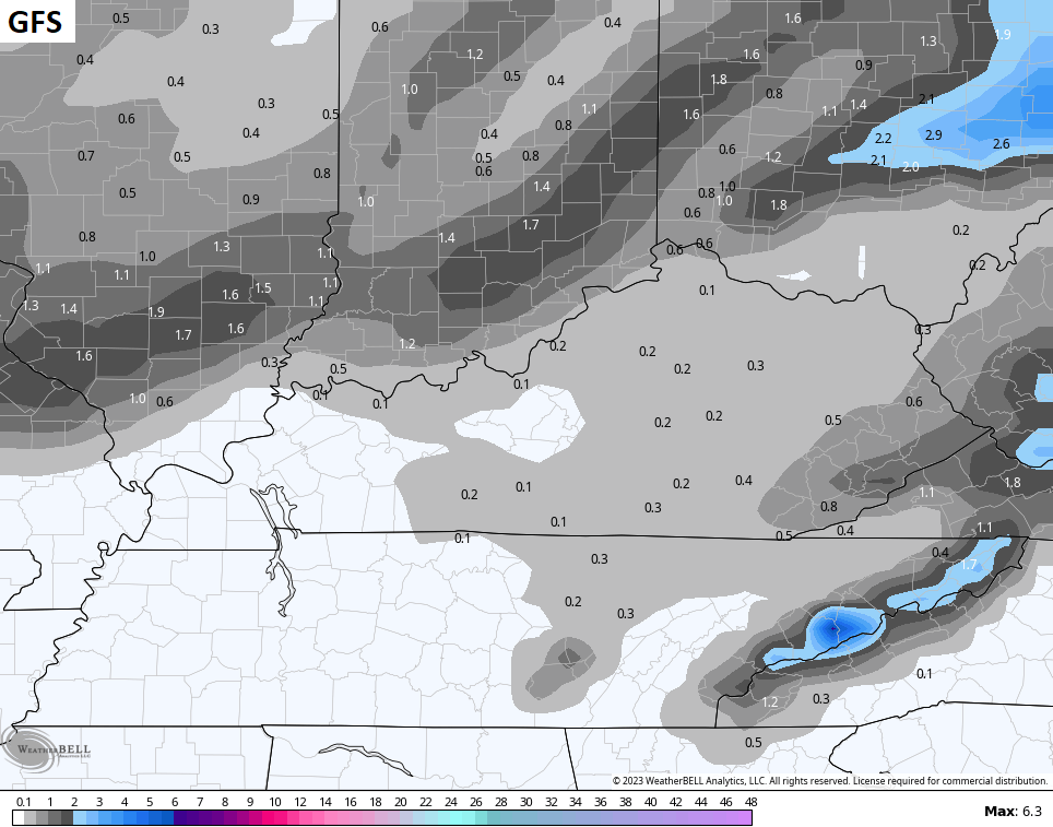
The GFS is the stingiest with the snow across the entire region…
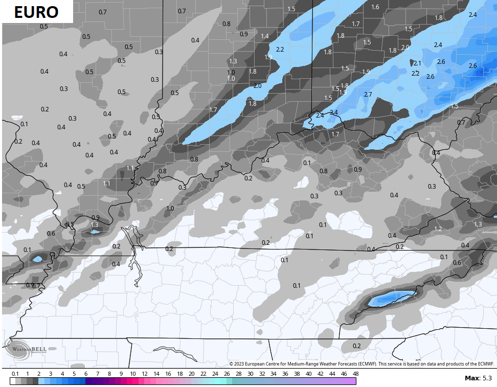
The EURO is a little more liberal with the snow farther south and east…
Obviously, I will be watching the trends of the day.
In terms of the next storm system coming from late Tuesday through Thursday, this one is really interesting as it’s likely a MUCH stronger system that can be a major winter storm from Texas to New England.
This puts our area in snow and rain, with the potential for this to become a WST.
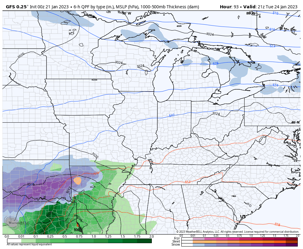
The GFS shows the healthy snow potential for parts of the state…
Notice the wraparound snow for everyone Wednesday night and Thursday with a follow up system a day or so later.
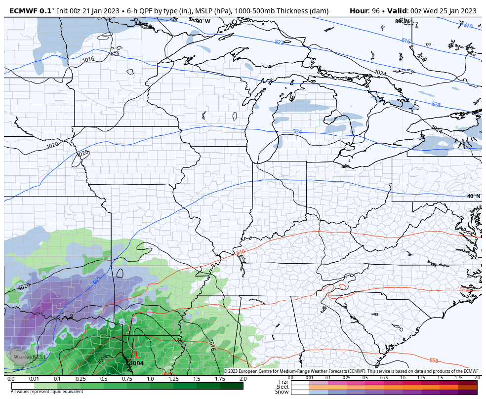
The EURO is also on board for a healthy hit to rain then back to some wraparound snow…
The GFS Ensembles average snowfall through Thursday is very enthusiastic with the snow chances…
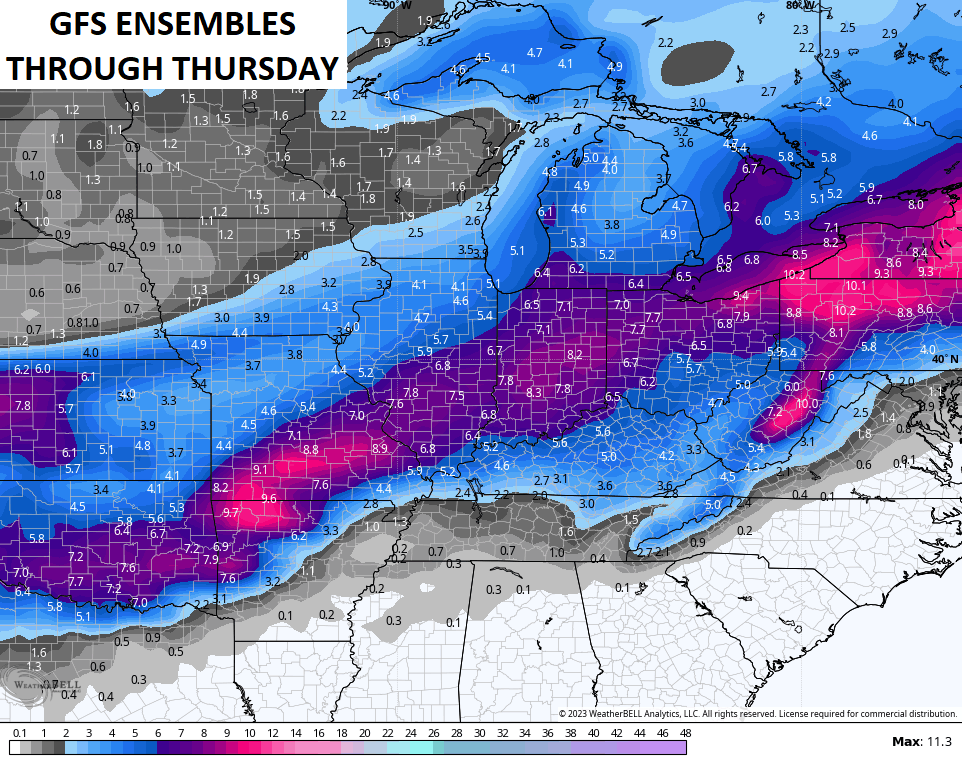
It’s important to note that the above map is the average of 30 different members that make up the GFS Ensembles. Here’s a look at those 30 members through the same time period…
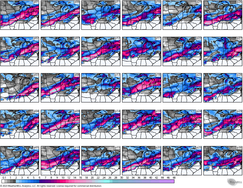
Notice how some of the members smack Kentucky more than others. There are also a few that take the majority of the snow to our northwest.
As you can see, we have our chances over the next week. Can we cash in? As always, we shall see.
I will have updates later today. Have a good one and take care.

Attempting to make a comment on this site is about as frustrating as hoping for a snowfall over three inches. LOL
The Sunday snowfall action reminds me of a late spring snow event. A lot of melting will be going on during the process.
As long as no ice, it can snow a trace or eight inches. LOL