Good evening, folks. Light snow showers and flurries will wind down overnight as we focus on a messy system for Sunday. That brings rain and snow in here and will be followed by a much bigger storm system by the middle of next week.
Let’s focus on this system coming in for Saturday night and Sunday. This is a light system with a sharp rain to snow line setting up from southwest to northeast. Right now, odds favor this line setting up along the Ohio River and just south.
Once this moves away, we have wraparound light snow and snow showers across central and eastern Kentucky Sunday night and Monday morning and that should deliver some coatings.
Here’s the First Call For Snowfall for all the above…
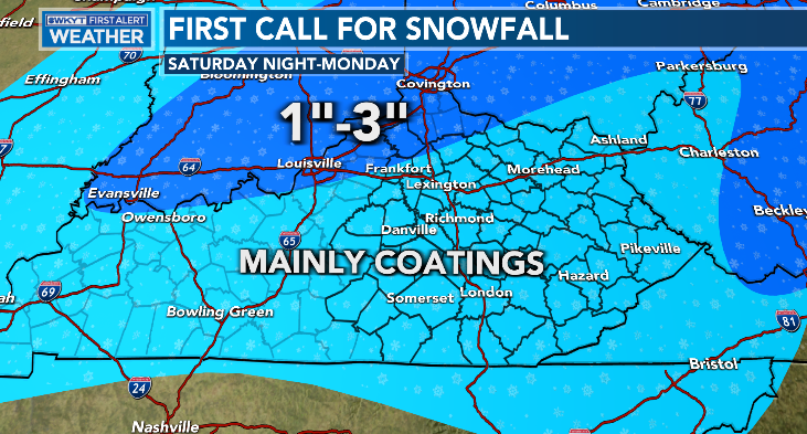
Again, areas of northern Kentucky have the best chance for picking up on a few inches of snow. Areas around Louisvile and southwest have a lower confidence level.
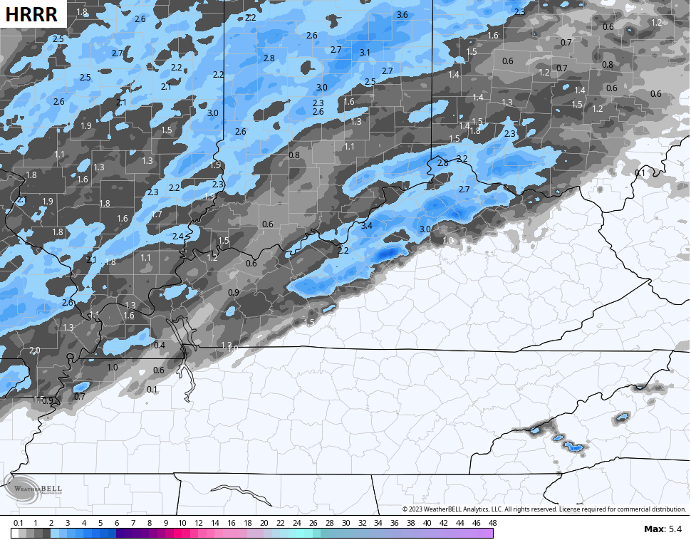
A few of the short range models are farther south with the best snow chances. Here’s the Future Radar from the HRRR through 1pm Sunday…
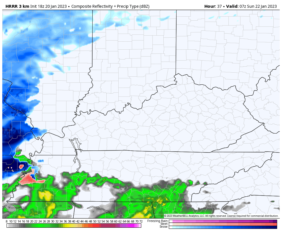
You can see how it brings the snow farther south…
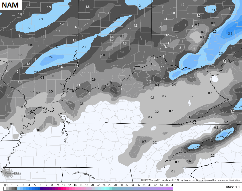
It has a buddy in the Hi Res NAM…
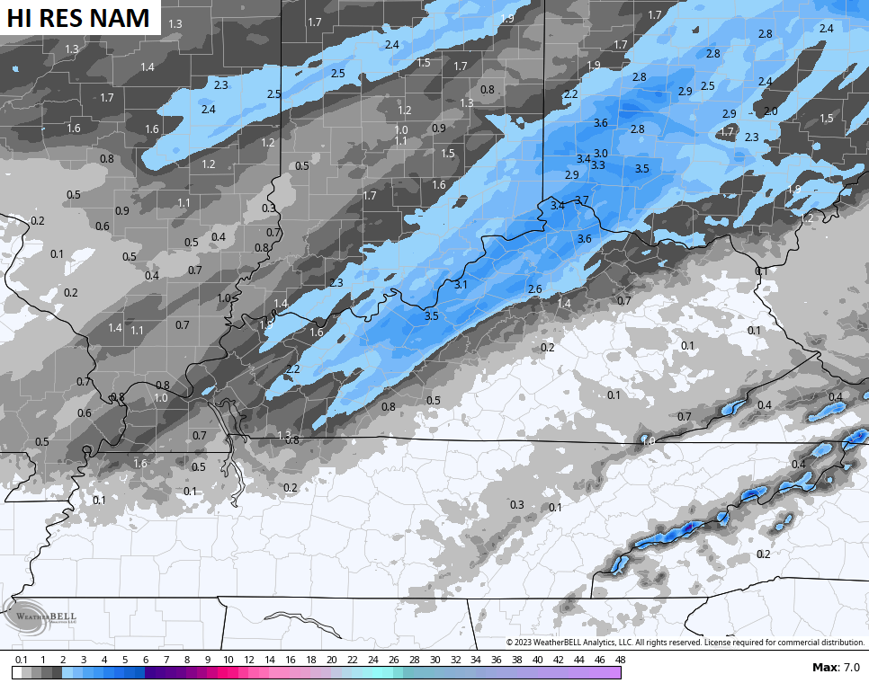
The NAM isn’t as juicy…
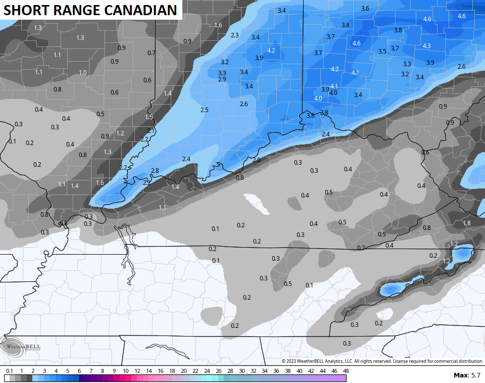
The Short Range Canadian has some decent totals along the Ohio and into northern Kentucky…
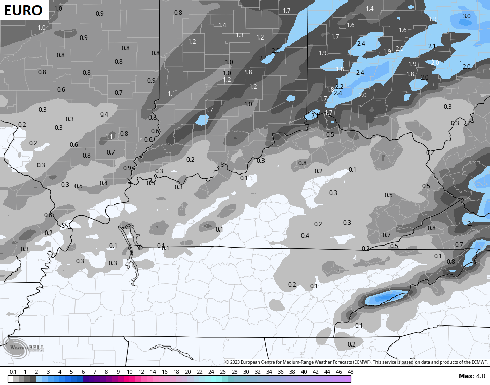
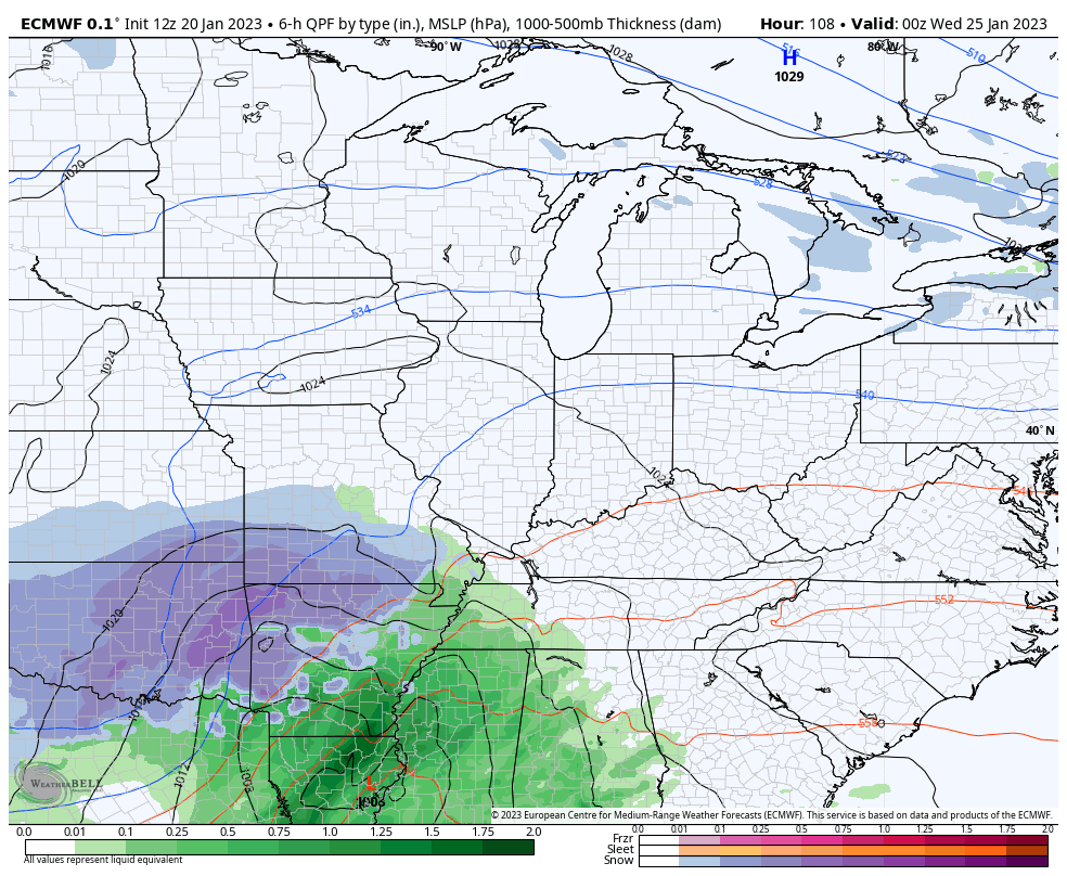
The EURO has a similar area in the north for the best snows…
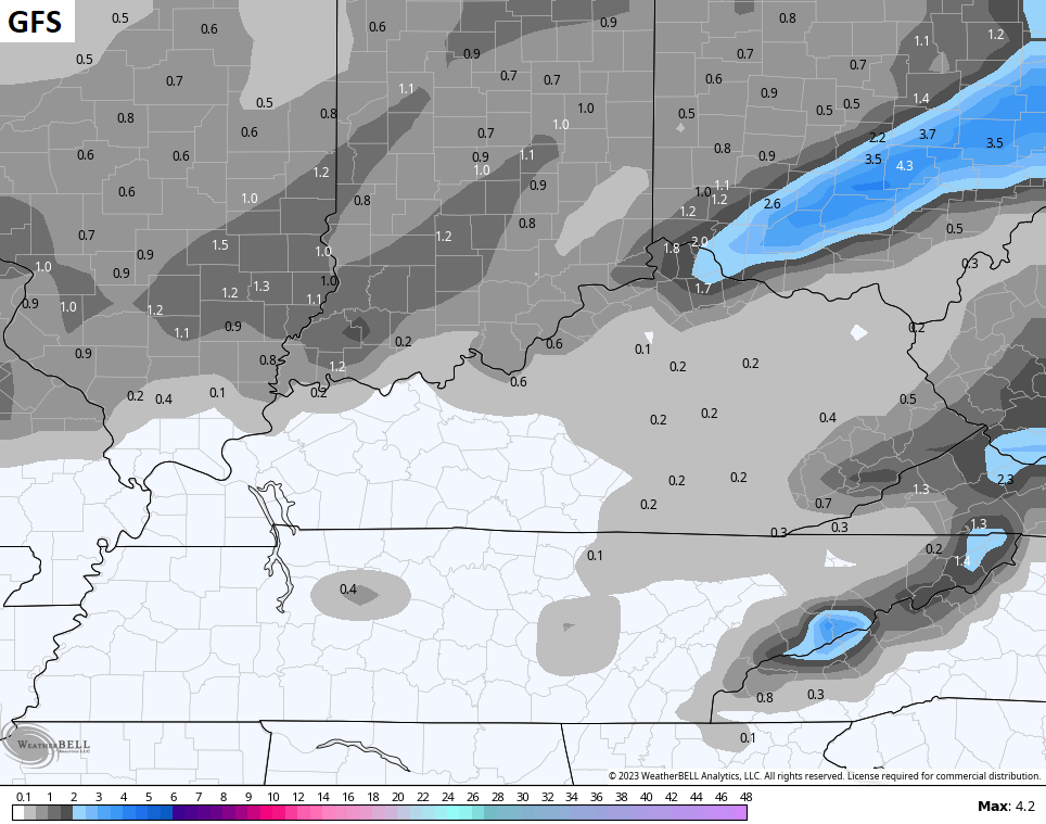
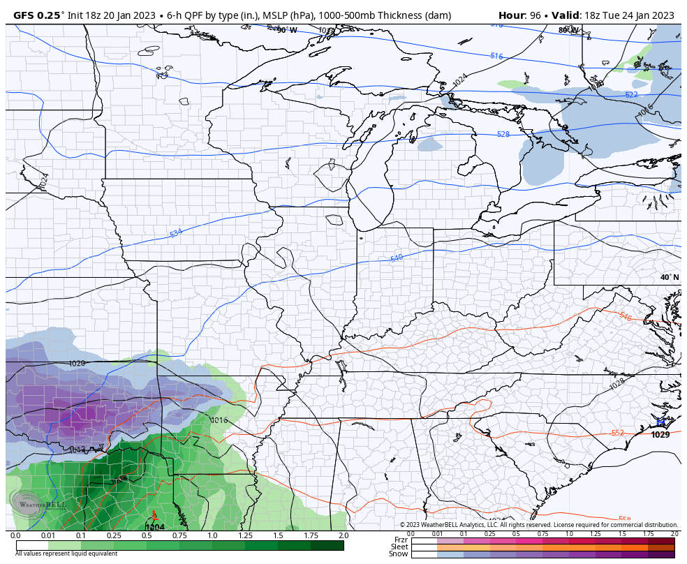
The GFS does too…
The setup for the middle of the week system continues to look the same with rain and snow across the area before wraparound light snow and another light snow system…
EURO
GFS
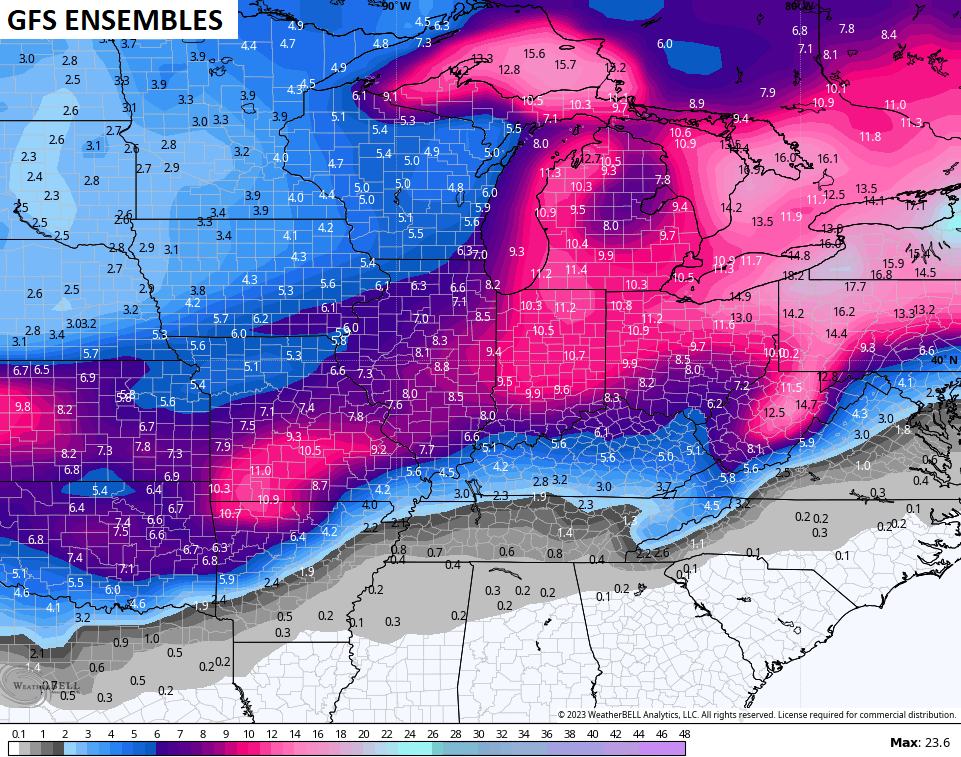
This pattern is likely to throw several additional systems at us into the closing days of January and the start of February. The Ensembles show the snow chances increasing over the next 2 weeks…
Enjoy the evening and take care.
