Good afternoon, everybody. It’s feeling the part of January out there today, but it’s nothing out of the ordinary for this time of year. As we get into the weekend, we have a messy system taking shape for Sunday, with a bigger storm coming by the middle of next week.
A few flurries and snow showers are flying out there this afternoon. Temps range from the low and middle 30s north and east to the low 40s west and south. Winds are making it feel much colder, so bundle up.
The system coming in for Saturday night and Sunday continues to look like a light mess maker for the state. Here’s my original map for who gets what…
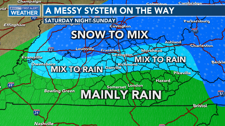
That doesn’t include the wraparound light snow and flurries for Sunday night and Monday morning.
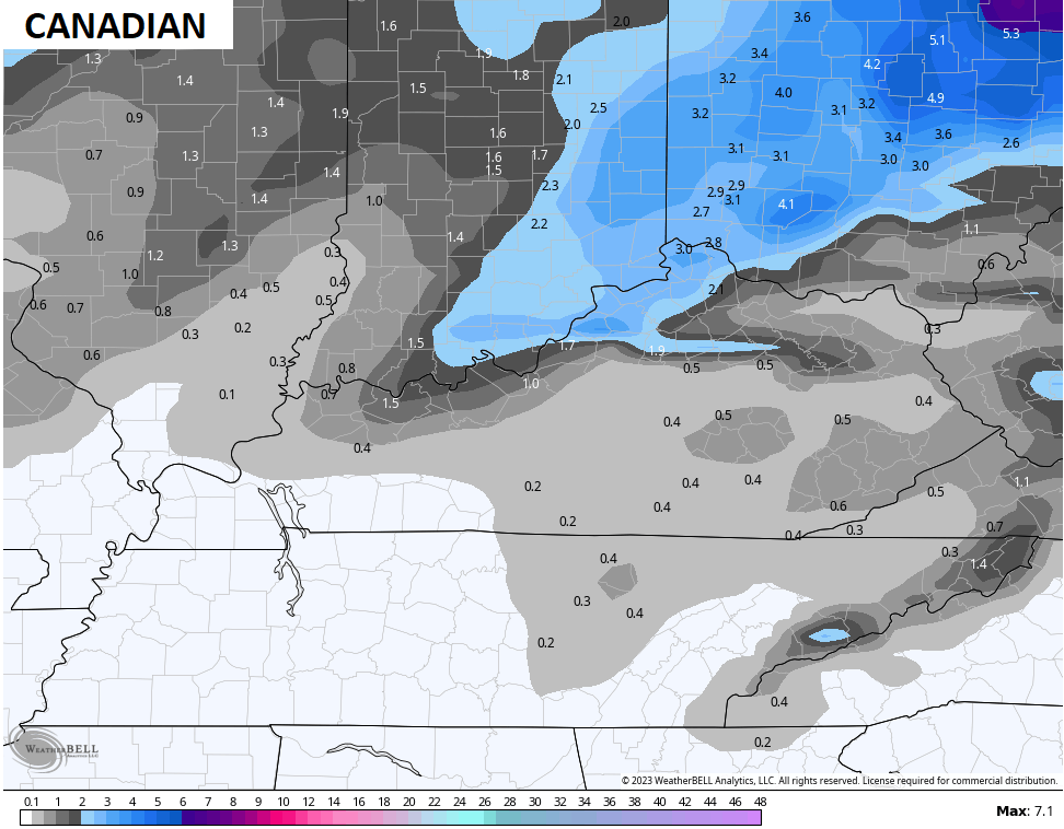
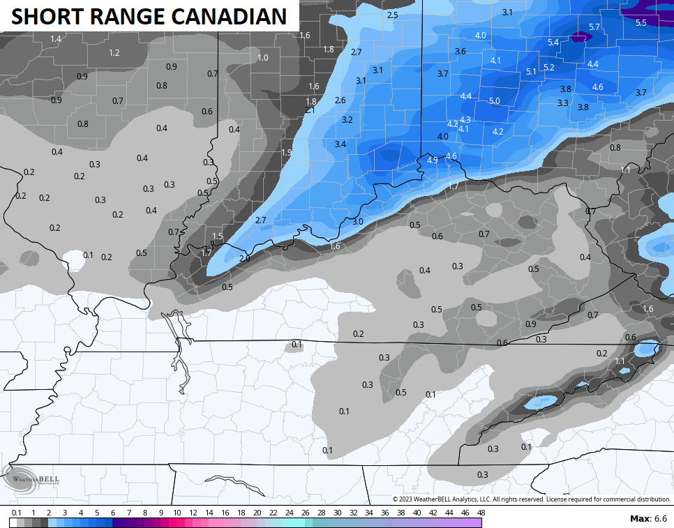
The snowfall forecasts from the models are lining up pretty well with where I have the best chance for snow in the north.
The Canadian Models are the snowiest in that area…
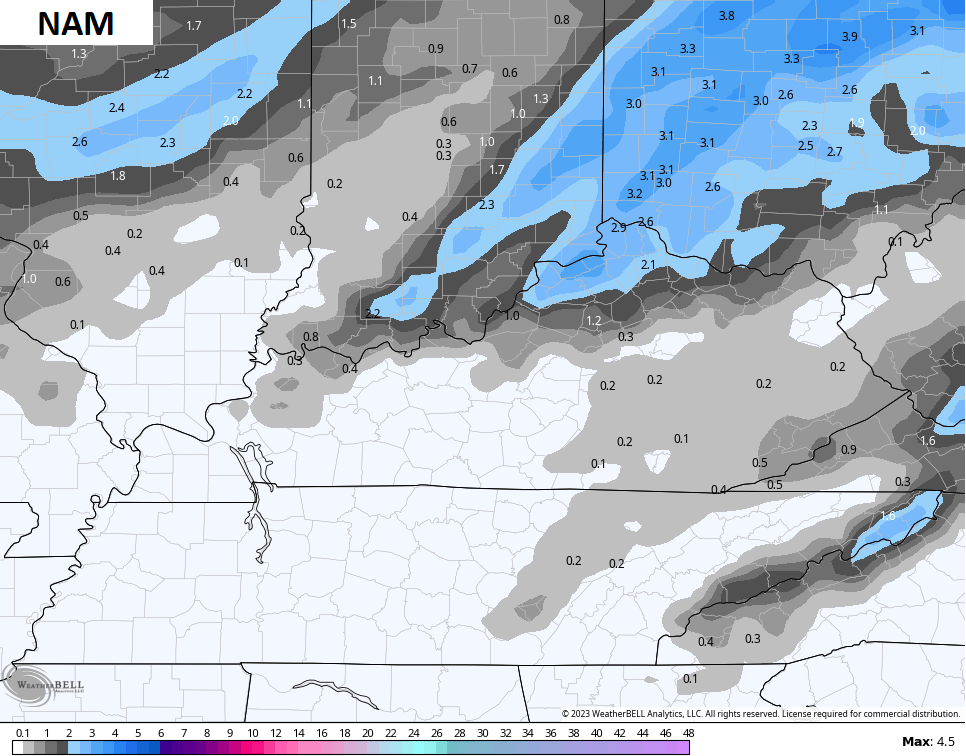
The NAM has lower totals, but hits the same area…
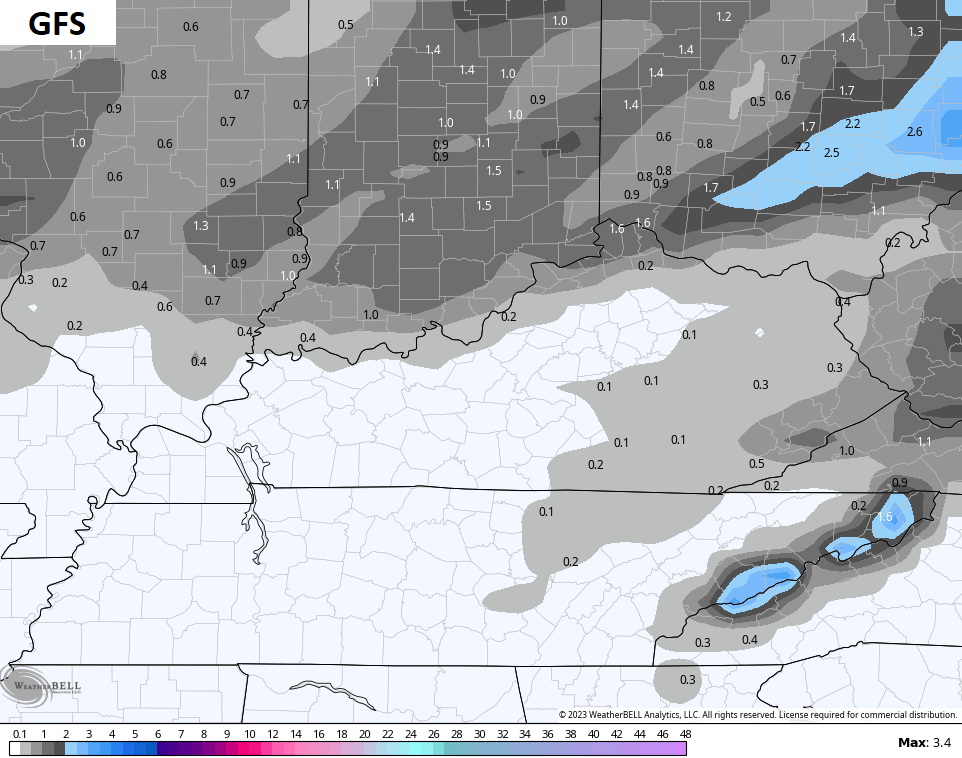
The GFS had some kind of major malfunction last night and didn’t run for two model cycles. It did finally start back this morning and looks like this…
The next system is a much stronger storm moving in with rain and snow late Tuesday and Wednesday with wraparound snows into Thursday. That will be followed up by another snow maker a day or two later.
The track of this storm is the key, obviously, but I can see this becoming a WST.
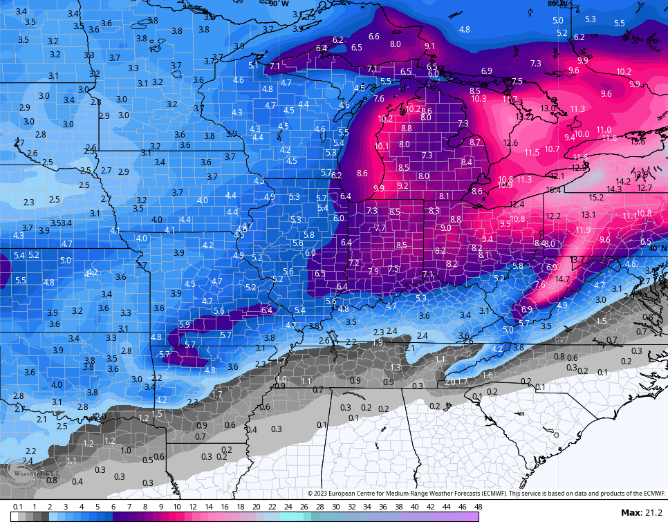
The GFS was way northwest with this track, but it’s trending farther southeast toward the EURO…
To illustrate the snow chances over the next 2 weeks, take a look at the EURO Ensembles…
Remember, that’s the average of 51 different members that make up the Ensembles.
I’ll have a Sunday First Call For Snowfall on WKYT-TV starting at 4pm and then here on KWC later this evening. Make it a good one and take care.
