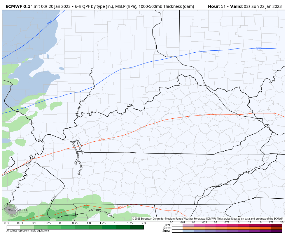
Good Friday, folks. We’ve made it to the end of the week and there’s an honest to goodness wintertime feel in the air. Flurries and snow showers are dotting our sky line and this is a sign of things to come. A messy system moves in late this weekend and will be followed by another a few days later.
Today’s temps are mainly in the 30s for most areas with gusty winds making it feel colder. A few snow showers and flurries will push across the state, especially in central and eastern Kentucky. I can’t rule out a hit and run coating on a few rooftops, but most won’t see much at all.
Here are your radars to follow the Friday flakes…

Saturday is a normal day across the Commonwealth with temps in the 40s and a mix of sun and clouds.
Our messy system then works in from the southwest Saturday night and Sunday, with rain, snow and a mix showing up. I have no changes to my earlier thoughts…
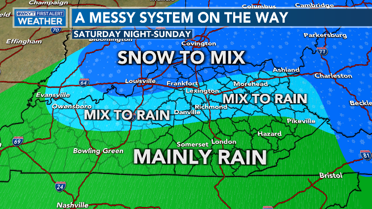
Light accumulations are possible in the snow to mix area, but just how much is the question. I will likely have a First Call For Snowfall out later today.
All of that will then end as some snow showers and Flurries late Sunday night into early Monday.
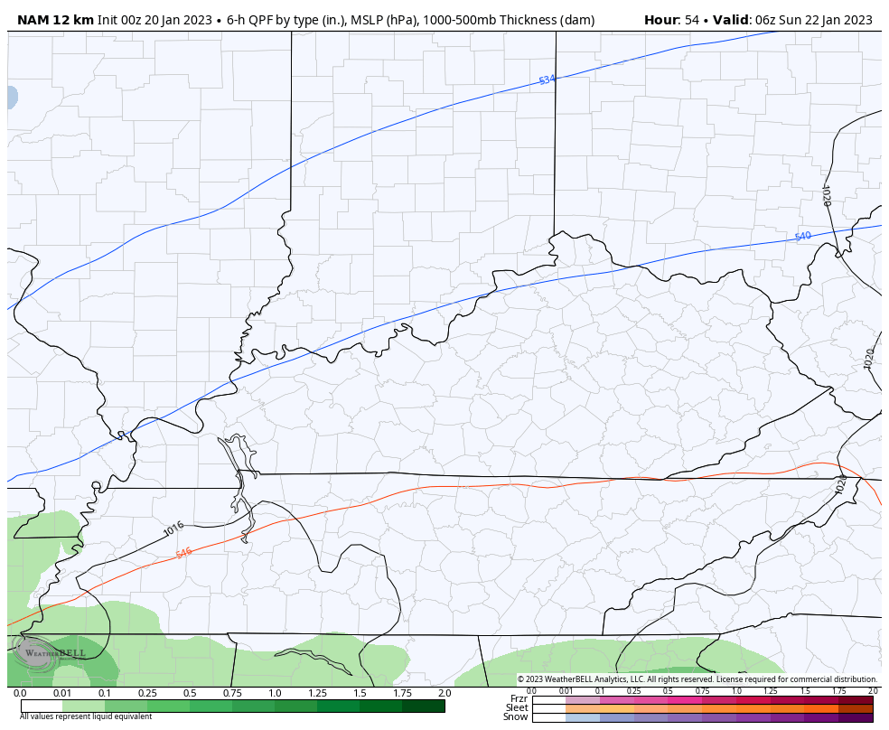
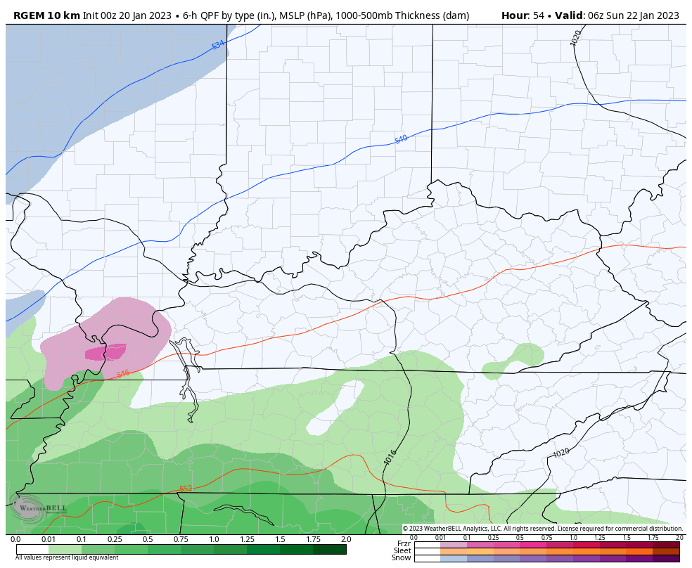
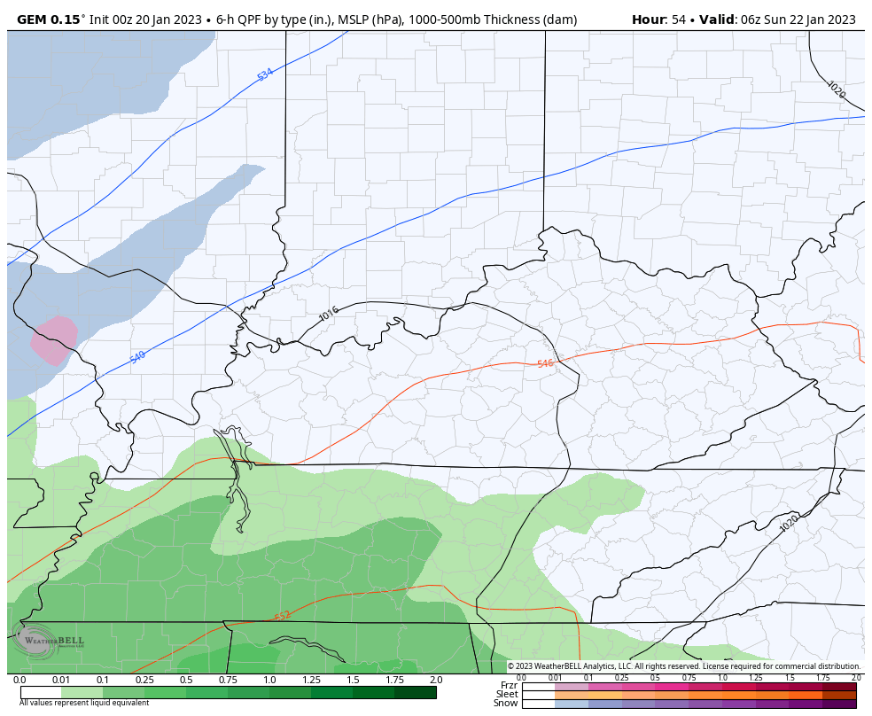
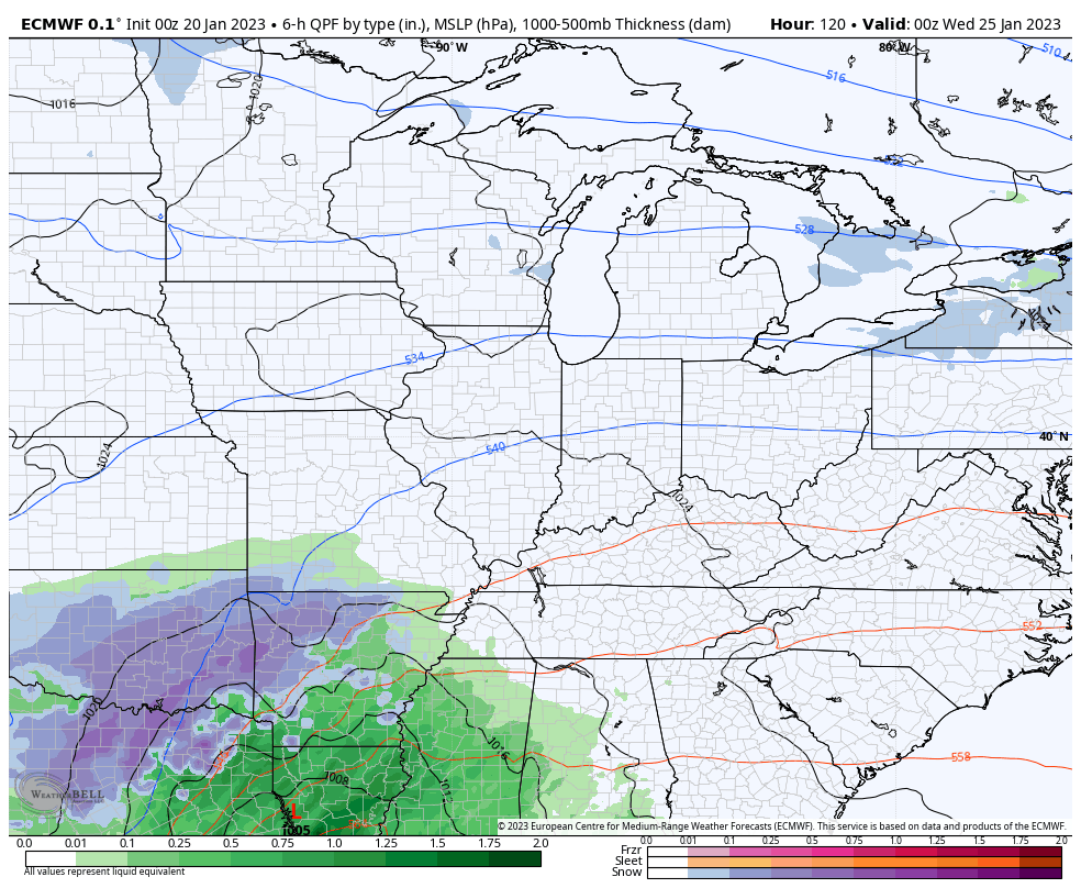
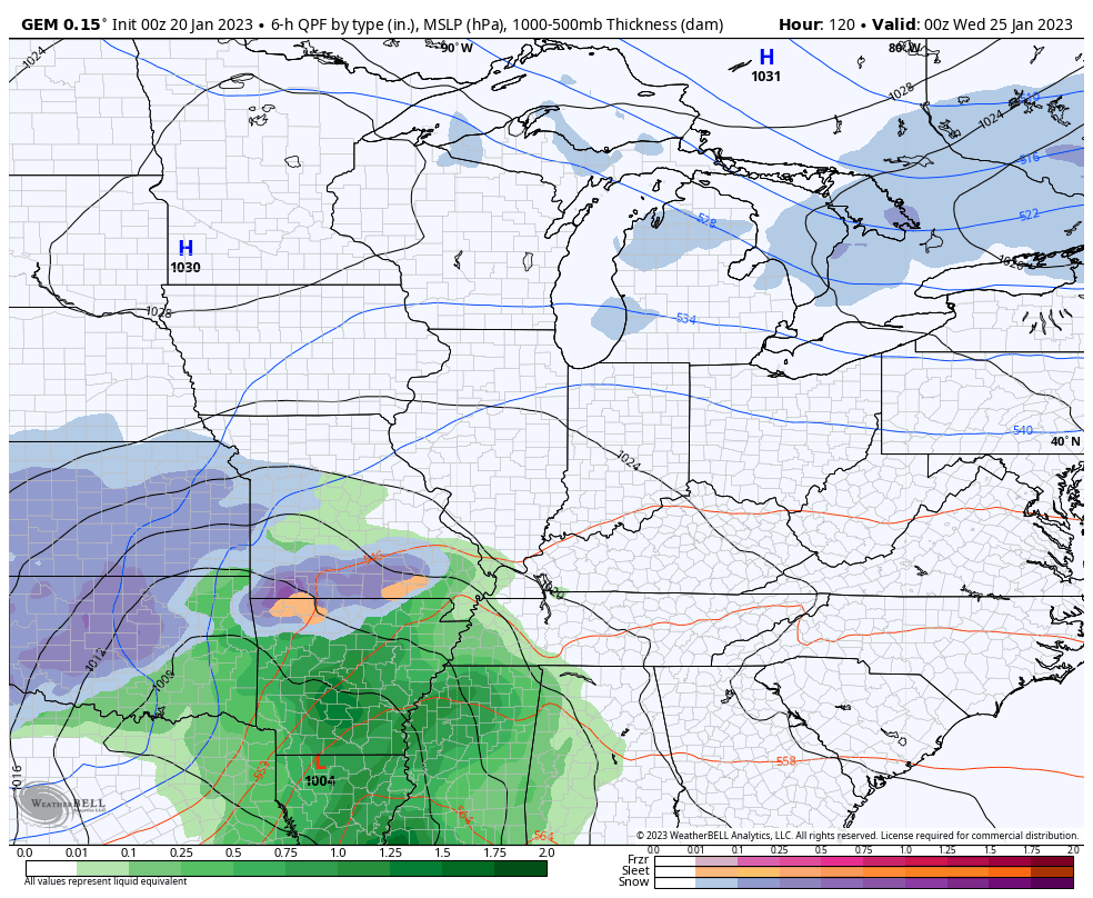
As far as the models are concerned, we are still seeing some differences.
Here’s the NAM…
The Canadian Family of models continues to see some freezing rain for some…
The EURO…
The next system rolls in very quickly late Tuesday into Wednesday and puts us back into riding the fence with rain, snow and a mix. Light snow would come in behind this strong storm system, with another light snow maker following this up a day or two later.
The EURO continues to have the snowiest look…
CANADIAN
I will have your normal updates later today. Make it a good one and take care.

The imaginary weather fence is the Ohio River and also the western edge of the Southeast Ridge. Looks like some depressing cold showers for my area this weekend. What a crummy Winter that needs to come to an end.
41 degrees at 11:36am I the town of Wayne, wva. It truly is a cloudy wintry day in western wva.