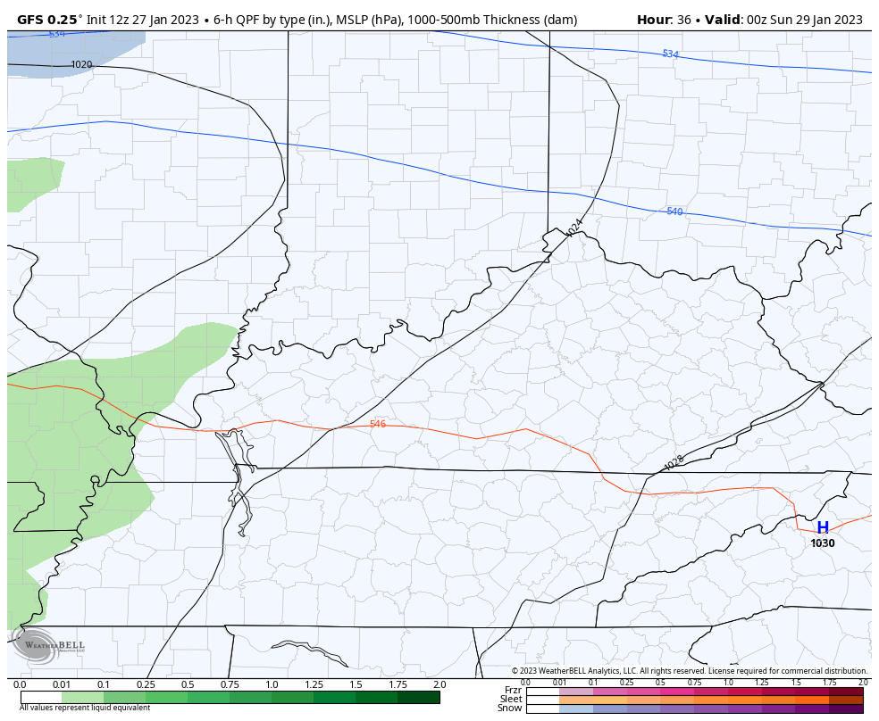
Good afternoon, everyone. The sun is shining on My Old Kentucky home and this will be with us into the start of the weekend. The second half doesn’t look nearly as nice with rain moving in to kick off a super active winter look for next week.
Let’s start things out with the morning issues from overnight snow showers. The Lexington Metro picked up under an inch of snow, but it was enough to turn many roads into a skating rink. Check out some of the images…
Wow! This morning was crazy in Lexington, KY! ICE Rink City!!! Got a ton of video to upload! You're gonna to want to see it. @Kentuckyweather @AlaStormTracker @LiveStormsMedia #KYwx pic.twitter.com/9l7QlF8AND
— KY-WX Video (@KYphotog1) January 27, 2023
@Kentuckyweather well today was a first for me — after a little over two hours of rerouting and road closures I couldn’t find a way into Lex. Sharp cutoffs of clear road to sheets of ice. pic.twitter.com/Cd61HacteS
— J Edge (@EKUgrad97) January 27, 2023
@Kentuckyweather Old Frankfort Pk and S.Yarnalton pic.twitter.com/DkWd2gDyN2
— Bobby (@Bobby_Davis) January 27, 2023
That caused numerous accidents around the area and forced many schools to close. This from the pesky snow showers and squalls we’ve talked about all week long taking us into Thursday night.
The rest of the afternoon is windy and milder with temps in the 40s on a gusty southwest wind that can reach 40-45mph at times.
There’s a small shower chance in the north as another weak front moves in. This front never fully crosses the area and that leaves us in good shape for Saturday with highs in the 50s.
Clouds increase Saturday evening with rain rolling in overnight into Sunday. This looks like a damp and chilly day as this first system pushes through leaving us with the chance for a few flakes to end this on Monday…
The setup after this features the potential for, at least, two winter weather threats next week. We will have a boundary stalled from southwest to northeast and this sets up farther south and east compared to the past few weeks.
The first system looks to threaten us Monday night and Tuesday with the next one a day or two later in the week…
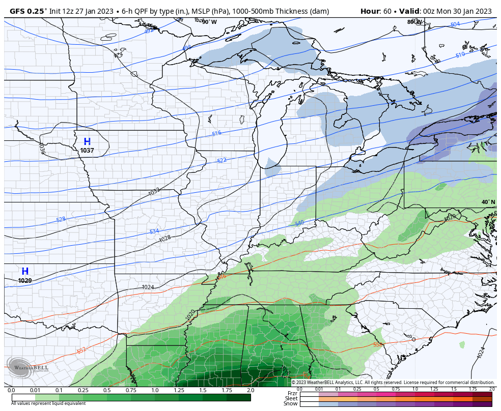
That’s going to be a setup to watch as rain, snow and ice will all be possible.
I will have anmother update this evening. Make it a good one and take care.

All the weather models are not the same as they use to be. A change needs to take place in forecasting the weather. I don’t know what that will be, but it probably happen in my lifetime.
won’t happen in my lifetime.
Thank you for those kind thoughts earlier today, Schroeder, I had a Reverse Total Shoulder Replacement on Tuesday, and it was no joke, especially since I’m facing 2 to 3 months of therapy! I’m right-handed ,so I f course it involved my right shoulder
The most recent forecast model changes have essentially been tweaks, but what’s really needed is a full scale revamp, including some intense analysis of changes that have taken place regarding the forecast model’s input parameters. Half measures just won’t cut it!
JoeD. I’ve been in therapy for a spinal fusion followed by a hip replacement and all of my therapists have told me that what I went through was nothing compared to shoulder surgery. I’ll be including you in my prayers and sending good wishes in your recovery.
You take care too Dottie. Back in 2020 I had a MRI on my Spine and it reviled a herniated disk. My right foot has absolutely no feeling since then.
Thank you, Dottie,
Yes, it’s been especially gnarly since it was a “reverse” shoulder replacement
Joe, I will eventually need surgery on my right shoulder too. I have a rotator cuff that needs repair. I’m more or less confined to the indoors as my walking balance is off and my left side is partially paralysed due to the two strokes I had earlier last year. The Doctor I was seeing told me my blood pressure was too high, but I think it was the two bouts of Covid virus I had last year that caused the two strokes.
Take care Joe and may God Bless
Schroeder, you have certainly had far more than one person should have to experience in a lifetime! I had rotator cuff surgery about eight years ago, which at the time was destined to be temporary. Last year, my surgeon informed me that not only was my shoulder bone-on-bone, but that my rotator cuff was “destroyed”, hence the need tor the reverse replacement.
I certainly hope that things improve for you this year!!
Betting most of the frozen stuff next will probably not be anow.
snow, anow.
“asnow” I feel the way you do.
I checked the teleconnections and both the AO and the NAO are trending positive as we enter February. I
hope this is not another calculation going awry. If this holds we won’t have any problem with either Ice and Snow or dry Arctic air if the forecast is correct. We could just have cold rains through next week.
While you guys in Kentucky are going to be in the 50s on Saturday, the Chicago area is only going to be in the 20s with a widespread snowfall of 2 to 6 inches from Saturday morning through late Saturday night, with the heaviest snowfall being in the North and Northwest Suburbs. Winter Weather Advisories are already in place.
That will be followed by bitter cold next week, with several nights going down below zero, helped by the fresh new snow cover.
Mike, I just read that the Southeast Ridge is expanding and getting stronger, so we shouldn’t get that cold here. Rain and Ice is in our forecast next week, but I’m hoping it will just be the cold rains we seem to be having this month. As we get into February it will start to warm up I hope. Enjoy the Snow !