Good Friday, folks. We have a very windy day taking shape as a weak front impacts the region. This kicks off a half and half weekend before we get into a setup likely to feature winter weather threats next week.
Let’s kick this party off with what’s happening out there today. Snow showers and flurries are moving out of eastern Kentucky early today, but some fresh coatings are out there for some to start the morning. Slick spots are very likely this morning in some areas of the region, so keep that in mind if traveling.
Here are your radars to track those last flakes out of the Commonwealth…

Winds today will be very gusty with temps in the 40s. There’s also a small chance for a shower in the far north later this evening as a weak front drops into the Ohio Valley.
As far as the weekend goes, Saturday looks amazing with highs in the 50s with a partly sunny sky. Winds will still be gusty from the southwest.
Clouds thicken quickly by the evening with rain arriving Saturday night and Sunday. Sunday looks pretty darn wet before cold air crashes back in for Monday with the chance for some rain and snow…
The boundary then becomes rather stationary across our region, likely setting up much farther south than what we just saw. This will put Kentucky in the line of fire for more winter weather threats as waves of low pressure form along this boundary.
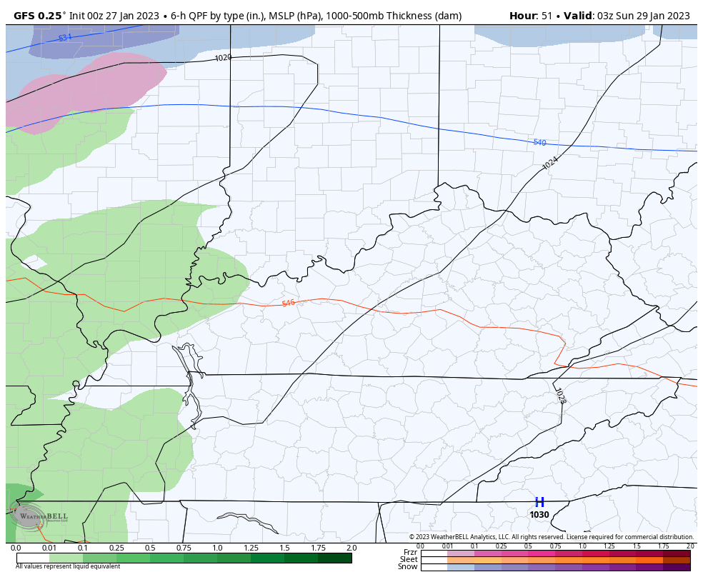
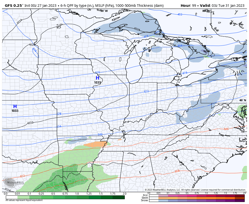
The GFS is in more of a snow mood on the latest run…
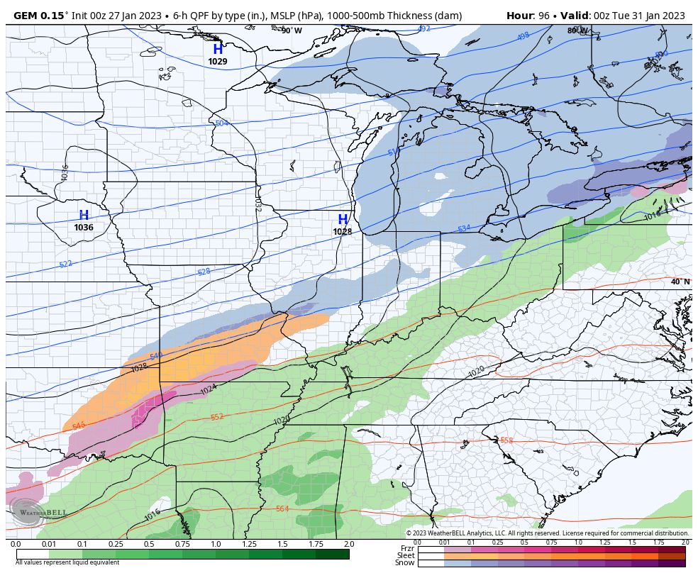
The Canadian is says ” Alright stop, collaborate and listen”…
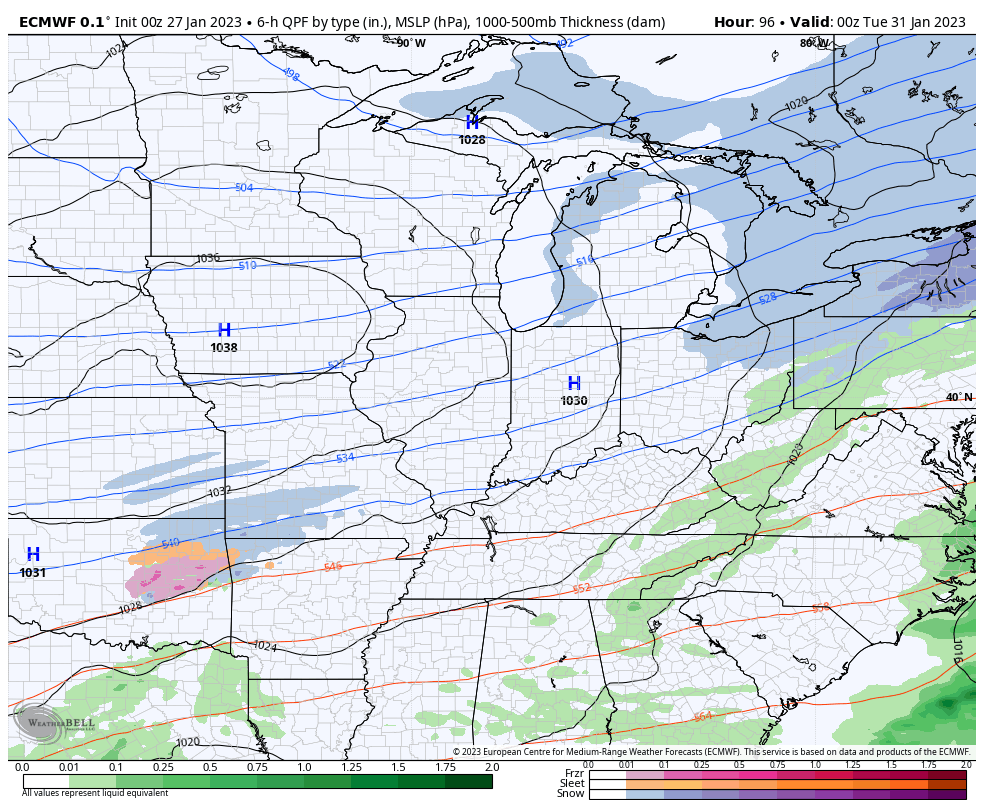
The EURO is a singing more of a duet between the two models…
I’ll have my normal updates for you later today. Make it a good Friday and take care.

call the LAW!!!!!!!!
All I see is frozen junk.
I hope colder air wins.
I doubt it.
Preparing for an ice storm.
This seems more likely for us than snow. Messed up mix the further south and ice seems a player.
If we have the Ice storm like we had in 2009 with all the damage I will be leaving Kentucky. I don’t want too, but would not be able to handle the cost and the long power failure that may result. Probably will end up in my home town in an apartment.
bailey dropping vanilla ice lines today.
Again with no agreement among the three weather models. Weather predicting seems to be getting more and more unreliable. How does one plan on any severe weather events such as Snowstorms, Ice storms and severe weather ( tornado outbreaks. ) ???
Conditions in most areas of the country have ranged from one extreme to another, and forecast models for most part seem prone to amplify these chaotic extremes. It’s one reason why the accuracy of these models drops off sharply beyond a one or two day time frame. Stranger still is the fact that some seasonal models seem to return more accurate results than the GFS or EURO models o e week out. These inaccuracies worry me, especially as severe weather season looms.
Please excuse my typing errors, as I’m slowly recovering from major surgery.
Joe, hoping you are recovering from your surgery okay. I’ve been in the same situation. Getting old is no fun. It’s like the weather these days. One never knows what’s next. Your in my prayers for a speedy recovery.
Joe from BG~ Please take care of you! Your comments are useful and your underlying wit is evident! Be easy on yourself as you heal. Best to you, Joe.
T hanks Schroeder!
T hanks Schroeder!
Thanks Clay’s Ferry
For once the Euro and Gfs agree for next week..Snow in the East..Canadian showing no snow but big ice storm for western parts..Think the CMC is the outlier..Who knows with modeling may show something entirely different today..
Those weather model forecast have never panned out for a longtime now. They use to be, especially the European weather model. Weather forecasting was much better in the past when the late great Marcia Yockey was around back in the 1960’s and 70’s. She got me hooked on Meteorology way back in the early 1960’s.
It appears that KY DOT still does not listen to Chris Bailey or read KYWeatherCenter.com It does not appear they did much of anything to prepare the roads this morning and I-75 is shut down from 110-108 and Winchester Road is ice in places.