Good Saturday to one and all. Our weekend is off and running with cold temps slowly moderating today as a gusty southwest wind kicks in. Temps really take off in the days ahead before we enter into another super active pattern. It’s one threatening a winter look by next weekend.
Let’s kick this party off with what’s going on out there today. The day starts with single digit wind chills and temps in the teens for many. A mix of sun and clouds will be noted with a nice rebound in temps this afternoon with readings deep into the 40s.
Winds tonight are going to crank and may reach 40-45mph at times into Sunday morning. This is ahead of a weak front bypassing us just to the north. Highs will be in the 50-55 degree range for Sunday.
Those numbers return for Monday with a shot at 60 or better by Tuesday.
This is when our next storm system rolls our way with widespread rain becoming likely for the middle of the week…
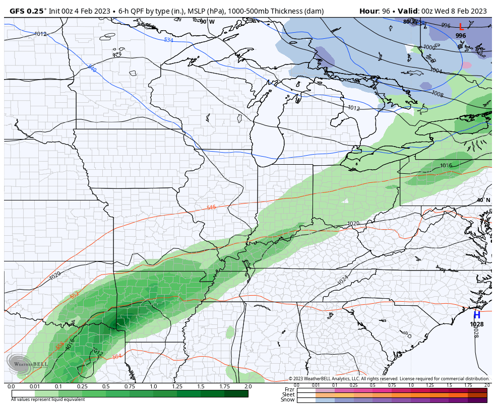
Once that goes through, we watch a second system rolling in by Friday into the weekend. This one may have some cold air to tap, bringing the potential for winter weather. The GFS has been on this for a while…
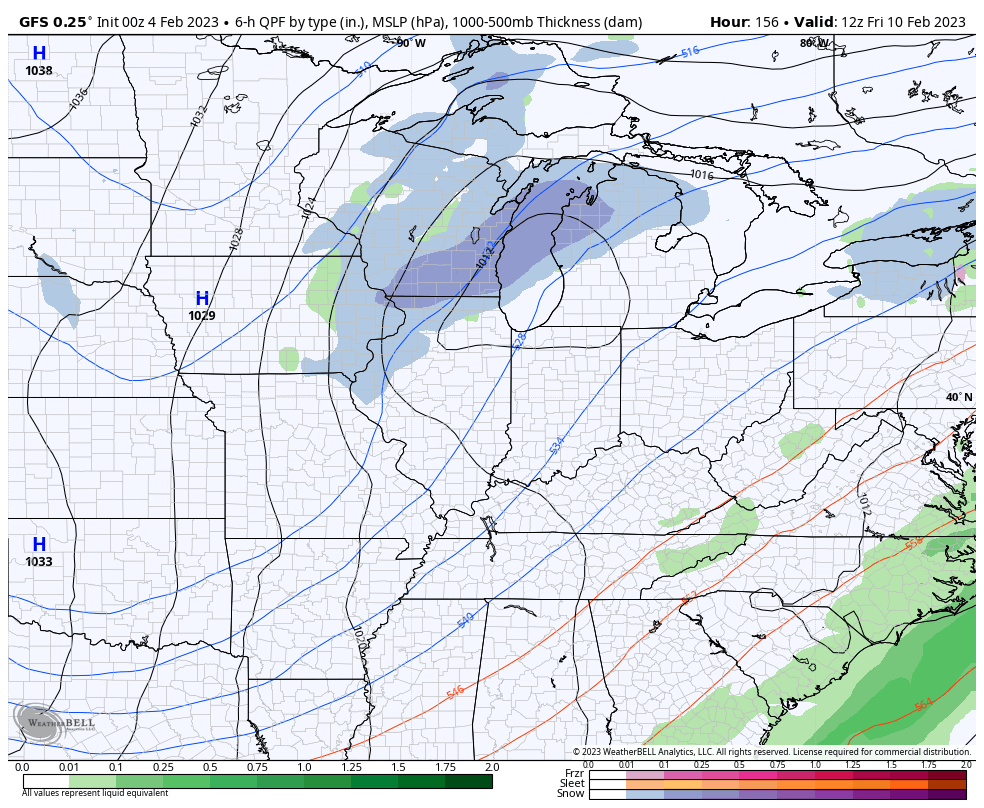
All of a sudden, the Canadian looks a lot like the GFS with both systems…
We shall see how this works out, but the chance is there.
I’ll have another update later today. Make it a good one and take care.

Thanks Chris, Thirteen degrees F. here in Maple. I think this is the lowest temperature since Christmas. Will enjoy the brief milder days next week, but I hope there will be Sunshine and not so much gloom.
Excited about the sixties.
The GFS snow maker looks weak.