Good Thursday, everyone. It’s a very active weather day across Kentucky and surrounding states as rounds of strong to severe storms rumble through. These storms are also packing a torrential rain punch that may cause issues before a massive temp drop leads us into a flakey Friday.
Here’s a breakdown of how things play out through Friday:
- Rounds of showers and storms are with us to start the day and continue through the morning.
- Some of these storms may be strong or locally severe.
- Torrential rains will be noted and we could be dealing with some flash flooding.
- As our low pressure cranks and heads into southern Indiana this afternoon, we watch for additional storms to develop along and ahead of the front it’s dragging.
- These are the storms that have the chance to spit out a tornado or two. The best chance looks to be across central Kentucky this afternoon and early evening.
- The severity of these storms should diminish as the action moves into eastern Kentucky by late evening.
- Cold air crashes in tonight and Friday with wind chills reaching the upper teens by late tonight.
- A few flurries and snow showers will be dancing around for Friday.
The Storm Prediction Center continues with the Enhanced Risk for severe weather for much of our part of the world…

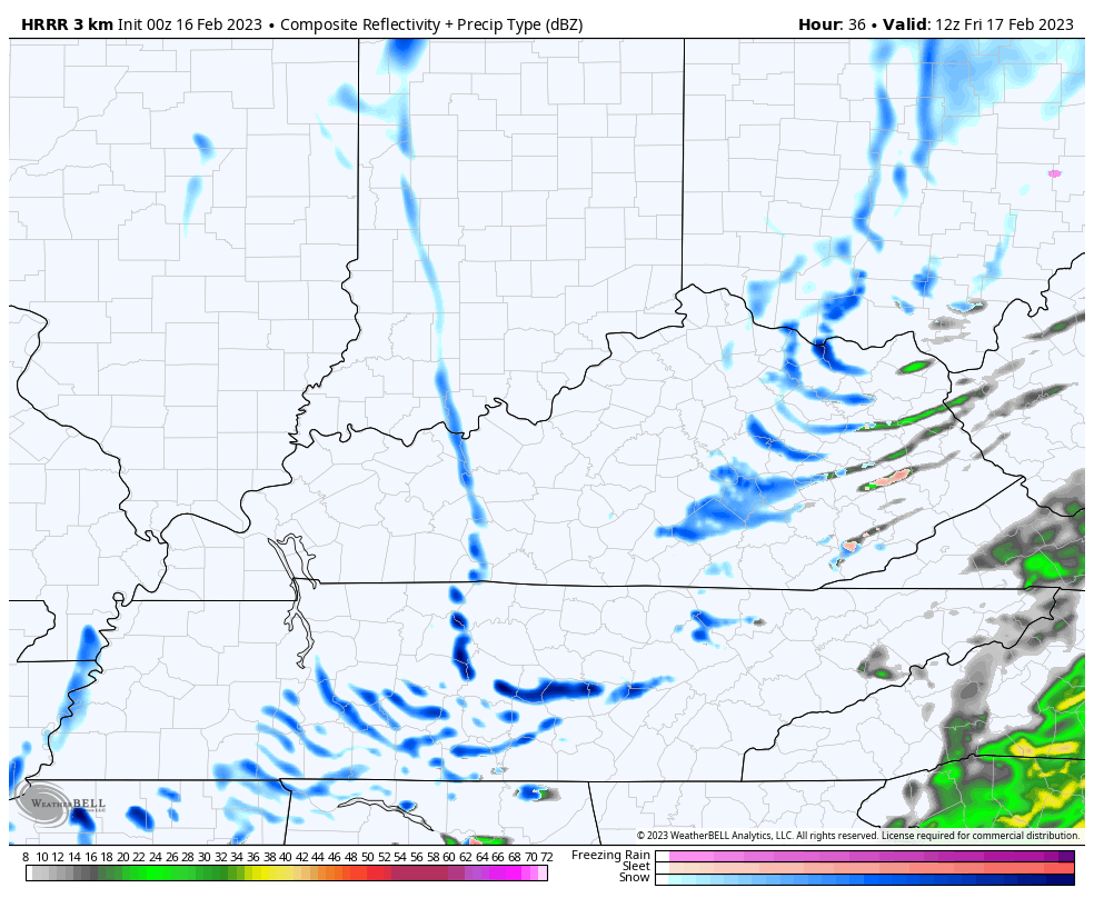
We go from severe storms to snow showers in a matter of hours. The Furure Radar from the HRRR shows the snow showers going through much of Friday…
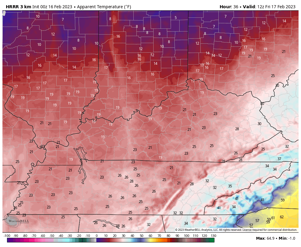
The same model keeps wind chills in the upper teens and low 20s all day long…
I will have updates later today and be on WKYT-TV for all your breaking severe weather needs. Until then, here are your Thursday storm tracking tools…

Current watches

Possible Watch Areas

Have a great day and take care.

In contrast to the severe weather threat across Kentucky, there are Winter Storm Warnings for far Northern IL for the counties along the Wisconsin border, and Winter Weather Advisories for the rest of the Chicago Metro Area through Thursday evening. Mainly snow is expected for the warning area, and a mix of sleet, freezing rain, and snow changing to all snow later on for the advisory areas.
Anywhere from 1 to 6 inches of snow is predicted, heaviest by the IL/WI border, as we try to make a dent in the major snow drought that’s been ongoing this winter.
At 3:50 AM EST, the radar looks really active with heavy rain and storms over many areas of KY.
It has been a long, thundery night for Bowling Green area residents, and not because the storms were particularly violent. It’s just that for some South Central Kentuckians, the memory of the December 11th, 2021 tornadoes is still too fresh, my wife included. The thunderstorms have put down approximately 0.70″ of rain overnight. We remain in the warm sector of the storm, but if the thick cloud cover currently in place continues into the afternoon, we may be spared from the worst of the potentially violent storms. Time will tell
Hey weather fans, better buy all the bottled water you can after the Palestine Chernobyl chemicals start floating down the Ohio River toward KY. It’s the biggest environmental disaster in decades. Those people have been warned to even bath with bottled water. I don’t know the plans our Louisville Water Company has to treat such a toxic mix, but I’m sure I don’t want a sip.
Yes and it’s disgusting because no one trust what the officials say and I don’t blame them.
Wow DashConnely I knew it was bad but I didn’t know they told them not to even bath in it. Now I guess water will go up in prices too.
Don’t trust the officials, they blew up a train loaded with toxic chemicals right over a waterway. The fish kill miles from the explosion is saddening. They have burms set up in all the creeks and waterways to hide all of the chemicals in the water. There is also a oily film on the water per family members who live close to the disaster zone.
As of 10:25 am EST, Here in Flatwoods, Ky, we’ve got 1.06″ of rain since midnight according to my PWS. Still raining hard here also. Looks like no real breaks in sight, which Is good for the severe threat.
As of 11 am, we now have 1.30″ of rain and no signs of letting up. Oh well, we need it but am afraid It’s gonna cause some flash flooding.
Up to 1.51″ in Flatwoods, let up some but still raining.
I knew the SPC was going to take Kentucky completely out of the Enhanced risk area. Too much cloud cover, too much rain, too close to the low. Once again, areas of Mississippi, Alabama and Tennessee will take the energy right out of Kentucky. Seen this happen so many times that I am surprised this hasn’t been established as a meteorological pattern
It happened in December of 2021 and again in January of 2022. I believe that there has been a subtle pattern shift, but it has been overwhelmed by the effects of the 3 year long La Niña. Once the El Niño Oscillation becomes ENSO Neutral, we may experience some of the effects of this shift. The biggest threat right now is localuzed flooding, and the affect of straight-line winds on trees sitting in saturated ground. Could see some power interruptions.
However, I’m not convinced that the Oscillation will move to El Niño in the near term. The Pacific may be slowly warming but it takes time for that temperature increase to make a noticeable impact on our weather. We probably won’t see El Niño effects until Winter – ’23/’24 or Spring ’24, if at all.
Could see a tornado watch expanded to include parts of South Central Kentucky:
https://www.spc.noaa.gov/products/md/md0163.html
We have had roads and driveways blocked In Johnson County Mesonet is at 2.51 inches of rain we still have light rain. Had some 911 calls water around houses.
Thunder in southern Johnson County
My PWS is showing 3.06 for the day so far. I’m so glad that we didn’t have severe weather this afternoon.
Have had some heavy rain in Pikeville. I just wonder if anyone knows when the rain will clear out from the east? Has it cleared Lexington area it kind of looks like it has?