Good evening, folks. It’s a warm and windy Wednesday that we are wrapping up as we focus on the threat for severe storms. This threat increases tonight and Thursday with the potential for some flash flooding to come along for the ride.
The Storm Prediction Center continues to highlight a late evening chance for severe storms across the west…

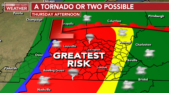
As expected, much of the state was upgraded to an Enhanced Risk for severe weather on Thursday…

Rain and storms increase tonight and some of those could be strong or severe. The setup tomorrow afternoon is one that can produce a tornado or two, especially in central Kentucky. We find this region near the triple point where the low, cold front and warm front meet and that’s usually where we can get some storms to spin…
If we can get any breaks in the clouds late morning or early eafternoon, look out.
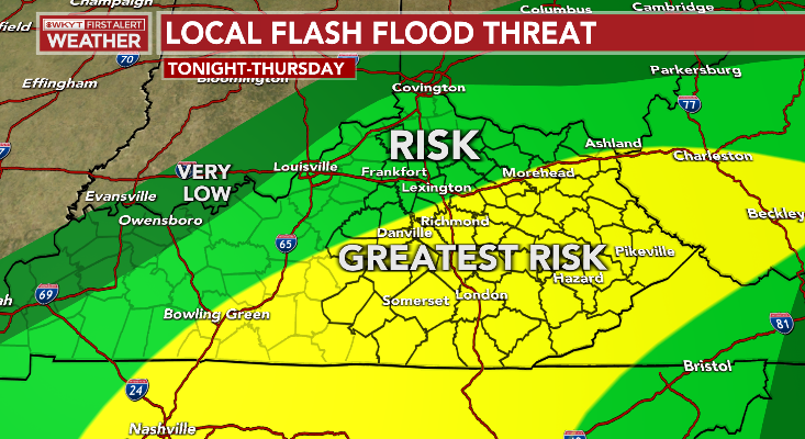
There’s also the potential for some flash flooding, especially late tonight and early Thursday. Here’s a look at the area I’m watching…
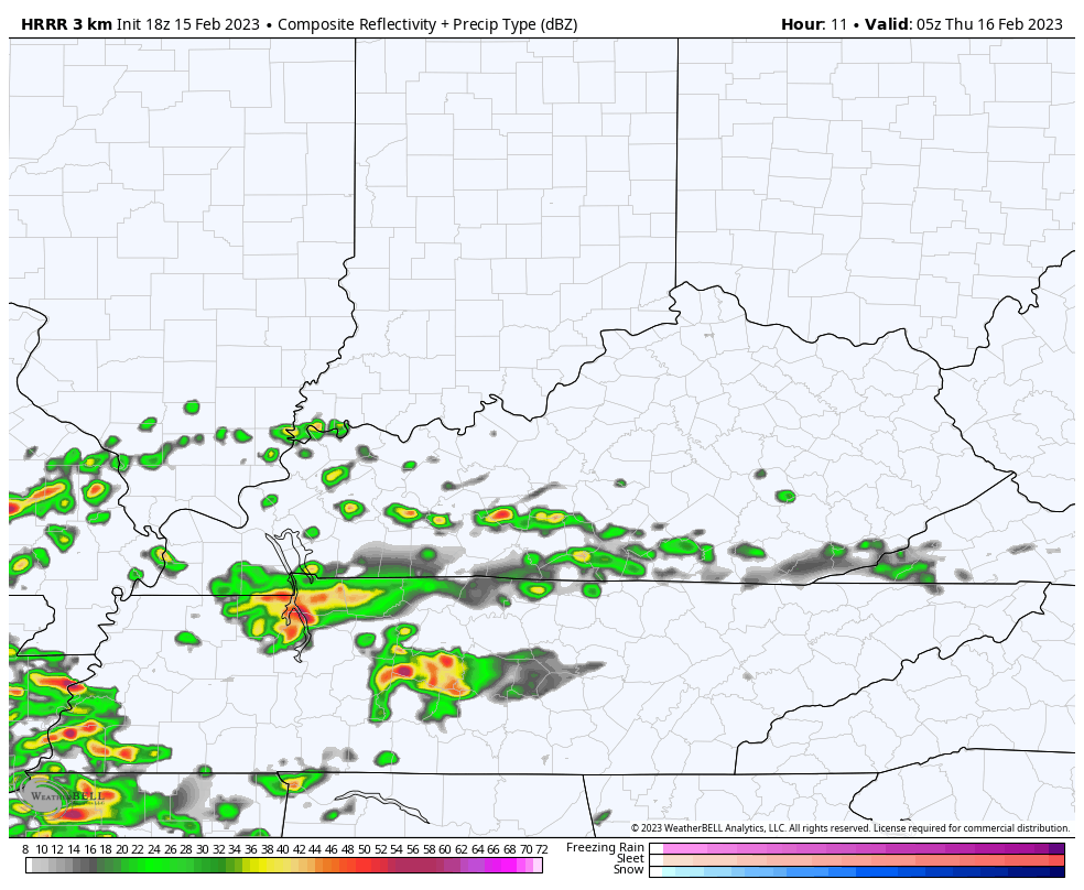
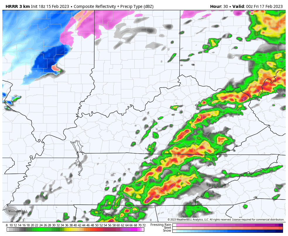
The Future Radar from the HRRR shows the overnight storms and the threat for rotating storms tomorrow afternoon…
Cold winds come in behind this with a few flurries and snow showers into early Friday…
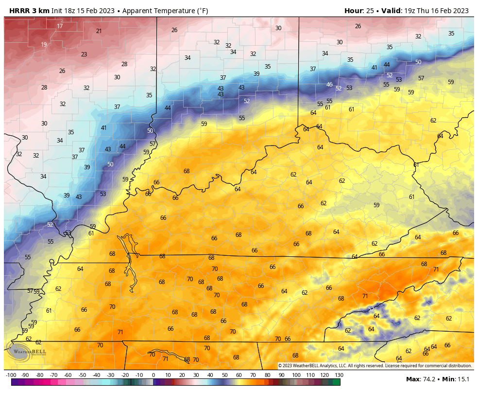
The change in what it feels like will be incredible. Check out how fast we go from the 60s to the teens from Thursday afternoon to Friday morning…
Here are your severe weather tracking tools for the evening…

Current watches

Possible Watch Areas

Enjoy the rest of the day and take care.

High temperature today at my Bowling Green PWS was 71°F. Tomorrow continues to look rocky. With forecast models continue show high levels of wind shear, and dewpoints in the 60’s, the chances of some rotation is good. I wouldn’t be surprised if the SPC increases the threat level for the severe storms to Moderate Risk.
Buckle up and stay safe!
Thanks Chris for the update. Take care everyone.