Good Wednesday to one and all. You’re probably checking your calendar to make sure it still says February because today’s weather is looking and feeling more like April. This warm surge of air will bring an increased threat for strong to severe storms later tonight and Thursday.
Temps out there today hit 70-75 for many areas and that threatens all kinds of record highs for the day. Strong southwest winds will continue through the day but should diminish some into the afternoon.
That brings us to the severe weather part of the program. Here’s a breakdown:
- Winds crank again tonight and Thursday. Gusts to 50mph will be possible and that’s without thunderstorms.
- Rounds of thunderstorms quickly increase from south to north overnight and Thursday morning. Some of those could be strong or severe and put down a lot of rain that may cause flash flooding issues.
- With low pressure tracking to our west and northwest Thursday, our region will be in the area to watch for additional strong to severe storms.
- Damaging wind is the main threat, but there’s enough spin for a low tornado risk.
- I’m especially concerned about a few spinups across areas of central and north central Kentucky between Noon and 6pm.
The Storm Prediction Center has western Kentucky in the low-end threat for severe storms later today into this evening…

The SPC then increases that severe threat farther east for Thursday…

As our cold front moves east, temps crash quickly from the northwest and we may even see some flurries or snow showers by Friday morning. Check out the Future Radar from the Hi Res NAM that shows how quickly we go from storms to flakes…
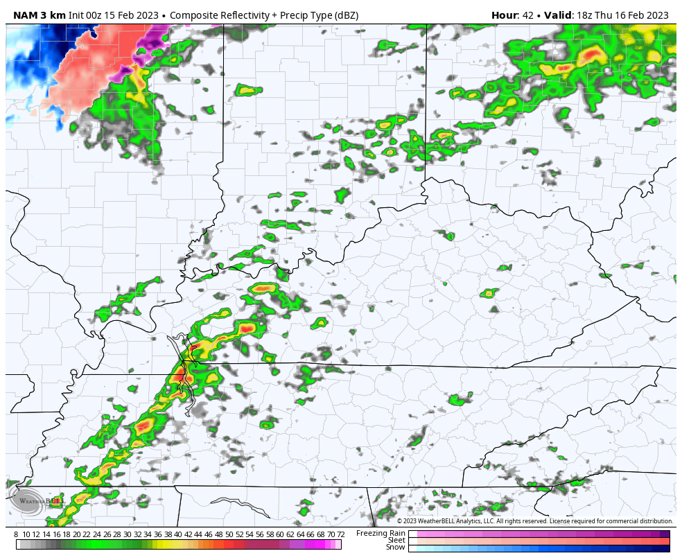
That animation starts at 1pm Thursday and runs through 7am Friday.
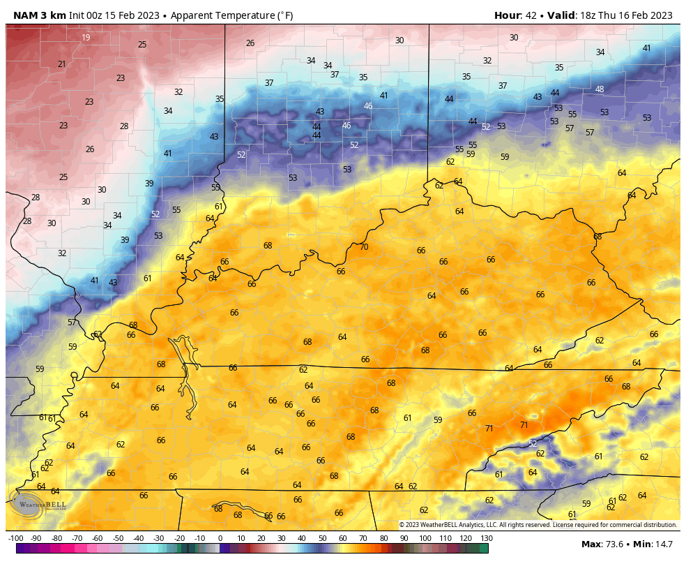
The wind chill animation for the same timeframe is wild…
I will have another update later today. Until then, here are your tools to track the increase in storms from the west and southwest…

Current watches

Possible Watch Areas

Have a wonderful Wednesday and take care.

Today will be nice. The calm before the storm.
Thanks Chris for the update. Concerned about the enhance areas of the state tomorrow. Was hoping for a more stable atmosphere tomorrow to lessen the severe weather threat. CAPE tomorrow for my area is forecast to be 1400 J/kg. Last evening’s storms past through quickly without much fanfare with very little rain.
Today’s high temperature in the Warren County area is forecasted to reach 77°F, which would tie the record set in 2018. The upper air dynamics on Thursday continue to indicate plentiful shear, with dewpoints in the mid-60°F range.
A 120-130kt SW to NE-oriented upper air jet stream continues to be forecasted to overlay western Kentucky tomorrow. Right now, the tornadic threat appears to be minimal, but we could see +60kt wind gusts, especially if some strong cells organize into a squall line. Would not surprise me to see the SPC bump up the southern portion of the Enhanced corridor to a Moderate risk, from the Gulf of Mexico through south central Kentucky.
Last time we were in a moderate risk Joe was in December ( can’t remember the day and year ) when that F5 Tornado destroyed Mayfield, Kentucky and one Tornado F3 touch down about one half mile from my home on the North side of Taylor, County. Tornado Alley has moved from Oklahoma to the Ohio Valley and my County is a Tornado magnet.
https://en.wikipedia.org/wiki/2021_Western_Kentucky_tornado