Good evening, everyone. Cold winds continue to blow across the region and we are seeing some honest to goodness winter weather as flurries and snow showers fly. Much better weather blows in for the weekend, but the pattern looks wet again next week.
Snow showers and flurries continue to fly this evening and I can’t rule out a rooftop coating or two. Here are your radars…

Temps this weekend reach the mid and upper 40s for Saturday then into the 55-60 degree range for Sunday.
The setup for next week is one likely to produce additional rounds of showers and thunderstorms. That puts our region back into the line of fire for more heavy rain…
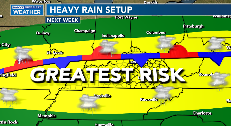
That setup is likely to continue deep into March.
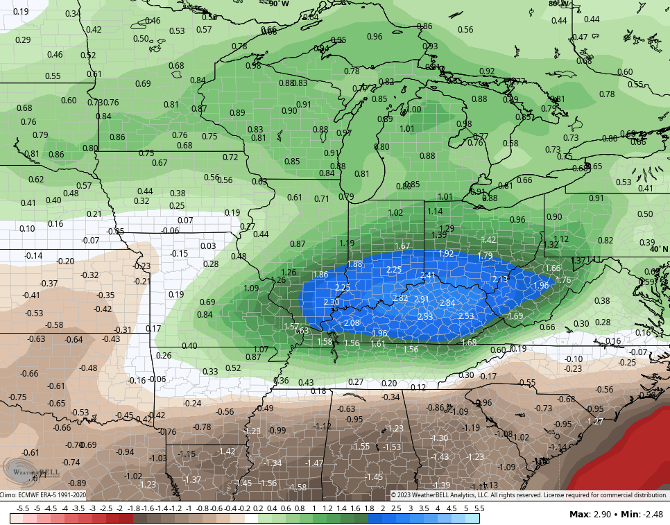
The GFS Ensembles paint the bullseye of above normal precipitation right on top of our region over the next 2 weeks…
Ugh.
Enjoy the rest of your evening and take care.

It is cold and snow flurries have been flying. I just hope the River crest soon. Levisa fork at Pikeville was 33 feet last time I checked. I have missed Schroeder comments stay warm.
I was off line from yesterday till now. We had a great amount of rain and a lot of lightning. Not a flake of Snow today, but very cold and windy. Hope tomorrow the Sun will shine.
Glad to see you back Schroeder!
Glad to hear from you Schroeder. It really is cold tonight we have had some flurries today. I checked looks like the levisa Fork of the big Sandy just crested tonight good news.I don’t like it when the river gets up in the bottom behind my house. I dread what Chris said more rain next week too.