Good Monday to one and all. As Kentuckians continue to pick up the pieces from Friday’s historic storm, much needed nice weather rolls into the start of the week. That said, changes are on the way before the week is over.
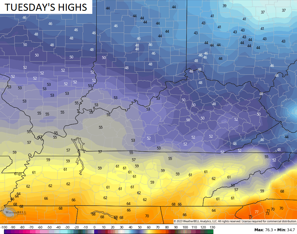
Temps out there today hit 70-75 for most of the state with a partly sunny sky. You will notice some clouds creeping into the picture later this afternoon and evening, and those clouds are ahead of a cold front dropping in from the northwest.
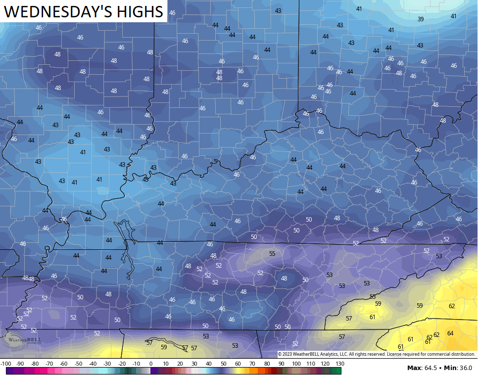
This front is fairly moisture starved with only a small chance for a shower or storm later tonight, but it does bring us a fairly steep drop in temps…
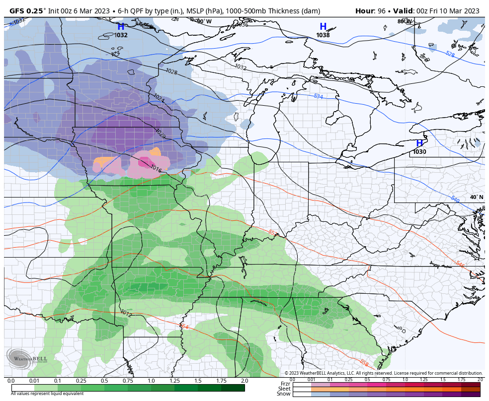
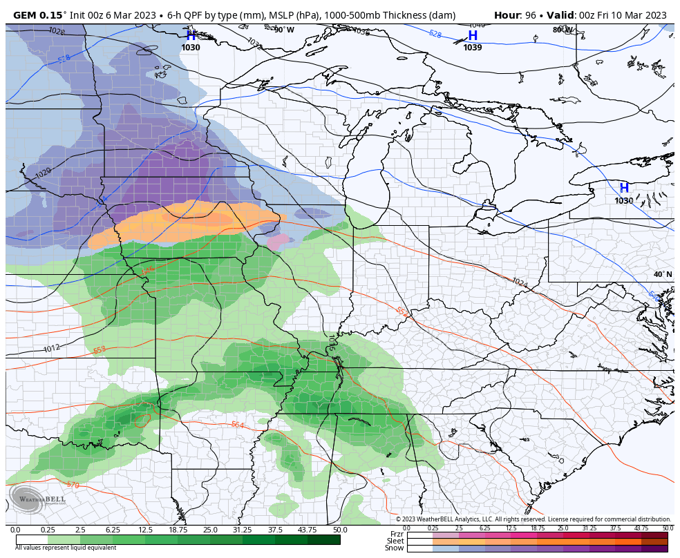
The weekend looks to feature two systems with one to start and one to finish. The chance for a little winter weather is there behind the second one…
GFS
CANADIAN
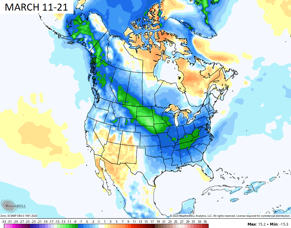
Looking ahead toward the middle of the month, the various Ensembles continue to paint a much colder than normal picture.
The EURO Ensembles 10 day temp anomalies are the least cold of the bunch…
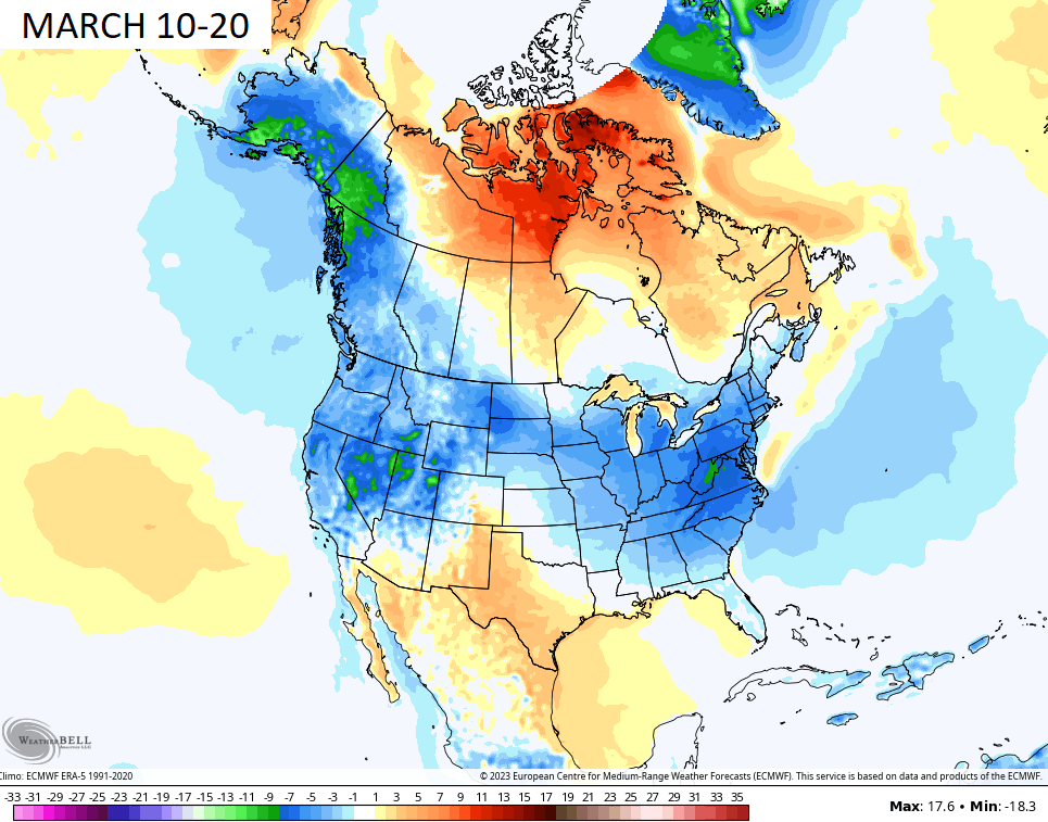
The Canadian Ensembles are the coldest…
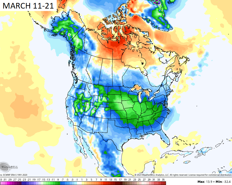
The GFS takes the middle ground…
Didn’t Mother Nature get the memo that we are ready for spring to lock in for the long haul?
Have a magnificent Monday and take care.

El Nino making a comeback in 2023! Great read my weather students….
https://www.zerohedge.com/weather/triple-digit-la-nina-ending-el-nino-may-strike-soon
Great article on ENSO. Thanks for sharing Dash.
Today will probably finish in the top 25 for the year.
I am headed outside & not coming back inside until the evening.
I’ve been without power since Friday. Also no water or phone service or internet. No property damage from the vicious winds. Just a few branches along the road. Hope everyone is Okay.
I hope your power comes back on soon Schroeder. We were only out for 8 hours plus we didn’t have any major damage, except for our camper so we feel blessed. It’s crazy that I don’t know any of you, but you were all in my thoughts during this recent event and I was hoping everyone was ok.
Glad you didn’t have any major damage Dottie. All the utilities are back up and running. Hope there aren’t any more storms like that for a long long while.
I thought about you Schroeder I figured your power was off glad you Joe Dottie and everyone that was without power has it now. Chris sure called this one and was on top of it all the way !!
Yeah, thanks Crystal. Chris did warn us about this dangerous wind in advance. I just wish it could have been one of those heavy March Snowstorm.
Here is the link for the summary of Friday’s high wind and severe storm event for Kentucky.
https://weather.gov/lmk/2023-03-04-KentuckyandSouthernIndiana-HighWinds
Mike, I would really like to know why that low pressure had that record barometric reading. Something natural or maybe it was HAARP ? Thanks for sharing the stats.