Good Tuesday, folks. Chillier winds are blowing across the region today behind a weak cold front dropping to our south. This brings in a pattern more typical of March with the opportunity for a little bit of winter to show up over the next few weeks.
Today’s front slides through early on with just the chance for a shower or storm. Most stay dry, but your radars will show some scattered stuff…

Highs today range from the upper 40s to middle 50s with highs in the 40s following this up for Wednesday.
This brings us into the end of the week and weekend with two storm systems set to impact our weather. The first brings some rain in here for Friday. The second system brings rain and the chance for some winter weather Sunday and into early next week…
Here’s the Canadian for this time period…
And the GFS…
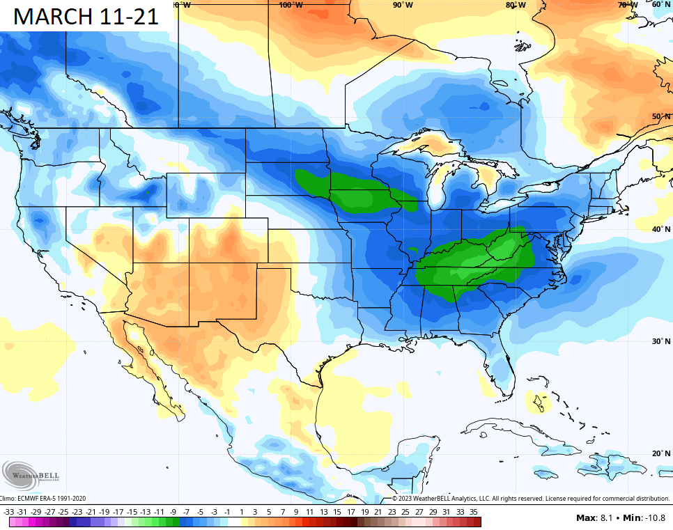
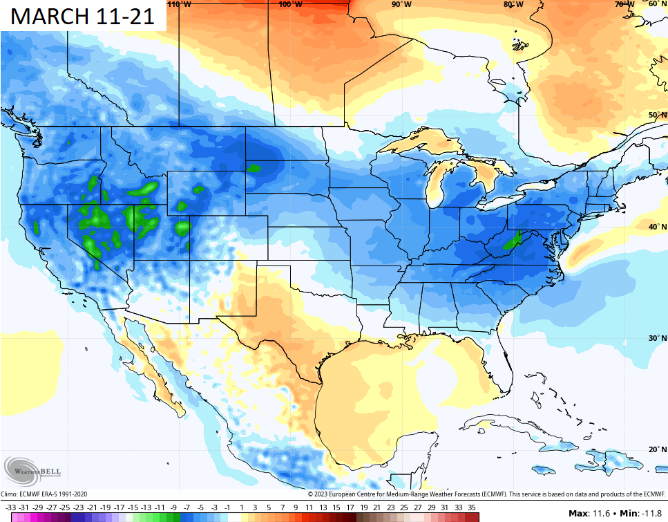
The Ensembles continue to show below normal temps taking shape for the middle of the March…
GFS ENSEMBLES
EURO ENSEMBLES
Is this a sign of things to come? The CFS Seasonal Model certainly thinks so. Check out the 3 month forecast for the spring…
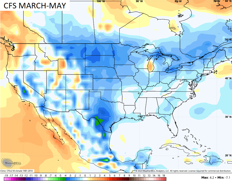
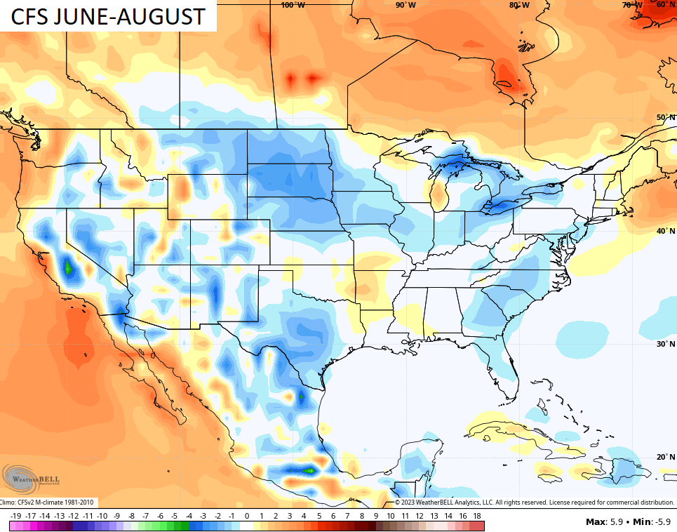
That shows our temps a little cooler than normal and the model keeps that rolling into the summer months…
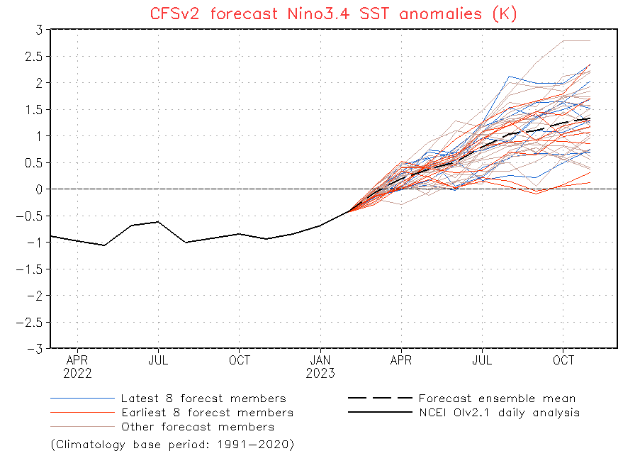
This comes as our 3 year run of La Nina comes to an end with an El Nino likely blossoming this summer and fall…
Have a terrific Tuesday and take care.

When El Nino comes into play maybe our Snow drought will end. Hopefully the PDO will go way positive and give us a better chance of that happening.
I’m not buying a cool summer.
Yeah, but one can only hope for a cooler than normal Summer here in Kentucky. The coolest Summers I can remember are when we had Volcanos erupting somewhere in the World. The Summer of 1992 was below normal in temperatures due to Volcano activity.
You know in August they’ll doom and gloom how hot it is….kinda like what they do in late Jan/early Feb. Global warming is a hoax.
Artificial amplifications of weather events makes more sense than Global warming.
I wish Chris would removed the Advance Profanity Filter from this site.
If somebody is on the website screaming 4 letter words just have that person permanently blocked or put into a timeout.
It is frustrating to write a 3+ paragraph statement only to have it removed because you did not thoroughly proofread it.
This is the United States of America. You have the right to express your opinion. First amendment to the constitution, but you must express your opinion in a sane and intelligent way.
Global Warming discussion will become mute in the near future.
Checkout the advancement in H2O fission.
Planet has plenty of water.
My theory is certain weather events are being amplified like Hurricanes, Tornadoes and even Snowstorms to cause widespread destruction in certain areas. A recent example is the removal of the drought in California in a year with La Nina dominating. La Nina in the last two years has worsen the drought. Bringing the jet stream down to the surface to cause widespread damage to power lines. I have never seen what occurred on Friday in my entire lifetime.