Good Wednesday to one and all. The overall weather pattern has completely changed and this is a change likely to throw a little winter at us over the next few weeks. Below normal temperatures are likely during this time. Boo!
Let’s begin with today and roll forward.
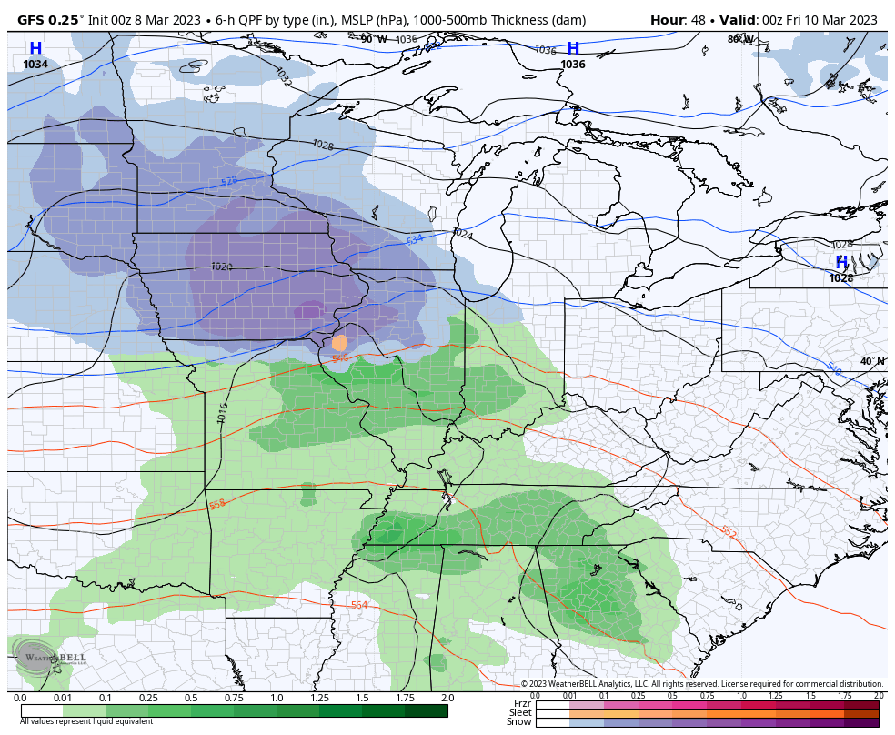
We have a weak system working across the Tennessee Valley and it’s bringing clouds to Kentucky. It may also spawn a rain or snow shower across the western half of the state today. The chances are low, but your friendly radars may pick up on some action…

Temps today are low and middle 40s for many.
The next system zips in with some showers from Thursday evening into the first part of Friday. There’s the chance for a few snowflakes to wrap in behind this Friday night and Saturday morning…
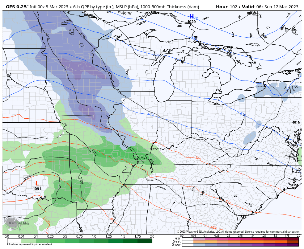
The next system quickly comes in by Sunday could get a little interesting with a swath of rain and snow possible. That unlocks even colder air behind it and that means some snow showers and flurries could fly early in the week.
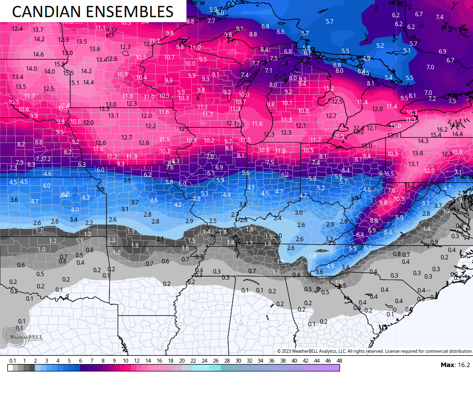
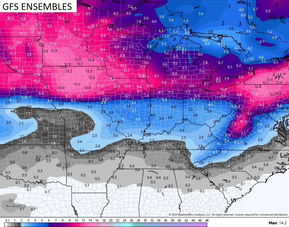
The GFS is all in on a band of snow for Sunday…
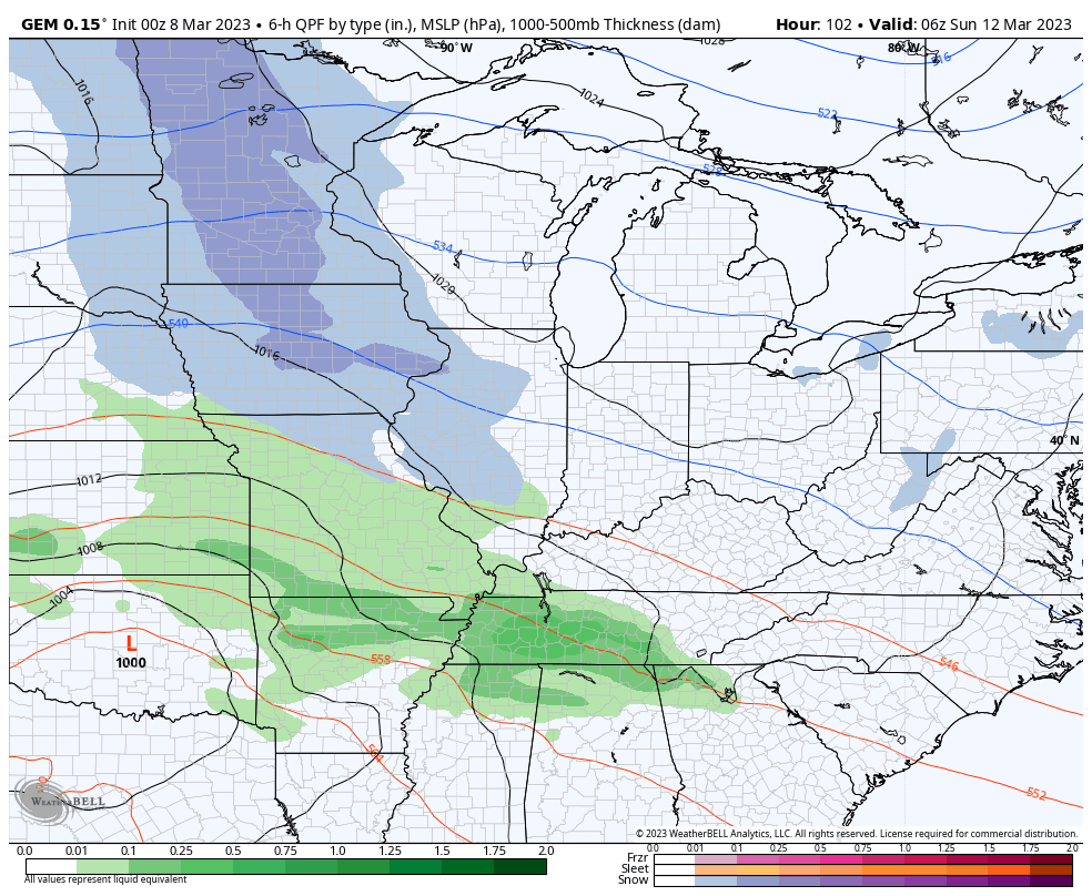
The Canadian is trying…
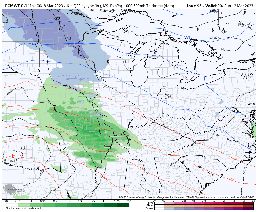
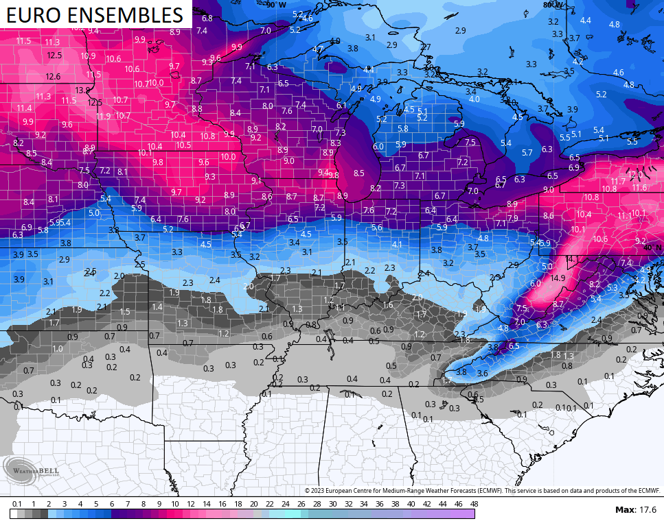
The EURO is also going that way…
We know this is a cold pattern and I’ve pointed that out on numerous occasions, but what about the snow chances. All the Ensembles say you will see, at least, some flakes over the next two weeks…
Ugh.
I will have another update later today, so check back. Make it a great day and take care.

1987 clay county won state tourny, then boom a monster snow storm hit. anybody remember.
the first part that aint never happening again, clay county powers that be are blind stupid and crazy. had worst coach ever for years. he walk out after district game and left the team a note.
Thanks Chris. I’m glad that the temperatures in the next several days are going below normal, or is it normal ? The plant life will stay dormant I hope until Spring weather takes hold in late April. Maybe we will receive one of those heavy March Snowstorms we use to receive around basketball tournament time.
If any significant snow is to fall it will not be advertised a week out.
It’s more likely to be a surprise event.
(Borderline cold/warm temperatures)
Also any Snowstorm would be a dynamic event at this time of the year.
I don’t foresee any significant snow the rest of the “winter”.
There’s always a 50 /50 chance of any weather event happening in the month of March.
i do remember april 1987. pike county ky. little over 2ft of snow fell. i absolutely cant stand the cold now. nothing like being outside enjoying warm sunshine. i randomly mention to my wife that we need to move to a warmer climate. if only i could live in permanent june – august 🙂
WOW ! That’s a lot of Snow. Being that the event occurred in April I bet it was the good packing kind of Snow. My Sister hated the cold and moved to Florida. Now she has to worry about Hurricanes.
Winter Storm Watches are already in effect in far Northern IL for the counties by the Wisconsin border for the Thursday afternoon-early Friday morning time frame.
Just like the event last week, there is doubt about where the heaviest snow may fall, temperatures may be a few degrees above freezing which would limit accumulations, and there will be a sharp cutoff in snowfall amounts. All of those make for a very tricky forecast once again.
The ensembles are predicting between 7 and 10 inches of snow for the entire Chicago Metro Area in the next two weeks. I have my doubts that will verify, but one can always hope. At least something interesting to follow in this meager snow season.
Mike when we had that major Snowstorm in South Central Indiana back in December 2004 two days before Christmas the ground temperature was around 38 degrees and the air temperature was 35 degrees. We accumulated up to 24 inches of Snow due to dynamic cooling below freezing in the upper layers of the atmosphere brought to the surface by heavy falling precipitation.