Good evening, folks. Two systems are on the way for the next several days and each of them can bring a few flakes into our part of the world. This continues to be part of a pattern skewing colder than normal over the next few weeks.
The first system arrives on the scene late Thursday with some showers. Those drops continue into early Friday before colder air crashes in from the northwest. That same northwest flow may touch off a few flurries or snow showers Friday night.
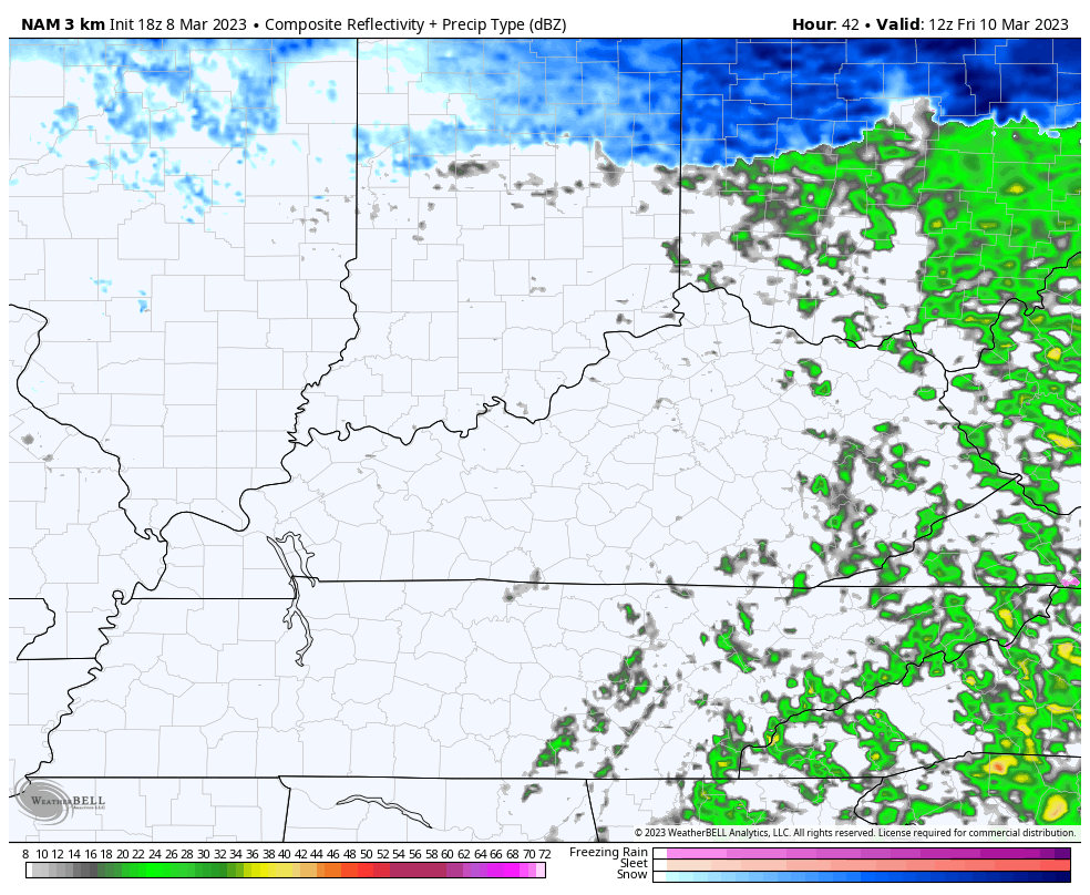
You can see those on the Hi Res NAM Future Radar that goes from 7am Friday through 1am Saturday…
That clears out on Saturday as we turn our attention toward the next system coming in. That arrives on Sunday and brings a period of rain and snow to the region, with the best snow chance across the north.
A cold northwest wind behind that cranks some snow showers and flurries on Monday and Tuesday.
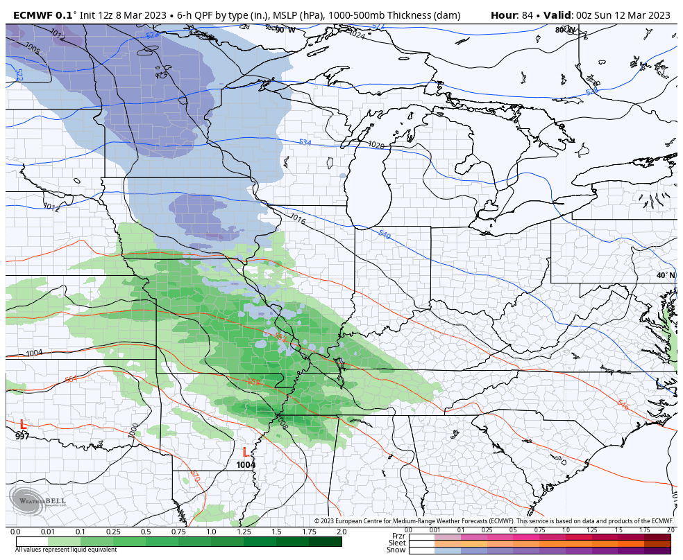
Here’s how the EURO see this scenario…
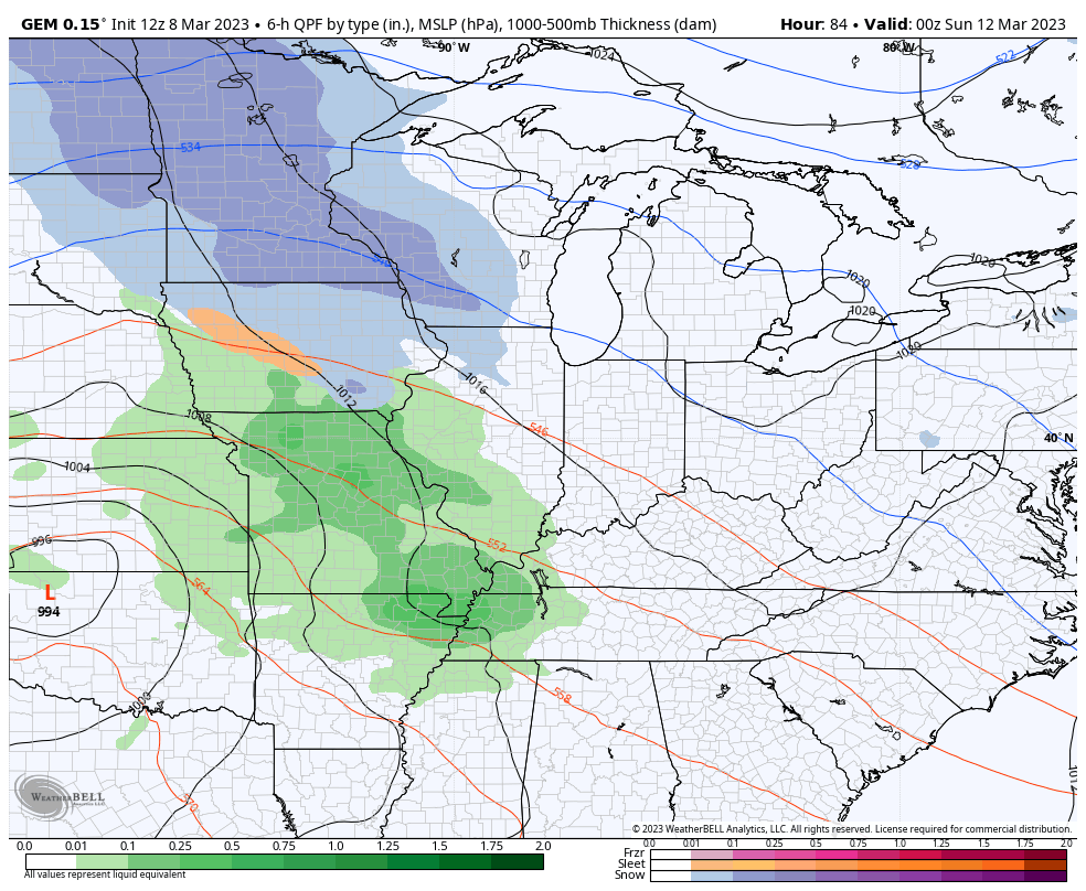
The Canadian is similar…
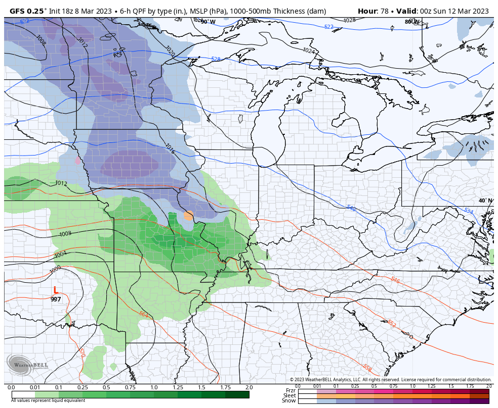
And the GFS…
Enjoy the rest of the evening and take care.

It won’t be much.
Probably the ground will be warm. Although the action will be during the night.