Good evening, folks. We continue to track a very active setup across the region for the next few days. This brings the potential for strong to severe storms and flooding rains to parts of the Commonwealth.
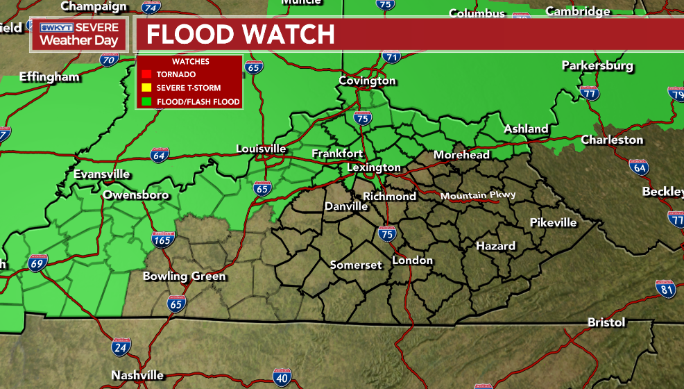
Let’s start with the updated Flood Watch that was expanded to include northeastern Kentucky…
A few of the evening storms may be strong or severe, but the risk is fairly low. The Storm Prediction Center has the Marginal Risk from the Louisville Metro and west-southwest…

That risk will expand farther east into Friday. The Storm Prediction Center even has the Enhanced Risk across the southwest…

There’s even the low-end risk for a few tornadoes in the west and southwest, especially. The models are showing the potential for a few rotating storms…
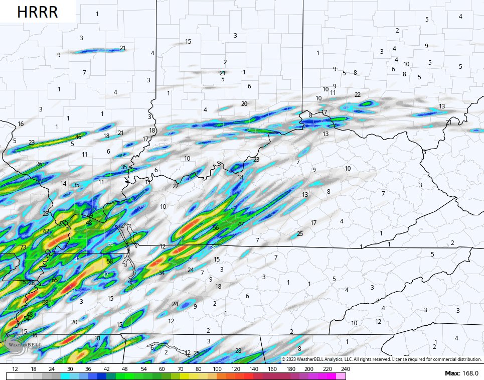
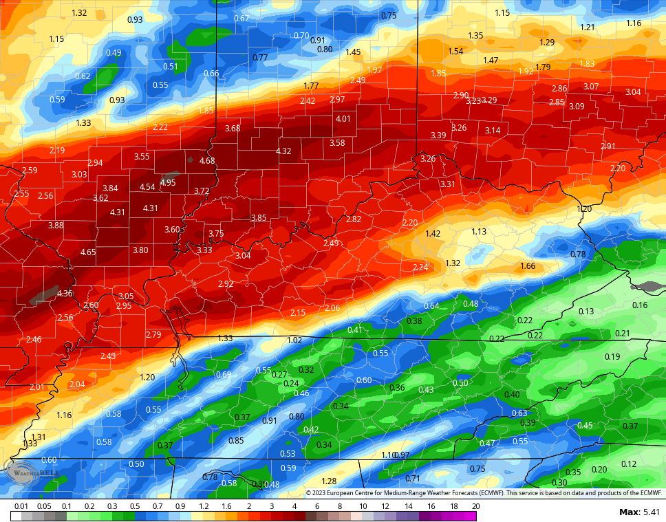
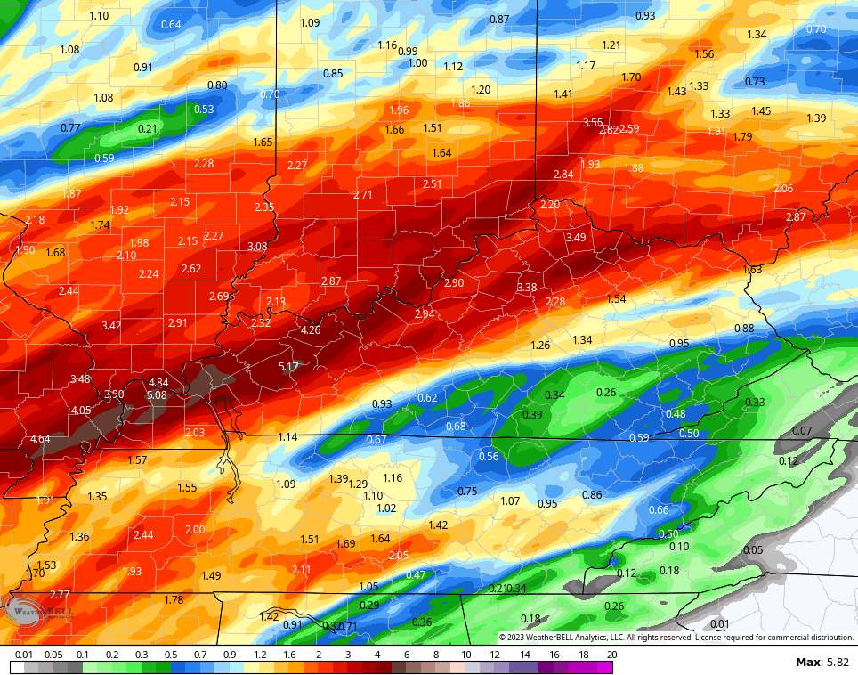
In terms of the flooding potential, the HRRR has been the farthest south with the heaviest rainfall…
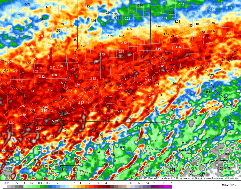
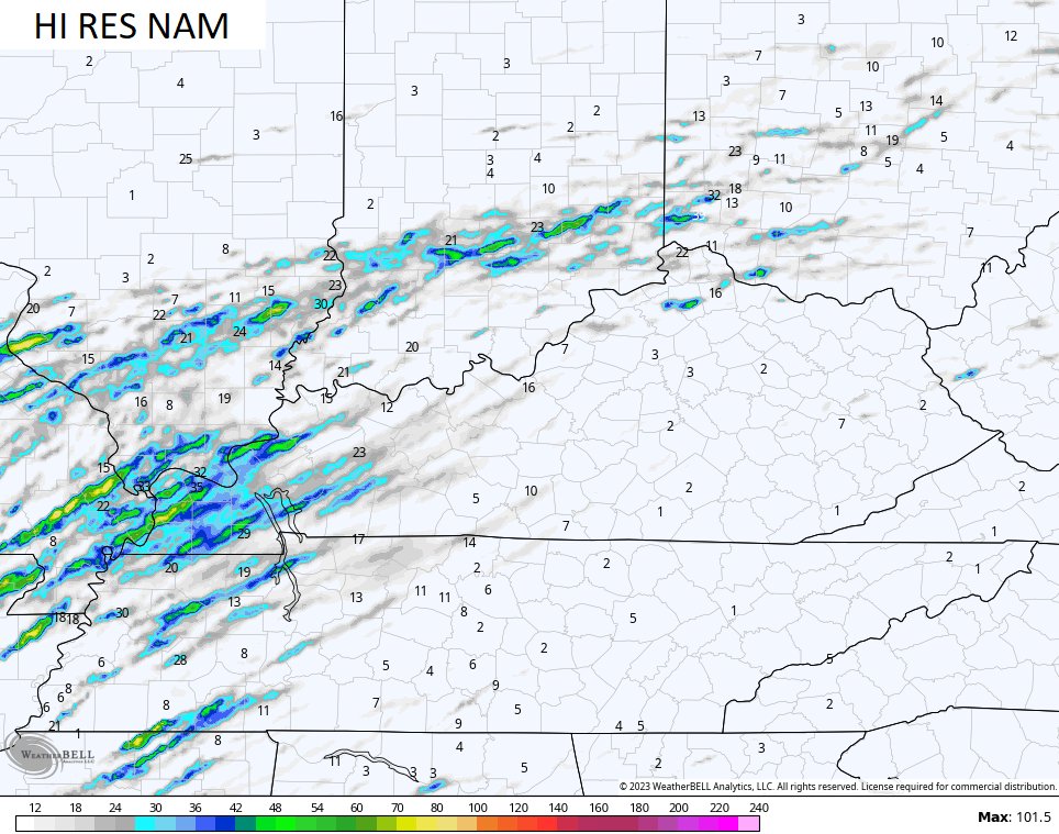
It now has some friends…
EURO
WRF
I leave you with the Thursday evening storm tracking tools…

Current watches

Possible Watch Areas

Have a great evening and take care.

Thanks Chris. I hope we receive at least a couple of inches of rain, but it looks like the soaking rains will be along the Ohio River and points northward. I’m afraid were going to receive the high winds and severe weather in the warm sector of the storm. I wish this pattern would change, but I feel it will be around for most of the Spring months.