Good Tuesday, everyone. Smokey skies continue to blanket the region today as those wildfires in Canada continue to burn. The smoke is coming at us from the northeast and is ahead of a much cooler pattern settling into our part of the world.
The smoke is giving us a very milky sky today as cooler temps begin to take control. There’s a slight chance for for a late day shower or storm coming from the northwest as a cold front slides in from the northeast. Yes, the push of cooler air is coming from the north and northeast, but thunderstorms developing along this boundary to our northwest will slide southeastward along the front.
Here are your radars to follow anything that goes up today…

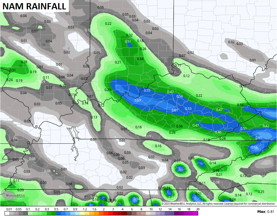
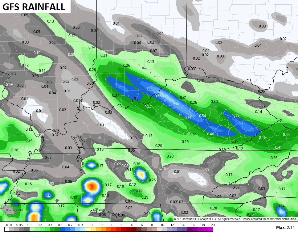
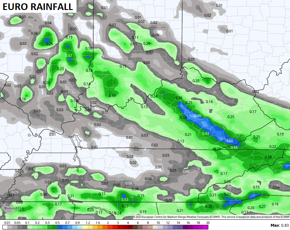
Those showers and storms rolling in later tonight and early Wednesday will put down some needed rainfall but not for everyone. The models show some decent totals across central and eastern Kentucky…
Temps on Wednesday will struggle for those areas under the rain and clouds. It may be in the 50s while rain is falling with a recovery toward 70 with any sunshine following the rain. Still, it’s a very cool day for June.
Lows by Thursday morning dip into the 40s for parts of central and eastern Kentucky…
Highs Thursday and Friday may not get out of the 70s for these same areas under a partly sunny sky.
Another deep trough dives in over the upcoming weekend and into early next week. This is the one I’ve said has a chance to produce a bigger cut off storm system than what the models were showing. Those same models are showing now showing a bigger cut off system.
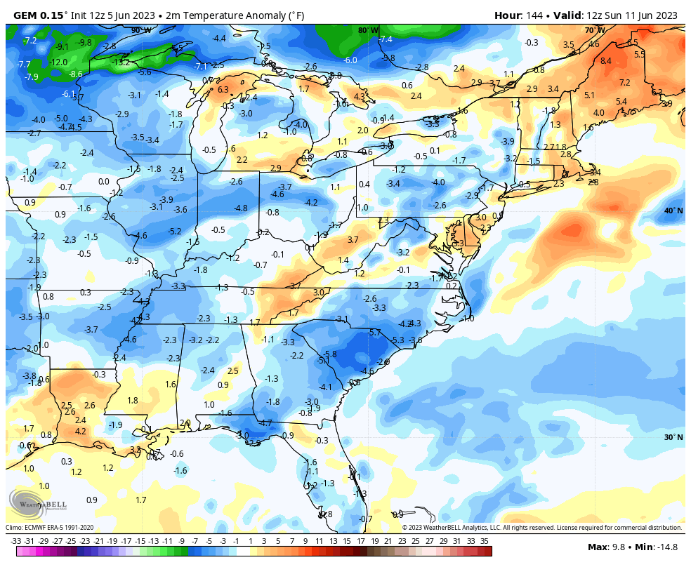
The Canadian is the most potent with this setup and would bring beneficial rains and very cool temps from late Saturday through Tuesday…
Temps are likely way below normal once again…
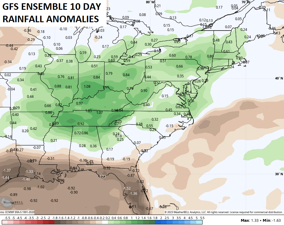
This is part of an overall more active pattern for our region. The GFS Ensembles 10 day rainfall is above normal for June 10-20…
Bring it.
Have a terrific Tuesday and take care.

I’ll believe it when I see it. 🙂
Thanks Chris. Looking and sounding like late August early September type weather. Be glad when our bright blue skies return.
Bring it!!!!!!!!!
Not liking the chances for rain in South Central Kentucky at all! Over the past 16 days I’ve recorded exactly 0.01″ of rain. With groundwater levels dropping all over the region, it wouldn’t take much to push us into drought conditions.
Going from one extreme to another is a hallmark of our “new normal”.
I think when we see an end to this Omega Blocking pattern our weather will return to our usual Summer pattern with more chances for some soaking rains. The latest on ENSO comes out this Thursday.