Good Wednesday to one and all. A cold front is pushing through the region today and it’s bringing needed rains to the region. It’s also unleashing a September looking and feeling pattern with temps well below normal.
Rain and some thunder is out there today with the greatest concentration across central and eastern Kentucky. Some areas may push close to an inch, but many of us fall between a quarter and a half inch of rain. The rain tapers quickly from north to south during the afternoon with sunshine following the drops.
Here are your radars to track the mid-week rainfall…

Temps with the rain are in the middle 50s to low 60s. Where skies clear early enough in the north and west, readings recover to the 70s. Overall, this is a really cool day for June!
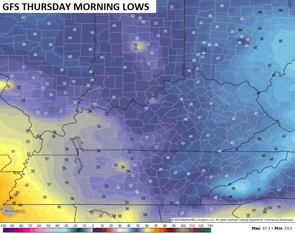
This cool air gets almost chilly tonight and early Thursday. Lows may reach the mid and upper 40s across central and eastern Kentucky…
Highs in the 70s Thursday and Friday look common for much of the region. The west will be warmer than everyone else, but this is some amazing weather for this time of year!
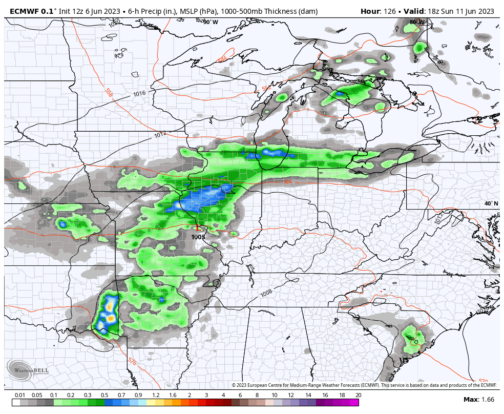
Our next system arrives later this weekend into early next week and may be followed by another rain maker a few days later.
The EURO is a little slower with the arrival time and shows that second system bringing rain and storms by this time next week…
Temps ahead of that system will bounce closer to normal before coming right back down once that blows through here.
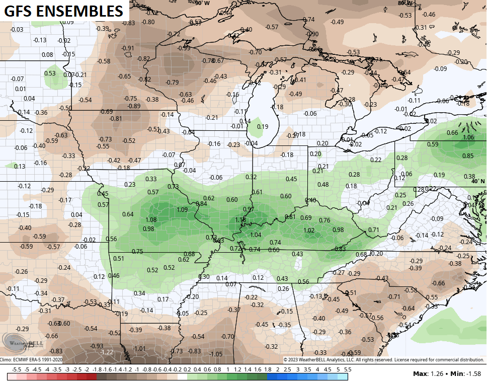
This kicks off a much more active pattern for our part of the world. It’s one that will result in rounds of showers and storms for the second half of the month. The GFS Ensembles show above normal rainfall over the next two weeks…
Enjoy your Wednesday and take care.

An inch or so isn’t too bad for two weeks if that happens.
It appears that I am only going to pick up some spotty rain. The main track of rain is slightly to the east of my house. I am a little disappointed.
Too little too late on the rain. Crops in my area are really struggling. Oh well there’s always next year with a different weather pattern. I hope in everyone’s favor in the agriculture industry. We have good years and bad years in our harvest. That’s the way it’s been as long as I can remember.
Over the past 19 days I’ve recorded only 0.01″ of rain. Radar is picking up showers, but they’re either dissipating as they near the BG area, or splitting around us. My lawn looks more like is should during the first week of August, instead of the first week of June!
It is raining hard at my house at this moment.
I will not lie I am quite surprised.
Only 0.25 in this ” rain event ” in my area. Doesn’t matter anyway. To hell with this Summer, I’m ready for Fall and Winter.
The front is nearly past my locale south of Bowling Green, and the good news is we’ve picked up some rain.
The bad news is that it totaled just 0.01″.
The disturbing news is that the total rainfall at my location over the past 19 days is now 0.02″.
Quite frankly, this brief “cool spell” is not blowing me away. Comfy yes, but not a big deal.
Does anyone know if there is a map of the us that shows the smoke like a radar as it moves???