Good Saturday to one and all. We have another really nice day out there today but the focus is on a much more active pattern as waves of storm come our way. The first round of big boomers arrives Sunday with the potential for strong to severe storms.
Smoke continues to show up in our skies today and it’s fairly noticeable once again. Highs reach the upper 70s to low 80s for many with a mix of smokey sun and some clouds.
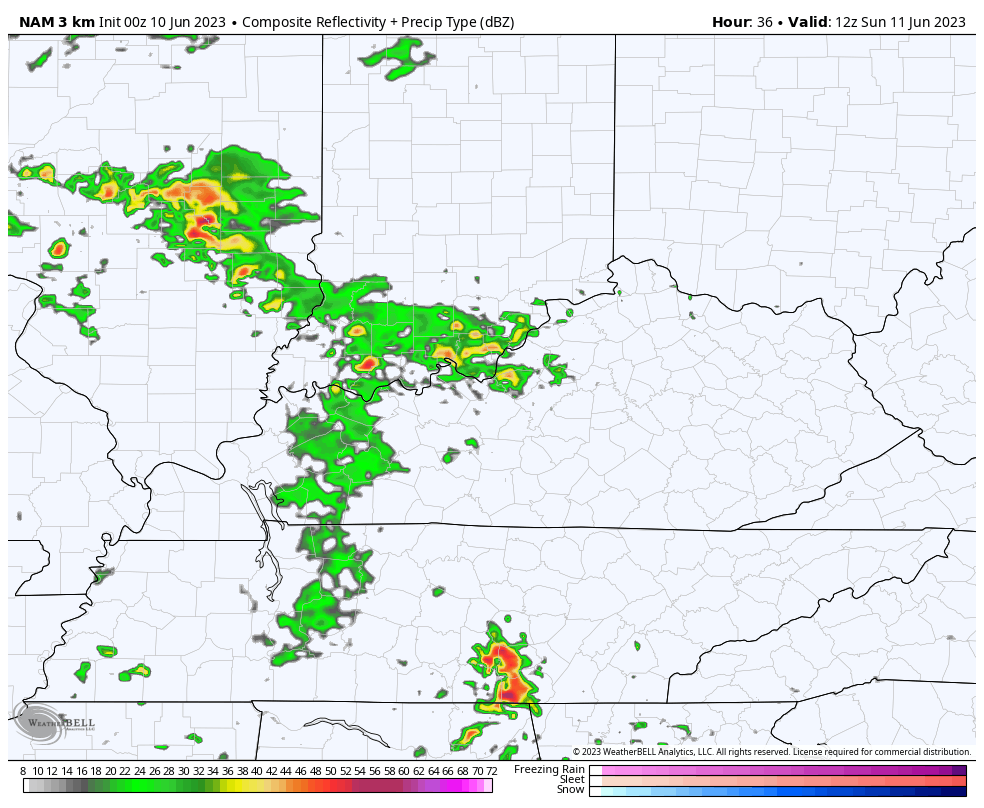
Clusters of showers and storms may get into western Kentucky as early as later tonight with the best chance coming Sunday and Sunday night. That’s when the risk for a few severe storms will show up.
The Storm Prediction Center has a Marginal to Slight Risk for severe storms for much of the region…

The tornado risk in this setup is pretty low across the board…

The chance for Damaging wind is the primary threat from the SPC…

A few of the storms may also produce large hail…

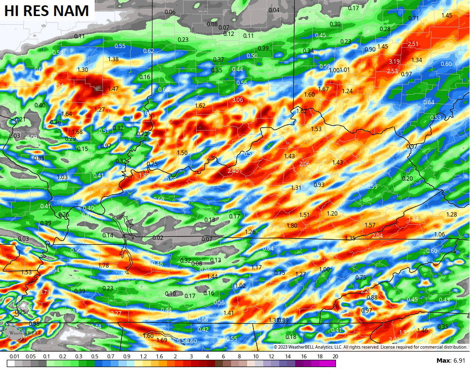
Check out the Future Radar from the Hi Res NAM showing these waves of storms. This animation starts at 8am Sunday and goes through 8am Monday…
That model is spitting out some hefty totals that could cause local high-water issues…
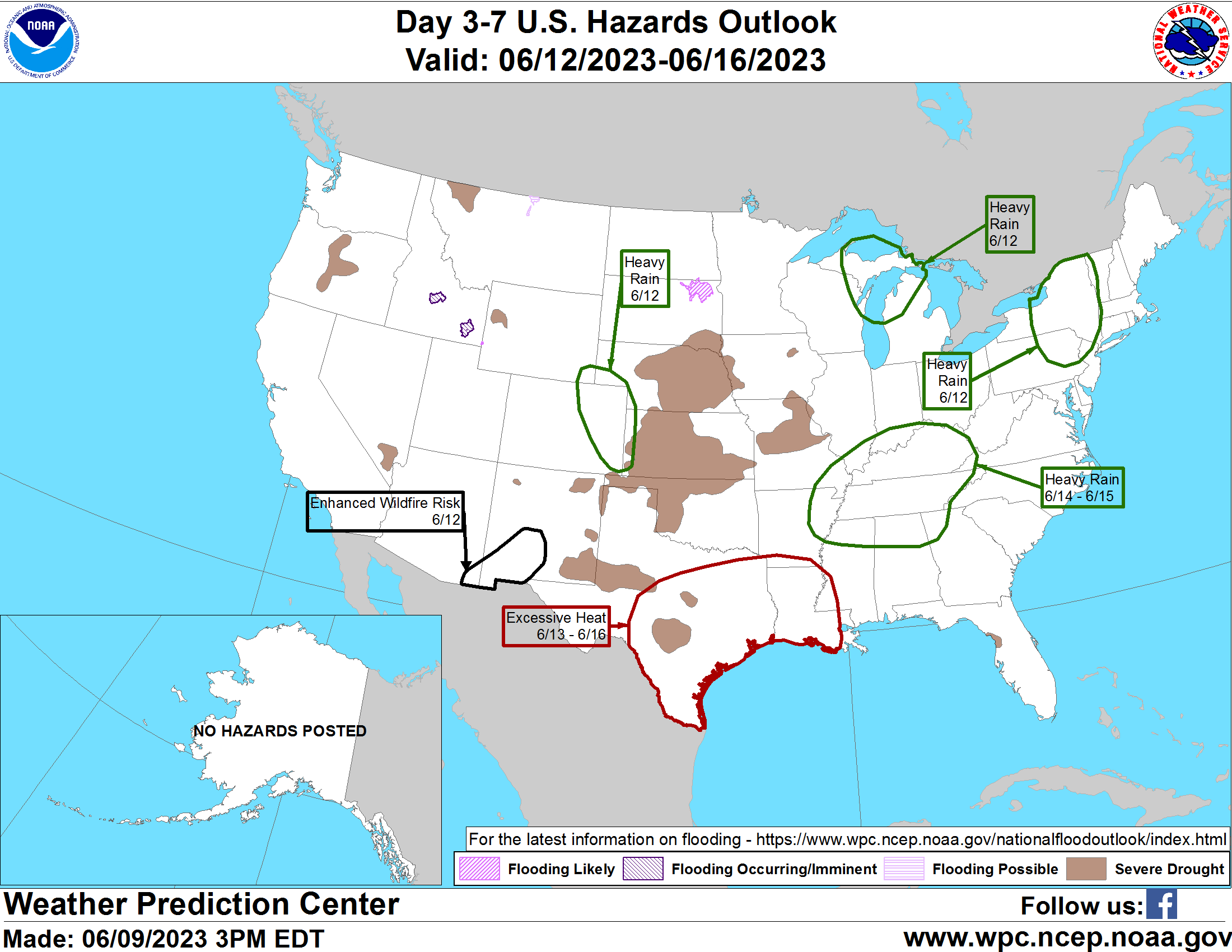
This stuff winds down very quickly on Monday with low clouds slowly clearing. Temps Monday may really struggle in some areas. This better weather will give way to the threat for additional rounds of showers and storms for the middle and end of next week and into next weekend…
We will have to watch for the strong to severe storms threat during this time.
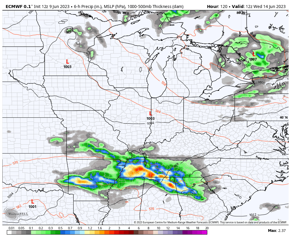
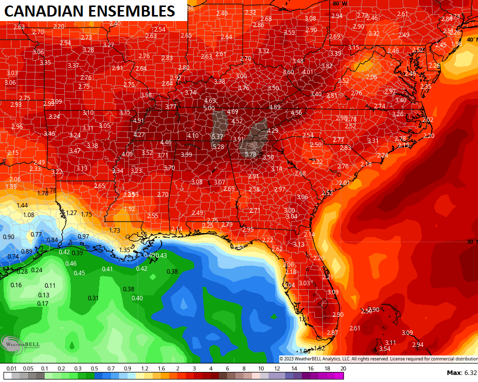
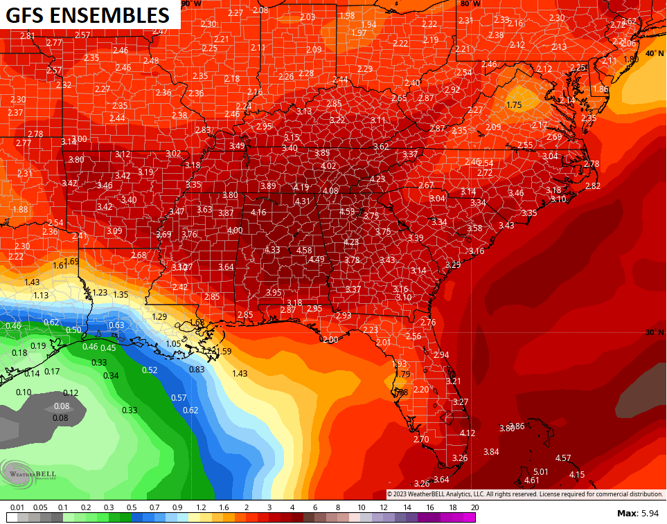
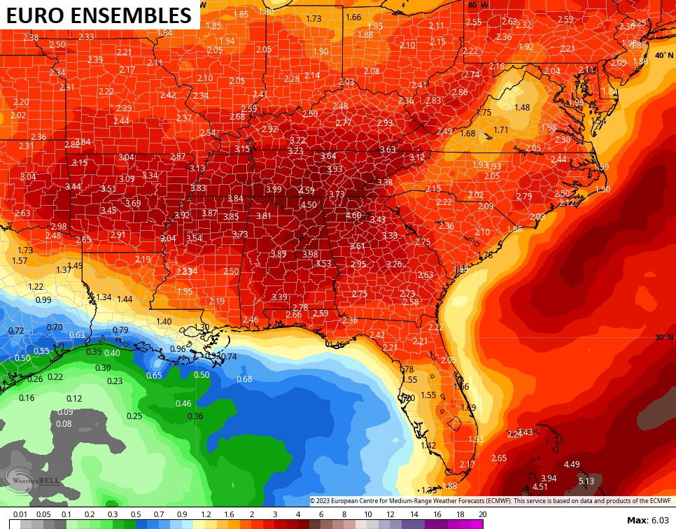
It’s also a pattern that can put down some healthy rainfall. The Weather Prediction Center is highlighting Kentucky and points south for heavy rainfall…
The various ensembles show this well…
Have a great Saturday and take care.

The ensembles will be wrong as usual
Hoping the ensembles are correct and wrong on the severe threat.
Here is the complete ENSO update for June from the CPC, containing links to relevant charts:
https://www.cpc.ncep.noaa.gov/products/analysis_monitoring/enso_advisory/ensodisc.shtml#:~:text=Synopsis%3A%20A%20transition%20from%20La,Ocean%20%5BFig.%201%5D.
I’m waiting on NOAA to issue an El Nino Warning. That tell us that the Pacific Decadal Oscillation has gone into the positive phase. This means there is atmospheric reaction with ENSO, then the Snow will fly next Winter. This is what happened in the years 1969-70 and 1976 to 1979.
In addition to heavy rainfall (I’ll believe it when I see it…), the ensembles are calling for cooler temperatures, during the near future time-frame, but that can be deceiving. This close to the Summer Solstice, cooler than normal temperatures may not “feel” so cool, because as the Sun reaches it highest, most vertical position overhead, its rays are at their most direct and provide maximum heating. The thermometer may read 70° with a nice breeze, but you can still get a nasty sunburn!
Worse Sunburn I’ve gotten was when I was swimming in the Gulf of Mexico near Tampa, Florida in 1960. A long long time ago.
I don’t think there’s too much beneficial rains with this next event ? Nothing has really changed in the atmosphere that would really give that ” Heavy Rain ” chance. Right now the temperatures are pleasant with smoky skies. This morning I went ahead and watered my plants. Buy the way, my Catawba Rhododendron is growing extremely well after being injured this past Winter with that dry, frigid Arctic air we had at Christmas.
On the HRRR + ICON model there’s our first 100 to 102 degree weather showing up on the 22 nd and 23 rd of June. Hoping this is WRONG !!!