Good Sunday, folks. It’s a busy weather day across the Commonwealth as we track the threat for severe storms and heavy rainfall. This is part of a very active setup that skews us wetter than normal and cooler than normal for the next week or two.
Storms today come at us in waves today with the greatest severe threat this afternoon and evening.
The Storm Prediction Center continues to blanket the region in today’s Severe Weather Outlook…

Damaging wind and large hail are the main threats with any storm that goes up today. Here’s the Severe Wind Outlook from the SPC…

And the large hail potential…

The tornado risk is low with this kind of setup, but a few spin ups can’t be ruled out…

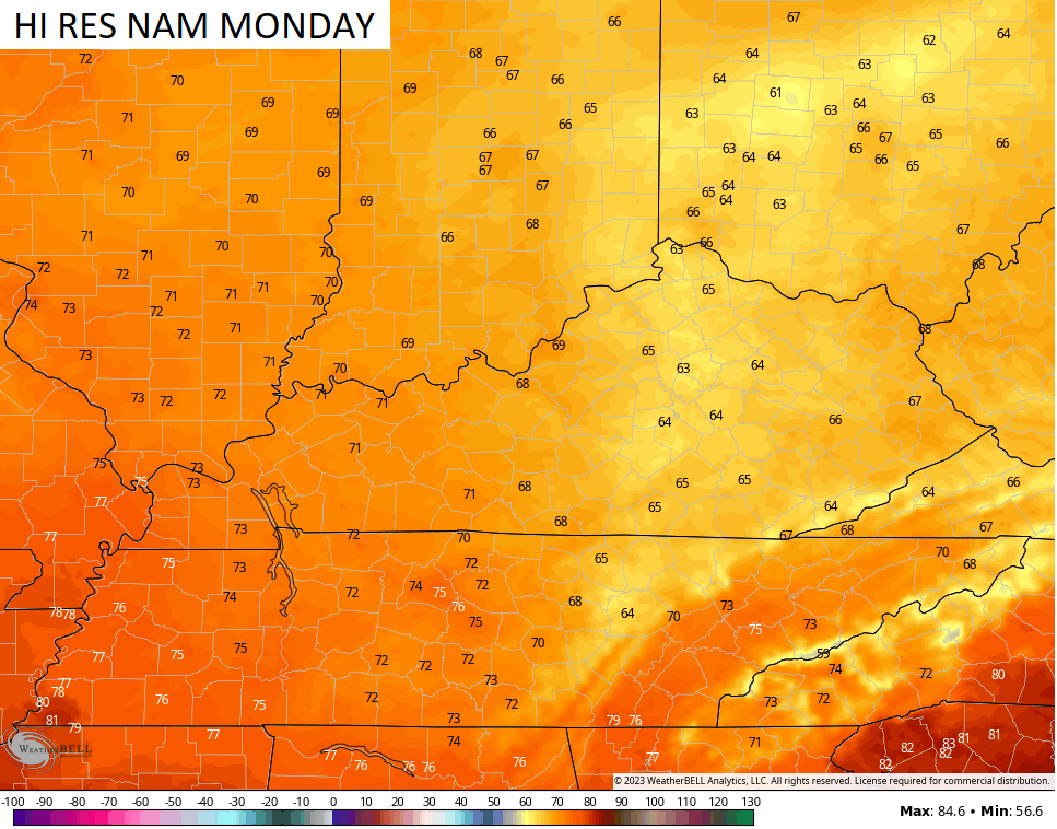
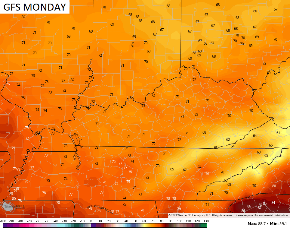
Lingering showers will move out of the state by early Monday but clouds will be a little stubborn across the central and east. Regardless of when skies clear, Monday is a very cool day.
The Hi Res NAM has later clearing and keeps temps in the 60s for many…
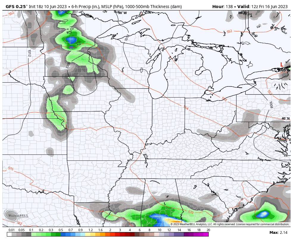
The GFS has earlier clearing but only gets us into the low 70s…
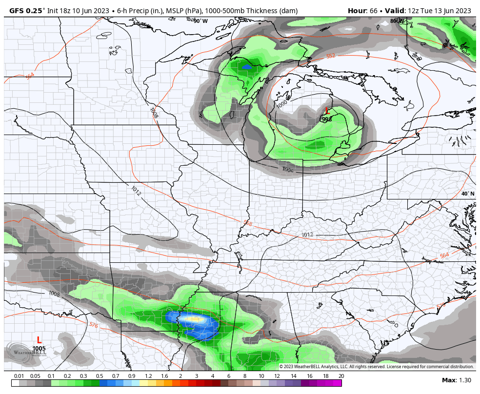
Some wraparound showers are possible Tuesday as another system zips across the Tennessee Valley. That will set the stage for the chance for some showers and storms into the middle of the week…
If we look at the overall upper level pattern across the country, this doesn’t look like summer by any means…
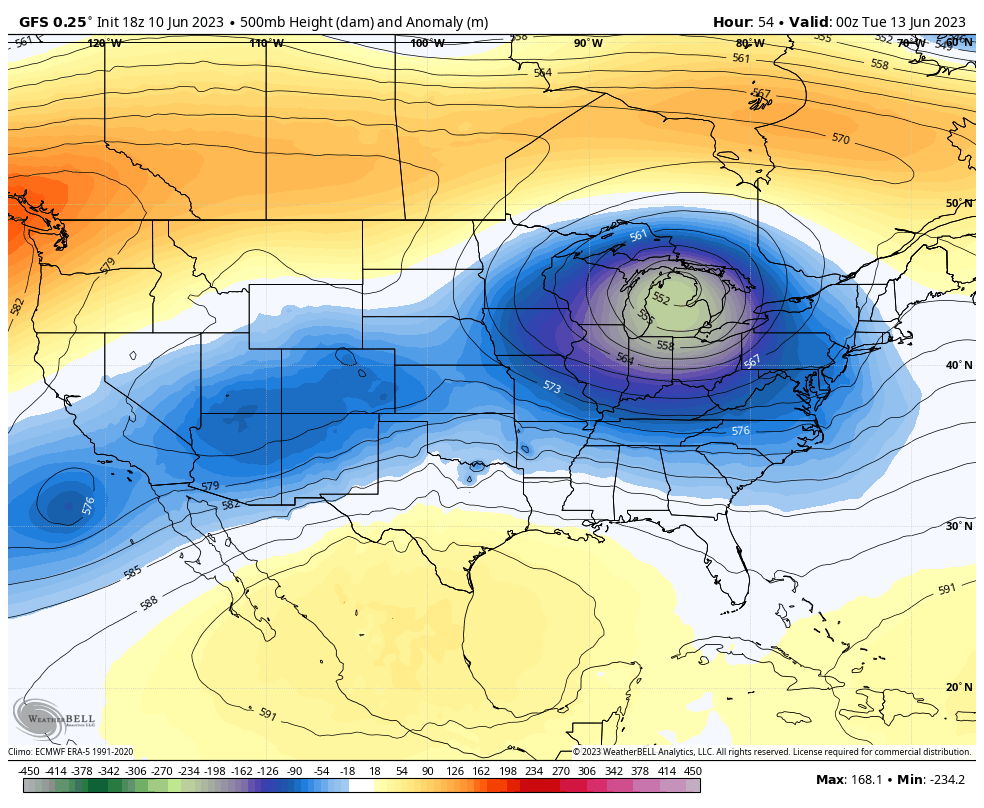
Those big dips into the eastern half of the country produce lows that can bring additional showers and storms in here for the end of the week into next weekend…
I will drop by for updates as needed through the day. As always, I have you guys all set to track today’s severe weather threat…

Current watches

Possible Watch Areas

Make it a terrific Sunday and take care.

It will be consistently hot before long.
Thanks Chris. Here we go again with the severe weather threats. The SPC has my area at a 70 % chance of thunderstorms late this afternoon. If this materializes it will be the first bout of thunderstorms this season. Damaging winds of course is the main threat as always with these setups. I don’t no why we can’t receive a good soaking all day rain. The ridge to our south always forces the best and most rain well to our north and we get the left overs with the front. The cooler than normal temperatures this time of the year are great, but usually don’t last too long in our area of the country. Hot and Humid is generally our Summer.
NOAA still playing guessing games with ENSO. They did issue an El Nino Advisory, which means El Nino is currently present. It currently has no connection with the North Pacific Atmosphere. This may occur this Fall and Winter if the PDO goes way positive. The PDO is still negative as it has been for several years. Until this changes we will remain in the same weather pattern.
NOAA’s CPC has always taken a very conservative path in all of their forecasting responsibilities, whether it be long-term temp and precip forecasts or ENSO, and their reticence to commit on El Niño is one more example of this. I believe that their forecast algorithms do not fully take into effect the increases in atmospheric heating and its related increase in our atmosphere’s capacity to hold moisture, which we’ve experienced over the past 10-20 years. Our weather is a giant heat engine, and like most engines, a rise in temperature will produce unpredictable effects
All weather forecast are probable. Maybe in the distance future this will change.
I wonder if this pattern will be around during the winter months?
I do love this pattern during the summer months.
Depends a lot on ENSO.
ENSO’s main drivers are variations in sea surface temperatures in the eastern, equatorial Pacific, while its most significant effects are changes in trade wind intensity and direction (especially in the Gulf of Mexico & Caribbean), jet stream deviations, and an increase or decrease in surface moisture. I’ve been looking at some historic charts that show the SSTA’s for a particular point in time, and in an El Niño scenario, those effects were amplified when the greatest temperature anomalies occurred close to the coast of equatorial South America, as is the case currently. Not seen in most of those charts is the extensive are of warm water in the North Pacific, which may cause additional northward ridging of the Polar jet to take place. This is something we’ve seen recently in Winter months; I’m uncertain what its effect in Summer will be.
https://www.ospo.noaa.gov/Products/ocean/sst/anomaly/
As long as we have a negative Pacific Decadal Oscillation, it won’t matter what phase of ENSO we are in. The most recent positive phase of the ( PDO ) was in 2014-15. The last time we were actually Snowbound for a week ,and we didn’t have a drought the following growing season. Maybe this Fall and Winter this may happen ?
Just saw a tornado warning for Eastern Taylor County. Stay safe Schroeder!
Thanks Joe for alerting me that a Tornado Warning has been issue for my county. Doesn’t surprise me any. Where I live there isn’t any weather alert systems. Very very rural area. We only accumulated about 0.20 inches of rain. Maybe some more later. Don’t know. Glad I watered my plants Saturday morning.
One thing that bothers me about our reliance on “tried and true” forecast parameters in terms of this crazy climate, is how many continue to be tried, but aren’t always true. Where we used to count on a forecast model to deliver across a variety of scenarios, we now see models that are routinely ignored because they have difficulty rationalizing one or more input parameter, making them notoriously unpredictable.
Yeah, weather forecasting 60 to 70 years ago was much more reliable. Especially when forecasting Snowstorms. Things have really changed. Future forecasting I hope will be better.
Only about a tenth of an inch of light rain fell across the Chicago Metro Area this morning, which was the first measurable rain in over three weeks for much of the area.
It’s a cloudy, very cool afternoon here with temps only in the upper 50s with the wind blowing off Lake Michigan.
Mike, We didn’t receive any rain that amounted to anything either. The best rains were just south of the Chicago area, and central and northern Indiana where it’s rained most of the day. We almost alway receive what’s left over. I’ve been in Chicago and felt those cold northeast winds coming off Lake Michigan. Burr…..
Receiving rain now and loud thunder that’s the loudest thunder I have heard in awhile.
Rain coming down very hard now.
Overall I’m pleased with what fell in Madison County.