Good Monday to one and all. Our severe storms of Sunday are long gone and now we are tracking some pretty cool air to start the week. It’s a week with below normal temperatures overall as we roll back into a stormy setup that’s likely to last through the upcoming weekend, at least.
Storms Sunday afternoon and evening produced damaging winds and large hail while putting down quite a bit of rain. Some leftover showers are possible early today across the eastern half of the state. Here are your radars to track these out of the area…

Clouds will be slow to clear from west to east, but the sun should take over during the afternoon and early evening. Some areas of the east may not get out of the upper 60s while the rest of the state hits 70-75 degrees for another cool June day in Kentucky.
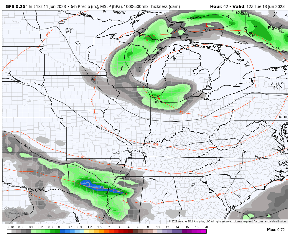
The setup for Tuesday and Wednesday features this big upper level system spinning across the Great Lakes and Ohio Valley. This can throw a shower or storm in here later Tuesday with a Tennessee Valley system set to throw a little juice at us on Wednesday. That’s followed by a scattered storm threat for Thursday…
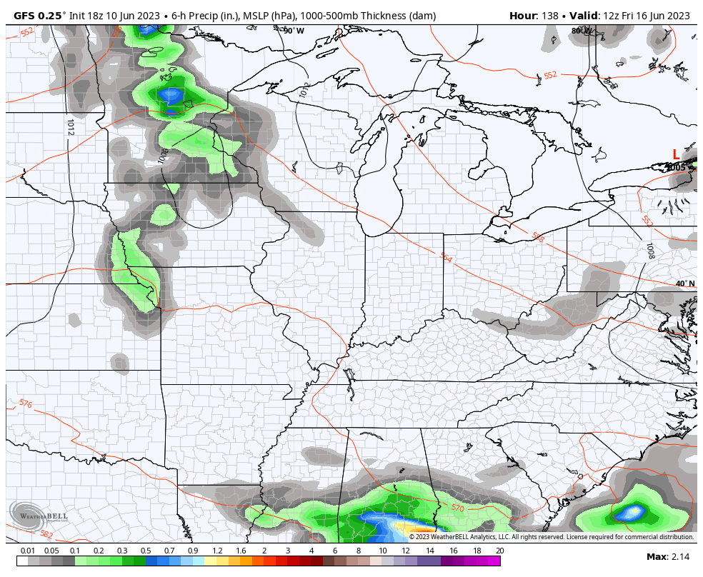
The flow then features a system dropping in here from the northwest over the weekend. That one can fire off additional rounds of showers and storms into early next week…
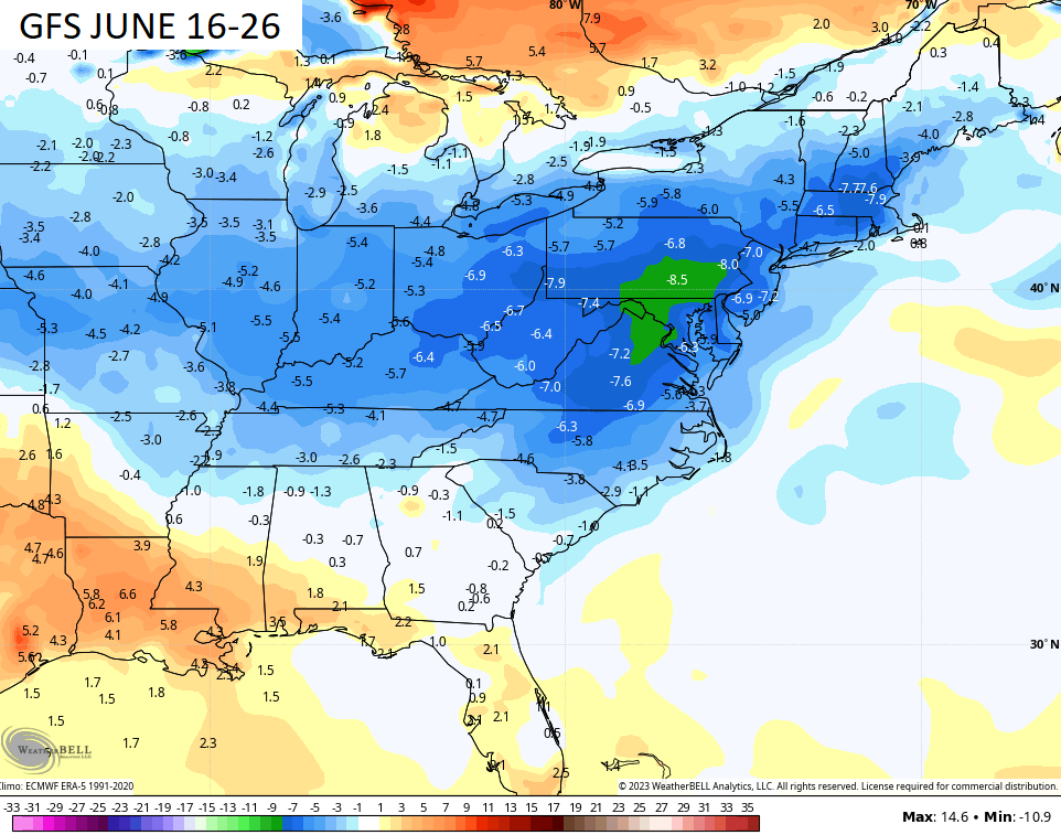
The GFS is then throwing additional below normal numbers as we get deep into the month. Here are the 10 day departures from normal…
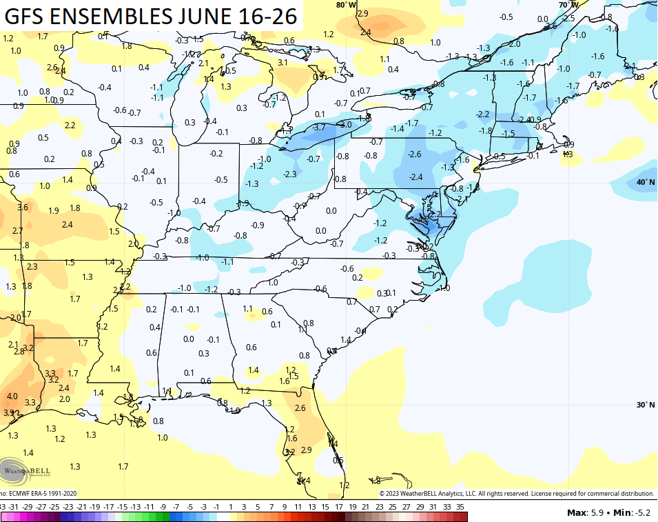
The GFS Ensembles aren’t as cool but they do show slightly below normal for the same time frame…
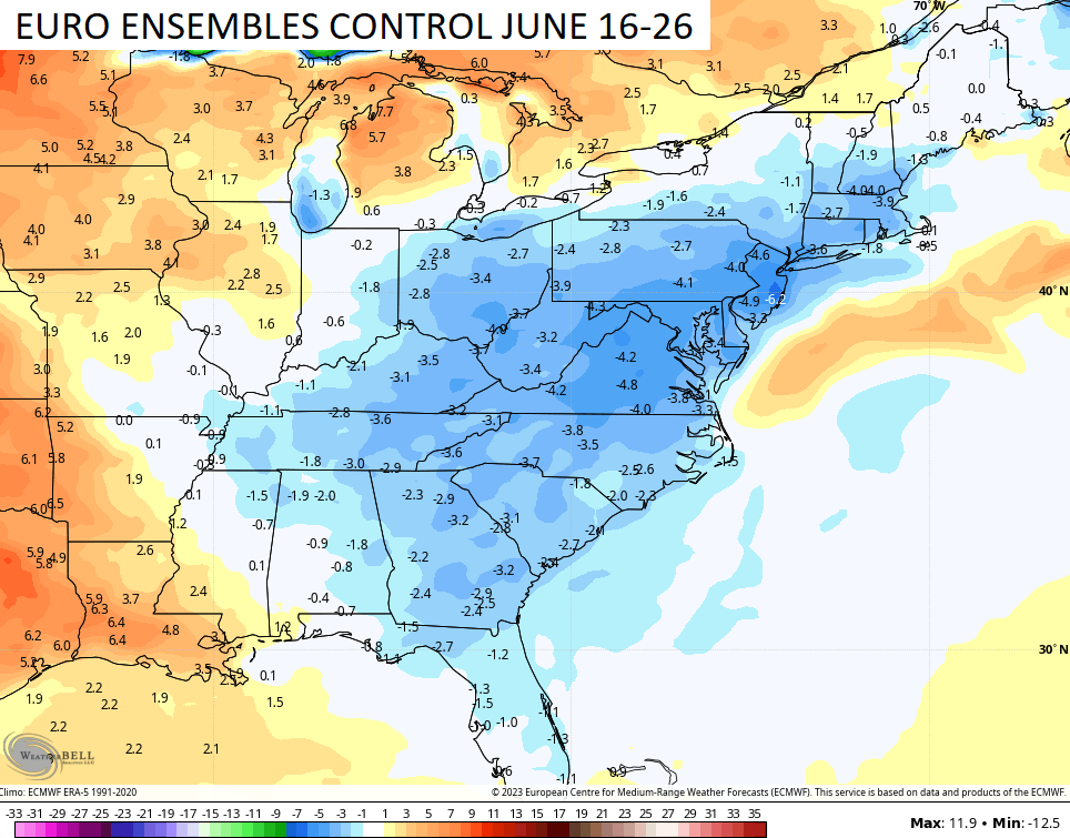
The control run of the EURO Ensembles is a closer match to the operational GFS…
It’s really difficult to get really hot summers during El Nino years and, so far, 2023 is following along the temp trendline.
Make it a great Monday and take care.

This “cool” spell isn’t going to last.
Thanks Chris. We received 1.45 inches of Rain late yesterday. Most of the Rain fell in less than 15 minutes. No severe weather occurred here in Maple, but the southern parts of Taylor County had a lot of tree damage, especially down by Green River Lake.
NOAA issued an El Nino Advisory this past Thursday. El Nino condition are now present, but reaction with the ocean and atmosphere is not happening just yet. I was told by NOAA this reaction won’t occur until sometime this Fall and Winter. NOAA also added there is a 5 % chance that El Nino could fizzle. I hope not, because we really need a change in our precipitation pattern.
Schroeder, drop me an email at jaderosa@gmail.com. I have something to share that you may find useful regarding your storm early warning situation.
Joe, I don’t have the know how to send e mail. I’m not familiar with the internet. I’m lucky I have learned what learned. It would be better to share the information with everyone on Chris’s blog.
Here is a simple way to setup an email address. Go to google request an email address. ESP: Schroeder@gmail.com
It would be easier for me if Joe would post the website. Thanks anyway.
Schroeder, regarding your storm early warning situation, I am surprised you don’t have a NOAA weather radio that will alert you with an alarm tone for watches and warnings issued by the NWS. They are programmable, so you can receive alerts pertaining only to your county. Even though you live in a rural area, you should still get good reception.
…and there is a NOAA weather radio transmitter located in your county of Taylor, which covers the entire county.
I am digging the temperatures.
Keep up the good work my dear friend El Niño.
El Nino is NOT causing the below normal temperatures. It’s being caused by the Omega Blocking. Troughs in the extreme West, ridge in the center, troughs in the East. Why we are having this blocking is unknown.
The prolonged dry spell in central Warren County has stretched on for nearly a month, so yesterday’s forecast looked very promising. However, the good soaking we needed never materialized. We ended up picking up a total of 0.13″ of rain, bringing our total for the past 25 days to 0.15″.
Not good…
The rain we received yesterday more or less ran off. It will be back to dry, and maybe hot by weeks end ?