Good Wednesday to one and all. We’ve made it to the middle of a very cool week in the Commonwealth and we have more below normal numbers over the next week or two. This cooler setup will also be accompanied by a few rounds of showers and storms.
We are in the middle of an awesome summer month in terms of temps. My tweet from Tuesday sums it up well…
Our incredibly cool June rolls on. Temps this morning hit the 40s for the 7th time since June 5th. Here are the top 10 coolest from the Kentucky Mesonet. #kywx pic.twitter.com/n5tdzHsuzf
— Chris Bailey (@Kentuckyweather) June 13, 2023
I’ll take this all summer long, folks. The below normal numbers match my thoughts on summer from back in the spring. El Nino summers typically bring us cooler than normal numbers and this year is starting off with exactly that. I must add that a few of my analog years such as 2002 started tame and turned hot by the end of summer. That’s something to keep in mind, but this year doesn’t look anything like that one, so far.
Temps out there today are a little warmer with temps closer to normal. There’s also the threat for a scattered shower or storm going up…

Temps continue close to normal for Thursday as we watch a continued chance for a shower or storm going up.
Another system approaches us by the weekend with a better threat for showers and storms. Western Kentucky might even get in on some of the good stuff this go around…
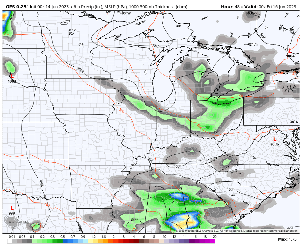
This could be another decent rain maker across our part of the world.
The pattern next week will continue to feature troughs into the eastern half of the country. The chance is there to close off another big upper low near the region…
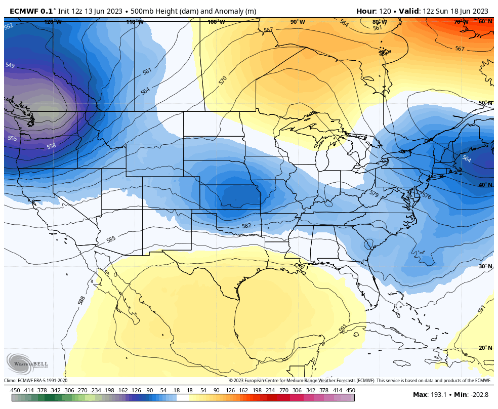
That type of setup would then spin some additional showers and storms into our region…
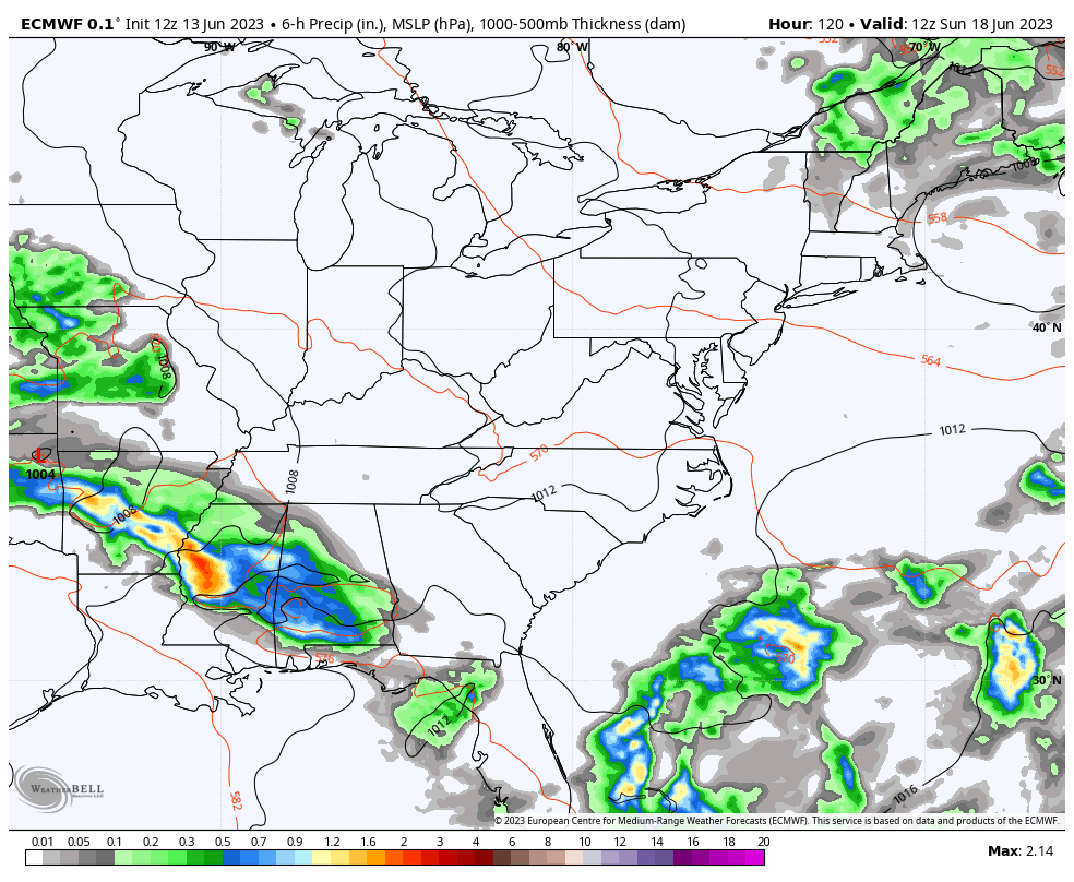
Obviously, temps would stay, at least, a bit below normal.
Make it a wonderful Wednesday and take care.

#TeamSummer #TeamHeat;)
Chris… wouldn’t it be WILD if the entire summer stayed in this pattern?
I would love for it to stay this way. I am enjoying it but I am sure I (think ) that the heat will be coming. I just hope that we don’t have summer all fall.
There’s been some talk about areas where severe weather alert coverage is not the best, so I’d like to tell you about a service I’ve used for the past 15 years. During that time, I’ve never missed a warning for my area. It’s called WeatherCall, and this link explains how it works:
http://www.weathercallservices.net/services/for-your-home
Thanks for sharing Joe. GREAT PROGRAM SERVICE for All !!!
I hope it stays this way too ( temperature wise it’s great ) , BUT we need the Heat and Humidity along with periods of Showers for the Agricultural Industry. We don’t need the crops to fail in these times.
Once again we are in an interesting weather pattern ( Omega Blocking Pattern. ) If this happens when El Nino kicks in this late Fall and Winter. We could be buried in Snow. In an El Nino Winter the Southern tier States tends to be Snowier and Northern States not so much.
Currently, El Nino is present ( El Nino Advisory ), but it’s weak, and the PDO is still holding at negative. It’s still a waiting game as to whether El Nino strengthens or fizzles out and returns to ENSO / neutral or worse back to ENSO / La Nina. I hope this doesn’t occur, but NOAA saids there’s a small chance this may happen. Nothing in Nature is ” carved in stone. “
I predict 25 days of 90-plus degree highs and above normal rain. 🙂
Temperatures around 90 degrees with normal Rainfall would be perfect for the crops.
Another sign El Niño taking shape is the subtropical jet in the South..Today’s severe weather outlook..
https://www.spc.noaa.gov/products/outlook/day1otlk_1200.html
Looks like also El Niño may be strong or moderately high end..May need that to offset the Pacific warm pool..
Yeah, I noticed that on the three day severe weather outlook. El Nino is very weak at the present, and I doubt that ENSO is influencing our Atmosphere this Summer. El Nino really affects our Atmosphere during the late Fall and Winter months. The severe weather predicted for the deep South is just either ‘ bad luck ‘ or is a lag over from this past La Nina event.
2002 to 2003 was a moderate El Nino in place.
For at least the next week, any significant rain is going to be well south of the Chicago Metro Area, as our moderate drought continues. So far this month, the NWS Forecast Office in the SW Suburbs has received only .25 inches of rain.
The last three days have averaged over 10 degrees below normal. It’s a nicer day today, with temps in the upper 70s under partly sunny skies and light winds.
The high here in Maple was 81 degrees under mostly Sunny skies. A stiff breeze out of the Southwest is really drying out the soils. Hoping for Rain / Showers maybe on Sunday, but not a great chance.