Good Tuesday to one and all. We are in one heck of a wet pattern across the region and this doesn’t look to break anytime soon. Rounds of heavy rain producing showers and storms take us through the week with a similar setup possible next week.
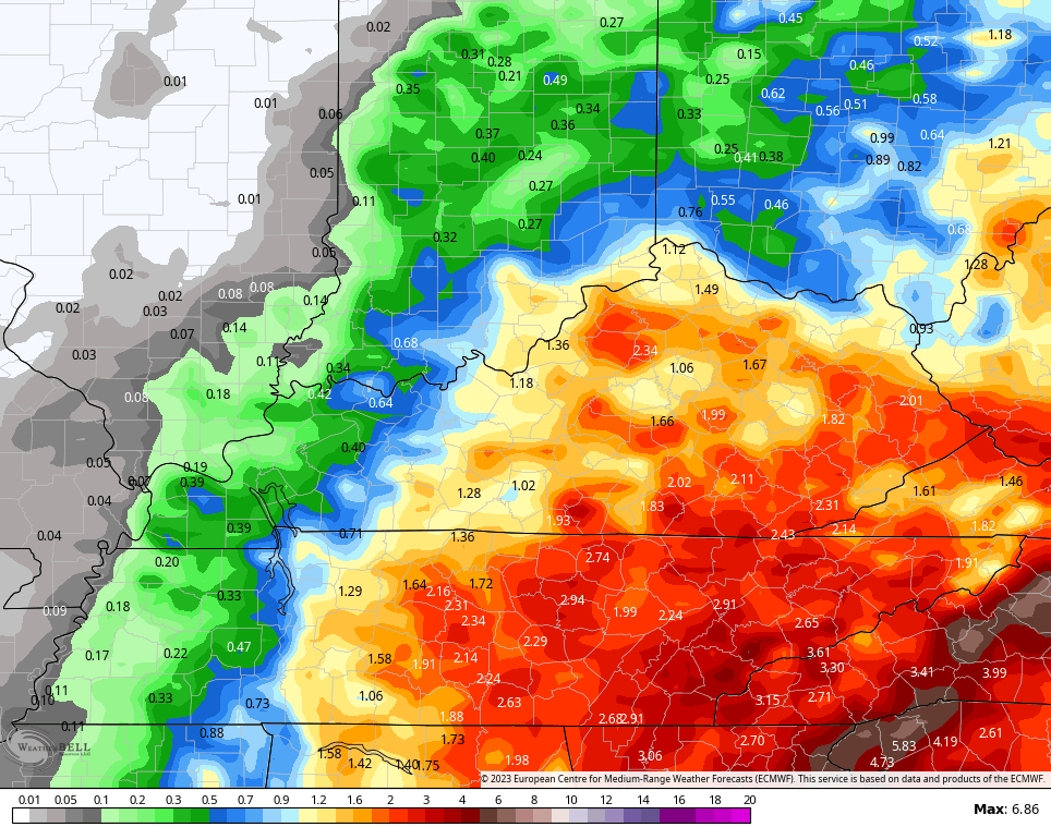
All in all, many of us will pick up more rain in a week than what’s normal for the entire month of June. Some of us are almost there with 1″-4″ of rain already since Sunday.
Rounds of showers and storms are with us once again today with the focus of heaviest rain across the southern half of the state. Local high water issues will be possible once again. Here are your radars for the day…

Our low sinks to the south on Wednesday but it will continue to send showers and storms at us from the east.
The low then begins to lift back to the north on Thursday and will cross the region again by Friday and Saturday. Watch the upper level low spin back in here…
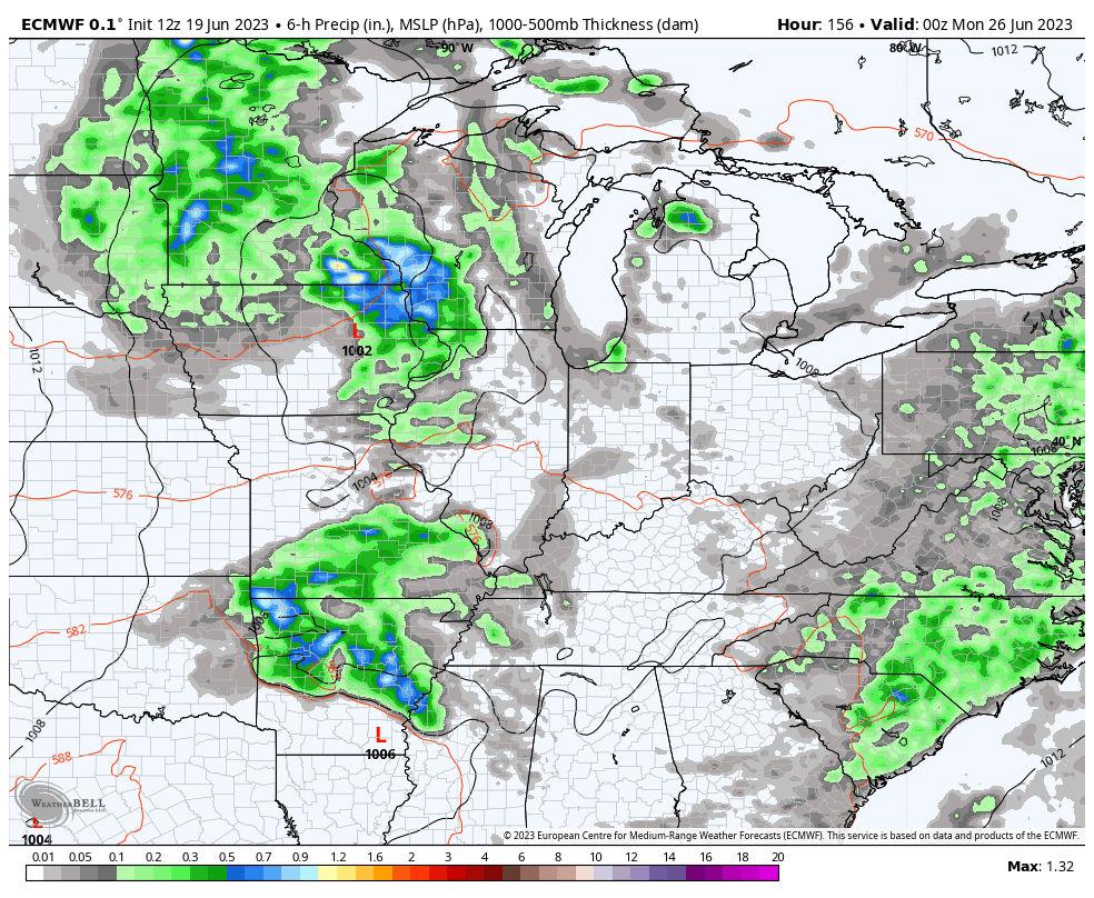
Watch how the heavy rain producing showers and storms ramp back up from Thursday into the start of the weekend, especially during the afternoon and evening hours…
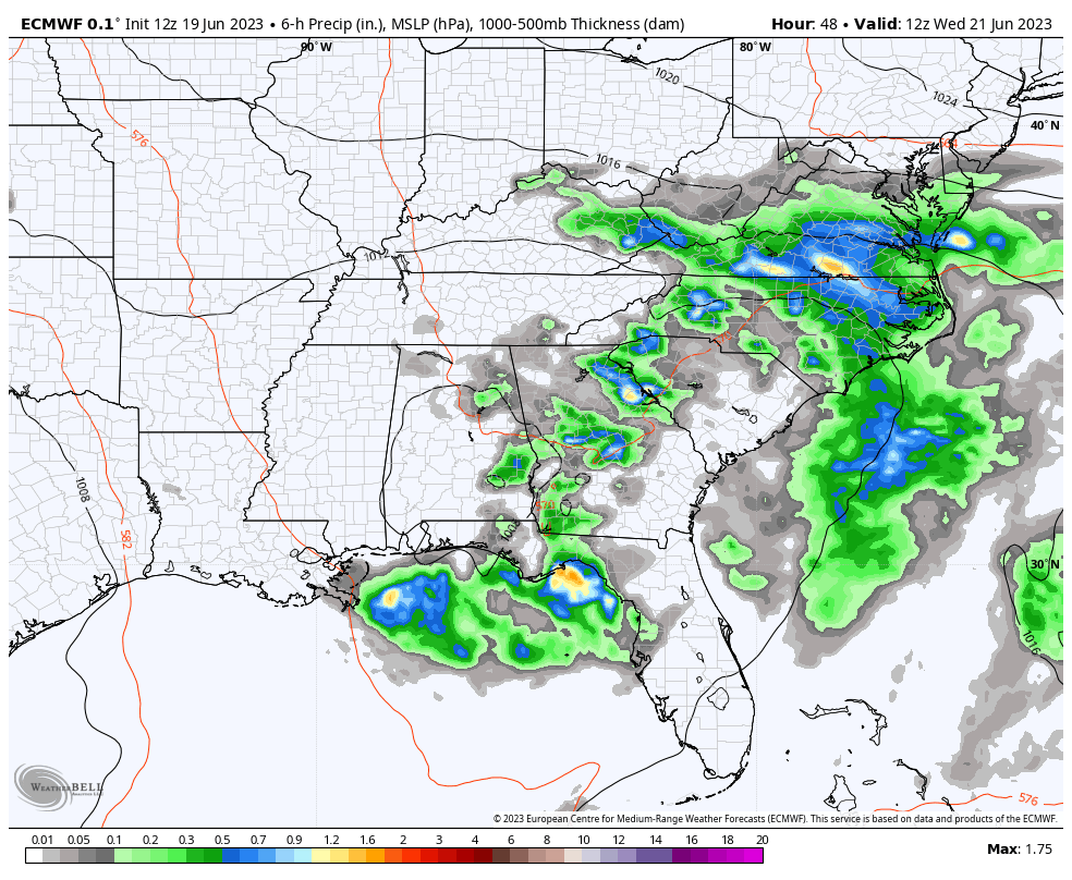
Heavy rain may cause additional high water concerns. The EURO is forecasting another 1″-3″ of rain during this time across central and eastern Kentucky…
This system FINALLY moves away over the weekend but another system looks to drop in for much of next week. This is yet another DEEP trough that can cut off from the main flow. The EURO looks like something we would see in the winter months…
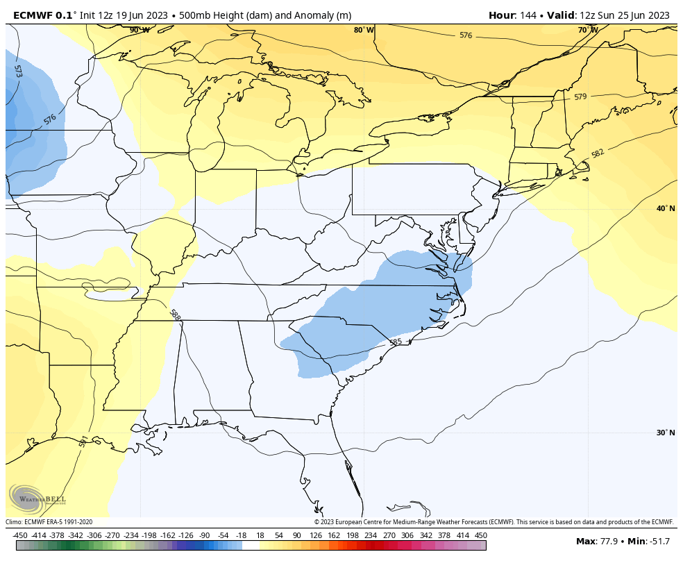
The end result of that scenario is rounds of rain and some storms spinning through the area…
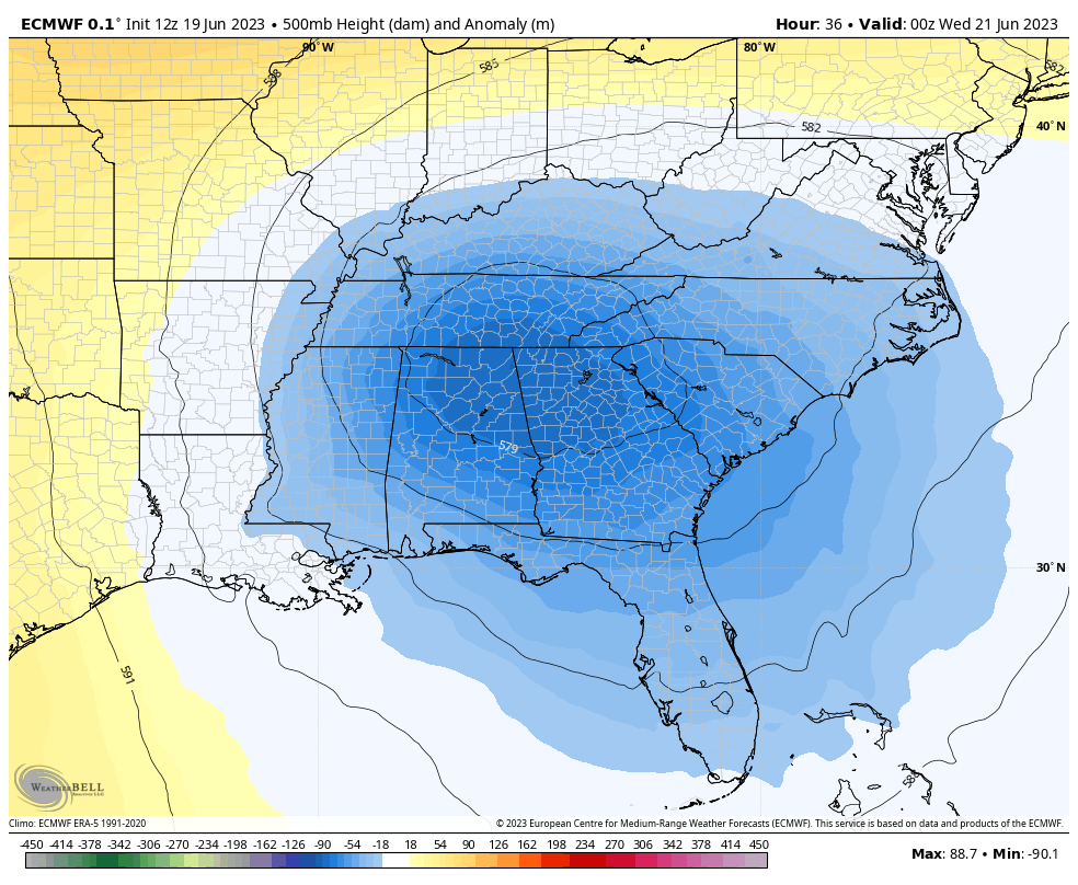
I cannot express just how anomalous this pattern is across the country. This is just another in a long line of extreme weather that’s becoming the normal.
How about a little more extreme coming from the tropics. Brett is expected to become

Brett has a buddy trailing behind and this may also become a named storm…

What makes Brett historic?
#Bret has formed in the central tropical Atlantic – the farthest east that a tropical storm has formed in the tropical Atlantic (south of 23.5°N) this early in the calendar year on record. pic.twitter.com/tx43WbHh8V
— Philip Klotzbach (@philklotzbach) June 19, 2023
This also portends a very active hurricane season. Ugh.
Make it a great day and take care.

1.25 so far in Corbin
Too much rain already. Sick of it.
Tell that to those who Farm for a living, and listen to their reactions Jeff.
Too bad if you don’t like what I have to say.
You could have said : We had enough Rain, but now I would enjoy some drier and warmer Summer weather.
The ¼ inch of rain I recorded yesterday at my PWS just south of Bowling Green is the first measurable precip in the last 27 days, but far less than expected. Maybe, we’ll get a decent soaking today, but I’m not optimistic.
The formation of a central Atlantic tropical system this early in the season is another symptom of our changing climate. It should reached hurricane strength in 24-36 hours, but wind shear in the eastern Caribbean will knock it back to tropical strength. This area of shear will strengthen as El Niño becomes more established.
I never cared for the term ” Climate Change. ” It sounds so definite. In my opinion it is purely political. Man has not been on this Planet long enough to determine such. We can only refer to our Climate in terms of Cycles. For instance, this Fall and Winter we could be in ENSO / neutral or ENSO / El Nino, and the year after that back to ENSO / La Nina.
Only 0.50 inches of Rain / showers recorded by the Mesonet for Maple. We were in the dry sector of the closed low pressure system most of the day. This amount of Rain is only welcome in the short term. I expect the closed low pressure to weaken, and the high pressure ridge to our north will take over, and end the current ‘ Rex Block ‘ finally.
Very difficult to determine what may happen the rest of this month, as well the following months. El Nino still present in the Tropical Pacific, but not yet influencing our atmosphere. I wouldn’t expect this to occur until sometime in the late Fall and Winter.
Tropical Atlantic looks active now, but NOAA is still predicting a ” normal ” Tropical Storm season. We need a Tropical Storm in the northwest sector of the Gulf to give all areas a good soaking rain here in the upper South.
I was very fortunate yesterday it rained the majority of the day at my house.
I was northeast from the center of the low.
1.62” at our PWS just south of the Arboretum in Lexington.
I’m curious. What’s the name of the Arboretum South of Lexington ? I was wondering if they had a collection of the ‘ Schroeder Azaleas. ‘
Schroeder, the Arboretum is called The Arboretum State Botanical Garden of Kentucky. I’ll try to find out about the Azaleas for you.
Thank You Dottie. I am trying to find out if any Arboretum in the State of Kentucky has our Azaleas, and I appreciate your willing to help. Hope all is well with you and your Family.
There is too much scientific evidence at hand from a wide variety of sources to doubt that average global temperatures are rising.
Atmospheric systems have become more energetic, both from an increased temperature gradient and higher levels of available atmospheric moisture, due to increased evaporation.
Agree to disagree with that a*s*sumption. I believe that this ” Climate Change ” theory was manufacture by the left to get their agenda through.
Agree to disagree with that a*s*sumption. I believe that this ” Climate Change ” theory was manufacture by the left to get their agenda through.
Has anyone heard anything about a heat wave that we might get??
Yes in my local forecast, but some indicate that the ridge of high pressure in the center of our country will stay put through the rest of the Summer, putting us on the cooler side of the ridge.