Good Saturday, folks. Temps are climbing a bit and it’s finally feeling more like summer this weekend, but the focus is on the increasing potential of severe weather Sunday and Sunday night. This happens as another deep trough digs into the eastern half of the country.
Temps today surge into the 80-85 degree range for much of central and eastern Kentucky with a scattering of showers and storms going up this afternoon and evening. The west will see temps into the mid and upper 80s and pushing 90.
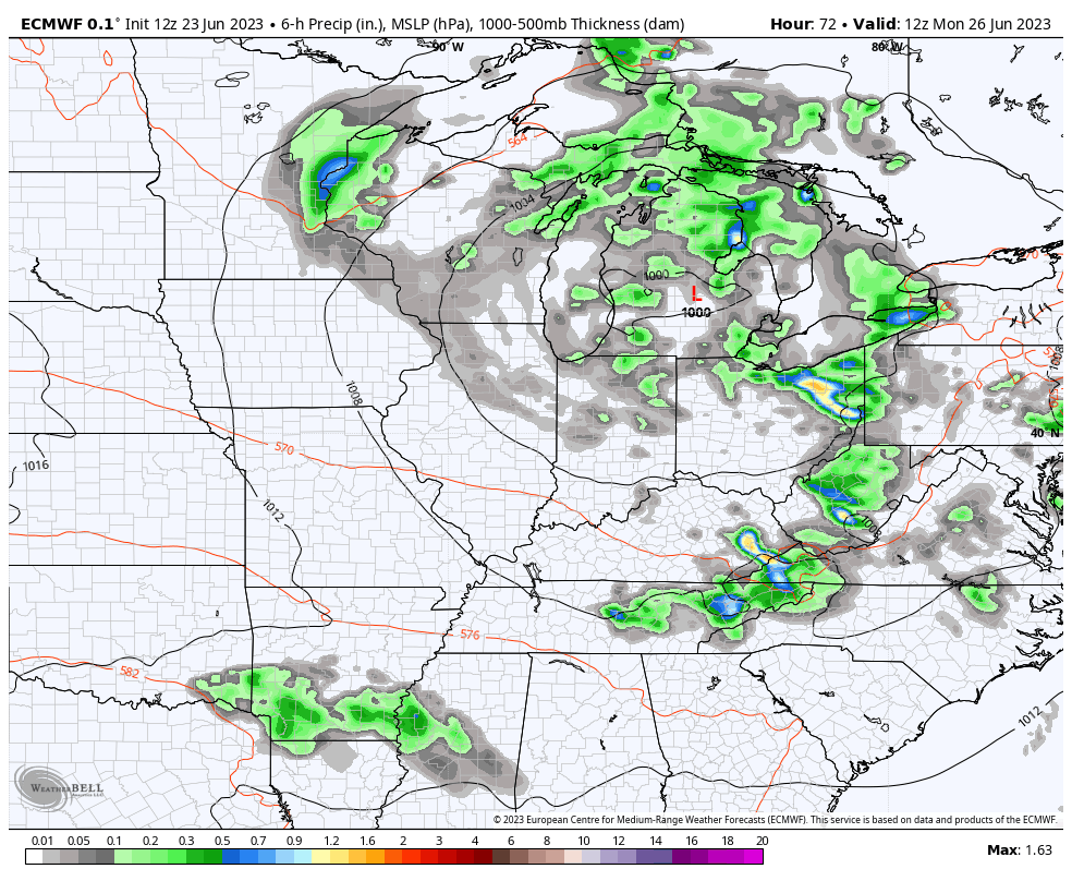
This is ahead of a system dropping in here for Sunday and Sunday night, and it will bring rounds of strong to severe storms into the region. The first cluster is likely to impact the west later tonight and the Storm Prediction Center has the far west in a low-end severe risk this evening…

Unstable air overspreads the state tonight and Sunday and this will combine with the system dropping in from the northwest to increase the threat for strong to severe storms. The greatest threat looks to come from late Sunday into Sunday night and this is when the SPC is upping the severe threat around here…

Damaging wind is the primary threat from these storms…

Large hail is also a good possibility for some…

There’s enough shear available to get some of these storms to start spinning and that could lead to a few tornadoes. Here’s the Tornado Probability map from the SPC…

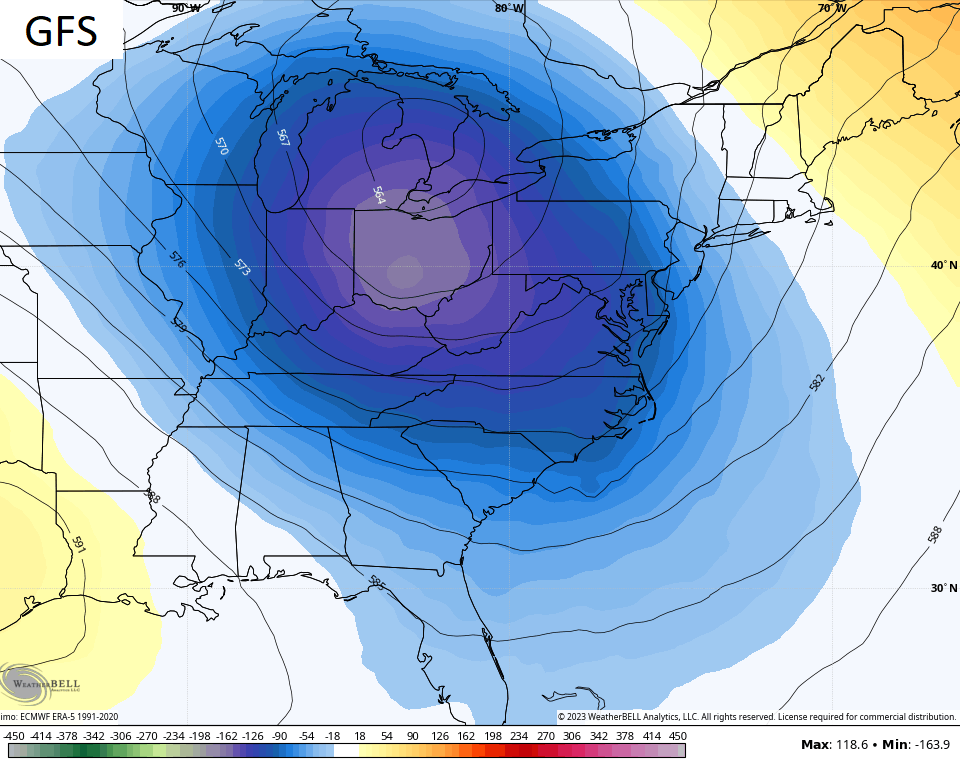
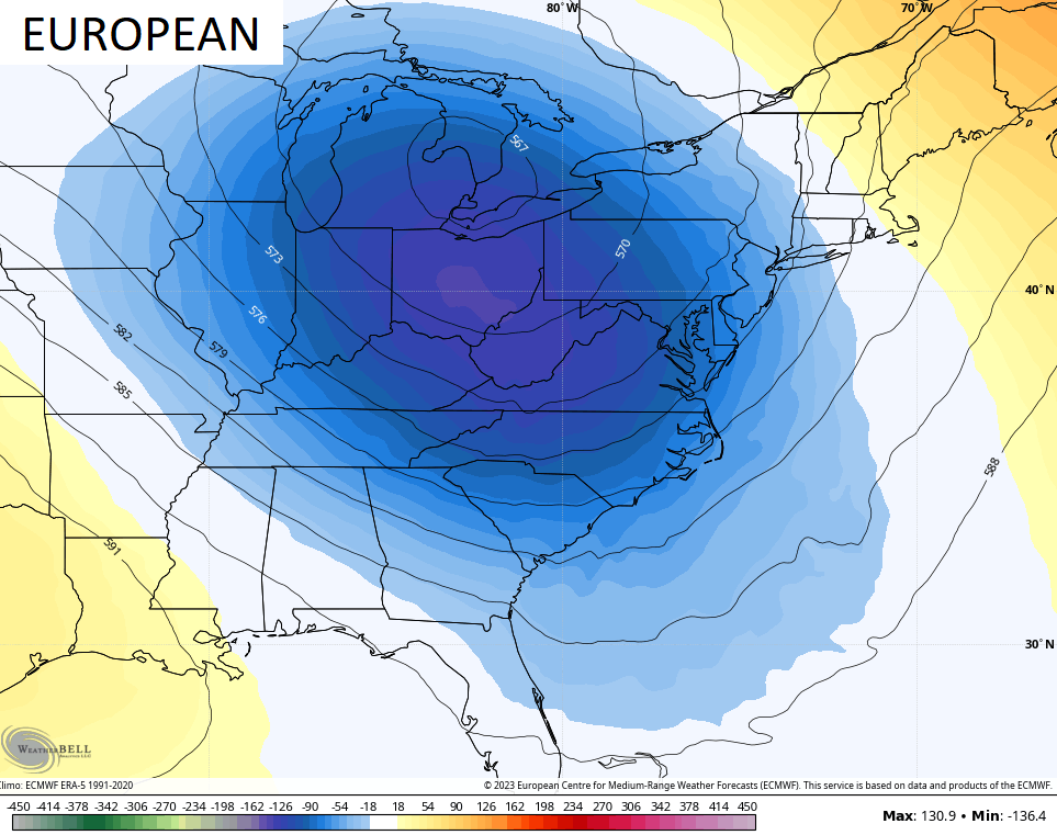
This is ahead of another massive trough sliding in from the northwest. We’ve talked about this for a while now and the operational models are all agreeing on this massive dip in the jet stream…

Much cooler than normal temps settle in behind this system once again for Monday and Tuesday. Highs in the 70s should be common once again with some wraparound showers and thunderstorms…
“Wrap around showers and thunderstorms” isn’t a sentence you hear much of, but the weather isn’t normal and this summer is pretty nuts, so far.
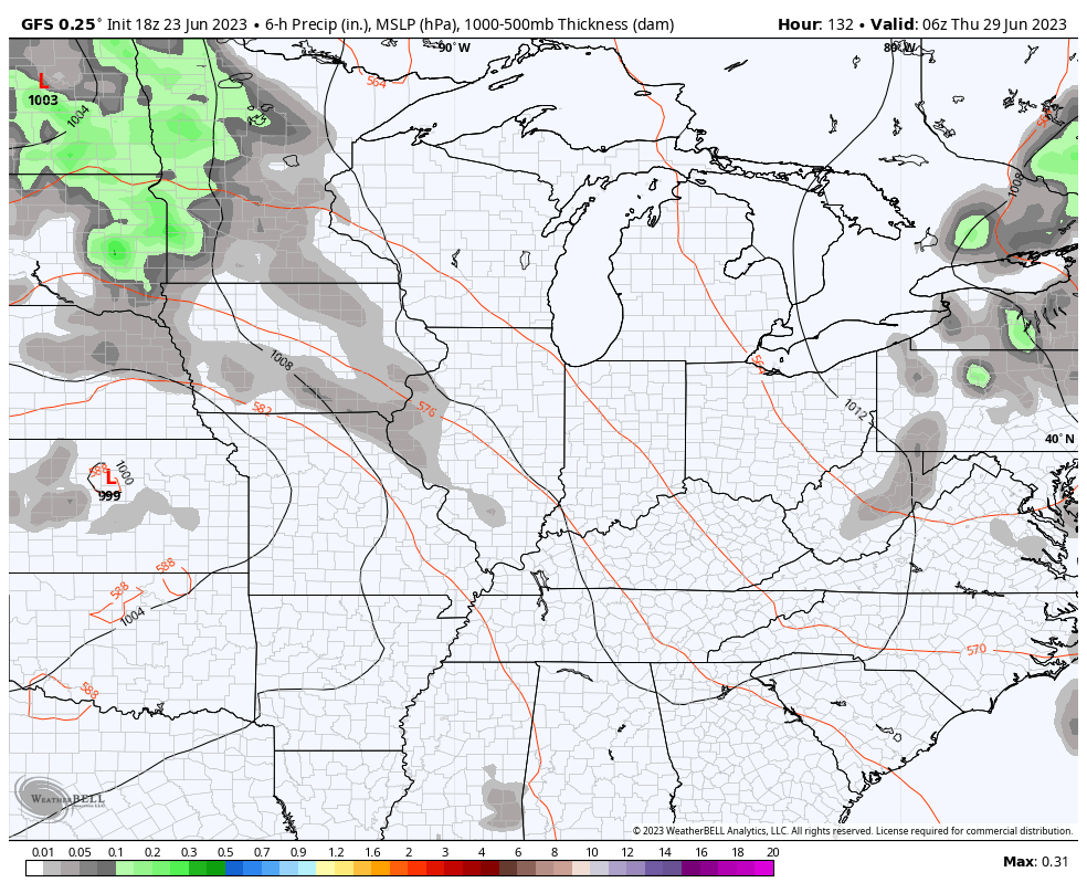
A surge of summer temps will work in from the southwest by the end of the week and this is likely to put us in the line of fire of several rounds of thunderstorms beginning Thursday. This is a “Ring of Fire” looking setup and we will need to be on guard for severe storms and damaging winds for the end of the week into the start of the weekend…
All of this leads to another round of cooler than normal temps to start July. Check out how far below normal we may be over the 5 day period that will make up the 4th of July holiday period…
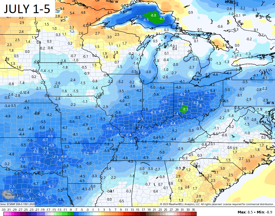
Those are some pretty stout 5 day averages, folks.
I will drop by for another update later today. Until then, here are your radars to follow any scattered stuff in the east and the stronger stuff heading toward the west…

Have a great Saturday and take care.

We had some heavy down pour this evening before dark or late afternoon just didn’t last very long still was glad to get it. Will be on the look out for the severe storms we may very well get. I have heard several weather persons talking about this including Chris. Chris looks like you might Be busy more then normal.
First time in a long time that all the models are in agreement. Hope this Winter they will agree 100% on Snowstorms in our area. My confidence on what may happen tomorrow is about 20%. What happens next weekend about 10%. Still waiting on that good soaking rain. Today looks like a great Summer day, after a brief foggy morning.