Good Friday, everyone. As low pressure FINALLY begins to pull away from us, our rain chances are going down to start the weekend. Never fear, we still have some scattered stuff and there’s another system rolling in by late this weekend and early next week.
Folks, it simply doesn’t get much cooler in the summer than what we’ve been dealing with this June. Guess What? Cooler than normal temps look to continue.
Today features much warmer temps, especially in the west with temps in the 80s. The eastern half of the state will be in the 70s with more clouds and those scattered showers and storms going up in the afternoon an evening. Here are your radars to follow along…

Saturday will see a few more showers and storms firing up across the eastern half of the state as low-level moisture remains. Once again, this looks scattered but will keep the temps much cooler than the toasty west.
The system moving in late Sunday and Monday may throw a few strong or severe storms into the western half of the state early Sunday with a greater severe threat farther east Sunday night.. The Storm Prediction Center is highlighting this potential…

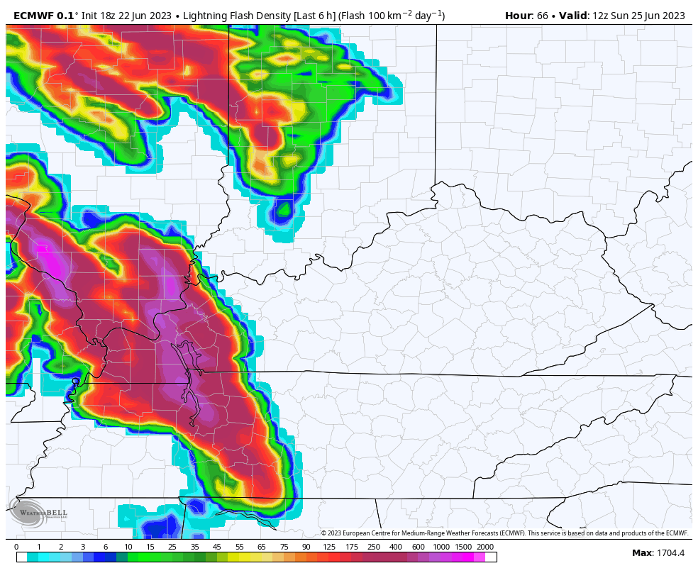
Check out the lightning from 8am Sunday through 8am Monday…
This severe threat is on the leading edge of another deep trough slowly rolling through the region into the first half of next week…
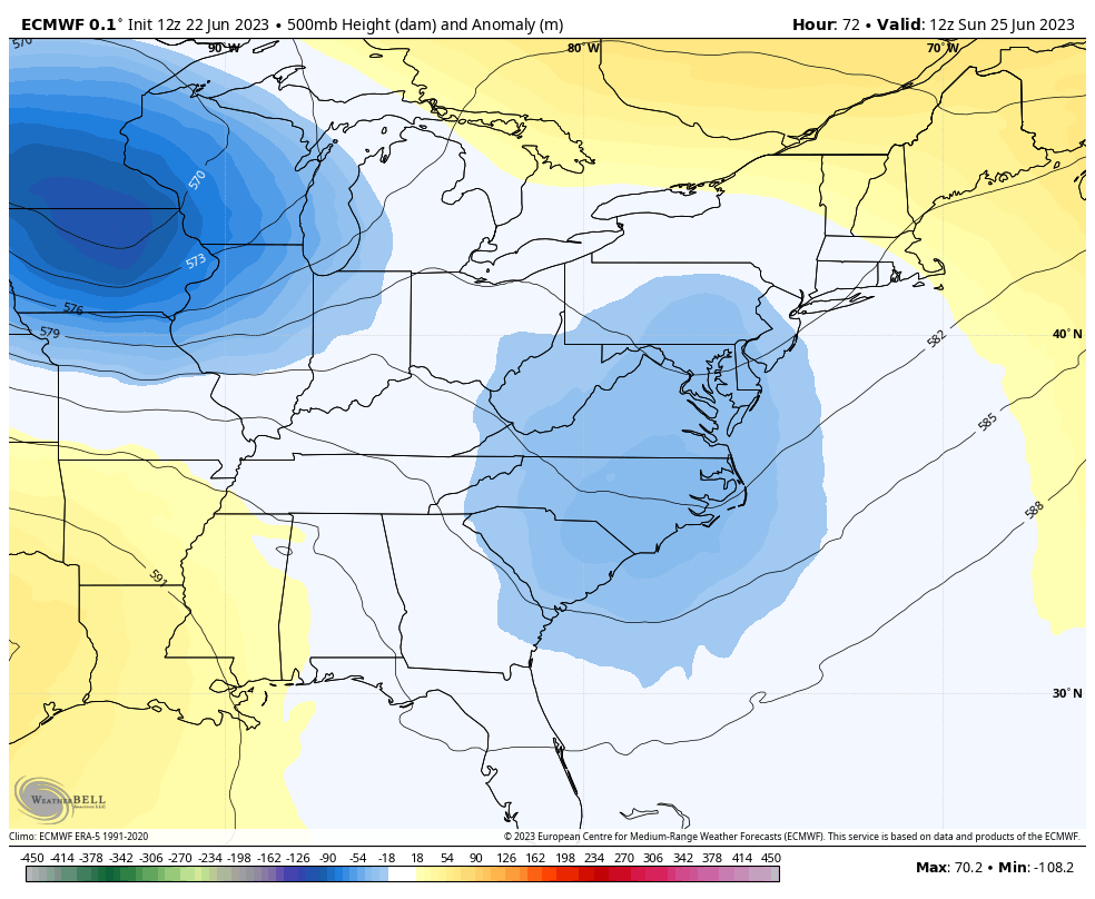
Again, that’s a winter looking setup and it’s one likely to bring cool winds and a few more showers with it from Monday through early Wednesday. Watch this northwest flow kick in…
Tuesday has a chance to be as cool as what we just had on Thursday. 👀
That trough lifts out by late next week as a quick-hitting surge in temps shows up by Thursday and Friday. This may also spawn some strong to severe storm clusters that would rumble through here before the next trough digs in.
This one has been all over the Ensembles for quite a while and it’s now showing up strongly on the operational models like the GFS. Check out this trough to kick off the month of July…
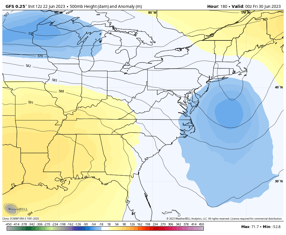
Additional rounds of showers and storms will be noted as that swings in here and will likely interrupt some 4th of July holiday weekend plans.
The tropics are alive and kicking early this year with two systems in the Atlantic basin. Neither should impact the United States…


Have a fantastic Friday and take care.

It won’t be this “cool” and rainy all Summer.
I’ve seen cooler Summers. Cool enough to wear sweaters and jackets at a Fourth of July picnic.
The Rains we had this past week definitely helped the local crops, But the moderate drought still lingers ( low soil moisture. ) Not expecting much relief in the next few weeks. Basing this on how previous frontal Rains have behaved these past few years.
If the upper level High to our West bridges with the Bermuda High to our East, we would have a Heat Wave to deal with, so I hope the troughs in the Eastern third of the country continue through the Summer, Fall and Winter.
A new article is out on the progress of ENSO. Now their saying the above SST in the Atlantic may hinder the development of El Nino ? It’s all connected Folks. I don’t think that El Nino will start affecting our Atmosphere until the PDO turns positive. That’s the way it worked in the past. The PDO is still negative at this time, so we are still in ENSO / neutral, but El Nino is present. Confused ? I am.
NOAA says that El Nino will cause the Earth to warm to near record levels. They give El Nino only one season, before returning back La Nina the following Fall and Winter 2024-25. Then the Earth cools. I’m just waiting to see what really happens.
https://www.climate.gov/news-features/blogs/how-do-noaa-scientists-predict-annual-global-temperature-ranking-ahead-time
I am curious is it possible to have summer time Clipper type systems coming through. We definitely have a northwest flow.
Clipper systems are rarely seen during the Summer months, as the Bermuda high, which by this time of year is usually well established, would push the systems far to our North. This current setup is not typical, so anything is possible.