Good Monday to one and all. Our week is starting off with tame temps and some storms dropping into the region. As the week wears on, temps start to sizzle a little bit with a few more thunderstorms rumbling about the region.
Let’s kick things off with what’s going on out there today.
Temps today are deeper into the 80s with a mix of sun and clouds. We are watching for scattered showers and storms to blow up, especially during the afternoon and evening. The future radar from the HRRR show clusters of storms dropping into central and eastern Kentucky during the evening into the overnight. This animation starts at 2pm today and goes through 8am Tuesday…
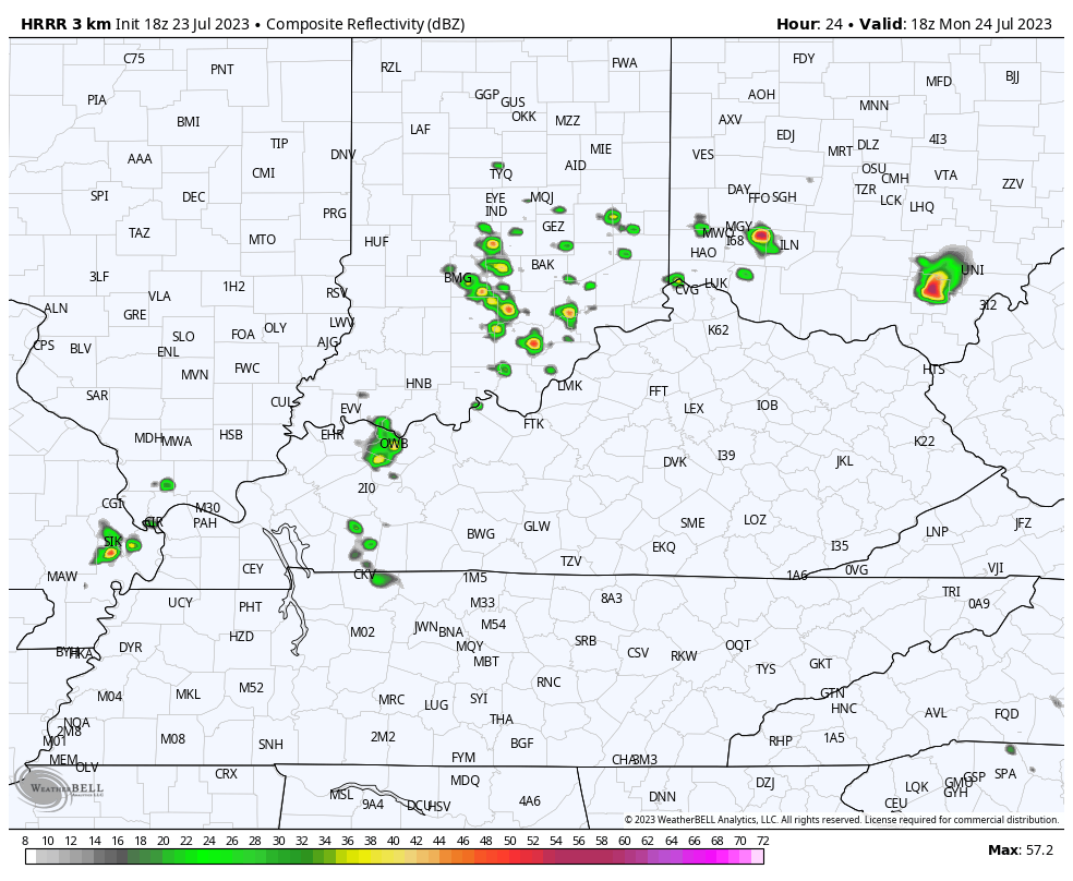
Local severe storms are possible with this. Here are your radars to follow along…

Scattered showers and storms will be around for the rest of the week as the heat across the plains makes that expected run at us. Highs can reach the upper 80s to low 90s across central and eastern Kentucky later this week with the numbers in the west possibly going above that. The wet ground and lush vegetation are both at work here and may very well keep the numbers on the lower end of all this. Those scattered storms will also have a say.
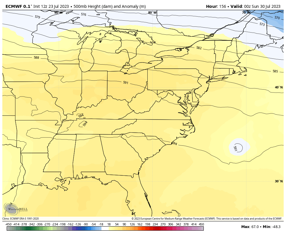
I always tell you guys that any surge of heat that begins with storms isn’t likely to lock in for the long haul. The EURO is going toward another deepening trough early next week as we close out July and begin August…
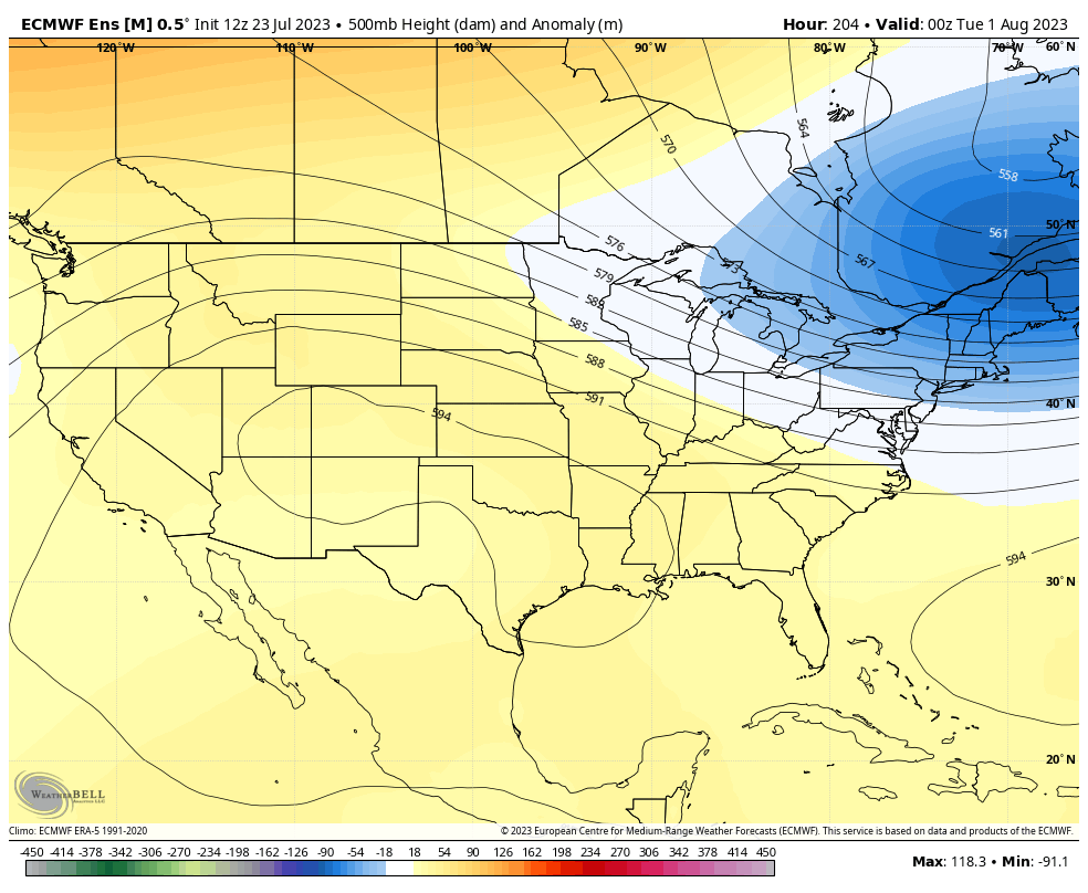
The EURO Ensembles are also going for that trough digging into the east through the first week of August…
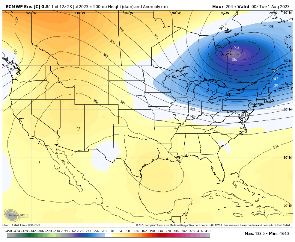
The Control Run of the EURO Ensembles is even more pronounced with that trough…
We will also need to watch the tropics during this time as we may have a system developing and heading toward the Caribbean…

Make it a great Monday and take care.

Thanks Chris. With the predicted ” Hot Days ” ahead I hope there are afternoon and evening thundershowers around to give us a daily break from the heat. I hope the European Models are correct with the trough.
Yes… if any clouds develop in the afternoons (even party cloudy) makes a significant difference than if it’s totally clear with full sun. Whether you get rain or not.
The Hurricane Center has reduced its odds on the development of that Caribbean tropical wave from 75% to 20%. This is due to shear in the lower Caribbean, along with steering winds in the western Atlantic taking a northerly track at the surface and mid-levels.
Looks like this week could be the hottest week of the summer so far in the 90’s through Sunday. Just what Jeff order.
This is not what the doctor ordered. LOL