Good Sunday, folks. We continue to see nice temps taking shape out there today as we watch for a storm or two to impact parts of the area. As we roll into the week ahead, we find an increase in temps and storm chances for the middle and end of the week.
As always, we kick things off with what’s going on out there today. Temps are pleasant once again with upper 50s to low 60s to start and low to middle 80s this afternoon. A mix of sun and clouds will be noted with with the chance for a shower or storm rolling in from the northwest this afternoon and evening.
The best chance for these will be across the west and north, and your friendly radars are on standby to help you through the day…

Temps come up into the week ahead as some steam makes a run at us. That may get cut off at the pass again by some thunderstorms dropping in from the northwest. I’ll take a look at that with an update later today.
Let’s take a look toward August and see what the CFS is currently thinking. The model continues with an area of below normal temps…
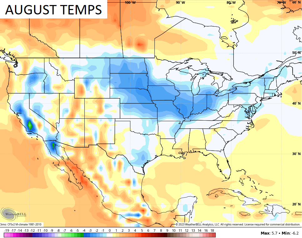
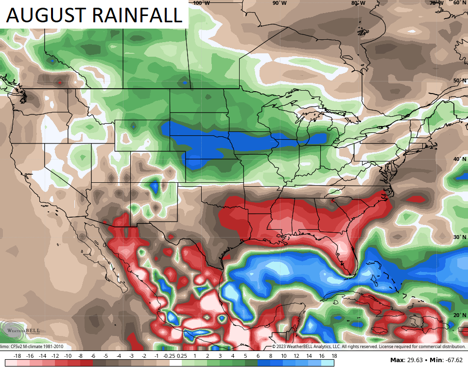
Check out how the rain forecast matches up with the same area forecast to be cooler than normal…
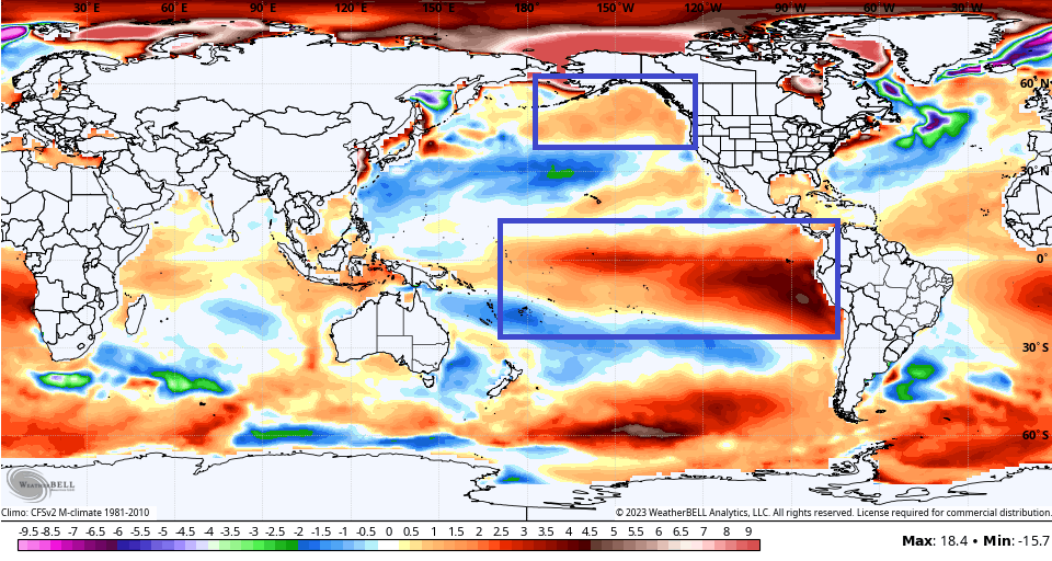
Looking deeper down the road into the winter months, we are still likely looking at a Moderate to Strong El Nino. Several models threaten to take this into Super El Nino status like 2015 and 1997.
The latest CFS shows this strong Nino and also shows a healthy pool of warmer water in the Gulf of Alaska…
That should make for quite the winter battle between those two.
Enjoy your Sunday and take care.

Still a hot summer to be had.
Jeff looks like 90′ s will be back later next week
Thanks Chris. I’ve had enough Summer. Ready for a cool and colorful Autumn, and a cold and Snowy Winter. Hopefully like the one I experience in 1969 – 70. That Winter we had a foot of Snow that fell on Christmas Eve, and another foot of Snow fell on New Years Eve. How perfect is that ? This event occurred at home in South Central Indiana. I’m hoping that we receive the predicted El Nino Winter, and the same occurs here in South Central Kentucky.
Wouldn’t a Super El Niño be the same as a Normal El Hombre?
A big exception in our current Sea Surface Temperature Anomaly chart compared with historic charts is the large pool of warmer than normal water in the northern Pacific, from Japan to the Gulf of Alaska.
The warm water causes ridging, pushing the Polar Jet northward, which subsequently dives to the south over Canada, and brings outbreaks of very cold air into central and eastern US. Combine this with a strong El Niño, and Winter around here could get very interesting!
I hope it does get interesting Joe