Good Tuesday, folks. It’s a steamy day across the Commonwealth as a few scattered storms join the fun. Temps get set to do a little late July sizzle in the coming days before a strong cold front sweeps in by early next week.
Temps today range from the middle 80s east to the low and mid 90s west. Humidity levels are up there and that will help fuel a few storms to go up as the day wears on. Here are your radars to follow anything that blows up…

Storms today won’t be nearly as widespread but we will see some scattered stuff going up. This same trend will be noted through the rest of the week as temps start to sizzle just a bit. This is the first time all summer we will likely have some typical summer heat.
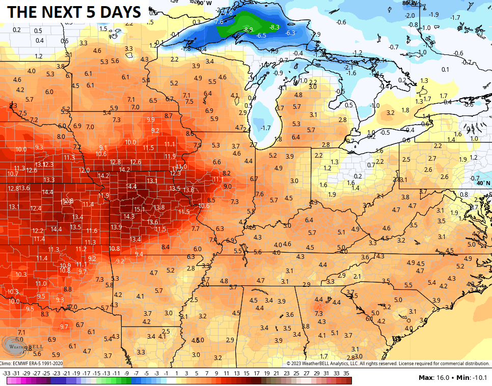
Highs hit the 90-95 degree range over the second half of the week into the weekend. While our numbers will be above normal, the core of the heat stays to our west. Look how far above normal temps are over the 5 days across Missouri…
A cold front drops into the region late this weekend and early next week. We need to watch the setup during this time because it may very well put us back into the zone of northwest to southeast tracking rounds of storms…
That’s a setup we’ve seen several times before this summer.
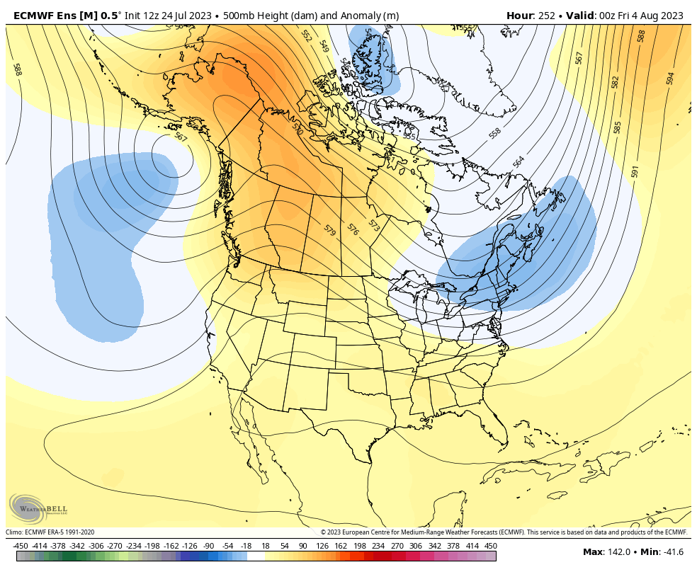
The EURO Ensembles continue to advertise that trough returning to the eastern half of the country in early August…
Have a great day and take care.

My ac is going to be working overtime.
My AC units are over 16 years old. I just hope they hold up through the duration of the heat wave. Really ready for Fall and Winter and I bet Chris and others on the Blog are too. Jeff you were right on when you said some weeks back that the heat of Summer would come. I just hope it doesn’t wear out it’s welcome and continue into our Autumn months.
I don’t think we get much rain this weekend.
I agree.
A buoy in Manatee Bay, between South Florida and Key Largo, has registered record breaking temperatures that exceeded 100°F during a 3-hour time span Monday night, and was recorded at a depth of 5 feet. Any tropical storms that develop in the Gulf could undergo explosive development.
Very interesting and WOW !!!