Good Sunday, everyone. Strong to severe storms and heat and humidity have been ruling the weather around here for the past several days. As we look into the week ahead, we find a much cooller pattern settling into the region. This is also calm to start the new month, but more storms are lurking.
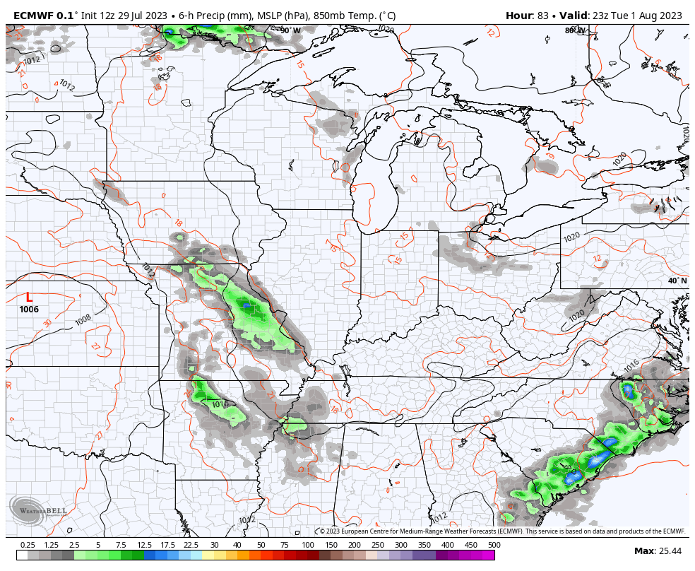
Temps out there today are generally 85-90 for many as a cold front drops through. Scattered showers and storms will go up once again with the greatest concentration across the west and south. There’s a very low-end risk for a few severe storms in these areas.
Your friendly Kentucky radars have had quite the workout of late and are still on duty to track whatever is out there today…

Cooler and drier winds blow in for Monday with just a small chance for a leftover shower or storm to go up. Highs are in the 80s and we will keep those low and mid 80s going into the first day of August on Tuesday. That’s a day that may actually start out in the 50s across central and eastern Kentucky.
Temps stay in the normal range for the second half of next week and into the weekend as we start to fire up the storm train once again. Rounds of storms will come at us from the west and northwest during this time and that may last into the first part of the following week.
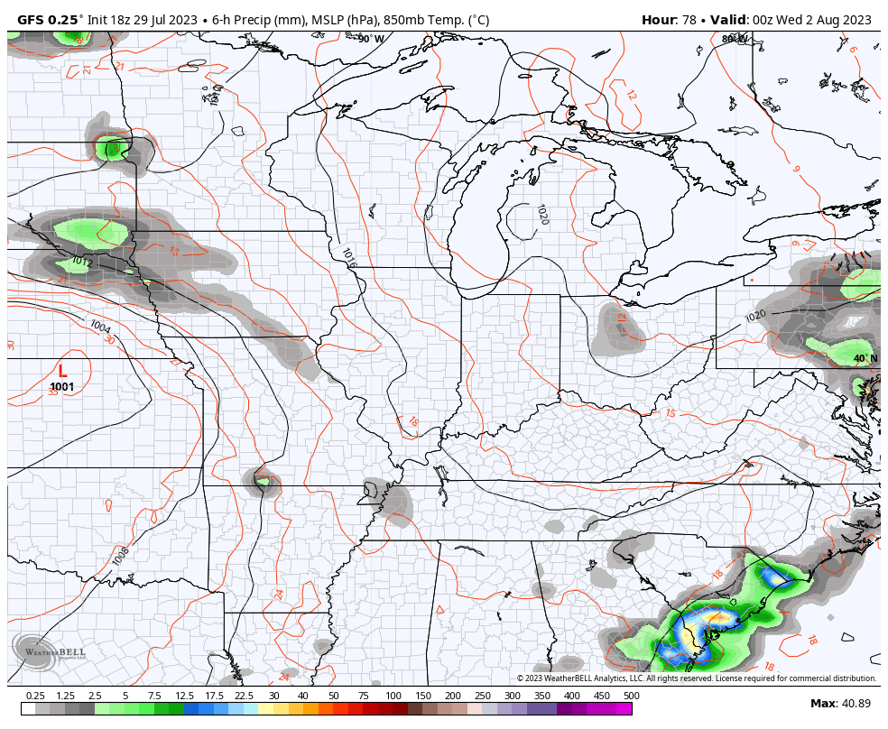
The forecast models are all seeing this pattern very well…
EURO
GFS
CANADIAN
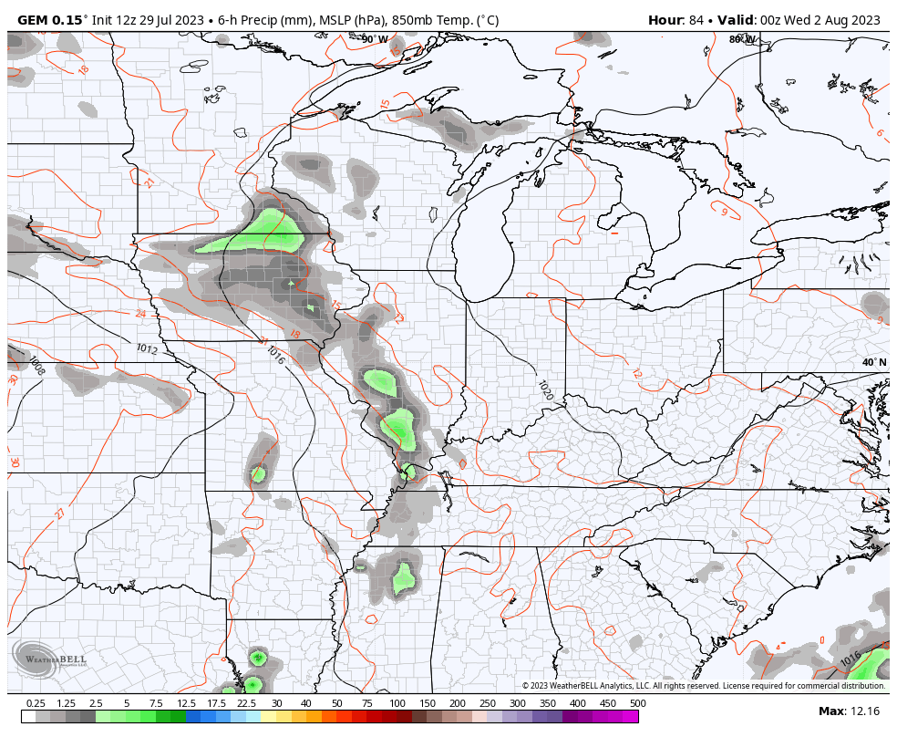
This setup needs to be watched as it can certainly produce some healthy rains and even some severe weather.
The models are also in very good agreement on the overall pattern shaping up for the first full week of August. The week of the 7th looks to feature a big trough across the central and eastern half of the country.
Check out this agreement…
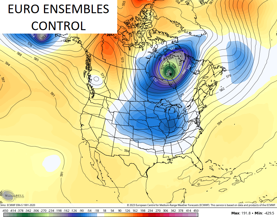
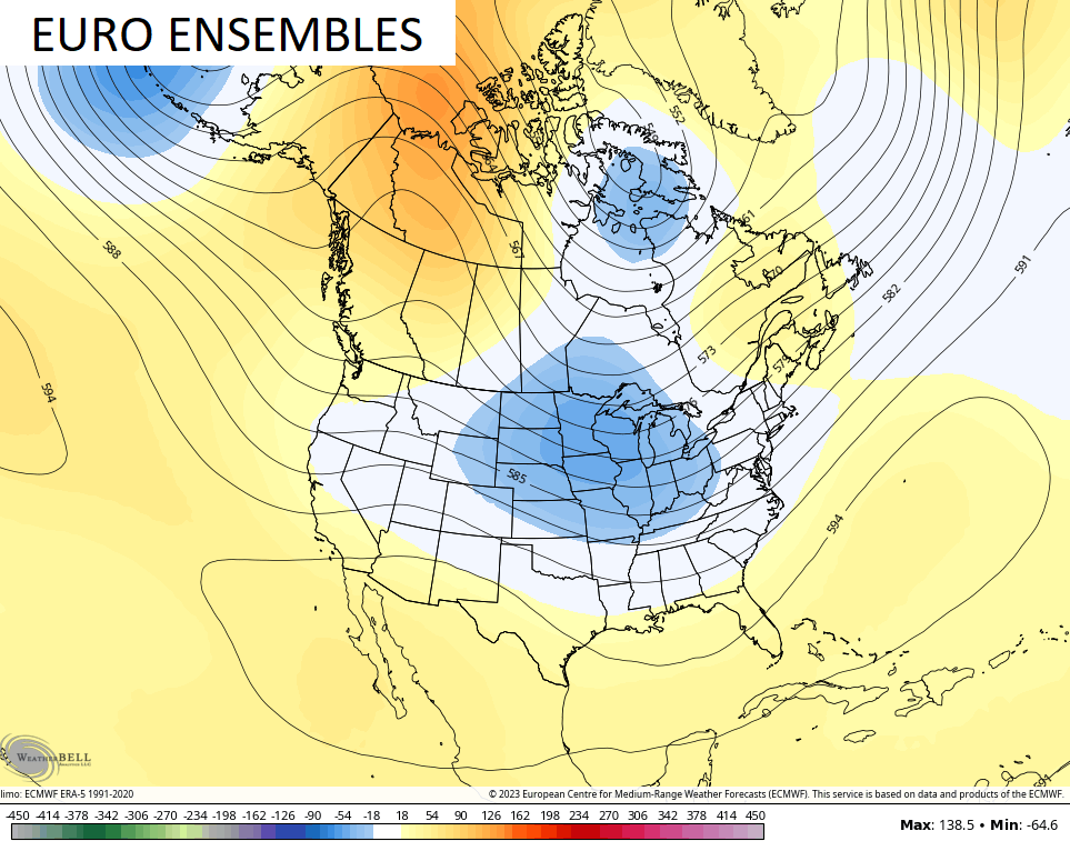
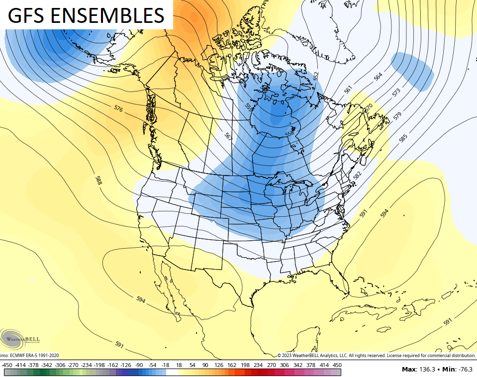
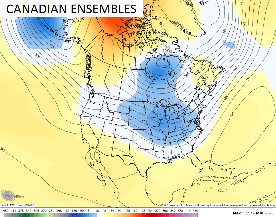
Much cooler than normal temps are likely with a trough like that.
Have a sensational Sunday and take care.

Just because the ensembles agree doesn’t mean they’ll be right.
I wish the various ensembles would use the actual maps instead of the anomaly maps. I want to know what’s really happening in our atmosphere.
Here’s the explanation for the above :
https://www.worldclimateservice.com/2021/08/23/probability-vs-anomaly-forecast/
I learned something while scrolling through Twitter/X. The insane high dewpoints in Iowa is because of the CROPS (called corn sweat).. Even still, at the mesonet our dewpoints were insanely high too… 78 and some places 80..
We completely missed all the rain/storms over the past couple of days here in Lexington.
I think the max heat index was 106… Still KLEX is always between 2 and 4 degrees warmer than mesonet
Just as temperatures continue to rise globally, a companion uptick in evaporation is driving up dewpoints, leading to insane heat index readings. My PWS near Bowling Green has recorded at least 3 instances this Summer where heat index readings exceeded 120°F!
The National Hurricane Center has targeted another tropical wave in the central Atlantic for development into a tropical storm>hurricane. But as El Niño continues to increase its influence on steering currents, the Center forecasts the system to veer to the north, making landfall highly unlikely.
This might be the only upside with the climate pattern we are in this summer.
The oceans temperatures are beyond normal.
If any hurricane does form ( threatens land)it’s probably going be a monster of a storm.
Here is the link for the summary of Friday night’s severe weather that occurred in the Chicago Metro Area. The oppressive near 80-degree dew points during the day did lead to explosive thunderstorm development in the evening. Four tornadoes were confirmed in the SW and S Suburbs. Also, a Severe Thunderstorm Warning for the SW Suburbs in the late evening was designated as a rare EDS (Extremely Dangerous Situation) by the NWS, due to winds in excess of 80 MPH.
https://weather.gov/lot/2023_07_28_SevereWeather
Wow 4 Tornadoes this weather is wild!! I bet if or when we do have a hurricane this year it will truly be wild. I never want to be in another one ever and the one that hit where we were was just a cat 1