Good Tuesday and welcome to August!! We’ve made it to the final month of Meteorological Summer and things are starting off on an awesome weather note. Changes are brewing for the rest of the week as rounds of storms look to target the area.
Temps out there today start in the 50s across central and eastern Kentucky with afternoon highs in the low and middle 80s. Humidity levels will be low with a mix of sun and clouds.
There is the chance for a few showers and storms impacting far western Kentucky and your friendly Kentucky weather radars are here to keep you company…

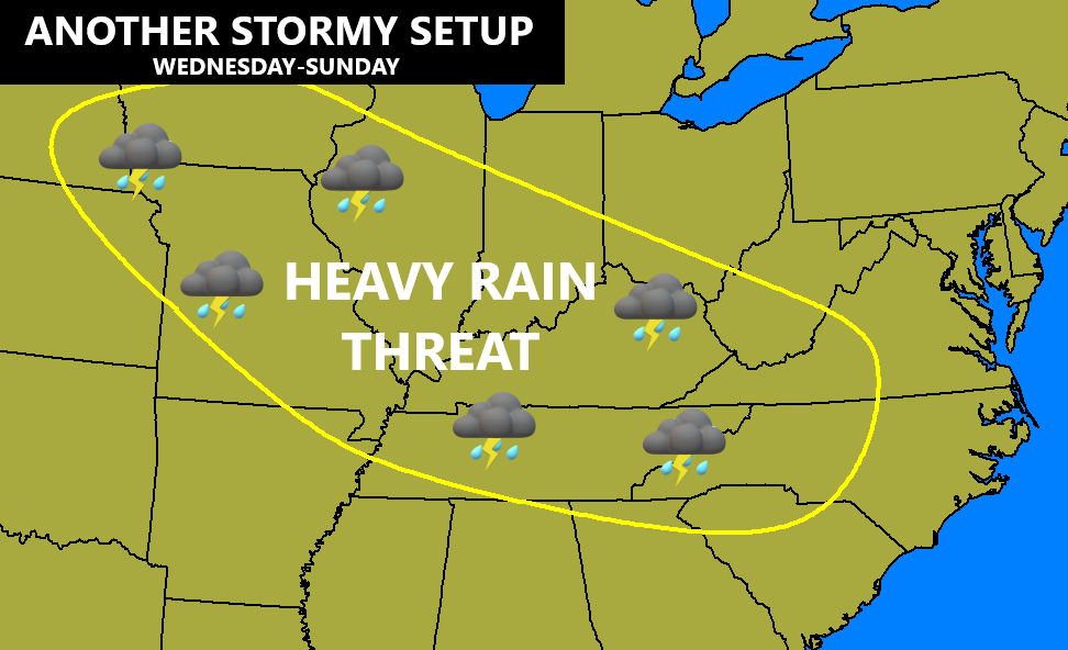
The threat for thunderstorms will then increase a bit in the west for Wednesday while the rest of the state continues with more in the way of nice weather. This kicks off a pattern of big storms coming in from the northwest to the southeast from late week through the weekend and into early next week…
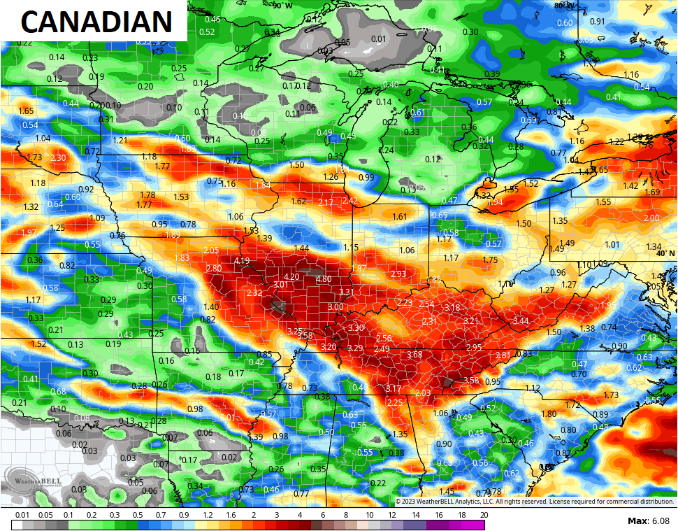
The forecast models are going to struggle mightly with the placement and timing of these storm clusters.
The Canadian seems to be the most consistent with the corridor of storms…
Once into next week, we will see a full blown trough developing across the eastern half of the country. Once again, we find good model agreement on this…
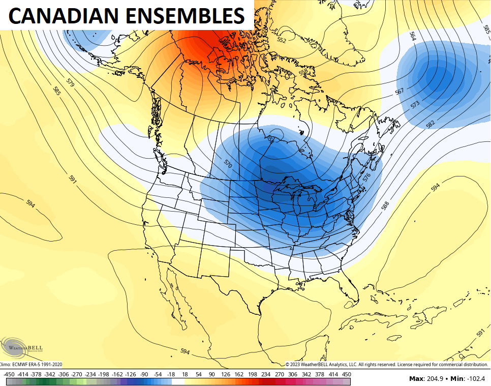
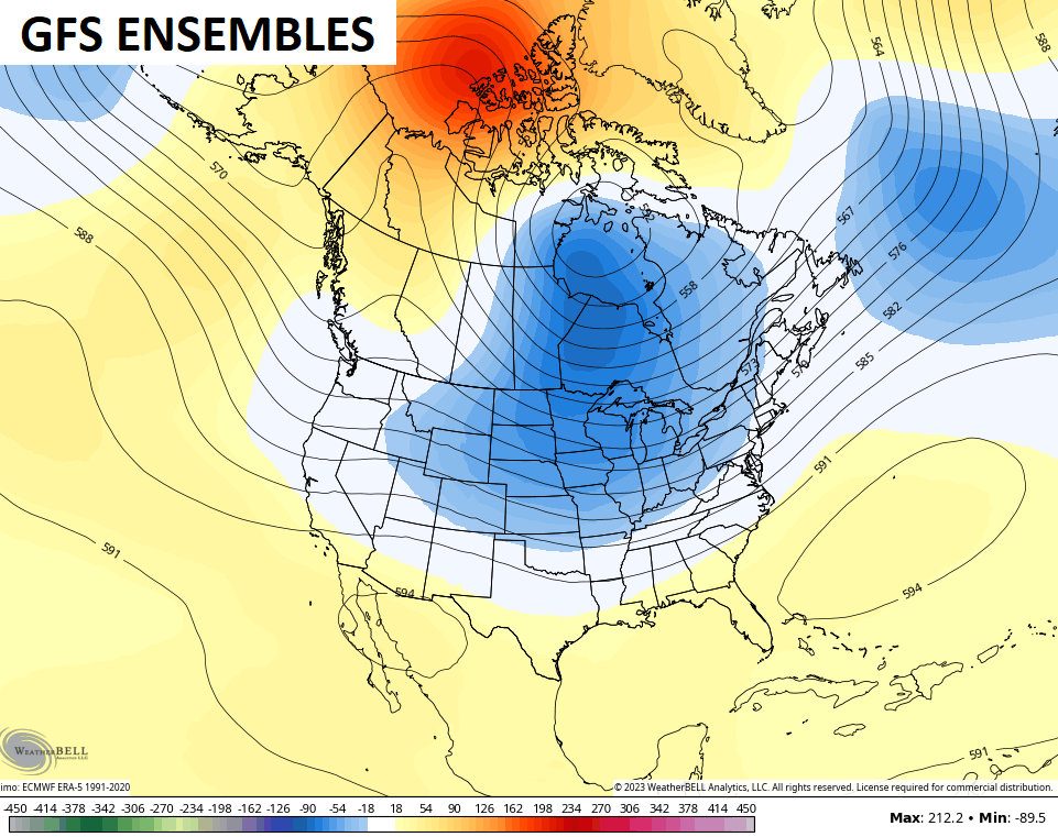
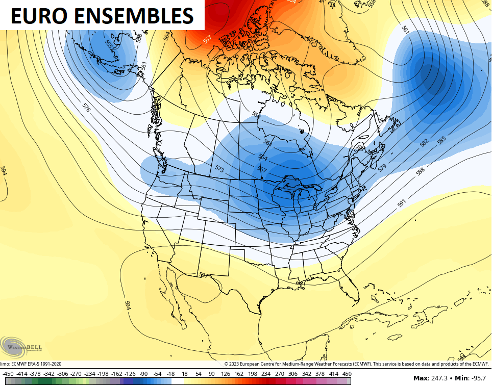 Below normal temps will be back with us for a spell into, especially, the middle and end of next week.
Have a great day and take care.

Thanks Chris, Nice, pleasant weather to start August. I wish it could continue through the whole month and then go right into Fall weather. Yesterday’s ensembles were more pronounced with the troughs, and now they look weaker ? In my opinion I think whatever is going on in the Atlantic is causing the precipitation pattern to be pushed back to our west and south. Don’t really know.
We should know more the second Thursday of the month on how the El Nino is progressing in the Tropical Pacific. As of now El Nino looks weak on the current SST map of the Pacific. The delay probably due to a very warm and positive Atlantic. Again, don’t really know.
Don’t know why my computer keeps repeating my comments. I don’t think I will ever be able to really learn to use the internet. It’s not from my generation. I’m more use to landline phones and TV that you can turn on and off at the switch. LOL……
I’m not sure… Maybe there’s a delay after you hit the reply button and then hit it again thinking the first hit may not have taken? Or it’s just a weird glitch of some sort…
I think what’s going on in the Atlantic has everything to do with west/east progression
I think that I was not aware that I hit the button twice causing the double post, or it’s my ageing brain that’s been through two strokes. Hell to get old so quick. I’m only 72 years old this year.
Hoping for eastern trough next week, CPC has backed off a bit.