Good Thursday, folks. We continue with a very active pattern and the setup ahead of us will bring more cold fronts through the region. This post will also look much farther down the road toward winter, so buckle up and let’s get after it.
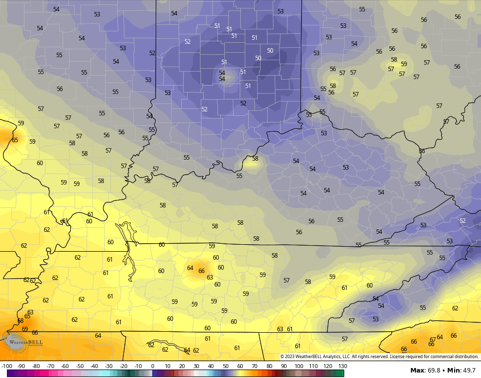
We begin with what’s going on out there today. Rain and some storms will start the day across central and eastern Kentucky with a slow drying trend settling in from the northwest. Some areas can pick up enough rain to cause local high water issues.
Here are your radars to follow along…

Temps for much of central and eastern Kentucky can only top out in the upper 70s and low 80s.
A mix of sun and clouds will be noted for Friday with temps in the 80s. There’s still a small chance for a shower or storm, but most stay dry.
Scattered storms rumble back in by Saturday and hang around into Sunday. This is ahead of a cold front crashing through here on Monday. That brings more widespread showers and storms.
It’s the first of 3 more systems set to drop in from the northwest next week into the following weekend.
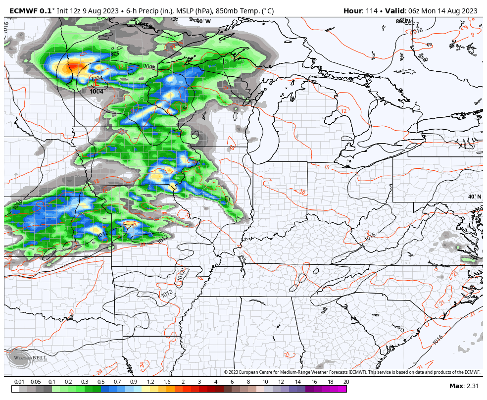
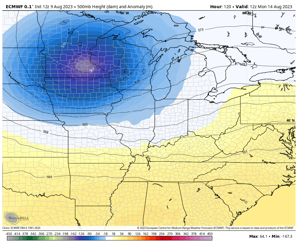
Once again, we find the EURO and Canadian Models in pretty good agreement with one another…
EURO
CANADIAN
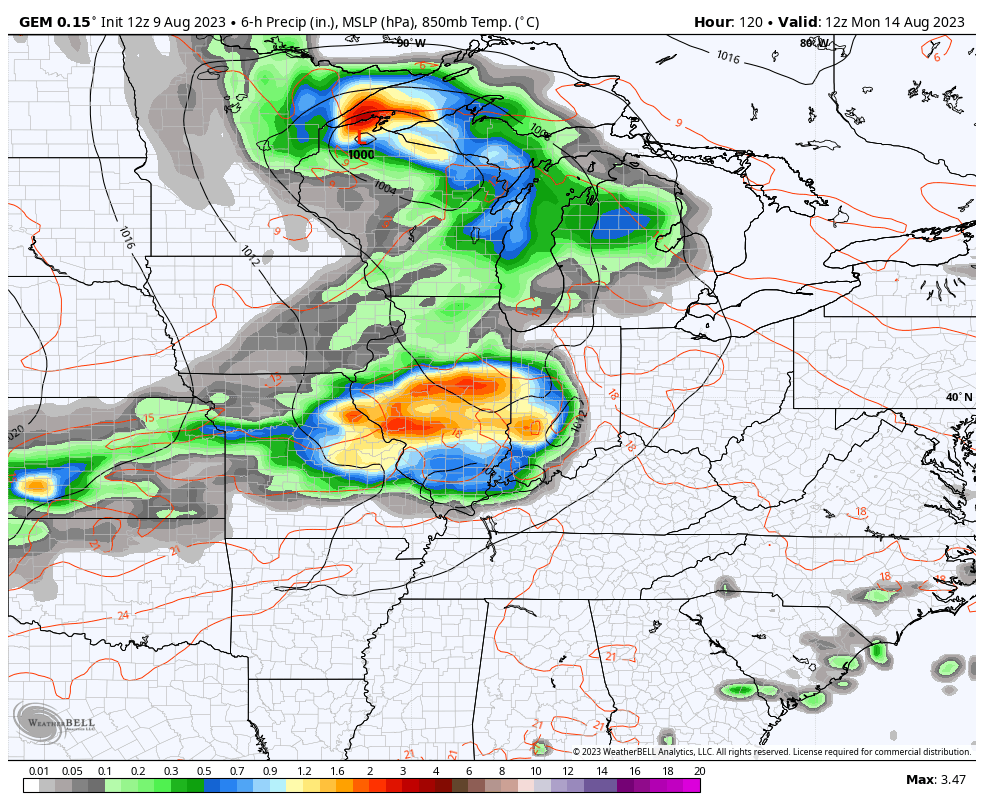
Both models continue to show deep troughs swinging in from the northwest during this time
EURO
CANADIAN
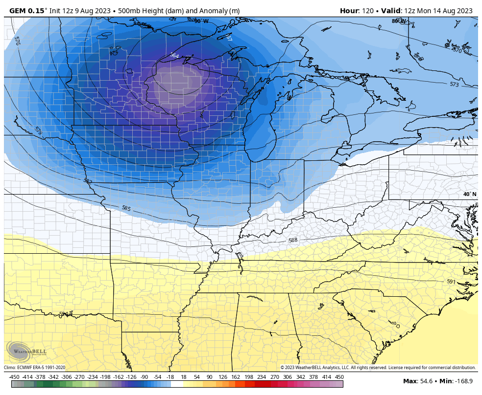
Those come with additional shots of below normal temps.
Y’all know my thoughts on the GFS and why I haven’t been using it very much this summer. It knows nothing but phantom heat waves and drought. Just a few days ago, I posted how the GFS was showing temps of 105-110 here next week while other models had cooler than normal temps.
The GFS now shows the cool and has lows deep into the 50s…
Those lows are coming on the same days the model has been showing phantom historic heat numbers. You can’t make this stuff up, folks.
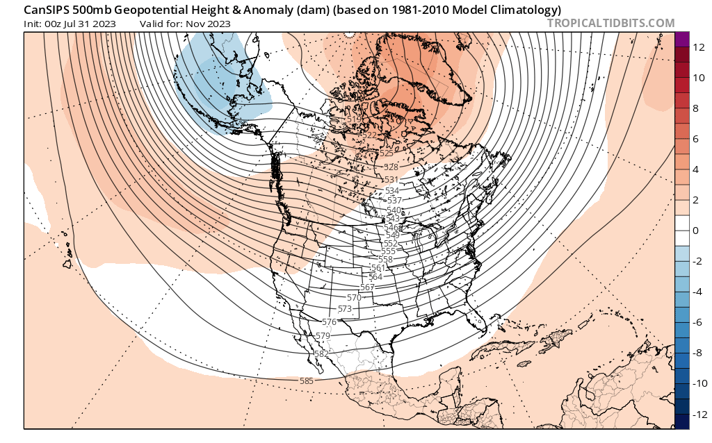
I’ve been promising some winter talk for a bit now and I’m finally doing just that. Some of the seasonal models now have the winter within their forecast range so I thought it would be fun to share with you guys what they are saying.
Obviously, skill scores aren’t the greatest in the world from this far out, but when has that ever stopped us from looking? 😎
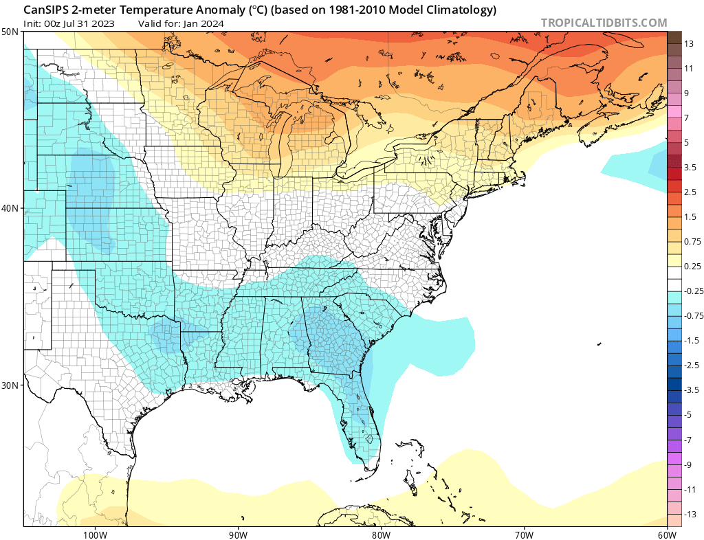
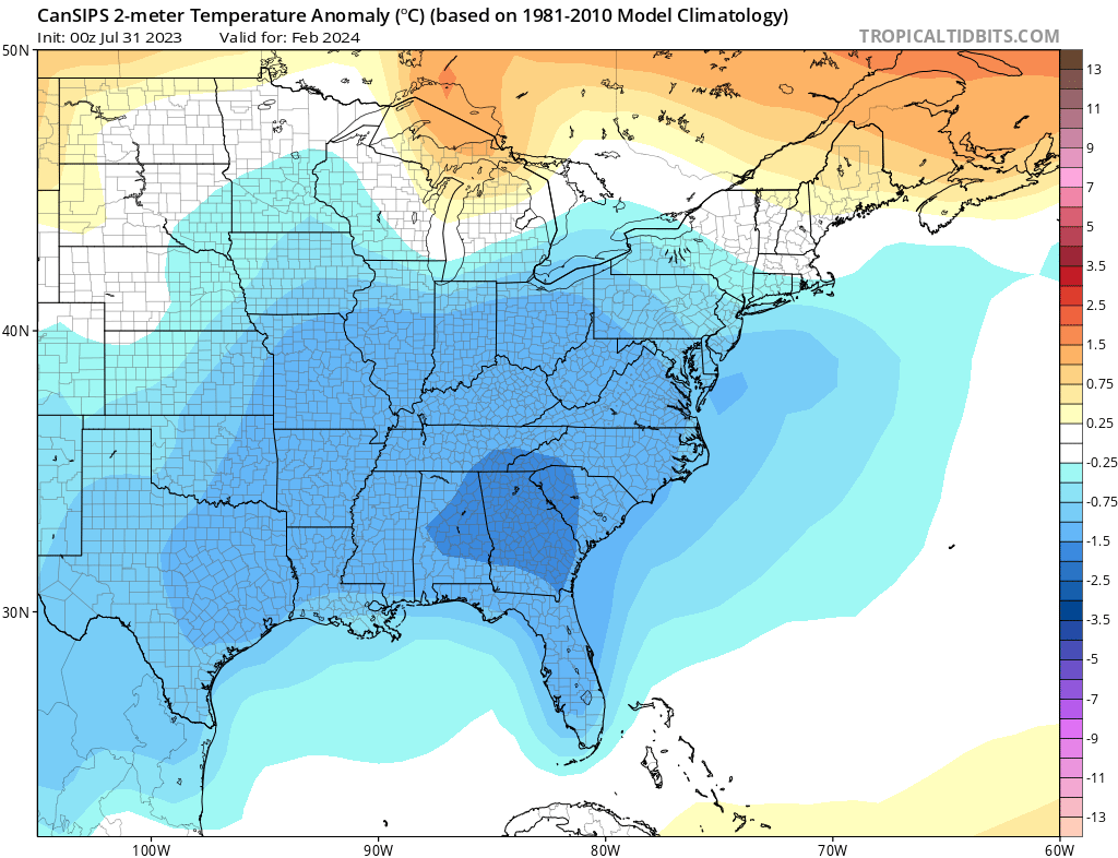
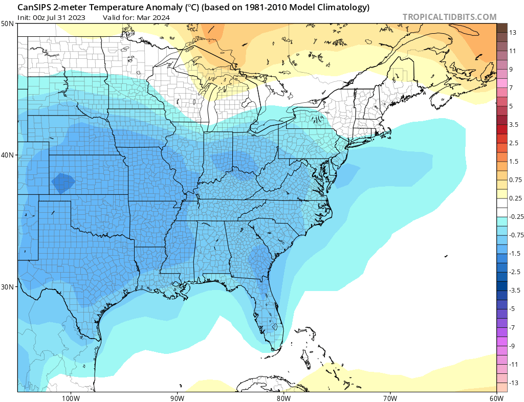
The CanSIPS is a seasonal model from Canada and rarely sees anything other than ridges and warm temps across the US and that’s why recent runs of the model have raised eyebrows. Why? Because it’s showing a colder than normal winter for much of the lower 48.
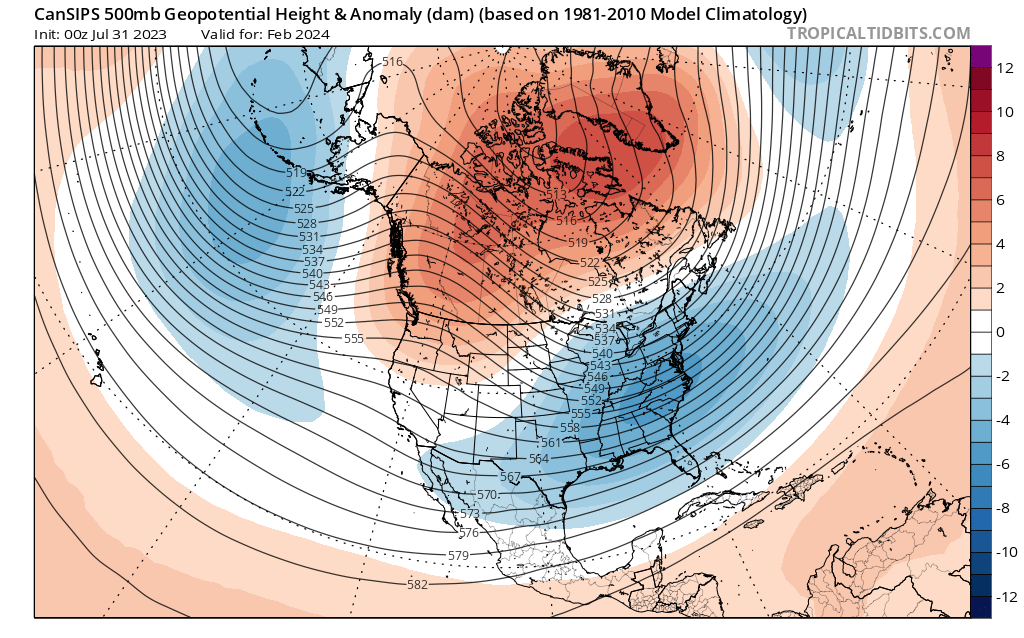
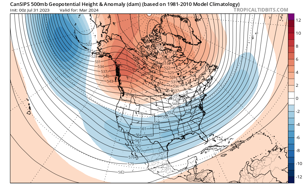
Let’s take it month by month and look a the 500mb height anomalies.
The monthly mean for November shows troughing developing across the eastern half of the country…
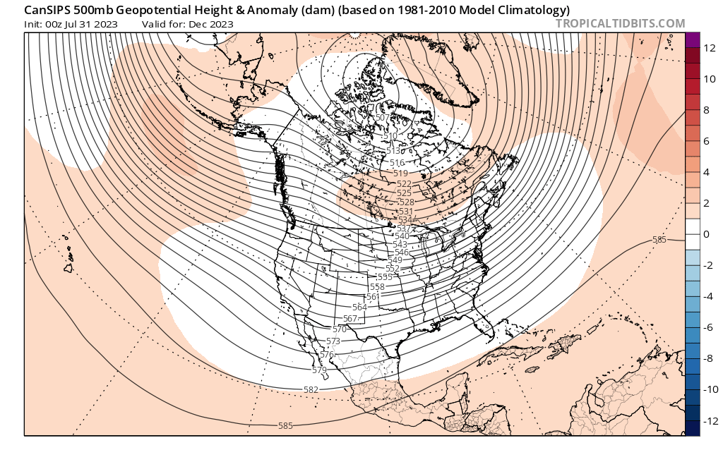
You can see this strengthening into December…
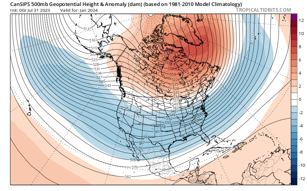
By January, we see blocking going up over the top with a an even deeper trough across the country…
The model shows the February trough going wild with a classic block from the west coast hooking up with blocking Greenland…
That continues into March…
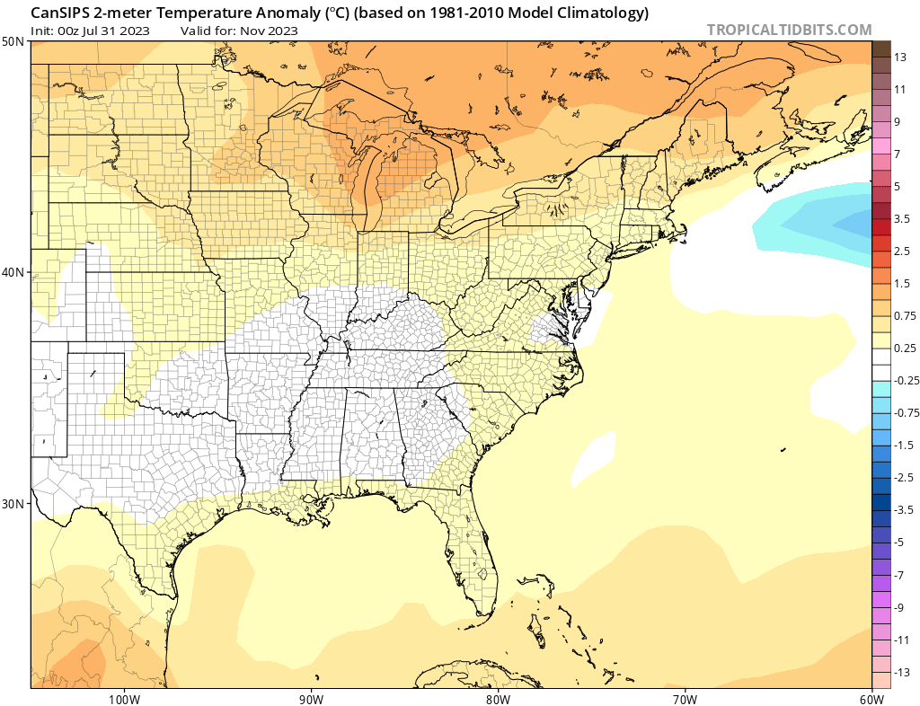
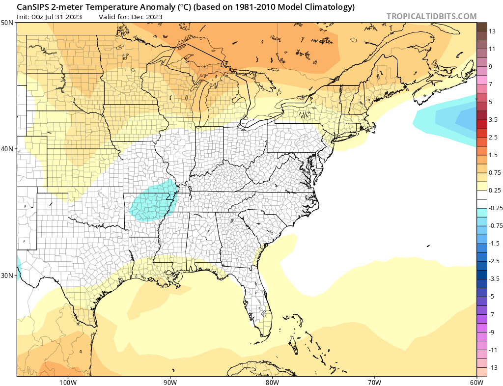
As mentioned, the CANSIPS rarely shows below normal temps in the winter months, but that’s not the case with this run.
Near normal temps for November…
Normal or a touch below for December…
Watch the colder than normal temps get more established in January…
And then go crazy in February…
And into March…
Interesting, eh? Get it… Canadian… Eh? I know, that’s a bad joke so I’ll just say…

Could the Canadian be onto something? I have another respected seasonal model that’s showing something similar and I’ll be sharing that this weekend.
Have a great Thursday and take care.

Like any ensemble or long-term model, I won’t belive it until I see it. 🙂
Wow… I thought we could at least muster .10 or rain or something out of this one in Lexington. Oh well
Thanks Chris. We received 0.80 ” of rain / showers after midnight. I think our soil moisture is about right for this time of the year. Crops look great. Ready for a bountiful harvest.
I don’t believe any anomaly long-range forecast maps on ridges or troughs across Canada or the United States. I think most on the Blog will wait and see where the most Snowstorms will be this Winter. If El Nino does come into play, I would expect some major Snowstorms somewhere here in the South. Thank you for all your hard work.
Sorry for the duplicate AGAIN. It’s not me, it’s this new computer I have. Made in China junk.
we received 1.13 in Corbin, even though the 00z GFS had the majority of heavy rain down in Tennessee…
The Climate Prediction Center has released the ENSO bulletin for August, which confirms that an El Niño event is in progress, and gives it a 95% chance of continuing through February, 2024. The odds of this becoming a strong El Niño have been increased to 67%. The latest Sea Surface Temperature Anomaly chart shows the El Niño plume has strengthened off South America, and above normal ocean water temperatures are especially evident in the Northern Pacific &Atlantic.
https://www.cpc.ncep.noaa.gov/products/analysis_monitoring/enso_advisory/ensodisc.shtml
Here’s the latest SSTA chart. Above normal ocean waters are especially evident in the far northern Pacific and Atlantic. Those patches of blue of the west coast of Greenland are from glacial melt. Regarding the El Niño plume off South America, the chances for a cold, snowy Winter would increase if we see that plume concentrate further off shore than it is right now.
https://www.ospo.noaa.gov/Products/ocean/sst/anomaly/
El Nino is slow to develop according to ( WOKE ) NOAA, so the forecast now has increase the formation of Hurricanes in the Gulf and the Tropical Atlantic. I believe this pattern remanent of La Nina will not change until the AMO turns negative and the PDO turns positive. Here’s the link :
https://www.noaa.gov/news-release/noaa-forecasters-increase-atlantic-hurricane-season-prediction-to-above-normal
The CANSIPS. model looks identical to the winter of 1978.
In 1977 – 78 we had a weak El Nino until late Fall 1979 when we entered the La Nina phase of ENSO.
Oh yeah the year of the one and only infamous blizzard that we had in my life time.
I would rather have a Winter like we had in 1969 – 70. A weak El Nino occured that Winter with training Snowstorms that lasted from December through March followed by a beautiful Spring in mid – April. A perfect Winter in my lifetime.
A new article came out today with an update on the current El Nino. Really no change, but is forecast to develop later in 2024 Winter. Maybe we will have a couple of Snows in February or March. Don’t really know.