Good Sunday, folks. It’s another awesome fall day across the region as we continue with pleasant temps and a good looking sky. As we head into the new week, rain chances are finally showing up across much of the region and nobody will complain about that.
Temps to start our Sunday range from the middle 40s to low 50s across much of the state. Afternoon temps are in the 75-80 degree range for many as a few clouds increase from the west. These clouds are ahead of an upper level system dropping into the region. This will bring some scattered showers and thunder into the west on Monday, but most of us wait until later Tuesday through Thursday for those rain chances to show up.
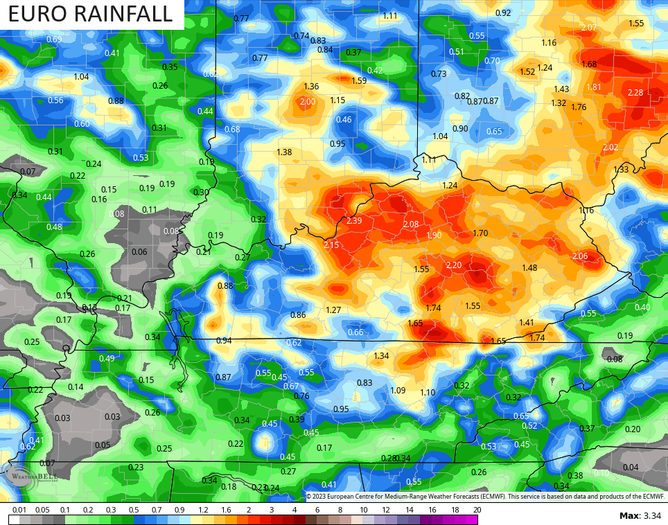
The forecast models are showing the greatest concentration of rain across central and eastern Kentucky. Here’s hoping the EURO is onto something because it brings the highest rainfall totals of any model…
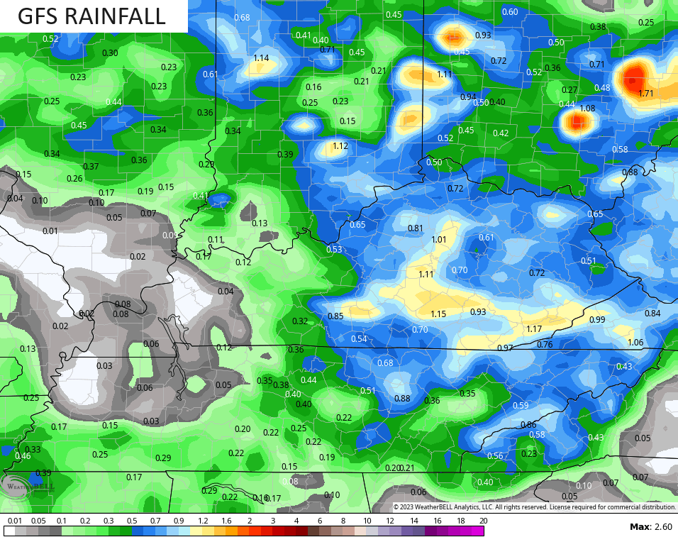
Given the current setup, those numbers are probably too high, but the GFS is trending in the same direction and shows several areas with an inch or more of rain in the week ahead…
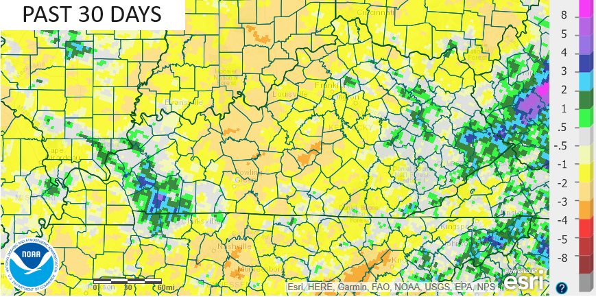
Whatever rainfall we can get is needed as the pattern has been very dry over the past month of so. After an above normal rainfall summer, things have turned dry over the past 30 days for most of the state. The 30 day rainfall departure from normal map shows only a few areas of above normal…
Much of what happens going forward will revolve around what else happens in the tropics. We already have Philippe way out there in the Atlantic and another system following it…

In addition to all this, we should watch the east coast once again for some up close and personal development over the next few weeks. This is something the ensembles are hinting at with a near stationary trough off showing up off the east coast to start October…
That slows everything down across the country and should mean the first week of October is normal to above normal for temps.
Have a great Sunday and take care.

Still an 80 or two ahead, I think.
Eighty degree temperatures is not the Autumns I have become accustom to in the past. The climate has really changed, but it’s natural, and may be caused by Solar Cycle # 25. Don’t know.
Thanks Chris. I made a comparison yesterday with the active Tropicals this Fall, and the Southeast Ridge in our Winter months. Both events block our west to east progression, and also our southwest to northeast progression. Also I notice that the events are weakened as they try to make the eastward progression. It didn’t use to be this way. ( new normal )
Disappointed that October is going to have above normal temperatures according to NOAA. We may not have that colorful Fall that I was hoping for. Last Fall the foliage was spectacular, but that’s the way it is in this new normal. One extreme to another.
Next week’s rainfall if any will be light. NWS saids if there are no significant rains next week, they will declare drought. I have news for them, we are already in a drought. Only .13 ” for the month so far.
Recent questions answered by NOAA was that this El Nino will have very little impact on our area of the country this Fall and Winter. Maybe cooler than last year though, but all models are not agreeing on this.
NOAA’s probability forecast for October 2023 :
https://www.cpc.ncep.noaa.gov/products/predictions/long_range/lead14/index.php