Good Thursday, everyone. Rounds of showers and thunderstorms continue to rumble across the Bluegrass state, delivering some much-needed rains along the way. These storms will slow down some later today and start to pull out of town as we head into early Friday.
Here’s a quick recap of today:
- A few strong to severe storms will be with us early this morning. Large hail is the primary threat from any storm that’s out there.
- These storms will also be accompanied by a lot of lightning and torrential rains.
- Some areas may get enough rain to cause local high water issues, especially this morning.
- Scattered showers and storms will then spin around low pressure moving through here this afternoon and evening.
Here are your radars to follow along…

Lingering showers may be noted early Friday before skies start to clean up. Highs are mainly in the 70s.
Saturday may feature some lingering clouds, especially early on. By the afternoon, skies turn partly sunny with 75-80 central and eastern Kentucky and low 80s in the west. That’s how we wrap up the month of September.
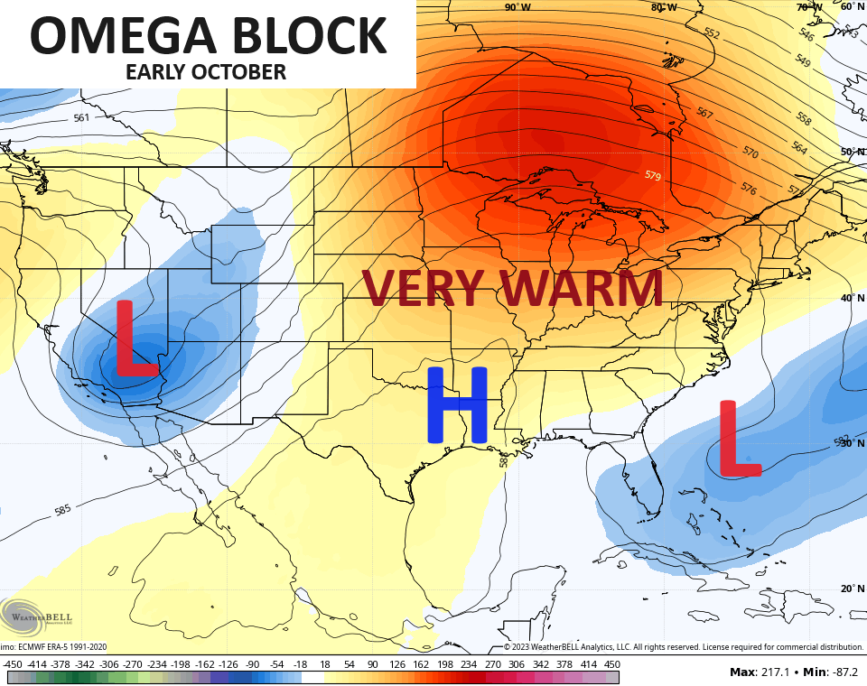
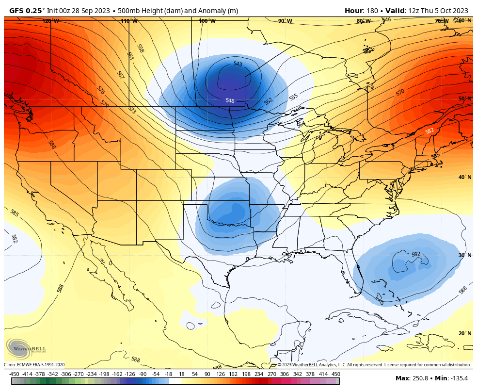
October continues to look rather warm to start as we find ourselves in the warm part of an Omega Block setting up across North America…
That leads to highs in the 80s next week.
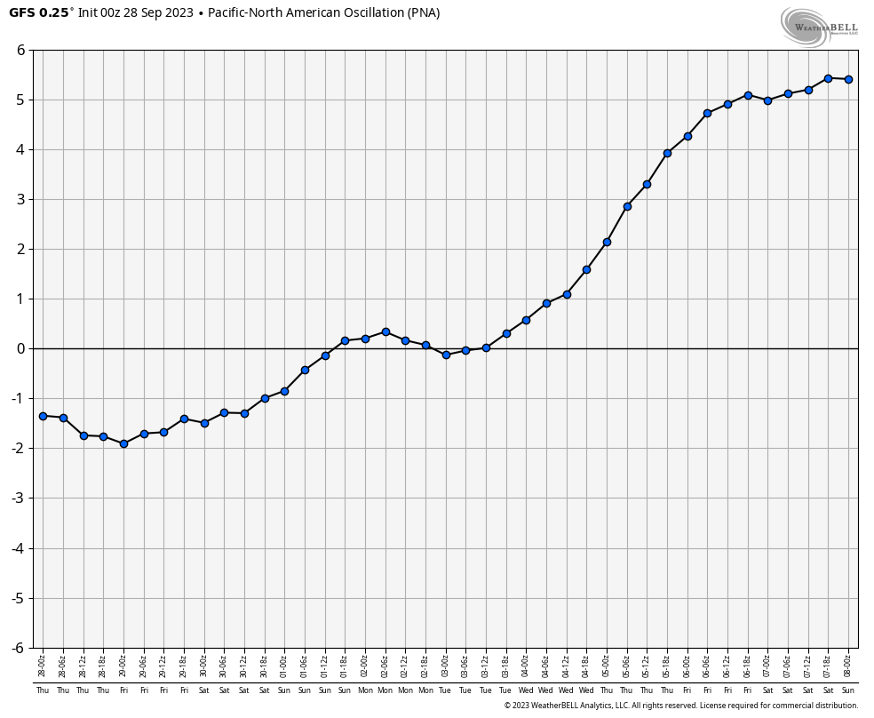
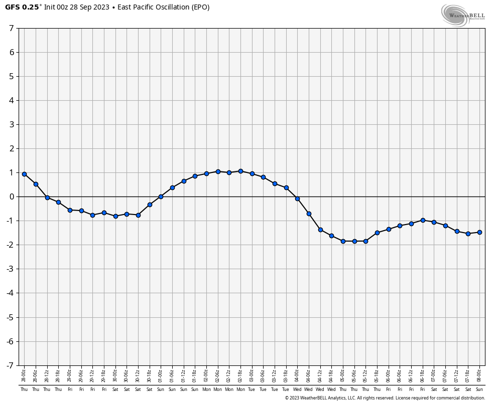
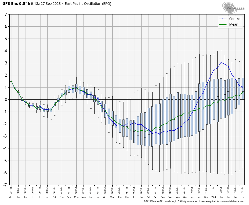
This pattern is going to change during the second week of October and the signals are there for a pretty big flip. If we look at the indices coming from the west coast and out in the Pacific, we find some pretty big blocking signatures. A positive Pacific North American Oscillation (+PNA) and a negative Eastern Pacific Oscillation (-EPO) are showing up on the operational models and ensembles…
Here’s the PNA on the GFS…
The GFS Ensembles…

The EPO on the GFS…
And on the GFS Ensembles…
Give me those two signals in the winter and I’m amping up the cold and snow chances. Give the fact it’s for early October, those signals would mean a big ridge going up along the west coast with deep troughs in the east
The GFS shows the case of an operational model matching the signals very well…
The CANADIAN doesn’t go out as far, but is going in that direction…
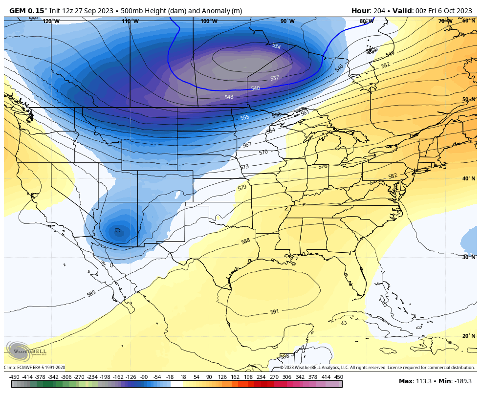
That would certainly set the stage for some chilly weather, but the exact timing is still in doubt from more than a week away.
Have a great Thursday and take care.

I am guessing we will be going back into another long dry spell.
Indian summer perhaps next week
” Indian Summer ” occurs after the first freeze of the Autumn season.
At our house we had .30” of rain yesterday morning, and .66” since midnight today. The sound of rain has been lovely. I’m hoping the yellow jacket nest that was built in the corner of our back gutter during this dry cycle got washed down the drainpipe.
It has been a LONG night in South Central Kentucky, as t-storms trained over the area. My PWS near Bowling Green recorded 1.55″ of rain since midnight, and a peak wind gust of 48 mph. Rainfall has ceased for the moment, but radar indicates that it will resume in the next hour or so. Our New Normal’s tendency to focus on the extreme continues, going from drought to flash flood in a matter of hours.
Last night.. I don’t know, maybe 230 am..it was raining so HARD that it woke me up…even with the TV on… and my air cleaner running on high..I could hear it over all that. I was never so happy to see pouring rain like that…. I think I heard thunder too… I was in such a fog I can’t remember.