Good Friday, everyone. We are rounding out the week with an improving sky and rolling into the weekend with more of the same. This weekend also marks the time we flip the calendar from September to October, with some big changes happening in the first week of the new month.
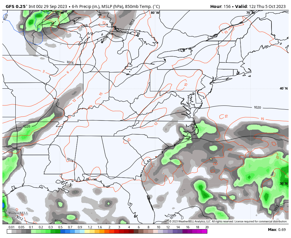
The rainfall of the past few days was exactly what the weather doctor ordered. Some areas picked up 4″+ of rain, with the majority of the state getting enough rainfall to alleviate the dry spell we’ve been in for much of September.
There’s the chance for some scattered showers out there early today as our low slowly slips away to the northeast. Here are your radars to follow whatever shower shows up…

Some fog may be fairly thick in a few spots this morning and may also be slow to burn away. Most of us will see afternoon sunshine with temps mainly 75-80 for most of the state.
Fog will be noted again early Saturday before a mix of sun and clouds takes control for the final day of the month. Highs range from the upper 70s east to low 80s west. Similar conditions and temps will be noted for Sunday.
The first half of next week is seasonably warm with 80-85 for many. Most October’s feature some 80 degree temps, especially in the first half of the month, so this isn’t really that uncommon. Dry skies should continue through Wednesday.
Yesterday, I showed you how most of the models were going toward a major reversal of the pattern by the end of the week into next weekend, then continuing into the following week. One model was a holdout, and it was the EUROPEAN. The EURO sometimes struggles to eject troughs out of the west and I even wrote about how the one model that may struggle with the upcoming pattern would be the EURO.
Well, the model has caught up to reality and quickly brings that deepening trough into the eastern half of the country…
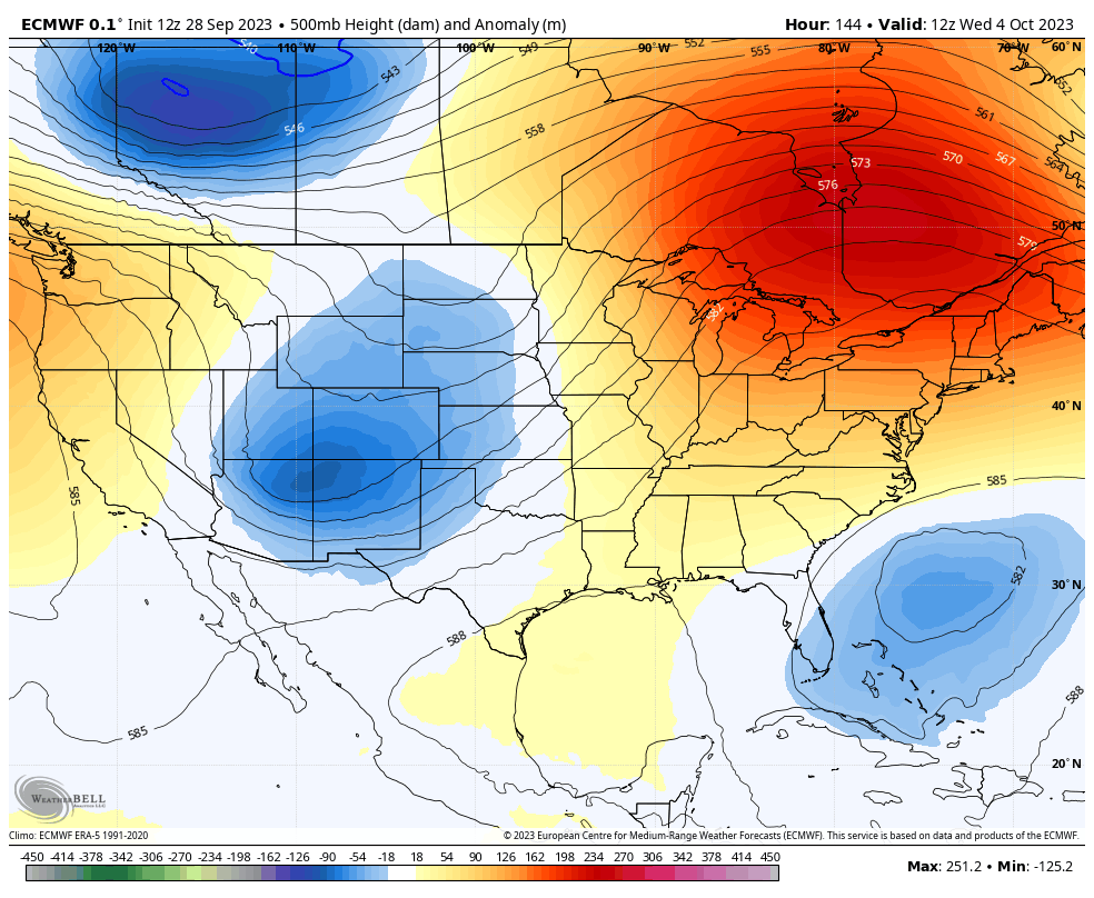
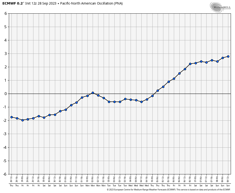
That’s one heck of a ridge going up along the west coast and that’s the +PNA pattern I wrote about yesterday. Here’s the PNA view from this run of the EURO…
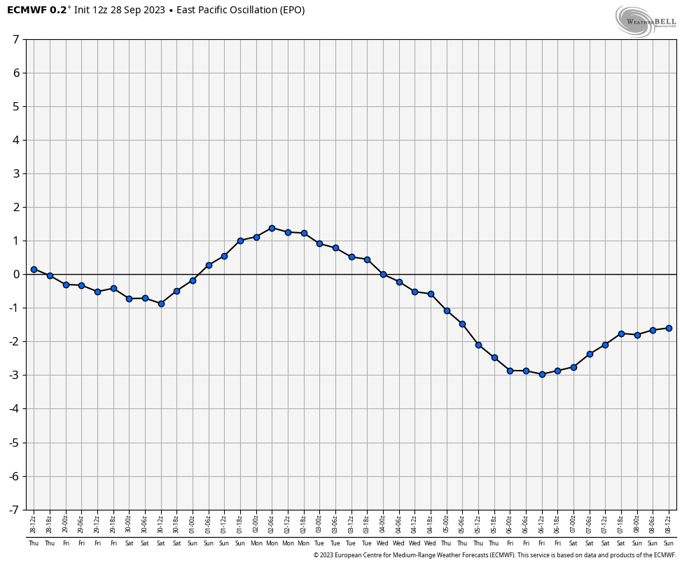
The model also finally caught the -EPO developing…
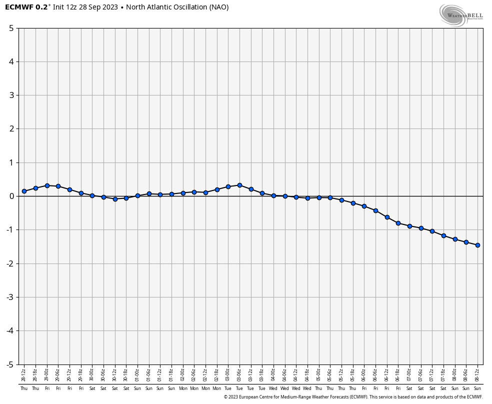
Oh and it throws in a -NAO to boot…
The end result in indices like that is a pretty darn chilly pattern for October. In the winter… Look out.
With the quick transition from the 80s to real deal October chill, some good rains should fall around here Thursday into Friday, at least. The GFS is trying to wrap up a pretty healthy storm system…
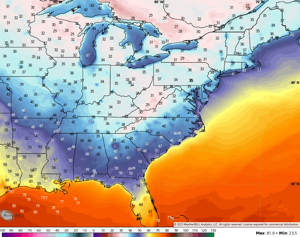
Even with it’s warm bias, the raw numbers from the GFS for early in week 2 of October have been reaching the frosty 30s from time to time…
We are almost to the time of year for “two a days”. No, I’m not talking about practices here, I’m talking about KWC blog updates as the busy season is about upon us. 😎💪❄️
Have a great final Friday of September and take care.

Lawns in Warren County, which had developed a distinctive “crunch” sound over the past few weeks, received some badly needed rain yesterday, and it was delivered in true New Normal style. My PWS near Bowling Green recorded a total of 2.49″of rain between the hours of Midnight and 1:00 pm CDT. Areas to the south and west picked up even more: Hopkinsville received nearly 5.00″ during the same period. Hopefully this means that our Fall colors will be just a bit more intense, and those leave have started to turn and drop more than 3 weeks earlier than they did in 2022!
We logged 1.1” and are thankful for that.
Joe, here’s a graph I found that I think you would be interested in. Explains why the weather is not the way it use to be. It’s comparing the AMO and the HadcruT4.
https://twitter.com/WHUT/status/1705450498030027170
It’s almost time to start up the leaf blower.
I like to use a good old fashion rake and form a pile, but I don’t burn leaves them like we use to.
Thanks Chris. Yesterday, early morning we received 0.92 ” of much needed rain. Maple has received 1.15 ” for the month, and for the year so far 34.40 ” I think we use to receive 52 ” of rain on average for the year, so we are well below average. I also notice that our precipitation pattern has not changed despite the declining day length.
On the various teleconnections the PNA ,EPO, NAO,and the AO change from week to week and month to month. The ones that are not discuss and should be are the PDO and the AMO. Good indicators to long term climate.
We should have a very colorful Autumn. Already, I have a Red Maple tree in the full glory of Autumn color.
Adding to the above, the Harvest Moon in Perigee is beautiful.
It rained a very good downpour yesterday. It didn’t last a very long time but was thankful to get it.
Interesting article on ENSO. Explains the position of the Tropical Pacific Jet stream in both La Nina and El Nino years. Here’s the link :
https://www.climate.gov/news-features/blogs/enso
It won’t be long before I start up my fire pit. 🙂